DJI’s latest enterprise drone—DJI Matrice 400—marks a significant milestone for the industrial drone operations. DJI M400 introduces a highly adaptable, intelligent platform built for extreme endurance, seamless sensor integration, and advanced situational awareness.
From rugged field conditions to complex mission requirements, DJI M400 redefines what’s possible for aerial operations.
Specifications at a Glance:
Max Flight Time: 59 minutes (with DJI H30T payload)
Hover Time: 53 minutes (with DJI H30T payload)
Payload Capacity: Up to 6 kg
Operating Temperature: -20°C to 50°C
Ingress Protection: IP55-rated
Video Transmission: O4 Enterprise Enhanced Transmission with sub2G frequency band support, up to 40 km range
Payload Mounting: Single or dual downward gimbals + a third gimbal
Smart Capabilities: AR Projection, Terrain Follow, Smart Detection, takeoff/landing on a ship
Software Compatibility: DJI FlightHub 2, DJI Terra, DJI Modify, SDKs
DJI Matrice 400 sets a new standard in aerial endurance, delivering up to 59 minutes of flight time and 53 minutes of hover time with the DJI Zenmuse H30T. This makes it highly effective for large-scale surveying, wide-area mapping and time-sensitive operations such as search and rescue or emergency response.
With an IP55-rated airframe, DJI M400 is engineered to withstand harsh environments. Whether operating in heavy rain, snow, dust storms, or temperature extremes from -20°C to 50°C, the drone remains mission-ready.
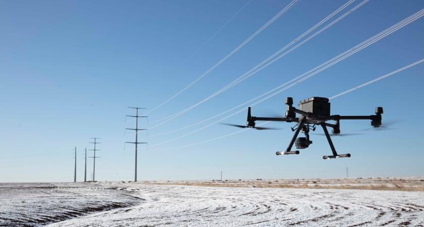
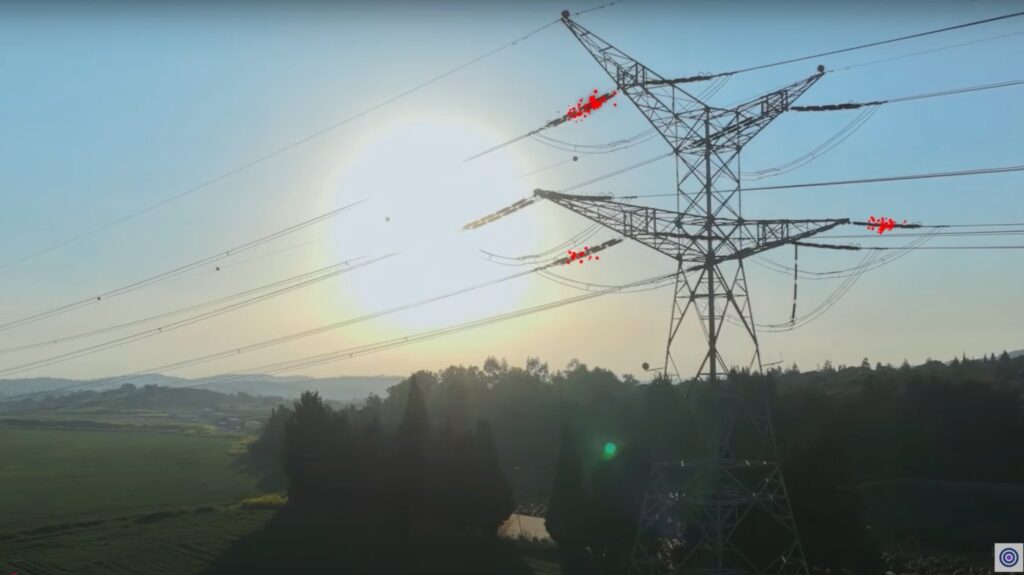
Built for safety and precision, DJI M400 offers omnidirectional obstacle awareness, combining rotating LiDAR, mmWave radar, and low-light full-color fisheye vision sensors. This multi-sensor system detects even thin wires at high speeds (up to 25 m/s)—a crucial capability for power line inspections.
It thrives in complex environments, including fog, darkness and visually cluttered areas, helping pilots safely navigate around building facades, mountainous terrain or critical infrastructure.
With a new generation of smart navigation tools, DJI M400 elevates flight autonomy. Features such as Real-Time Terrain Follow, Cruise Mode, Smart Track, and Point of Interest (POI) enable smooth, adaptive missions across varied topographies.
Real-Time Terrain Follow maintains consistent altitude above ground in any direction, ideal for corridor mapping or subject tracking.
When paired with DJI Zenmuse L2, it enables intelligent power line-following missions, dynamically adjusting to terrain and bypassing intersecting wires.
Using DJI Zenmuse P1 supports geometric and oblique flight paths for urban 3D modeling and large-scale photogrammetry.
Thermal missions benefit from real-time object recognition, allowing rapid identification of people, vehicles, or vessels—critical for public safety and emergency workflows.
Additionally, DJI M400 supports onboard computing modules for real-time task execution. On the ground, Augmented Reality (AR) overlays enhance pilot awareness by visualizing infrastructure, routes, and return paths directly on the controller. An AR-based aircraft shadow improves landing precision, while built-in tools for annotations and live area measurements simplify operational coordination.
Engineered for multi-scenario adaptability, DJI M400 supports up to 6 kg of payload and allows mounting of up to seven devices simultaneously. This includes support for dual downward gimbals and a third gimbal mount, opening a wide range of sensor configurations.
Through the E-Port V2 system and PSDK integration, users can also connect third-party payloads for advanced customization.
DJI Zenmuse H30 Series: Combines wide-angle, zoom, thermal imaging, NIR auxiliary light, and laser rangefinder into one hybrid payload. Ideal for inspection, surveillance, and emergency operations—day or night.
DJI Zenmuse L2: Integrates frame-based LiDAR system with 4/3 CMOS RGB and high-precision IMU. Supporting power line-following flights with real-time obstacle detection and bypass, the payload is ideal for utility inspections and topographic mapping. Maintaining terrain-following in sloped and obscured environments ensures Zenmuse L2’s high-density and accurate point cloud capture.
DJI Zenmuse P1: Full-frame photogrammetry sensor with interchangeable lenses on a 3-axis stabilized gimbal for high-accuracy 3D modeling of structures, facades and wide-area mapping.
DJI Zenmuse S1: LEP-powered spotlight for nighttime operations in search and rescue, inspection and law enforcement. The payload features multiple lighting modes for dynamic illumination and high adaptability in challenging low-light envornments.
DJI Zenmuse V1: Long-range powerful loudspeaker for live or pre-recorded audio—crucial for public safety, coordination, and crowd management during emergency evacuations.
Equipped with the O4 Enterprise Enhanced transmission system, DJI M400 supports up to 40 km range, dual-channel 4G hybrid connectivity using sub2G frequency bands, and DJI Cellular Dongle 2.
For missions over long distances or challenging terrain, DJI M400 can serve as a relay drone, extending communication and video signals to another drone opearting further. This capability is especially valuable in search and rescue, infrastructure surveys, and remote area operations.
DJ M400 operates within DJI’s ecosystem, supporting a wide range of professional software tools and development toolkits. This ensures flexibility for enterprise users and developers aiming to tailor the drone to their mission-specific requirements.
DJI Manifold 3 onboard module transforms DJI M400 into an edge computing powerhouse, offering up to 100 TOPS of processing performance.
With support for CUDA, OpenCV, and running on Ubuntu OS, Manifold 3 enables AI applications such as:
Note: DJI Manifold 3 is sold separately. The stated performance is only available with this module installed.
Use Cases Across Industries
DJI Matrice 400 is designed for flexibility across demanding industries:
The DJI Matrice 400 is not just a drone—it’s an intelligent aerial system tailored for the data-driven future of enterprise operations. With exceptional flight endurance, precision sensing, modular payload support, and deep software integration, DJI M400 delivers the tools professionals need to push boundaries in every mission.
Whether you’re conducting emergency response, utility inspections, 3D modeling, or environmental monitoring, DJI Matrice 400 delivers reliable performance and scalable capabilities in even the most challenging conditions.
At GNSS.AE, we provide comprehensive support for enterprise drone operations in the Middle East and beyond. We offer expert guidance, system integration, pilot training and after-sale technical support to ensure your team gets the most from deploying DJI Matrice 400 and its powerful ecosystem.