DJI has selected 15 winners of its Enterprise Drone Onboard AI Challenge 2026. The projects cover crop counting, bridge inspection, LiDAR processing, beach litter detection, traffic monitoring, pollution source tracing and search and rescue.
Five projects received awards for onboard AI models and ten for industry applications. They were developed for the Matrice 4 and 4D Series, Matrice 400, Dock 3 and Manifold 3.
The solutions use three processing setups: AI running inside the drone, on Manifold 3 or across onboard and cloud systems. Some have already been tested in the field, while others describe planned workflows still under development.

In a conventional survey, the aircraft mainly works as a sensor platform. It collects images, video, LiDAR or thermal data, but most of the analysis starts after landing.
Traditional workflow:
Drone → imagery/video → download → cloud or PC processing → AI detection → report
Onboard AI moves inference closer to the camera
Onboard AI workflow:
Camera → onboard computer → AI inference → detection and geolocation → operator or cloud
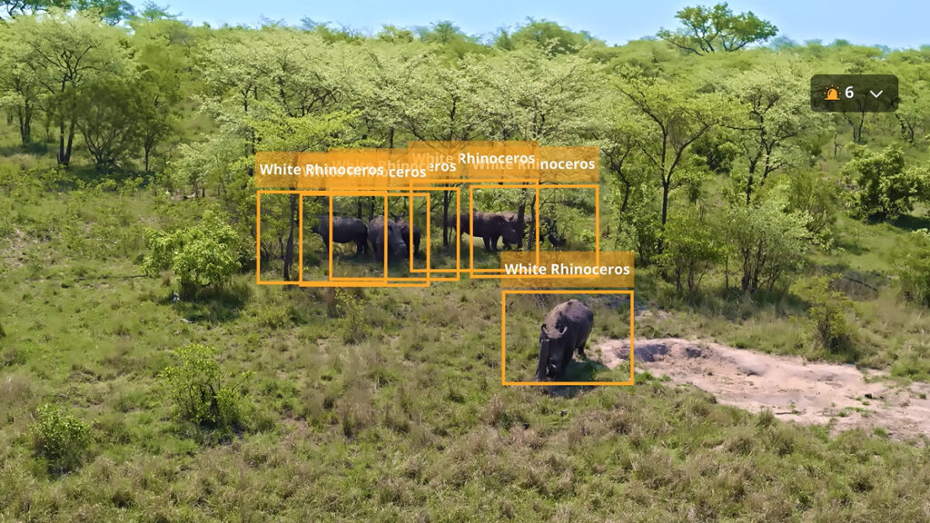
A model can therefore find a vehicle, person, crack, plant or pollution source while the drone is still flying. The result may appear on the controller, be stored with coordinates or pass to a remote operations platform.
DJI’s Intelligent Computing Platform allows developers to train a model locally, upload it for conversion and quantization, and distribute the optimized version to a compatible aircraft. More demanding applications can run on Manifold 3 or divide the workload between the drone and a cloud service.
Architecture | How it works | Typical applications |
Built-in AI | A lightweight model runs on the drone’s internal computing hardware | Object detection, counting and initial classification |
A separate onboard computer runs larger models and interacts with cameras, gimbals and flight controls | LiDAR processing, multi-model systems and automated data capture | |
Edge and cloud | The drone performs rapid screening while a remote service verifies results and manages the workflow | Fleet operations, traffic monitoring and automated work orders |
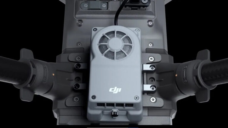
Manifold 3 provides up to 100 TOPS of computing power in a unit weighing about 120 grams. DJI says its GPU and deep learning accelerator can be used for model inference as well as flight, camera and gimbal control.
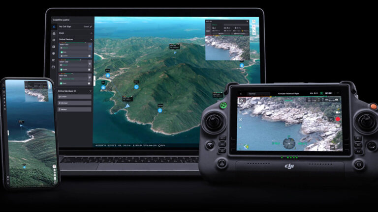
Cloud processing remains useful when a project needs larger models, historical comparisons or coordination across several drones. FlightHub 2 provides mission planning, live video, remote operations and third-party integration, while the developer can connect a separate AI inference service.
The winning projects demonstrate five broad functions.
Five of the winning projects show how these functions work in practice.
Faster results
Post-flight analysis may involve uploading thousands of images, creating an orthomosaic and running a model across the complete dataset. With onboard inference, the system can report that it has found 17 objects and provide their positions before the mission ends.
That difference is especially important in emergency response. A possible person detected during a search mission needs to be checked immediately, not after the aircraft returns and the video has been processed.
Less data to transmit
If the task is to find specific objects, the drone may not need to send a continuous high-resolution stream to the cloud. It can transmit a smaller event package containing:
The original images can still be saved for detailed review.
Local operation
Remote sites do not always have a reliable high-bandwidth connection. A locally deployed model can continue analyzing the camera feed when cloud access is limited.
This does not remove the need for connectivity in every project. Manifold 3 applications can exchange information with FlightHub 2 or third-party servers when a connection is available. Local inference and cloud services can share the workload.
A shorter route to action
The practical difference is visible in the workflow:
Post-flight analysis:
Detect → download → process → review → action
Onboard AI:
Detect → locate → alert → action
This is the basis of DJI’s description of the technology as a move “from data capture to decisive action.”
AgroCount AI, developed by Daniel Tovar, was tested at Finca La Suiza, a 50-hectare banana plantation in Colombia.
Its current workflow begins with a grid flight at 40–60 meters above ground. The images are processed into an orthophoto and divided into 640 × 640-pixel tiles. A YOLOv8 model detects banana crowns, after which the results are converted into GPS points and exported for analysis in QGIS.
During testing, the model detected 8,774 plants across 9.12 hectares. The developer reports an mAP50 of 0.901, with 0.814 precision and 0.873 recall. The current process, including flying, photogrammetric processing, inference and coordinate verification, takes about three days.
The planned Matrice 4E and Manifold 3 version removes the orthophoto from the main detection workflow. Each frame would be processed in flight, with every detected plant immediately linked to a position. The project’s target is to inventory 60 hectares in under four hours.
A team from East China Normal University trained a YOLOv8 model to detect small pieces of rubbish on beaches and tidal flats. The model was modified and quantized for the computing environment inside a Matrice 4E.
This is a difficult computer vision problem because many targets occupy only 1–30 pixels and can be confused with shells, vegetation or reflections. The team reports an mAP50 of 0.948 and an mAP of 0.646 for small objects.
The proposed flight settings include a height of about 70 meters and a speed of 3 m/s. Detection takes place on the aircraft, so a weak data connection does not stop the model from working. Results can be stored locally, assigned a location and later exported for clean-up planning.
Bridge Inspection Master uses onboard AI to search a live 1080p video stream for crack-like features. When the model marks a suspicious area, the pilot can hover, change the camera angle and capture a closer image.
The project reports an ability to detect cracks narrower than 0.1 mm, although the operating conditions matter. Its instructions specify a distance of approximately 3–4 metres from the surface and the use of 3× or 7× zoom.
The onboard model supports discovery and image collection. Precise measurement is completed later in a separate analysis platform, where the software extracts the crack outline and calculates its dimensions. RTK and POS data are then used to register the image against a 3D bridge model.
This division of work is practical. A lightweight model guides the field inspection, while a more detailed model handles engineering analysis.
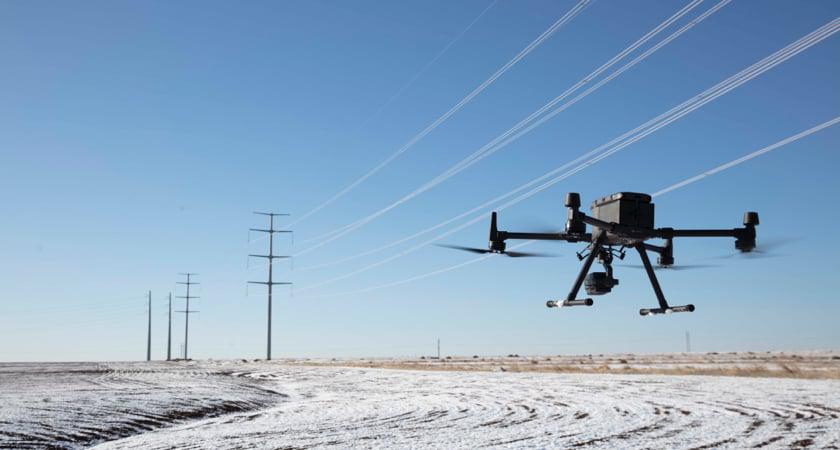
The Point Cloud Core Box combines a Matrice 400, Manifold 3 and an L2 or L3 LiDAR payload for power-line inspection.
The system processes raw point-cloud files in the field, including decoding, noise removal, coordinate correction and classification. It can extract conductors, locate vegetation encroachment and use the resulting 3D geometry to plan a closer inspection route for a smaller drone.
In a submitted case covering 91.666 kilometers of power lines, the developer reported that the complete workflow fell from nine days to 4.5 days. Processing for each span reportedly took less than two minutes, with clearance analysis errors kept within 0.3 meters.
The larger benefit is operational. If a possible clearance problem appears in the point cloud, the team can inspect it while equipment and personnel are still on site.
Hangzhou New Modal Technology developed a system that combines nine road-inspection functions in one workflow. It covers illegal parking, vehicles using cycle lanes, potholes, faded road markings, misplaced traffic cones, road debris, construction activity, congestion and riders without helmets.
The system first segments the image to identify lanes and regulated areas. A detection model then finds the relevant objects, while a rules engine determines whether their position represents a violation.
For a parked vehicle, Manifold 3 can adjust the aircraft’s altitude, distance and gimbal angle to obtain a closer image of the license plate. The event is sent through FlightHub 2 for further verification and can then generate an alert or work order.
detection → rule check → closer image → coordinates → evidence → alert → work order
This workflow explains why onboard AI is useful in enterprise operations. Detection becomes one part of a longer process that ends with an assigned action.
The remaining projects extend onboard AI into several additional fields.
Area | Application |
Power | Visible and thermal detection of equipment defects |
Solar energy | Identification of hot spots, damaged modules and other PV faults |
Nature reserves | Monitoring grazing, bird habitats and protected mammals |
Grasslands | Livestock counts for management, insurance and ecological research |
Water | Detection of fishing activity, fire hazards and algal blooms |
Air quality | Identification of dust emissions and open burning near monitoring stations |
Search and rescue | Multi-model screening followed by human confirmation |
Urban management | Detection of vehicles blocking fire lanes |
Road safety | Real-time identification of e-bike riders without helmets |
Traffic enforcement | Automatic close-up capture and evidence collection for illegal parking |
The projects follow a common sequence:
capture → understand → locate → verify → act
The model alone handles only part of that chain. Cameras and LiDAR provide the observations. GNSS, RTK and pose data connect detections with physical locations. Flight controls help collect better evidence, while cloud platforms and operational software turn the result into a report, alert or task.
DJI’s challenge does not point to one universal model for every enterprise drone. It shows an ecosystem of specialized tools: one counts plants, another finds small defects, and another processes point clouds. Their shared feature is that analysis is becoming part of the flight itself.
DJI Onboard AI allows enterprise drones to analyze camera or sensor data during flight. A model can detect an object, classify it, assign coordinates and send the result to an operator or cloud platform without waiting for post-flight processing.
Edge AI means processing data close to where it is collected. In a drone system, onboard AI is a form of edge AI because the model runs on the aircraft or an attached computer such as Manifold 3.
DJI’s 2026 challenge covered the Matrice 4 Series, Matrice 4D Series, Matrice 400 and Dock 3 operations. Manifold 3 is compatible with Matrice 400, Matrice 4 Series and Matrice 4D Series.
Manifold 3 is an onboard computer with up to 100 TOPS of processing power. It can run larger AI models, process video or LiDAR data and support applications that interact with cameras, gimbals, positioning data and flight controls.
Locally deployed models can continue processing data without a constant cloud connection. Internet access is still required for functions such as remote monitoring, cloud verification, fleet coordination and sending results through FlightHub 2 or third-party platforms.