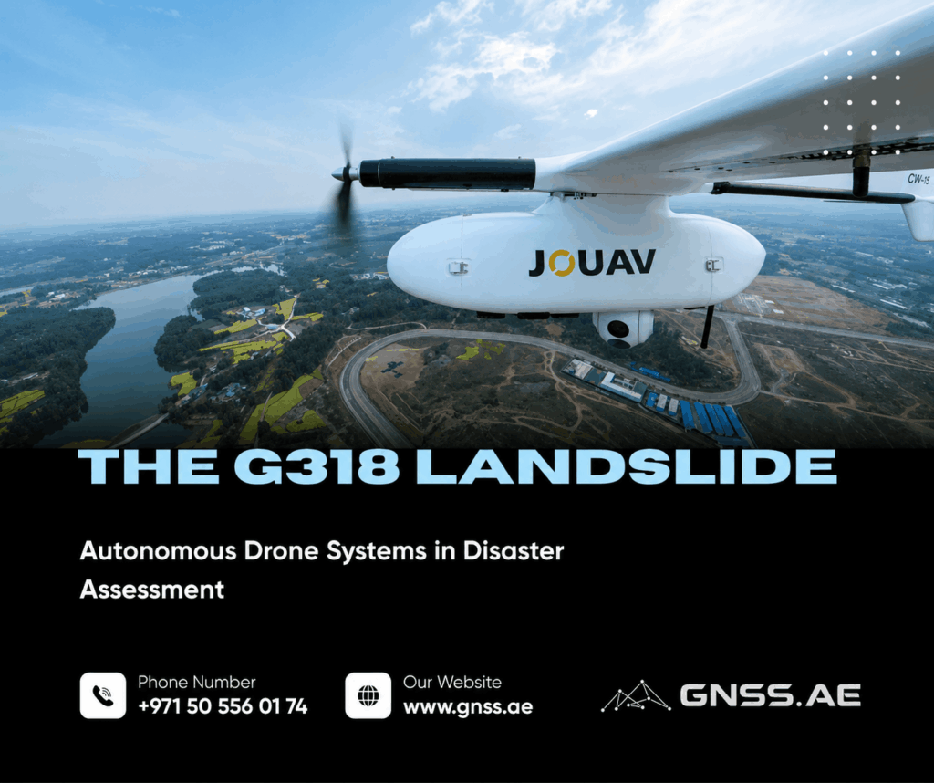
In the early hours of December 3, 2025, a landslide struck a section of National Highway G318 near Qixing Town in Chongqing. The ground beneath the road shifted, leaving the highway damaged and the surrounding slope unstable.
G318 is an important route for regional transport and tourism. Keeping it closed would disrupt traffic and supply chains, but reopening it without a reliable assessment could put drivers and recovery teams at risk.
Authorities needed to determine the size of the affected area, the volume of displaced material and the likelihood of further movement. Sending surveyors onto the slope was too dangerous, so the initial assessment was carried out from the air.
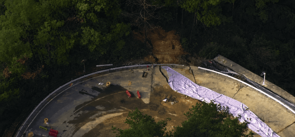
Two automated JOUAV VTOL Hangar systems were activated remotely. CW-15V drones flew more than 20 kilometres at night to reach the site.
Using the G318 landslide as a practical example, this article looks at why drones are used when ground access is unsafe, how autonomous systems differ from locally piloted aircraft, and why a VTOL platform was suited to this operation. It also covers the cameras and sensors used in disaster assessment, the value of repeated surveys, and the role aerial data can play from the initial response through to recovery.
A ground survey can provide detailed information, but only when the area is safe and accessible. After a landslide, roads may be blocked, the ground may still be moving and heavy equipment can trigger further instability.
Crewed aircraft can cover large areas, although arranging a flight takes time and may be too expensive for repeated local surveys. Satellite imagery is useful for regional assessment, but its timing, resolution and visibility can be affected by orbit schedules and cloud cover.
A drone can be sent closer to the affected area and collect detailed, georeferenced imagery within hours of an incident. It can also repeat the same route several times, giving specialists a consistent record of how conditions are changing.
On G318, aerial assessment allowed work to begin while the slope was still considered unsafe for survey crews. Authorities did not have to wait for physical access before gathering the first useful data.
Lorem ipsum dolor sit amet, consectetur adipiscing elit. Ut elit tellus, luctus nec ullamcorper mattis, pulvinar dapibus leo.
the site, finds a safe launch point, prepares the aircraft and controls the flight from a ground station. This keeps the pilot away from the exact object being inspected, but the team may still need to work close to an unstable slope, fire or damaged structure.
An autonomous system moves much of this process to a remote location. A typical setup includes a drone, a docking station, mission-planning software, communications equipment and a platform for receiving and processing data.
Depending on the system, it can automate:
During the G318 response, operators activated the aircraft from a command center rather than travelling to the landslide. The CW-15V drones then completed autonomous beyond-visual-line-of-sight (BVLOS) flights to the site.
Multirotor drones are useful when an aircraft needs to hover close to a bridge, building or small section of terrain. Their main limitation is endurance: covering a long road or a large disaster zone may require several flights and battery changes.
Fixed-wing aircraft use energy more efficiently and can cover greater distances, but conventional models need space for launch and recovery. Finding such a site in mountainous terrain or near damaged infrastructure may be difficult.
A VTOL fixed-wing drone combines vertical takeoff and landing with efficient forward flight. It can leave a compact docking station, travel to a remote site and survey a much larger area than a typical multirotor.
The current JOUAV VTOL Hangar system combines the CW-15V with an automated docking station and the JoCloud management platform. JOUAV lists an operating radius of up to 50 kilometres and flight time of up to 120 minutes for this configuration.
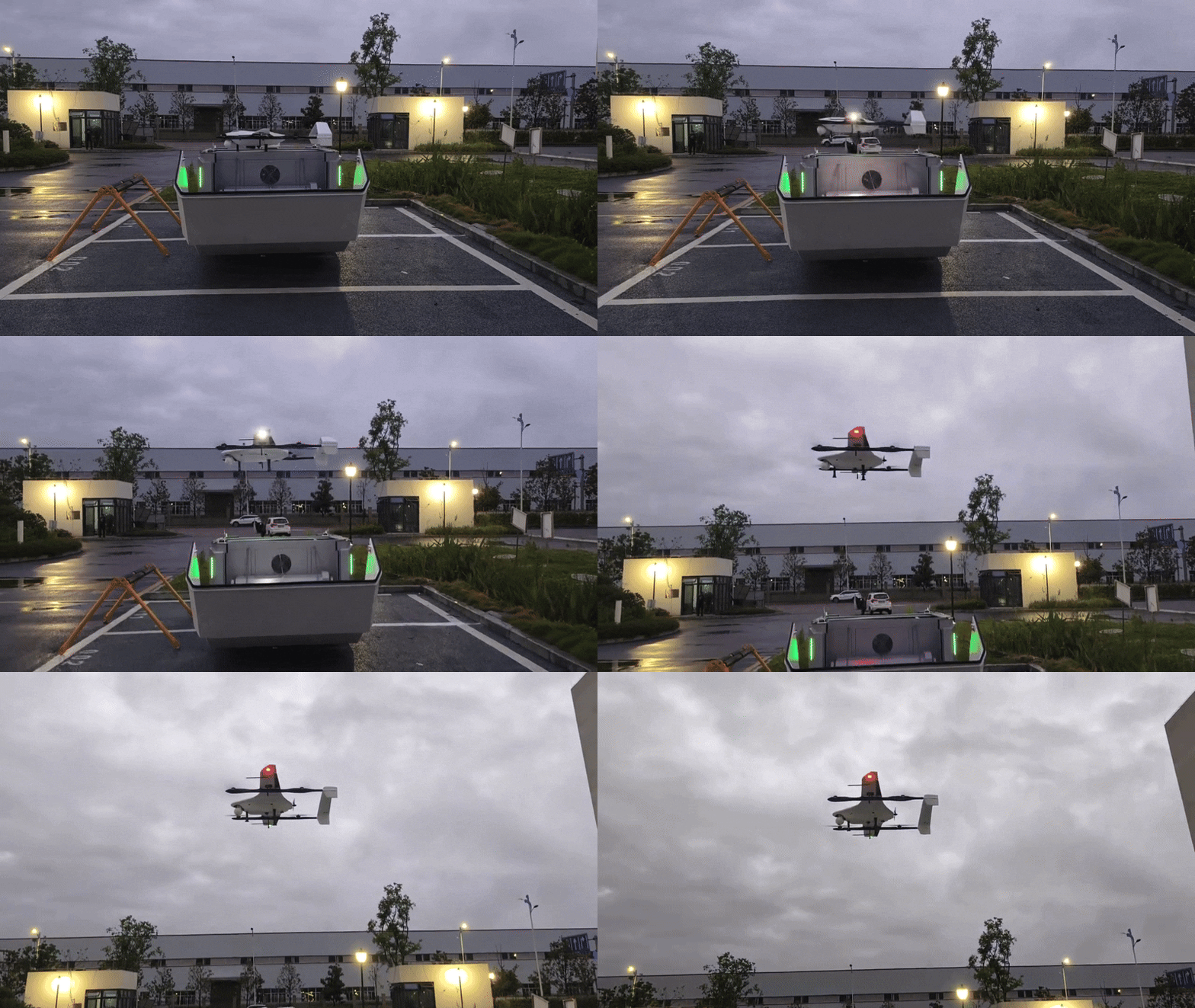
That type of performance suited the G318 operation. The aircraft had to travel more than 20 kilometres before starting the survey and then return for further missions over the following seven days.
The aircraft provides access to the site, while the payload determines what the team can learn from the flight. A standard camera may be sufficient for locating a blocked road. Measuring ground movement, finding heat sources or mapping terrain beneath vegetation requires more specialized equipment.
The models below are examples of current commercial payloads that can support disaster assessment.
Camera or sensor | Example device | What it can show |
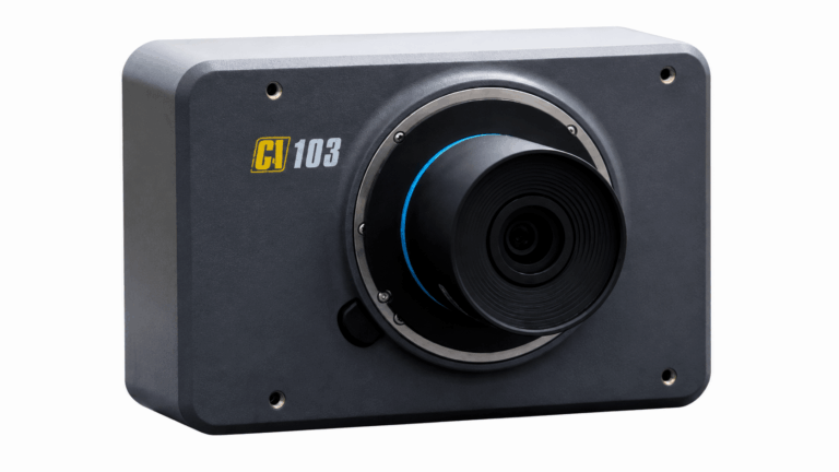
RGB aerial camera | A 61 MP full-frame mapping camera for detailed orthophotos. It can document road damage, cracks, debris and visible changes across the site. | |
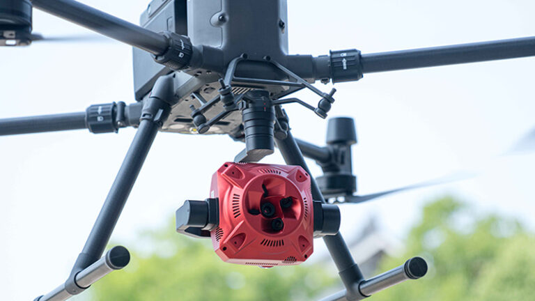
Oblique camera | A five-sensor oblique camera with more than 120 million effective pixels. Images captured from several angles can be combined into a detailed 3D model. | |
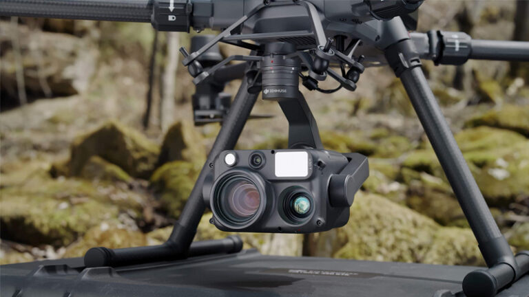
Zoom and thermal gimbal | Combines wide-angle and zoom cameras with thermal imaging and a laser rangefinder. It can inspect distant objects, identify heat sources and provide live situational awareness. | |
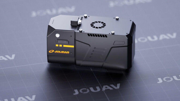
UAV LiDAR | Produces dense 3D point clouds of slopes and infrastructure. Multiple laser returns help map the ground through vegetation and support terrain or debris-volume calculations. | |
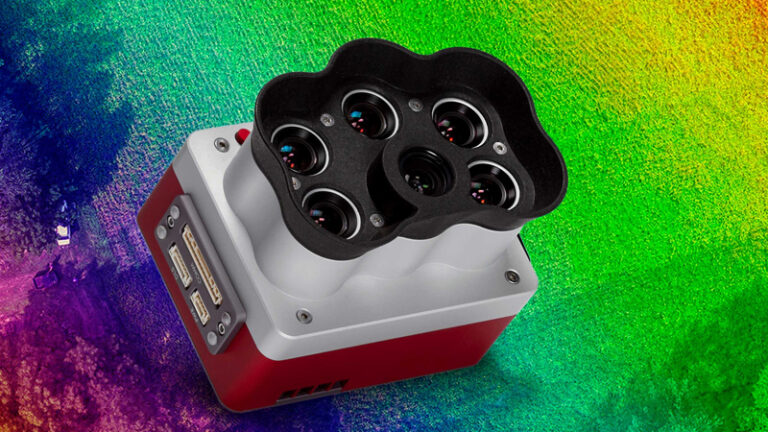
Multispectral and thermal sensor | Captures multispectral, panchromatic and thermal data together. It can help monitor vegetation stress, surface temperature and moisture-related changes around unstable terrain. |
RGB and oblique cameras are commonly used for photogrammetry. Overlapping photographs are processed into an orthomosaic or 3D surface model. These products make it easier to measure distances, areas and volumes than ordinary aerial video.
Thermal cameras are particularly useful during wildfires, industrial accidents and search operations. LiDAR is valuable where the shape of the terrain matters or vegetation obscures parts of the ground. Multispectral data can add information about soil moisture and vegetation changes, although interpreting it usually requires specialist knowledge.
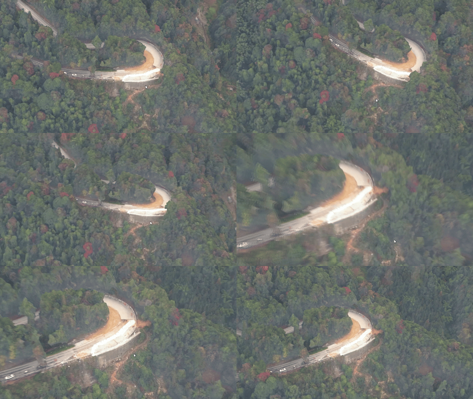
The first flight records the immediate damage. Later flights show whether the slope is stabilizing or continuing to move.
To make the comparison useful, the drone follows a similar route and captures images from consistent positions. Specialists can then compare orthomosaics, elevation models and 3D reconstructions from different dates.
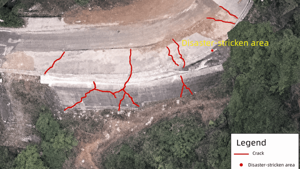
Even small differences may matter. A widening crack, a change in surface height or fresh debris near the road can indicate further movement. Repeated surveys can also show whether clearance work is changing the load on the slope or creating a new risk.
The same approach is used in other emergencies. Updated maps can show which access roads remain open, where evacuation routes are blocked and where equipment can be positioned safely. After floods, they can identify damaged bridges and isolated areas. During fires, repeated thermal surveys can reveal new or returning hot spots.
On G318, the CW-15V system monitored the area for seven days. The resulting data allowed specialists to detect subtle deformation, calculate the amount of material that had to be removed and follow changes in the risk level.
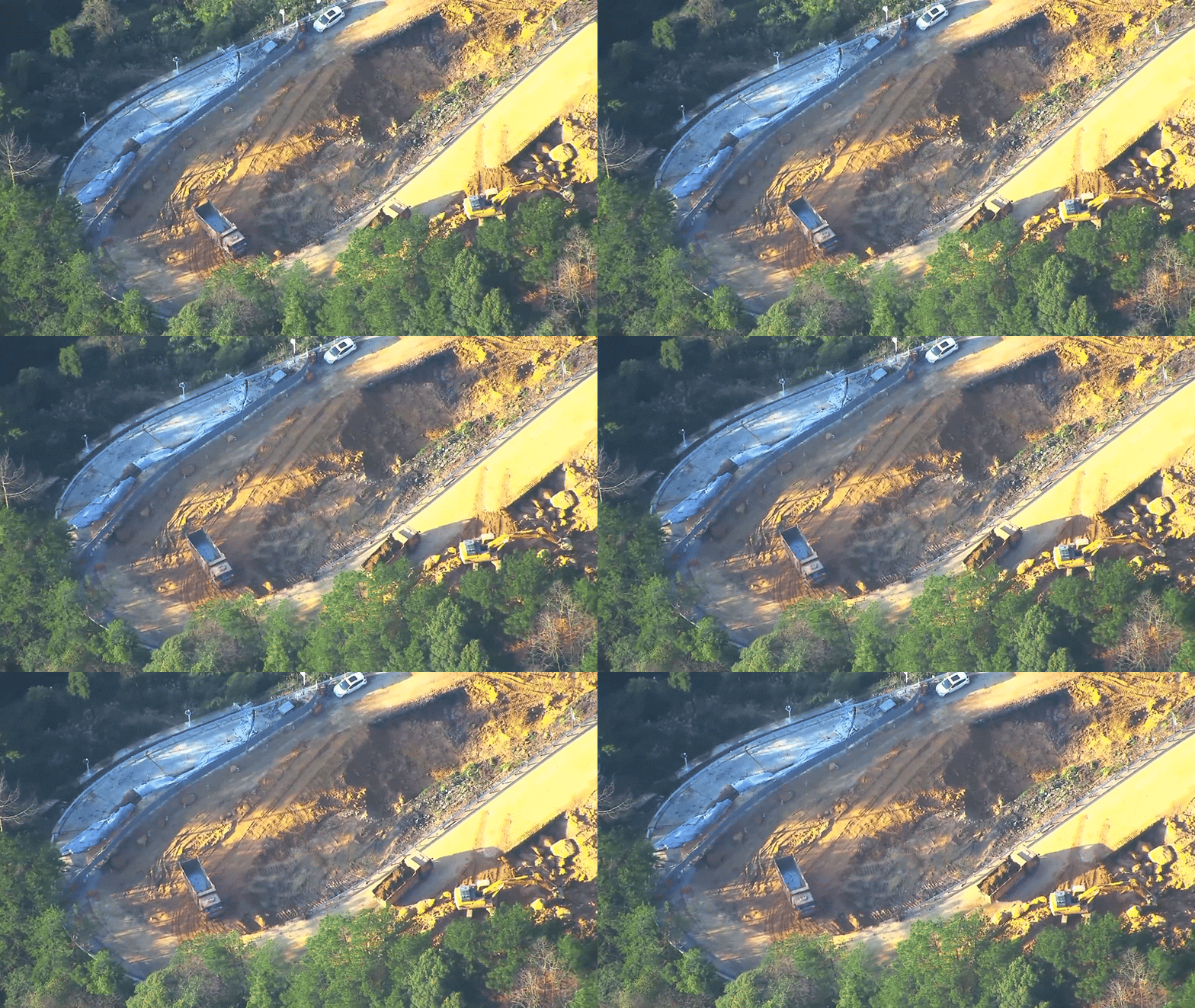
The danger did not end with the first assessment. Repair work brought people and machinery back to an area where the ground had recently failed. Excavation, vibration and changing loads could all affect slope stability.
In January 2026, the autonomous system returned to monitor construction of an emergency road diversion along G318. Regular surveys documented progress and checked whether the slope was showing signs of renewed movement.
This extended the role of the drones from emergency mapping to recovery monitoring. Project managers could follow construction without relying entirely on teams working below the unstable section, while survey data helped protect workers and equipment from a secondary slide.
The G318 operation began with a practical problem: authorities needed accurate information from a place that was not safe to enter.
Remote deployment allowed the survey to start without sending a flight crew to the landslide. The VTOL platform covered the distance from the hangar, while oblique imagery and live video provided a detailed view of the damaged area. Repeated flights then showed how the slope changed over time.
The same system remained useful after the immediate emergency had passed. It supported road-access decisions, removal planning and the monitoring of recovery work. For disaster teams, that continuity can be as important as the speed of the first flight.
The JOUAV CW-15V is designed for long-range mapping, emergency assessment, infrastructure inspection and surveillance. Typical missions include monitoring landslides, floods, wildfires, roads, pipelines and power lines.
JOUAV lists a maximum flight time of 120 minutes. Actual endurance depends on the payload, weather, flight speed, altitude and mission profile.
The CW-15V VTOL Hangar configuration has a stated operating radius of up to 47 km and a maximum take-off altitude of 4,500 metres. Actual operating limits depend on local regulations and environmental conditions.
The CW-15V supports dual payloads and can combine an RGB mapping camera with an EO/IR gimbal or LiDAR sensor. Available options include the 61 MP JOUAV CA-103 aerial camera, the MG-120E zoom and thermal gimbal, and the JoLiDAR-1000 system.
The hangar stores, charges and launches the CW-15V, while JoCloud handles mission planning, live data access and fleet management. The system can automate takeoff, route execution, landing, data upload and charging, enabling remote and BVLOS operations where authorized.