In many agricultural operations, crop stress is still identified the traditional way: walk the field and look for problems. The trouble is that by the time you notice discoloration, curling, thinning canopy, and growth compression on the ground, the crop has already been under significant physiological stress.
This delay is becoming less and less tolerable. Climate unpredictability, irrigation pressure, disease pressures, and skyrocketing input prices are forcing growers to react more quickly, with more field acuity.
In this article, we explore how early aerial sensing data can reveal crop stress before visible symptoms appear, what types of plant changes multispectral and thermal imaging can detect, and how modern drone-based workflows help growers monitor crop health more efficiently. We also look at the role of multispectral cameras and UAV platforms in building scalable, data-driven agricultural monitoring operations.
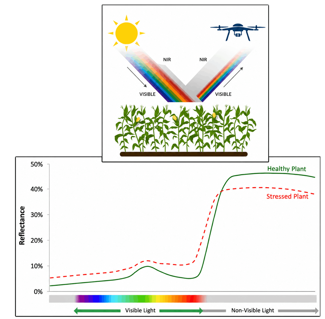
One of the most important aspects of crop monitoring is understanding that plants do not suddenly become stressed overnight. Physiological changes usually appear gradually, often before visible symptoms develop.
When plants experience water stress, disease pressure, nutrient imbalance, or root-zone problems, several things begin to change simultaneously:
Many of these changes are invisible during field scouting, especially across large agricultural areas. However, multispectral and thermal sensors can detect them much earlier.
Healthy vegetation absorbs most visible red light for photosynthesis while reflecting near-infrared wavelengths. As stress develops, this balance changes. Plants may reflect light differently, lose canopy uniformity, or show thermal anomalies long before leaves visibly yellow or wilt.
In practical operations, this means UAV-collected multispectral and thermal data can reveal the beginning of a problem days earlier than manual scouting alone.
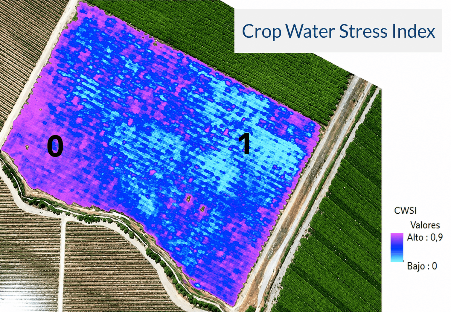
Water stress is one of the clearest examples of how aerial sensing can support early issue detection.
As moisture availability drops, plants reduce transpiration to conserve water. Because transpiration naturally cools the canopy, reduced water movement often leads to a measurable canopy temperature increase before visible drought symptoms appear.
Thermal imagery works particularly well in the earliest stages. Within one field monitoring project the California Heartbeat Initiative (CHI) researchers conducted repeated UAV flights over vegetation under different water treatments, combining thermal, multispectral, and RGB imagery throughout the day. They found that some plants began to exhibit measurable stress signs almost right after their water supply was cut off. Within just a day, the vegetation facing severe water shortages showed significant temperature spikes in thermal images, along with reduced moisture content and changes in spectral signatures as leaves lost their chlorophyll and the canopy structure started to break down.
Researchers also noted that drying vegetation not only became hotter but reflected light differently as leaves curled, browned, and reduced their effective leaf area. After several days without water, moisture levels dropped dramatically, demonstrating how quickly physiological stress can escalate and how early UAV sensors can detect these changes compared to traditional visual scouting.
What makes aerial sensing particularly useful is the ability to identify spatial irregularities such as:
Instead of treating an entire field uniformly, growers can focus scouting and intervention precisely where anomalies begin developing.
Disease observation presents another challenge. The earliest stages of disease tend to be fairly difficult to observe, and may be nearly impossible without high-resolution imagery or close-range assessment.
In crop trial environments, repeated UAV flights have shown strong results in tracking disease progression by analyzing vegetation cover, canopy vigor, and multispectral response over time. Rather than relying on isolated visual observations, operators establish baseline measurements and monitor how plots evolve across consecutive flights. A single flight can identify variability. Multiple flights reveal whether stress is spreading, accelerating, or stabilizing.
For example, repeated UAV missions can help detect:
This method is especially useful in large farming operations where it’s just not feasible to manually inspect every single field section.
One of the most common misunderstandings about using UAVs in agriculture is the belief that simply having better sensors will solve the problem. In reality, frequency and consistency are often more important than one extremely detailed dataset.
Research in precision agriculture consistently shows that multi-temporal UAV observations significantly improve the reliability of vegetation assessment compared to single flights. In one study, classification accuracy of vegetation patterns improved by up to 5–10% when multiple UAV flights were used across the growing season.
The reason is straightforward: crops are dynamic systems. Stress does not appear uniformly or at a single moment. It develops gradually and often unevenly across a field — influenced by micro-variations in soil moisture, irrigation efficiency, drainage, pest pressure, and weather exposure.
With higher flight frequency, aerial monitoring workflows can:
Another key factor is the concept of detection windows. Some stress signals — especially water stress and early physiological changes — may only be detectable for a short period before plants either recover or deteriorate further. This means that if farmers don’t collect data frequently enough, they might completely miss crucial changes.
In practical terms, this highlights why having high-resolution sensors isn’t sufficient on its own. Even the most advanced multispectral or thermal payload cannot compensate for missing time points. A field may look healthy on the day of a flight and already be under stress a few days later.
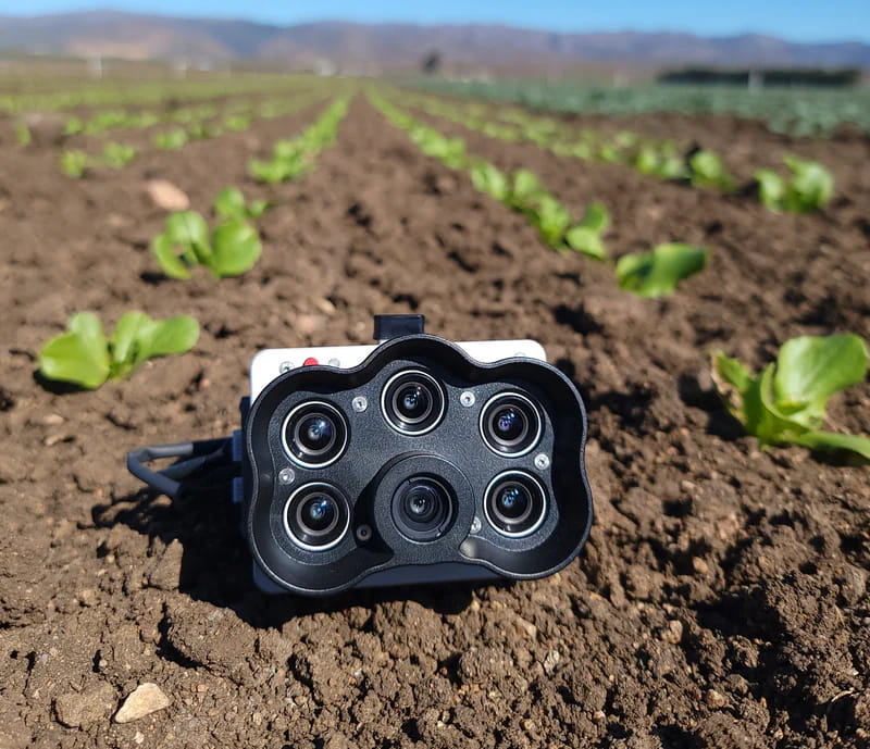
Modern crop monitoring is increasingly turning to multispectral imaging because it offers precise measurements rather than just visual assessments.
Systems such as the MicaSense RedEdge-P combine narrow spectral bands with high-resolution imagery to calculate vegetation indices such as NDVI and NDRE, helping operators evaluate crop vigor, chlorophyll response, and canopy consistency.
Overview of Agricultural Indices:
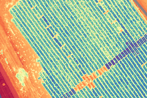
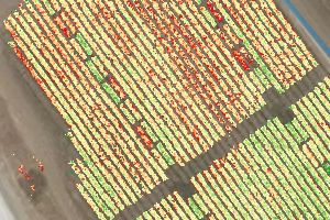
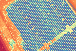
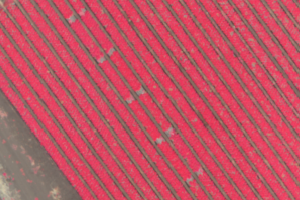
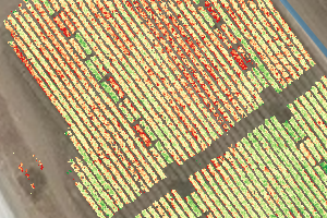
The RedEdge-P is particularly useful for:
Thanks to its higher-resolution panchromatic band, it produces clearer multispectral images, making it easier to spot smaller issues earlier in the stress cycle. The system also includes radiometric calibration tools that improve consistency across repeated flights and changing light conditions.
For water-related monitoring, thermal-enabled multispectral systems become especially valuable because they combine canopy vigor analysis with temperature mapping. This helps operators identify areas where physiological stress develops before visible symptoms appear.
Sensor performance is only part of the workflow. The UAV platform itself determines operational efficiency, repeatability, coverage area, and payload flexibility.
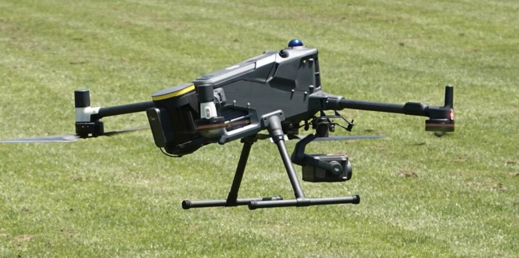
The DJI Matrice 400 is widely used in professional mapping and agricultural workflows. It supports advanced payload integration, RTK positioning, automated missions, and repeatable data collection. The platform can carry multispectral, thermal, and third-party agricultural payloads simultaneously, which is important for multi-layer crop analysis.
Its automated mapping workflows and high-precision flight capabilities are particularly useful for:
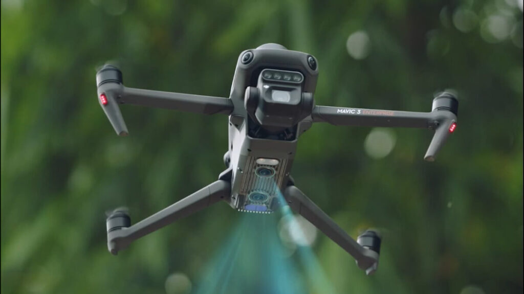
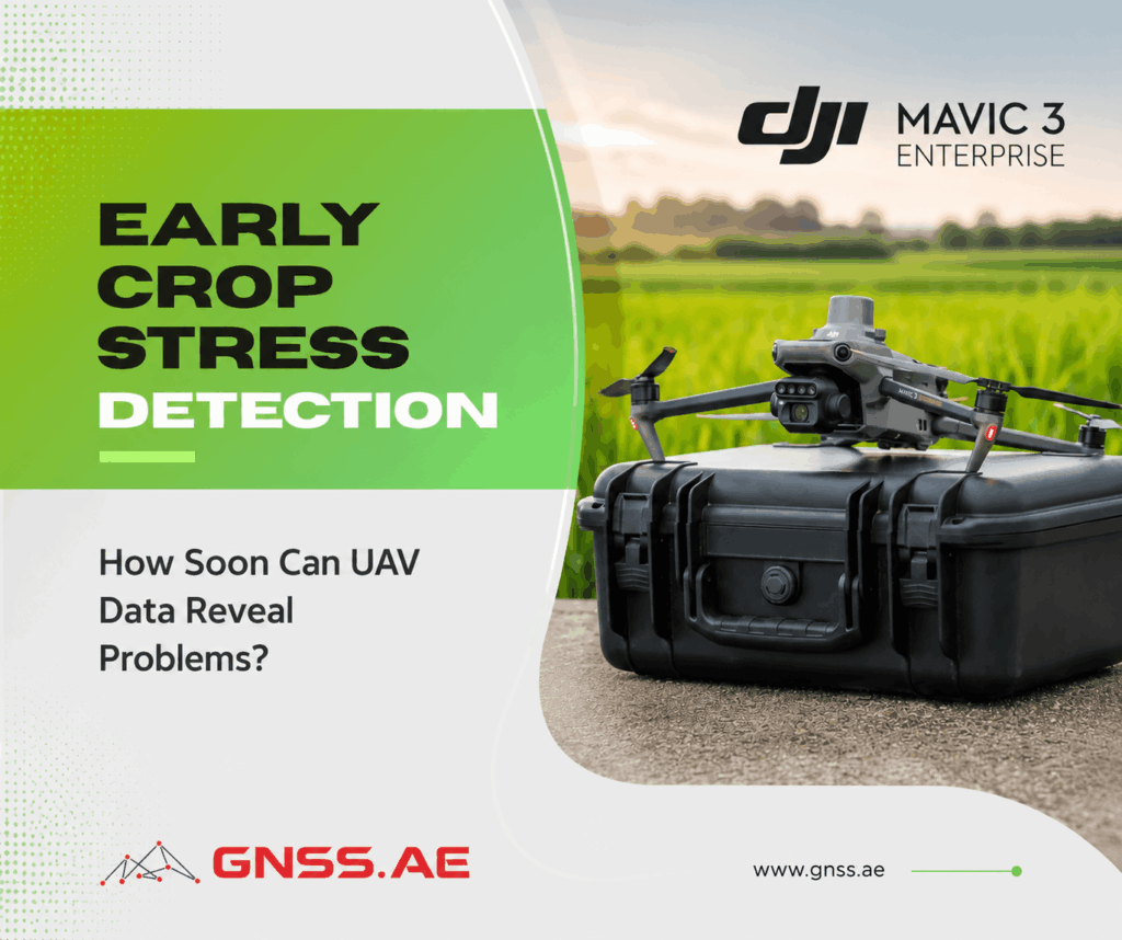
For faster deployment and routine scouting missions, the DJI Mavic 3 Multispectral offers a more compact workflow optimized for agricultural monitoring. It combines RGB and multispectral imaging in a portable platform suitable for frequent flights during the growing season.
The practical advantage of these UAV systems is not simply image capture. It is the ability to generate repeatable, scalable datasets across hundreds or thousands of hectares while reducing the time required for manual scouting.
Despite rapid improvements in aerial sensing, UAV data alone does not automatically diagnose every field issue.
Drone imagery identifies anomalies and stress patterns. Determining the actual cause still requires agronomic interpretation and ground validation.
For example:
This is why effective workflows combine UAV monitoring with:
In practice, UAV-based monitoring reduces uncertainty. Instead of manually checking entire fields, growers can focus directly on the locations where stress signatures begin appearing.
Crop monitoring is a complex process, and UAV systems are helping it become more scalable and efficient. However, aerial data is not a standalone solution — its effectiveness depends heavily on how it is implemented.
Sensor selection, flight frequency, environmental conditions, and field-specific variables all influence the quality and interpretability of the results. In addition, multispectral and thermal data still require agronomic context to translate imagery into actionable decisions.
This is where many operational workflows face challenges: not in data collection itself, but in ensuring that the right hardware, methodology, and analytical approach are aligned with the specific agricultural environment.
Choosing the appropriate equipment and building a reliable UAV-based monitoring workflow is therefore as important as the data itself. GNSS.AE can support this process by providing the right drone platforms, multispectral sensors, and integrated solutions for agricultural monitoring.
Contact GNSS.AE to learn more.