Oil spills represent a significant threat to marine ecosystems, coastal communities and global economies. According to the European Space Agency, over 4.5 million tons of oil are spilled annually, with 45% attributed to operational discharges from ships.
Timely detection and accurate characterization of oil on water are critical for rapid response and mitigation. In recent years, the integration of multispectral cameras into remote sensing platforms — particularly drones and satellites — has emerged as a powerful solution for oil spill detection and monitoring. This article explores how advances in multispectral imaging technology are enhancing our ability to detect oil spills with greater precision and operational flexibility.
Oil spills occur due to:
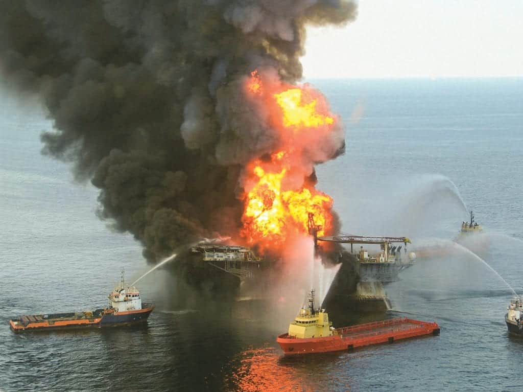
Major incidents, such as the Deepwater Horizon spill (2010) and the Sanchi tanker collision (2018), highlight the devastating effects on marine life, fisheries and coastal economies. Heavy oils persist for years, while light oils, though volatile, are highly toxic.
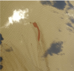
Conventional oil spill surveillance relies heavily on visual aerial inspection and synthetic aperture radar (SAR). While SAR provides all-weather monitoring, it often misidentifies biogenic slicks and algal blooms as oil. Visual methods are limited by lighting conditions, cloud cover, and observer subjectivity. Mapping oil thickness based on sheen color is often unreliable.
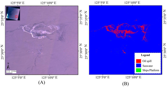
Satellite imagery such as Landsat 8 supports large-scale monitoring, while drones offer high-resolution follow-up. For example, the Spectral Gradient Energy (SGE) method has enhanced detection capabilities for events like the 2013 Persian Gulf spill.
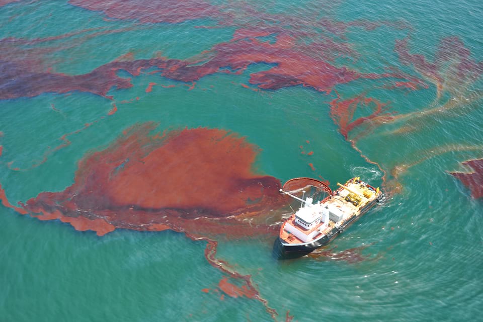
“Eighty percent of the oil is contained in twenty percent of the slick” is a well-known field adage—underscoring the need for tools that quantify, not just detect, oil (Svejkovsky et al., 2012).
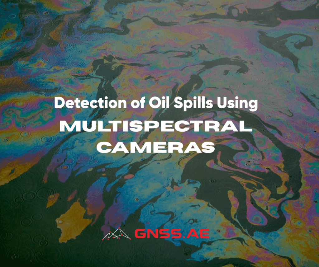
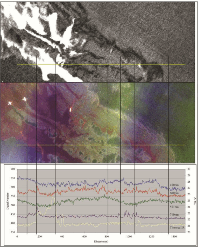
Multispectral cameras capture reflected light in discrete bands across the visible to near-infrared (VNIR) spectrum. Oil alters reflectance properties, producing unique spectral signatures that allow detection, classification, and thickness estimation.
BSEE-funded research confirmed that reflectance patterns from blue to NIR bands support detection of thin sheens (<0.01 mm) and emulsified oil. Thermal infrared imaging expands detection to thicker slicks (up to several millimeters), including at night or in turbid waters (Svejkovsky et al., 2012).
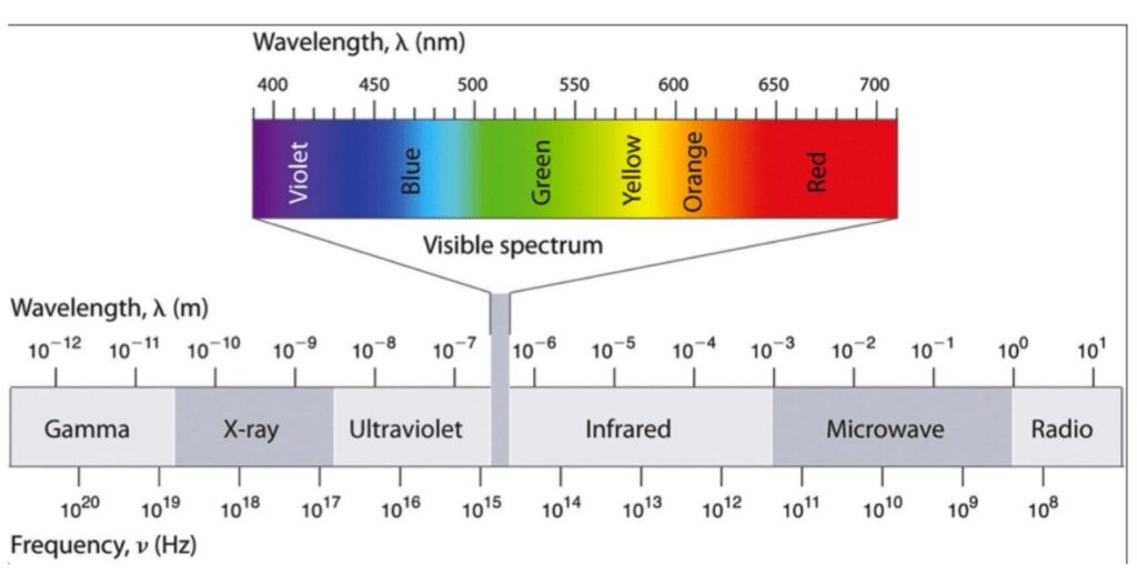
These spectral bands, especially in the 400–900 nm range, enable differentiation between clean water, oil sheens and emulsified oil due to their distinct reflectance characteristics.
Oil-water contrast: Enhances boundary detection.
Thickness estimation: Varies by spectral intensity.
Oil type classification: Different petroleum products exhibit distinct reflectance profiles.
Night operation: Detects heat differences independent of sunlight.
Improved boundary detection: Heat retention of oil aids in delineation.
Unmanned Aerial Vehicles (UAVs) equipped with multispectral and thermal sensors provide:
High-resolution imaging: Surpasses satellite granularity.
Rapid deployment: Ideal for emergency situations.
Cost efficiency: Reduces operational expenses compared to manned aircraft.
The BSEE study verified system performance in Arctic and turbid conditions:
Cold environments: Visible/NIR imagery remains accurate; thermal calibration is required.
Turbid waters: Sediment affects NIR bands but may enhance contrast in blue/green bands.
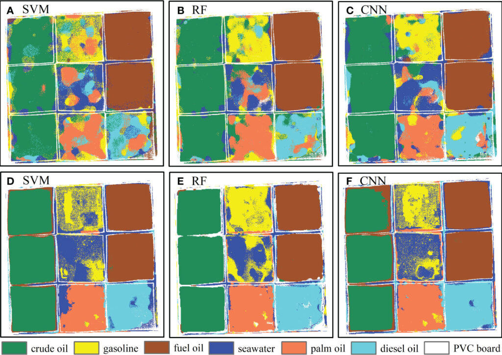
Machine learning techniques have also been successful. UAV-based hyperspectral imaging systems achieved 74–76% accuracy in oil type classification using SVM algorithms. Thermal sensors have demonstrated effectiveness in detecting thin sheens invisible to the naked eye.
Advanced models like SVM, RF, and CNN accurately distinguish oil types for targeted cleanup strategies (Frontiers in Marine Science, 2023).
The figure below (Identification of marine oil spill pollution using hyperspectral combined with thermal infrared remote sensing, 2023) compares classification results using Support Vector Machines (SVM), Random Forest (RF), and Convolutional Neural Networks (CNN) on hyperspectral (HSI) and thermal (HTI) imagery. These methods accurately differentiate crude oil, gasoline, diesel, and other substances—critical for targeted cleanup strategies.
For effective oil spill monitoring, advanced sensor technologies play a crucial role.
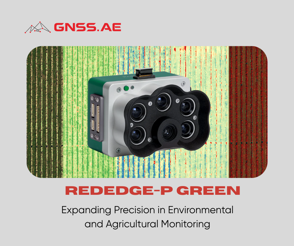
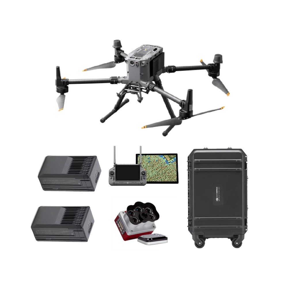
The Micasense Rededge-P Multispectral Kit with DJI Skyport and DJI Matrice 350 RTK drone enables real-time, repeatable and GIS-compatible oil spill mapping—suitable for government agencies, disaster response teams, and environmental consultants.
When deployed on drones, these sensors create a powerful remote sensing system capable of rapid response, detailed spill characterization and informed decision-making for cleanup operations.
Multispectral and thermal imaging systems deployed via UAVs offer a rapid, accurate, and scalable solution for oil spill monitoring. Their ability to detect, quantify, and classify oil enhances response efficiency and environmental protection.
As oil spills continue to threaten global waters, integrating these advanced remote sensing tools will be essential for resilient and sustainable ocean stewardship.
Svejkovsky, J., Muskat, J. (2012). Open Water Multispectral Aerial Sensor Oil Spill Thickness Mapping in Arctic and High Sediment Load Conditions. U.S. Department of the Interior
Bureau of Safety and Environmental Enforcement. Contract No. E12PC0002
Yang J, Hu Y, Zhang J, Ma Y, Li Z and Jiang Z (2023). Identification of marine oil spill pollution using hyperspectral combined with thermal infrared remote sensing. Front. Mar. Sci. 10:1135356. doi: 10.3389/fmars.2023.1135356
Zhao, D., Tan, B., Zhang, H., & Deng, R. (2022). Monitoring Marine Oil Spills in Hyperspectral and Multispectral Remote Sensing Data by the Spectral Gene Extraction (SGE) Method. Sustainability, 14(20), 13696. https://doi.org/10.3390/su142013696
European Space Agency (ESA). (n.d.). CleanSeaNet: Satellite-based oil spill monitoring. Retrieved from https://www.esa.int
European Maritime Safety Agency (EMSA). (2023). Remotely Piloted Aircraft Systems (RPAS) for Maritime Surveillance. Retrieved from https://www.emsa.europa.eu
NOAA Ocean Service Education. (n.d.). What happens during an oil spill? Retrieved from https://oceanservice.noaa.gov/education/tutorial-coastal/oil-spills/os03.html