Coral reefs cover less than 1% of the ocean floor, yet they support nearly a quarter of all marine species. They protect coastlines, sustain fisheries, and play a critical role in global biodiversity. At the same time, these ecosystems are increasingly vulnerable to rising sea temperatures, pollution, coastal development, and extreme weather events.
One of the main challenges for marine scientists is understanding how reef environments change over time. Traditional survey methods provide valuable information, but they usually cover limited areas and often require extensive fieldwork, repeated site visits, and significant resources.
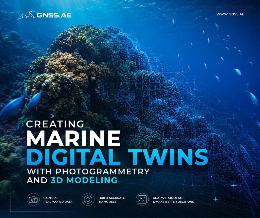
Advances in underwater photogrammetry and 3D modeling are helping address these limitations. Rather than relying solely on measurements, photographs, and diver observations collected during individual surveys, researchers can now generate detailed digital representations of underwater habitats that preserve their structure and visual characteristics. These digital twins provide a more comprehensive and scalable way to study, monitor, and manage underwater habitats.
In this article, we explore how photogrammetry and 3D modeling are used to create marine digital twins and how these technologies support long-term ecosystem monitoring and conservation efforts.

A standard 3D model captures the shape and appearance of an object or environment at a particular point in time. A digital twin expands on a conventional 3D model by integrating additional data layers and supporting ongoing updates as new observations become available.
For marine applications, a digital twin may include:
The result is a continuously updated digital representation of an ecosystem that can be continuously updated as new information becomes available. For researchers and environmental agencies, this creates opportunities that were previously difficult or impossible to achieve through traditional survey methods.

Creating an underwater digital twin starts with data collection.
Compared with aerial photogrammetry, underwater mapping introduces additional constraints. Water absorbs and scatters light, reducing visibility and altering colors. Refraction affects camera optics, while currents and changing environmental conditions complicate data acquisition.
As a result, underwater surveys require carefully planned imaging workflows
The process typically begins with the acquisition of large sets of overlapping photographs covering the target area.
Depending on the project, imagery may be collected by divers, remotely operated vehicles (ROVs), autonomous underwater vehicles (AUVs), or dedicated underwater camera platforms following predefined survey paths.
High image overlap is essential for accurate reconstruction. Each section of the reef is photographed from multiple viewpoints, allowing photogrammetry software to identify shared features across images and estimate their positions in three-dimensional space.
Depending on site conditions and survey design, teams may cover several hectares per day while maintaining image resolutions sufficient to resolve fine coral-scale features.
The scale of modern marine mapping projects is remarkable. Recent initiatives have reconstructed large sections of reef systems, underwater caves, pinnacles, channels, and coastal environments at resolutions fine enough to analyze individual coral colonies.
A digital twin becomes significantly more valuable when it is accurately positioned in real-world coordinates.
Unlike terrestrial surveys, underwater projects cannot rely directly on GNSS because satellite signals do not propagate through water. Establishing an accurate spatial reference therefore requires combining several positioning methods throughout the survey workflow.
Depending on the project requirements, teams may use:
Together, these systems allow underwater datasets to be positioned relative to geographic coordinates and local or global vertical datums.
Once georeferenced, digital twins can be incorporated into GIS environments, compared with historical surveys, and analyzed alongside other environmental datasets.

For underwater projects, Metashape is often used to process reef surveys, seagrass mapping campaigns, coastal habitat assessments, and underwater infrastructure inspections. The platform supports image alignment, camera calibration, point cloud classification, 3D mesh generation, texturing, Ground Control Points (GCPs), and coordinate system management, helping survey teams create spatially accurate models that can be compared over multiple survey campaigns.
The software also supports tiled 3D model generation, LiDAR integration, network processing, and export to GIS-compatible formats, making it suitable for projects ranging from localized reef monitoring to large-scale digital twin environments covering hundreds of hectares.
Following data acquisition, photogrammetry software transforms large image collections into detailed three-dimensional reconstructions.
Although workflows vary between projects, processing generally includes:
In Agisoft Metashape, this workflow typically starts with photo alignment, where overlapping images are matched to generate a sparse point cloud. The dataset can then be processed into a dense point cloud, followed by mesh reconstruction and texture generation. For large underwater surveys, processing can be distributed across multiple workstations using Metashape’s Network Processing functionality, significantly reducing turnaround times for datasets containing tens of thousands of images.
The resulting models may contain hundreds of millions of polygons, preserving fine structural details of the underwater environment.
Researchers can then examine coral morphology, map habitat features, quantify reef complexity, and document the distribution of marine organisms directly within the digital model.

One of the main advantages of marine digital twins is their ability to support long-term change analysis.
Conventional reef monitoring often relies on field observations, transect surveys, and repeated photographic documentation. These approaches remain valuable, but they are typically limited to selected sampling areas rather than entire reef systems.
When surveys are repeated using consistent acquisition and processing workflows, digital twins enable researchers to compare large sections of a reef across multiple time periods.
Model comparisons can be used to identify and quantify:
For example, by comparing photogrammetric models collected several years apart, researchers can measure growth rates of individual coral colonies with centimeter-level precision.
Coral bleaching is among the most significant stressors affecting reef ecosystems worldwide.
When water temperatures remain elevated for extended periods, corals expel the symbiotic algae that supply much of their energy and give them their characteristic coloration. Prolonged bleaching events can lead to partial or widespread coral mortality.
Repeated surveys of georeferenced digital twins allow researchers to evaluate how specific reef areas respond before, during, and after bleaching events.
Changes in coral coloration, surface condition, species composition, and structural complexity can be assessed directly within the three-dimensional model and compared with previous survey results. This provides a spatial record of how bleaching affects reef habitats and how those habitats recover over time.


Marine digital twins can incorporate more than the physical structure of reefs and seabeds. Increasingly, researchers enrich these models with biological observations collected during field surveys and ecological studies.
Species records may be linked to specific locations within the digital environment together with information such as:
By combining spatial and biological information, researchers gain a better understanding of how marine species interact with their environment.
Patterns that may be difficult to observe during individual dives often become visible when viewed across an entire ecosystem. This approach supports studies of protected species, habitat utilization, and long-term biodiversity trends.
High-resolution digital twins can also be integrated into visualization environments, including platforms such as Unreal Engine, enabling users to explore underwater habitats in an interactive setting.
Researchers can revisit survey sites, examine habitat features, and communicate findings to colleagues without returning to the field. The same environments can be used in education and outreach, giving students and decision-makers access to locations that may be remote, logistically challenging, or environmentally sensitive.
Depending on the application, these virtual environments may incorporate additional elements such as:
This creates a realistic representation of the underwater world that supports both scientific analysis and public engagement.
Although coral reefs receive much of the attention, the same principles behind marine digital twins can be applied in a wide range of underwater environments.
Digital twins provide a non-invasive way to document submerged cultural heritage sites, including shipwrecks and ancient structures.
Detailed three-dimensional records preserve site conditions at the time of survey and support future research without repeated physical interaction with fragile remains.
High-resolution 3D models can assist in the inspection of pipelines, subsea cables, offshore platforms, and wind farm foundations. Engineers can assess structural conditions, identify areas requiring closer investigation, and support maintenance planning using spatially referenced datasets.
Repeated surveys allow environmental agencies and researchers to compare conditions before and after restoration efforts, helping quantify ecosystem responses and evaluate whether project objectives are being achieved.
Similar workflows can also be applied beyond coral reefs, including lakes, rivers, mangrove systems, seagrass meadows, and other aquatic habitats where spatial change needs to be documented over time.
Marine digital twins provide a practical framework for documenting and analyzing underwater environments.
By combining photogrammetry, georeferencing, and three-dimensional modeling, researchers can build detailed representations of reefs, seabeds, and other aquatic habitats that preserve both spatial context and ecological information.
These datasets support applications ranging from change detection and biodiversity assessment to infrastructure inspection and habitat restoration. Equally important, they allow many forms of analysis to take place after fieldwork has been completed, reducing the need for repeated disturbance of sensitive environments.
As the underlying technologies mature, marine digital twins are likely to become an increasingly important component of marine monitoring programs, helping researchers track environmental change and make more informed management decisions.