Large construction projects are rarely limited by the lack of data. The main problem is how quickly that data reaches decision-makers and how consistently it reflects what is happening on site.
Delayed reporting, fragmented communication between contractors, rework caused by outdated information, and misalignment between planned and actual progress are common operational bottlenecks across residential, industrial, and infrastructure projects.
On large-scale developments, these issues are amplified by the scale of operations and the number of stakeholders involved. As a result, time-sensitive information is often processed too late to influence decisions effectively.
Drone technology has emerged as a practical response to this gap. In this article, we explore how drones are being used to improve construction monitoring, support faster decision-making, and enhance safety across large-scale projects.

Consider a routine operational decision: determining whether heavy equipment can be moved to a particular area of a construction site.
On a small project, the answer may be a short walk away. On large projects spanning several million square meters, this process can involve multiple site visits, manual verification of access routes, inspection of ground conditions, and coordination between different field teams.
What makes it worse is that different teams often report site conditions at different times, which leads to fragmented situational awareness.
This becomes even more critical in environments such as a large semiconductor manufacturing project in South Korea developed by SK ecoplant, where multiple construction zones operate simultaneously under varying environmental conditions, including winter temperatures dropping below -20°C.
In such conditions, information often becomes outdated before it reaches decision-makers, reducing the ability to respond effectively to changing site conditions.

Automated drone operations eliminate the need to organize a field inspection every time updated site information is required.
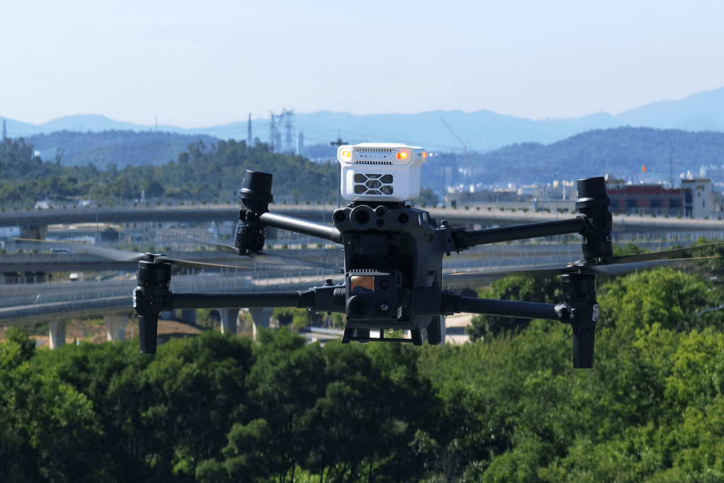
Project teams can schedule routine flights that run without a pilot on site. A drone launches from its docking station, follows a predefined route, captures imagery and survey data, and returns to recharge. On large construction projects, these flights can take place daily—or several times per day—providing a consistent view of site conditions and progress.
The type of information collected depends largely on the payload being used.
Together, these tools allow project teams to monitor construction progress, inspect critical assets, and evaluate changing site conditions without constantly deploying personnel across the site.

On large construction projects, automated drone workflows are typically structured around several repeatable mission types, each designed to solve a specific operational task.
One of the most common applications is routine progress tracking. Drones fly the same route at regular intervals, allowing project teams to compare site conditions over time. This makes it easier to monitor earthworks, verify construction progress, and identify deviations from the project schedule.
When teams need a complete view of the construction area, drones can capture imagery for orthomosaic maps and 3D models. These datasets provide an up-to-date representation of the entire site and are often used to document project milestones or support planning activities.
Large construction projects often include access roads, utility corridors, drainage systems, pipelines, and other linear assets. Drone flights along these routes help teams verify conditions quickly, especially after severe weather or heavy equipment activity
Inspection-focused missions are designed for detailed observation of specific structures, including cranes, scaffolding, temporary installations, and partially completed buildings.
Unlike scheduled flights, event-driven missions are triggered by operational needs, such as heavy snowfall, strong winds, or unexpected site disruptions.
In these cases, drones are deployed to rapidly assess site conditions, identify affected areas, and provide updated visual information to project teams.
Beyond real-time monitoring, drone programs create something equally valuable: a continuous record of site activity.
Regularly scheduled flights generate a verifiable archive of site conditions over time, including imagery, maps, and 3D models. This allows project teams to maintain a structured record of how the site evolves throughout the construction lifecycle.
This record is particularly useful when verifying completed work, comparing as-built conditions with design plans, or investigating discrepancies between project stakeholders. When questions emerge about progress, sequencing, or site conditions at a specific point in time, historical drone data provides an objective reference.

Drone data is not limited to visual representation. It also enables quantitative analysis of construction activities.
Photogrammetric and LiDAR-based models allow project teams to calculate stockpile volumes, monitor material movement, and track cut-and-fill operations across changing terrain.
Compared with traditional field measurements, drone-based surveys can be performed more frequently and across larger areas, helping teams maintain consistent reporting as site conditions evolve.

Safety is one of the main drivers behind drone adoption in construction, particularly on large projects where inspections may involve elevated structures, unstable terrain, active earthworks, or post-weather assessments.
Traditionally, evaluating these conditions required personnel to enter potentially hazardous areas. Drones reduce that exposure by allowing teams to collect inspection data remotely using high-resolution imagery, zoom cameras, and site models.
The value becomes especially clear after heavy rain, snowfall, or strong winds. Project teams can assess site conditions, identify potential hazards, and determine accessibility before sending personnel into the field.
On the SK ecoplant semiconductor project in South Korea, regularly updated aerial data helped teams identify and communicate potential risks earlier, supporting a more proactive approach to site safety.

Automated drone workflows reduce the dependency on repeated physical site visits by generating continuously updated site models.
Through platforms such as FlightHub 2, imagery, terrain models, inspection results, and flight records can be centralized in a single environment.
On the SK ecoplant semiconductor project, access to current site models helped teams move away from relying primarily on field observations toward a more data-driven approach to monitoring construction progress.
As a result, project teams were able to review site conditions remotely and maintain awareness across multiple construction zones without requiring frequent field inspections.
Large construction projects depend on coordination between contractors, subcontractors, consultants, engineers, and project owners.
When all stakeholders work from the same up-to-date site data, project discussions become less focused on verifying site conditions and more focused on resolving issues.
Instead of waiting for separate reports from different teams, stakeholders can review the same imagery, models, and inspection records. This reduces delays in communication and helps accelerate decision-making when project conditions change.
Drone-based construction monitoring is no longer limited to visual inspection tasks. It has evolved into a structured system for data collection, analysis, documentation, and coordination across the entire project lifecycle.
By integrating automated flight operations, specialized payloads, quantitative analysis tools, and cloud-based collaboration platforms, construction teams gain a more consistent and timely understanding of site conditions.
As construction projects continue to increase in scale and complexity, these systems are becoming an integral part of operational decision-making, supporting improved efficiency, safety, and project control.