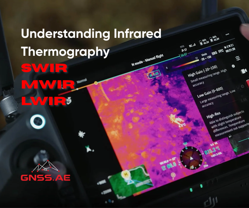
Infrared thermography has transformed a wide range of industries by delivering insight beyond the limits of visible light. It allows engineers, operators and decision-makers to visualize radiated thermal energy, effectively filling the gaps left by conventional optical systems.
At the core of this technology are three distinct spectral bands: Short-Wave Infrared (SWIR), Mid-Wave Infrared (MWIR), and Long-Wave Infrared (LWIR). Each band corresponds to a specific portion of the infrared spectrum and possesses unique characteristics that make it well-suited for particular applications. From remote sensing and industrial inspection to defense, agriculture, and scientific research, infrared imaging enables highly accurate, efficient, and non-invasive data capture across critical sectors.
Thermal imaging systems are commonly referred to as “cameras,” but in practice, they are sophisticated sensors designed to detect radiated heat, not visible light. Choosing the right infrared system—SWIR, MWIR or LWIR—requires careful consideration of several operational parameters, including:
Each spectral band provides a unique balance of imaging performance, atmospheric penetration, and system complexity — making it essential to align sensor capabilities with mission-specific objectives (see figure below).
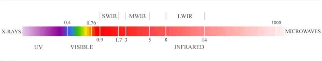
Wavelength range: 0.9–1.7 µm
SWIR sensors detect reflected light rather than emitted thermal radiation, making them ideal for non-thermal imaging in conditions where visible cameras fail. Thanks to strong solar reflectance in this band, SWIR systems perform exceptionally well in daylight and low-light (starlight) environments. They also offer the ability to see through obscurants such as fog, haze, dust, and smoke, which is critical in both industrial and tactical applications.
Wavelength range: 3.0–5.0 µm
MWIR cameras are optimized for high-temperature detection and operate by capturing emitted thermal radiation from objects. These systems typically use cooled detectors (such as InSb or HgCdTe), offering outstanding thermal sensitivity (NETD < 20 mK) and are well-suited for detecting hot targets over long distances—even in challenging environments. MWIR cameras provide superior atmospheric transmission for very long-range target detection (>10 km), especially in most climate conditions, compared to LWIR systems.
Wavelength range: 8.0–14.0 µm
LWIR systems are the most widely used infrared cameras, especially in commercial, civil and consumer sectors. They detect thermal radiation from ambient temperature objects, making them ideal for passive thermal imaging. Unlike MWIR systems, LWIR cameras typically use uncooled microbolometers, making them more affordable, compact, and low-maintenance.
DJI Mavic 3 Thermal – A compact, high-performance thermal drone ideal for field inspections and emergency operations
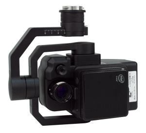
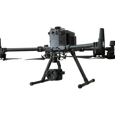
DJI Zenmuse H30T – A versatile multi-sensor payload with integrated thermal imaging, suitable for industrial and security missions
Choosing the appropriate infrared imaging system involves matching spectral capability with the imaging objective, environmental conditions, and system constraints. The following table summarizes key factors:
| Objective | SWIR | MWIR | LWIR |
|---|---|---|---|
| Thermal vs. Reflective Imaging | Reflective, non-thermal imaging; ideal for material analysis | High-temperature thermal imaging; excellent contrast and long-range capability | Passive thermal imaging of ambient temperature targets |
| Environmental Considerations | Performs well through haze and materials like silicon. | Offers strong atmospheric transmission and precise thermal detection | Performs well in fog, smoke, and darkness; less effective in high-humidity environments |
| Performance vs. Cost | Moderate cost; uncooled; requires external light source for some use cases | High-performance; cooled; expensive; requires stable operating conditions | Cost-effective; uncooled; suitable for broad commercial applications |
Multispectral infrared imaging is accelerating advancements in safety, automation, environmental monitoring and defense. The ability to “see the unseen” is revolutionizing how industries monitor assets, detect anomalies and make informed decisions in real time.
At GNSS.ae, our technical specialists are ready to help you navigate the complexities of infrared imaging. Whether your mission is high-precision aerial surveying, infrastructure diagnostics or tactical surveillance, we offer tailored solutions to meet your operational goals.