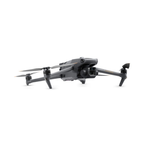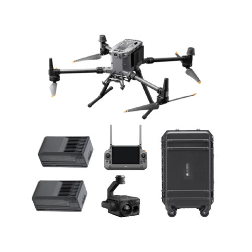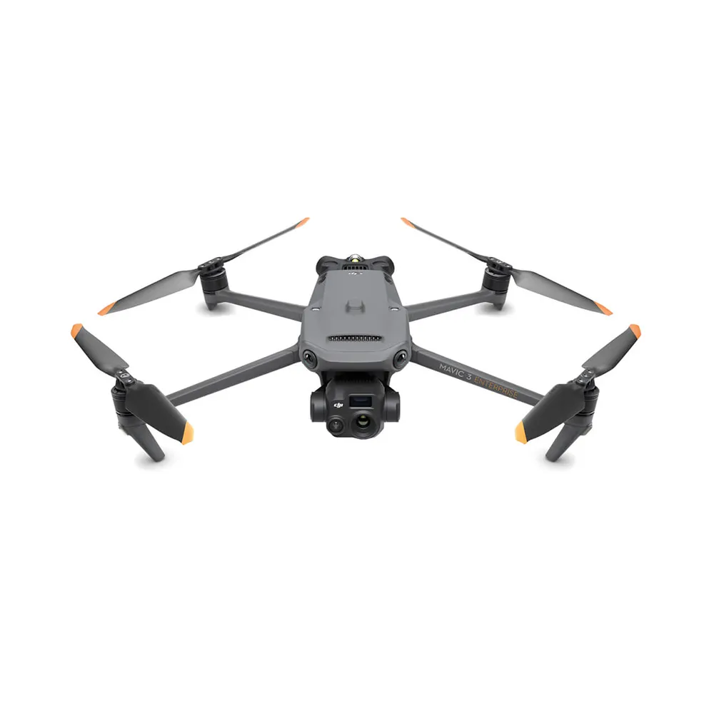
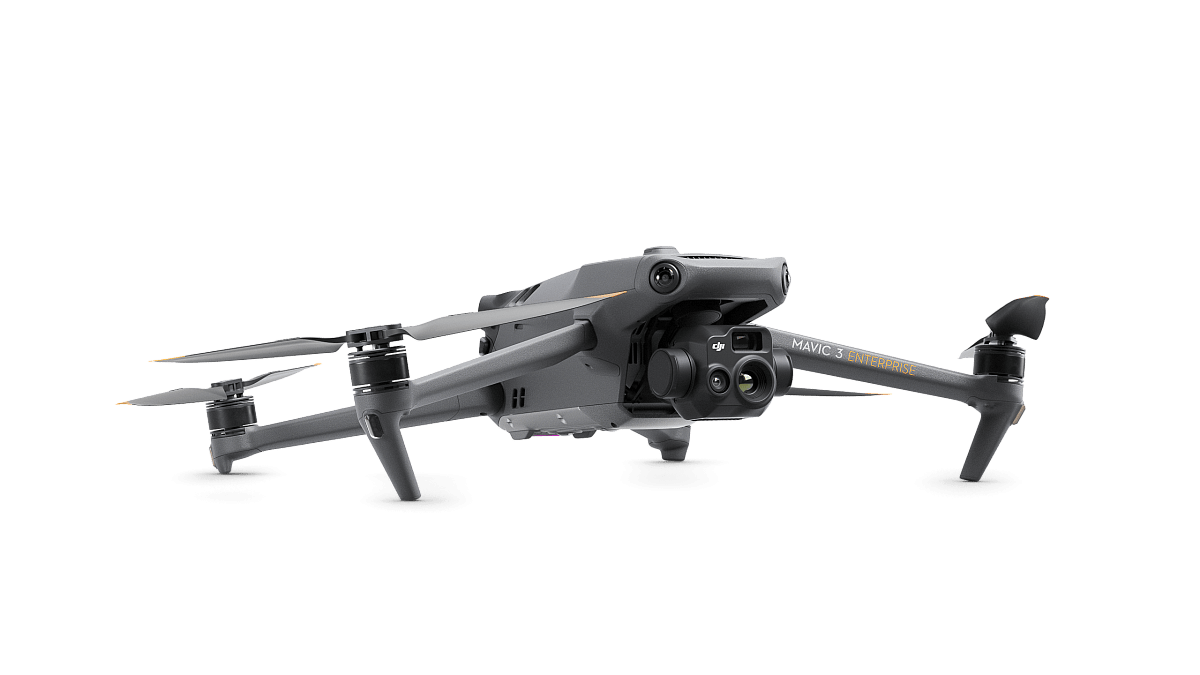
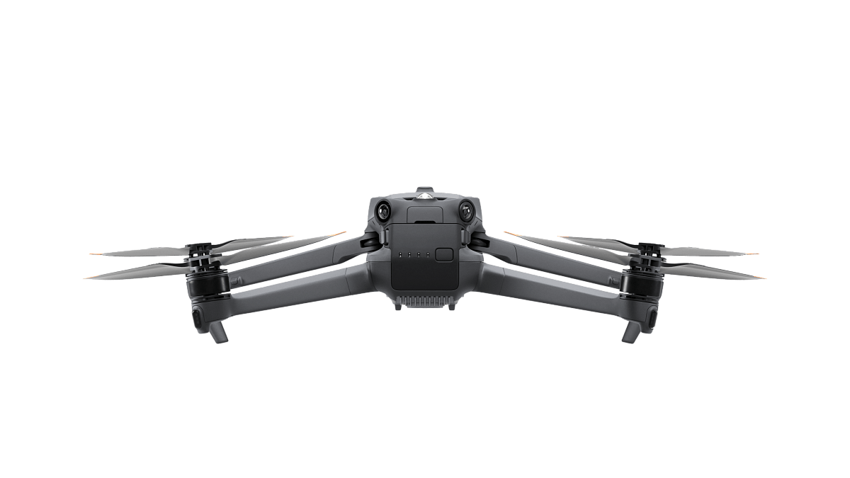
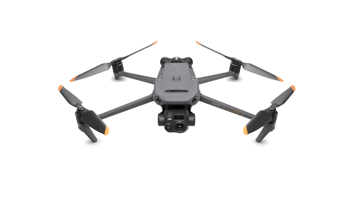
The Mavic 3 Thermal redefines industry standards for small commercial drones. With a mechanical shutter, a 56× zoom camera, and an RTK module for centimeter-level precision. A thermal version is available for firefighting, search and rescue, inspection, and night operations.
The Mavic 3 Thermal redefines industry standards for small commercial drones. With a mechanical shutter, a 56× zoom camera, and an RTK module for centimeter-level precision, the Mavic 3E brings mapping and mission efficiency to new heights. DJI Mavic 3 Thermal a thermal version is available for firefighting, search and rescue, inspection, and night operations.


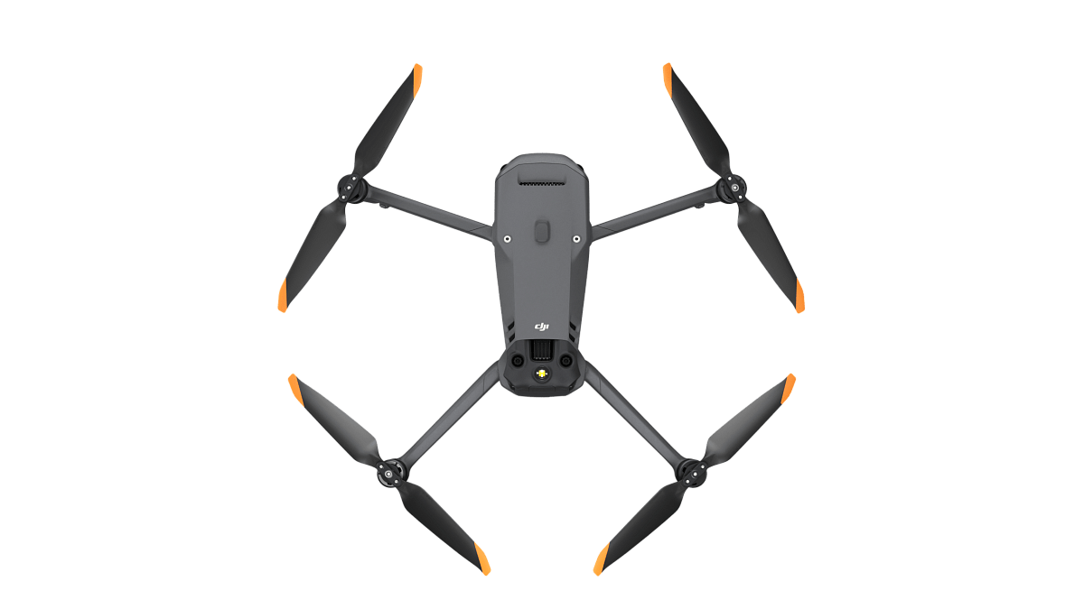
Streamlined and compact, DJI Mavic 3 Thermal can be carried in one hand and deployed at a moment’s notice. Perfect for beginner and veteran pilots alike, it’s built to perform on lengthy missions.
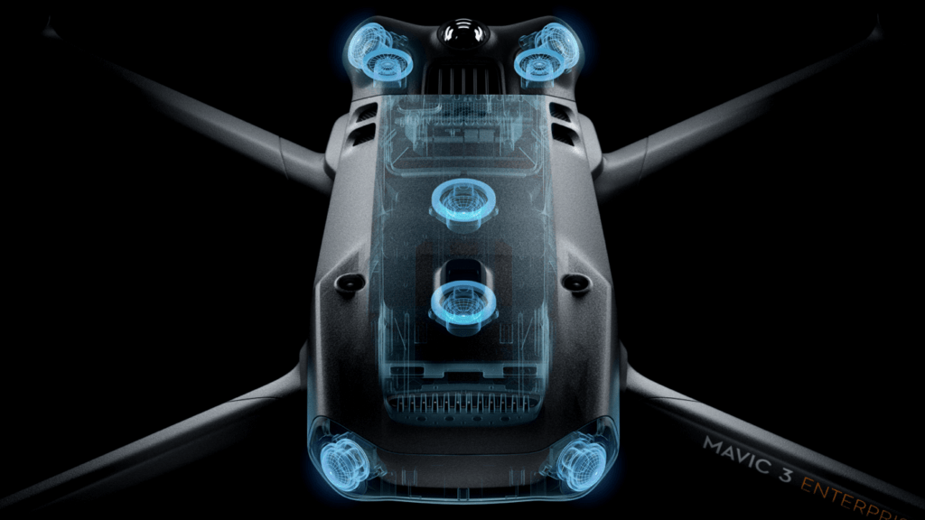
Both Mavic 3E and Mavic 3T are equipped with a 12MP Zoom Camera, supporting up to 56× Max Hybrid Zoom to see essential details from afar.
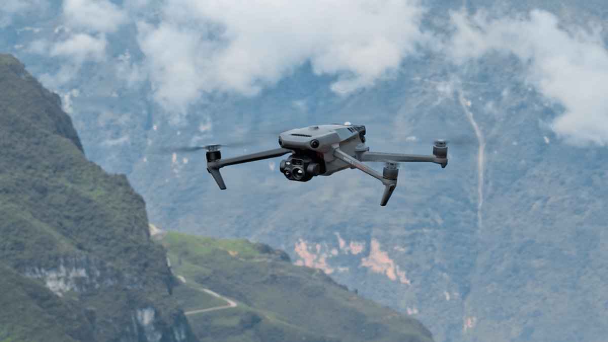
45-min flight durations let you cover more ground each mission, for surveying of up to 2 square kilometers in a single flight. [3][5]
Max Flight Time
45 Minutes [3]
Surverying Area in a Single Flight
2 Square Kilometers[5]
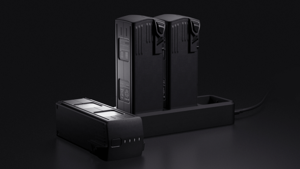
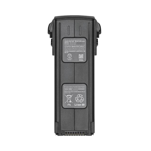
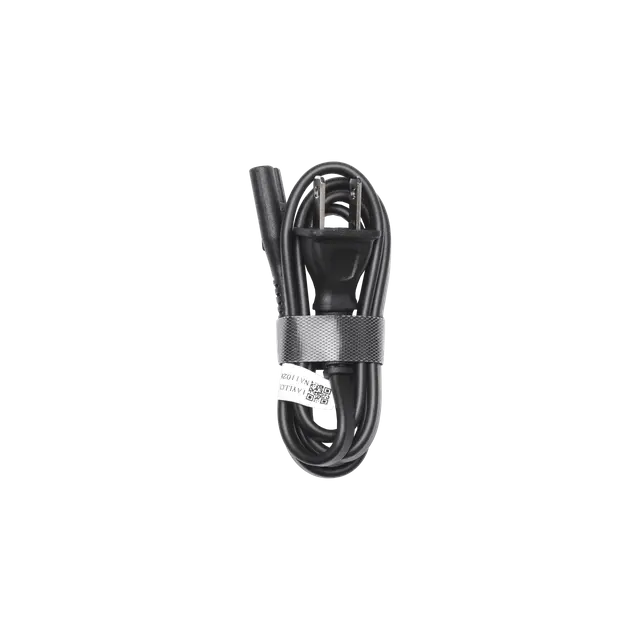
Fast charge batteries with 100W charging hub, or directly charge the drone with 88W fast charging.
Charging Hub
100W
Aircraft
88W
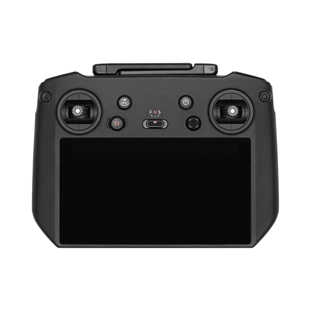
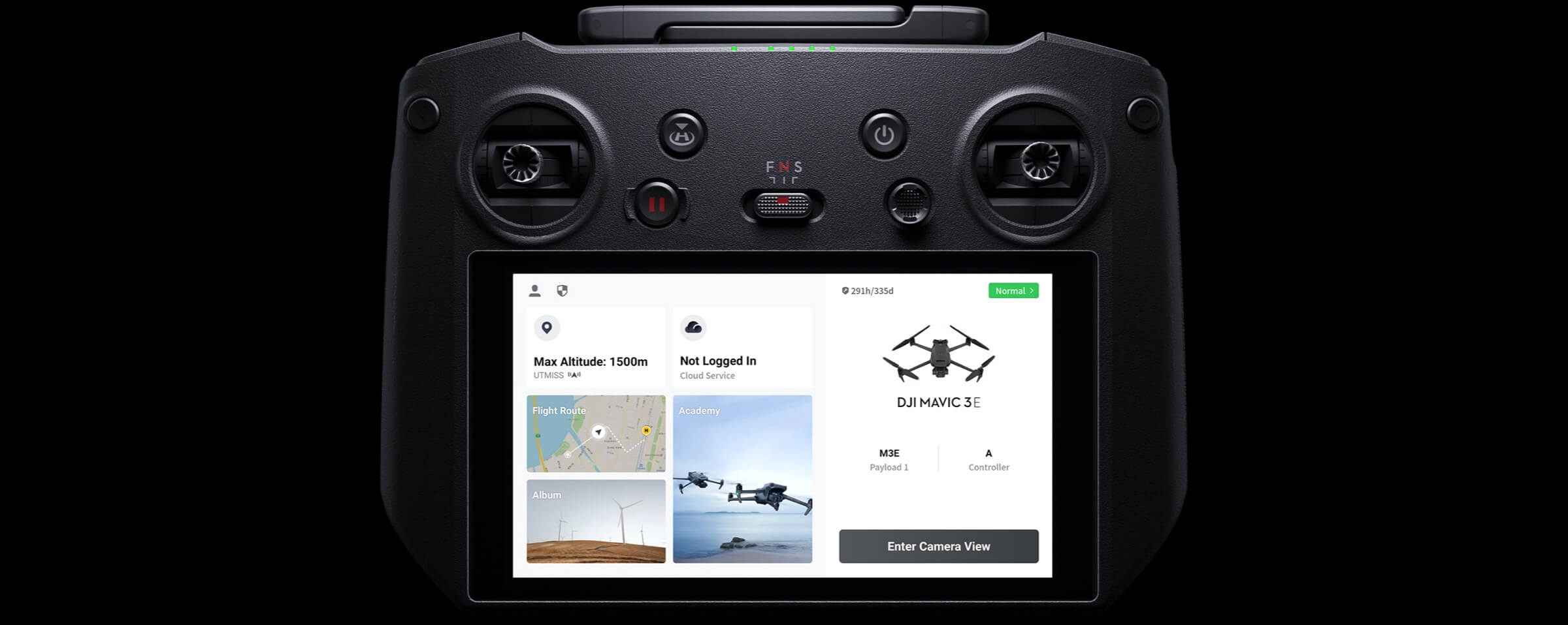 A revamped Enterprise flight interface designed to improve piloting efficiency and flight safety. Drone and payload controls can be easily accessed with one tap. Clear presentation of flight details and navigational information improves user experience together with support for various route types.
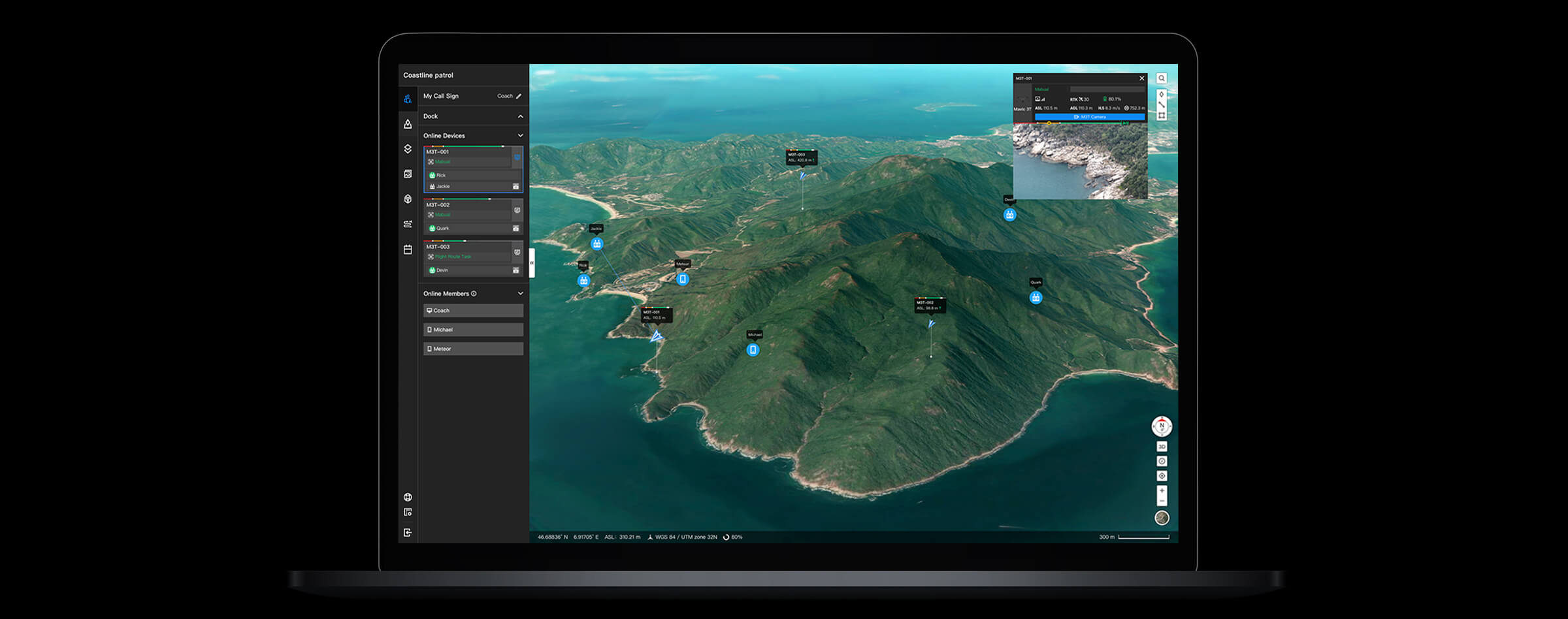 All-in-one cloud drone operations management for your fleet with support for live annotations and cloud mapping for seamless ground-to-cloud synergy. Efficiently manage inspection operations with route planning and mission management.
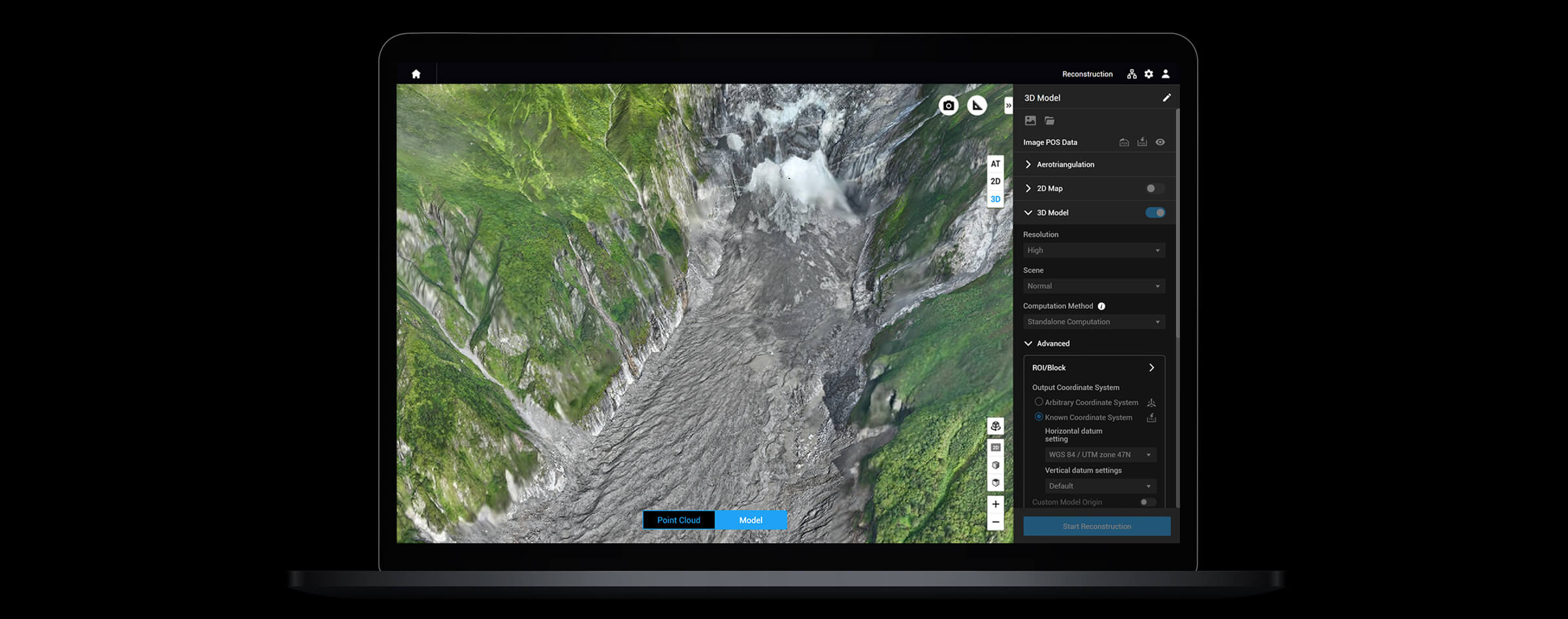 Full featured mapping software for all stages of work, from mission planning to processing of 2D and 3D models.
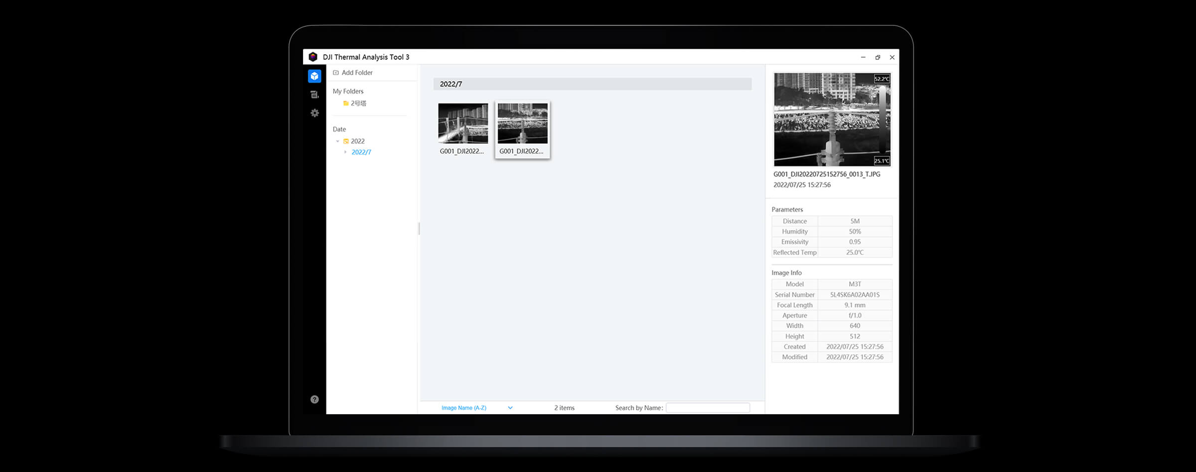 Analyze, annotate, and process images captured by M3T using DTAT 3.0 to detect temperature abnormalities in your inspections.
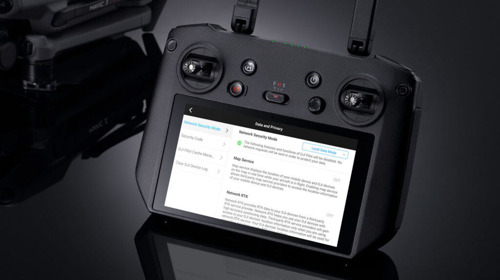
| Aircraft | |
| Weight (with propellers, without accessories) | 920 g |
| Max Takeoff Weight | 1,050 g |
| Dimensions | Folded (without propellers): 221×96.3×90.3 mm (L×W×H) Unfolded (without propellers): 347.5×283×107.7 mm (L×W×H) |
| Diagonal Distance | 380.1 mm |
| Max Ascent Speed | 6 m/s (Normal Mode) 8 m/s (Sport Mode) |
| Max Descent Speed | |
| Max Flight Speed (at sea level, no wind) | 15 m/s (Normal Mode) Forward: 21 m/s, Side: 20 m/s, Backward: 19 m/s (Sport Mode) *Maximum speed in Sport mode is 19m/s when operating in EU regions. |
| Max Wind Speed Resistance | 12 m/s *Max wind speed resistance during takeoff and landing. |
| Max Take-off Altitude Above Sea Level | 6000 m (without payload) |
| Max Flight Time (no wind) | 45 mins *Measured with Mavic 3 Enterprise Series flying at a constant speed of 32.4 kph in a windless environment at sea level until the battery reached 0%. Data is for reference only. Please pay attention to RTH reminders in the DJI Pilot 2 app during flight. |
| Max Hover Time (no wind) | 38 mins |
| Max Flight Distance | 32 km |
| Max Tilt Angle | 30° (Normal Mode) 35° (Sport Mode) |
| Max Angular Velocity | 200°/s |
| GNSS | GPS+Galileo+BeiDou+GLONASS (GLONASS is supported only when the RTK module is enabled) |
| Hovering Accuracy | Vertical: ±0.1 m (with Vision System); ±0.5 m (with GNSS); ±0.1 m (with RTK); Horizontal: ±0.3 m (with Vision System); ±0.5 m (with High-Precision Positioning System); ±0.1 m (with RTK) |
| Operating Temperature Range | -10° to 40° C (14° to 104° F) |
| Internal Storage | N/A |
| Motor Model | 2008 |
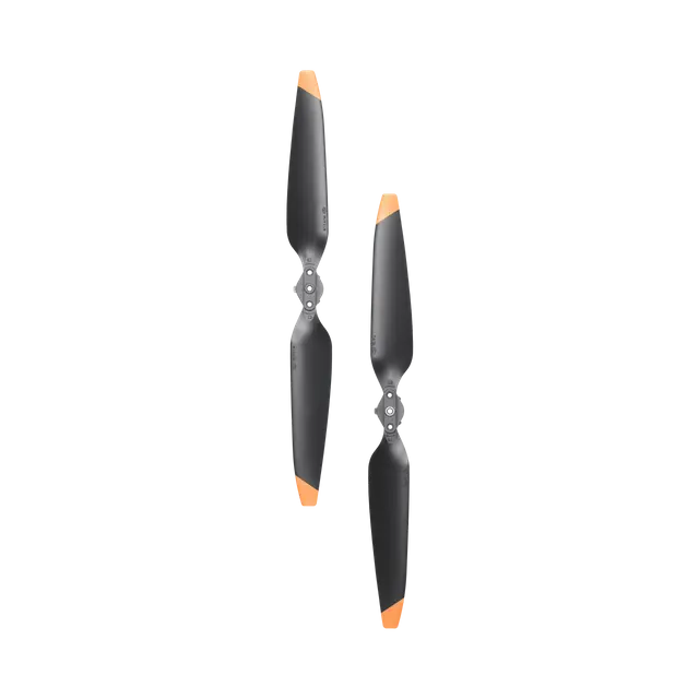
| Propeller Model | 9453F Propellers for Enterprise |
| Beacon | Built into the aircraft |
| Wide Camera | |
| Sensor | 1/2-inch CMOS, Effective pixels: 48 MP |
| Lens | FOV: 84° Format Equivalent: 24 mm Aperture: f/2.8 Focus: 1 m to ∞ |
| ISO Range | 100-25600 |
| Shutter Speed | Electronic Shutter: 8-1/8000 s |
| Max Image Size | 8000 x 6000 |
| Still Photography Modes | Single: 12 MP/48 MP Timed: 12 MP/48 MP JPEG: 2/3/5/7/10/15/20/30/60 s* Panorama: 12 MP (raw image); 100 MP (stitched image) Smart Low-light Shooting: 12 MP* Shooting 48MP photo does not support 2s interval |
| Video Resolution | H.264 4K: 3840×2160@30fps FHD: 1920×1080@30fps |
| Bitrate | 4K: 85 Mbps FHD: 30 Mbps |
| Supported File Formats | exFAT |
| Photo Format | JPEG |
| Video Format | MP4 (MPEG-4 AVC/H.264) |
| Tele Camera | |
| Sensor | 1/2-inch CMOS, Effective pixels: 12 MP |
| Lens | FOV: 15° Format Equivalent: 162 mm Aperture: f/4.4 Focus: 3 m to ∞ |
| ISO Range | 100-25600 |
| Shutter Speed | Electronic Shutter: 8-1/8000 s |
| Max Image Size | 4000 x 3000 |
| Photo Format | JPEG |
| Video Format | MP4 (MPEG-4 AVC/H.264) |
| Still Photography Modes | Single: 12 MP Timed: 12 MP JPEG: 2/3/5/7/10/15/20/30/60 s Smart Low-light Shooting: 12 MP |
| Video Resolution | H.264 4K: 3840×2160@30fps FHD: 1920×1080@30fps |
| Bitrate | 4K: 85 Mbps FHD: 30 Mbps |
| Digital Zoom | 8x (56x hybrid zoom) |
| Thermal Camera (Mavic 3T) | |
| Thermal Imager | Uncooled VOx Microbolometer |
| Pixel Pitch | 12 μm |
| Frame Rate | 30Hz |
| Lens | DFOV: 61° Format Equivalent: 40 mm Aperture: f/1.0 Focus: 5 m to ∞ |
| Sensitivity | ≤50 [email protected] |
| Temperature Measurement Method | Spot Meter, Area Measurement |
| Temperature Measurement Range | -20° to 150° C (-4° to 302° F, High Gain Mode) 0° to 500° C (32° to 932° F, Low Gain Mode) |
| Palette | White Hot/Black Hot/Tint/Iron Red/Hot Iron/Arctic/Medical/Fulgurite/Rainbow 1/Rainbow 2 |
| Photo Format | JPEG (8-bit) R-JPEG (16-bit) |
| Video Resolution | 640 x 512@30fps |
| Bitrate | 6 Mbps |
| Video Format | MP4 (MPEG-4 AVC/H.264) |
| Still Photography Modes | Single: 640×512 Timed: 640×512 JPEG: 2/3/5/7/10/15/20/30/60 s |
| Infrared Wavelength | 8-14 μm |
| Infrared Temperature Measurement Accuracy | ±2° C or ±2% (using the larger value) |
| Gimbal | |
| Stabilisation | 3-axis (tilt, roll, pan) |
| Mechanical Range | Tilt: -135° to 45° Roll: -45° to 45° Pan: -27° to 27° |
| Controllable Range | Tilt: -90° to 35° Pan: Not controllable |
| Max Control Speed (tilt) | 100°/s |
| Angular Vibration Range | ±0.007° |
Inquire price for DJI Mavic 3 Thermal