What is Simultaneous Localization and Mapping (SLAM)?

SLAM (Simultaneous Localization and Mapping) is a cutting-edge technology that enables devices to simultaneously build a map of an unknown environment and determine their position within it. It is widely used in robotics, drones, autonomous vehicles, and other autonomous systems, making it indispensable in modern technological applications.
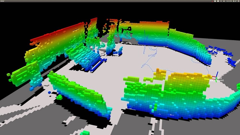
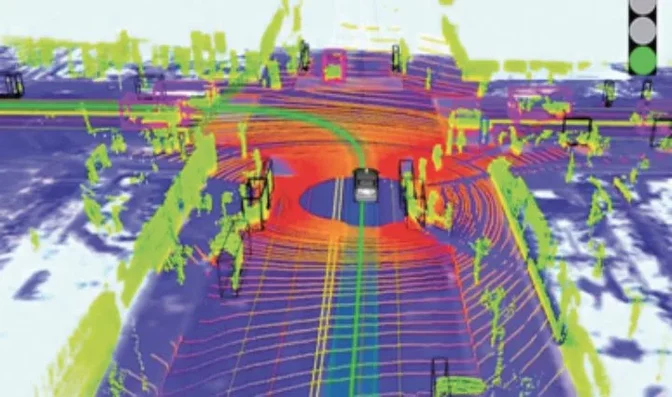
Key Components of SLAM

  1. Sensor Data: SLAM relies on input from various sensors, such as cameras, LIDAR, ultrasonic sensors, and others, to collect information about the surrounding environment. These sensors provide real-time data, which forms the basis of simultaneous localization and mapping.
  2. Motion Models: These include inertial measurement units (IMUs), odometry, and other methods that help account for the device’s movement. Reliable motion modeling is crucial for SLAM to work in dynamic and challenging environments, such as indoors or in GPS-denied areas.
  3. Filtering Algorithms: To reduce noise and improve the accuracy of positional data, SLAM employs algorithms like the Kalman filter or particle filter. These methods ensure that localization and mapping remain accurate even in environments with high noise levels or sensor errors.
  4. Environmental Map: Maps created by SLAM can take the form of 2D floor plans, 3D models, or topological maps highlighting key points and their connections. This adaptability makes SLAM a versatile tool for different industries.

How SLAM Works

  1. Initialization: The system begins without prior information about its location or the environment. It starts gathering sensor data to build an initial map.
  2. Map Updates: As the device moves, the map is updated with new data, adding objects, refining known ones, or removing outdated information.
  3. Position Estimation: Simultaneously, the system evaluates its position relative to the constructed map, enabling precise navigation.
  4. Loop Closure: When the device returns to a previously visited location, it identifies this area and adjusts its map and position estimation accordingly. This process is called “loop closure.”

Applications of SLAM

  • Autonomous Vehicles: SLAM is used to build road maps and determine real-time positioning for safe navigation.
  • Robot Vacuums: Many modern robot vacuums employ SLAM to create maps of homes and optimize cleaning routes.
  • Drones: Drones can utilize SLAM for navigation in indoor environments or areas without GPS signals.
  • Handheld Lidar Scanners: A handheld 3D LiDAR scanner is a compact and portable device that uses Light Detection and Ranging (LiDAR) technology to capture detailed three-dimensional data of objects and environments. Unlike fixed LiDAR systems, this version is designed for mobility and convenience, enabling users to manually scan and digitize spaces or objects with ease.

FAQ: Frequently Asked Questions about SLAM

What is SLAM technology used for?

SLAM technology is used for creating maps of unknown environments while simultaneously determining the position of the device in real-time. It is commonly applied in autonomous vehicles, drones, robotics, and augmented reality systems.

In autonomous vehicles, SLAM combines data from sensors like LIDAR, cameras, and IMUs to construct a real-time map of the road and surroundings. This map is then used to localize the vehicle and guide its navigation safely.
Challenges include high computational complexity, sensitivity to sensor noise, and difficulties in low-light or reflective environments. Despite these hurdles, advancements in SLAM algorithms and hardware are improving its reliability.
SLAM is not necessarily better but serves as a complement to GPS. It excels in environments where GPS signals are weak or unavailable, such as indoors, underground, or in dense urban areas.
Table of Contents