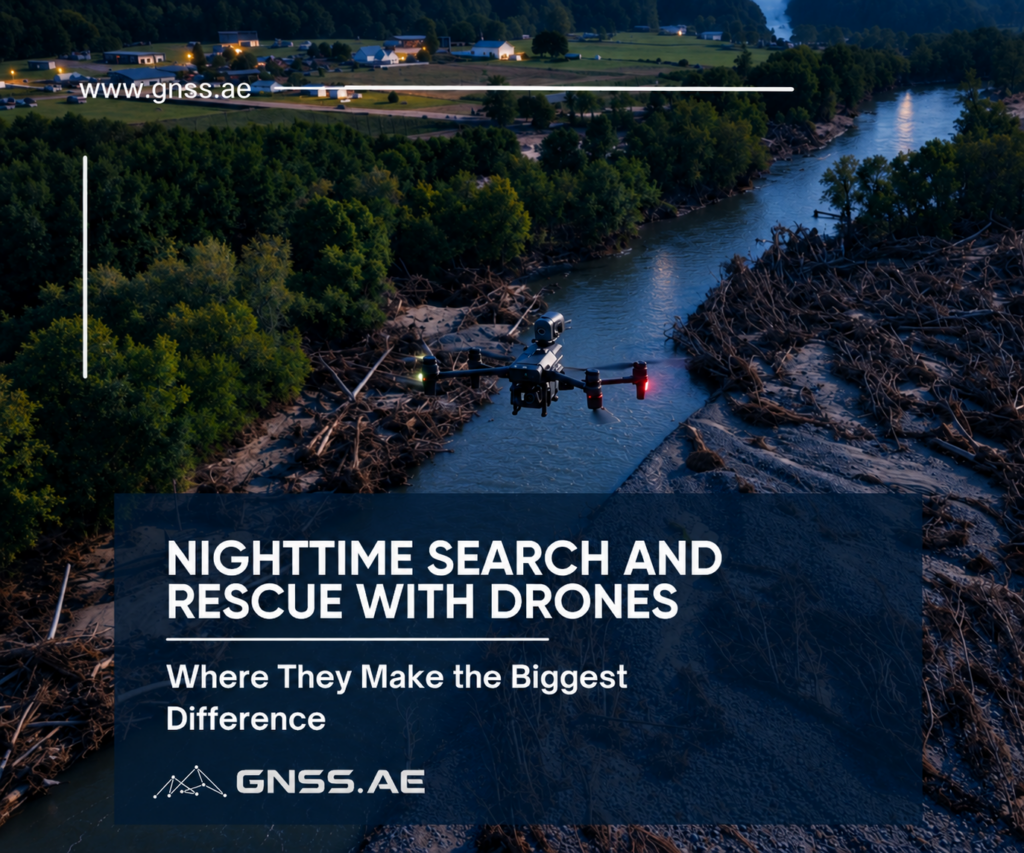
A search and rescue mission can become significantly harder after sunset. Trails disappear into the darkness, distant objects are difficult to identify, and ground teams may have to move through unfamiliar terrain with limited visibility.
Drones can give rescuers a different perspective. An aircraft can reach an area quickly, scan terrain from above and send live video back to the team. With the right equipment, it can also locate a person using thermal imaging, illuminate the area, transmit voice messages and help rescuers understand the safest way to approach.
That combination makes drones useful across a wide range of nighttime emergencies, from missing hikers to road accidents and natural disasters.
A forest is difficult to search at any time of day. At night, the problem becomes much more serious.
Several factors can slow down a search after dark:
In these conditions thermal imaging can help operators identify a human heat signature against the colder background of vegetation, soil and rocks.
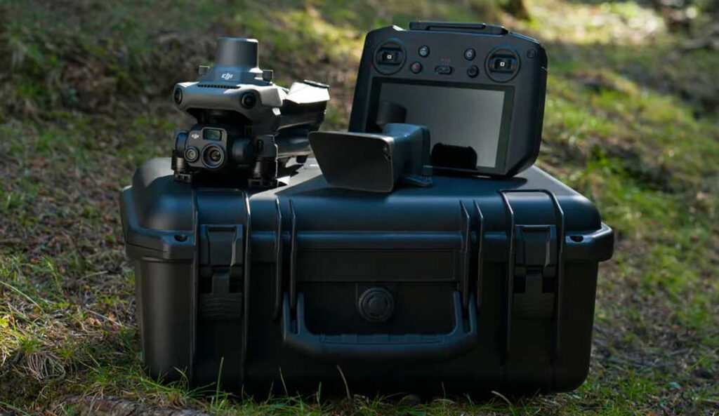
Compact thermal drones are particularly useful for rapid-response teams. The DJI Mavic 3 Thermal, for example, combines a 640 × 512 thermal camera with a 56× hybrid zoom camera and a 45-minute maximum flight time under manufacturer test conditions. The combination allows an operator to scan a wider area and then inspect a suspected target from a distance.
The search does not necessarily end when the person is detected. The drone can remain overhead and guide the ground team toward the location. In a dense forest, even knowing that someone is 200 meters away does not automatically reveal the easiest route.
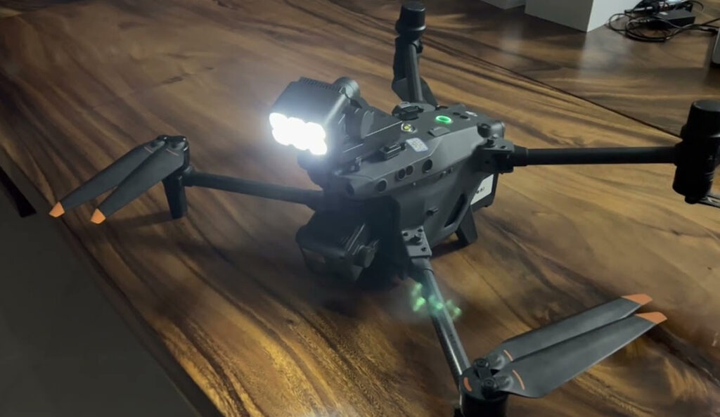
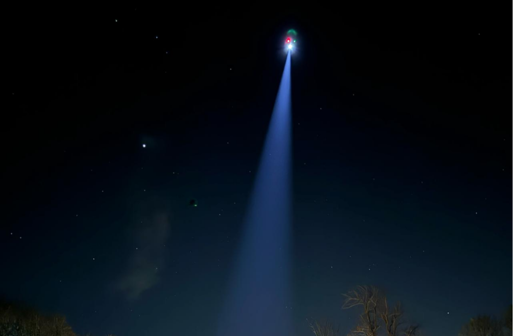
Lighting can help at this stage. A dedicated searchlight can illuminate the person or the surrounding terrain while the operator keeps the aircraft in position. The CZI GL60 Mini, for instance, is designed as a gimbal-mounted searchlight for enterprise drones and is rated for illumination distances of up to 150 meters.
For example, in 2025, a mountain search and rescue team used a drone-mounted CZI GL60 Mini to provide overhead lighting during a nighttime rescue in unstable terrain. The spotlight helped the ground team set anchors for a safe evacuation and reduced the risks associated with working in poor visibility.
Mountain terrain introduces another challenge. A thermal image may show where a person is, but reaching that person can still be difficult.
Cliffs, steep slopes, ravines and narrow trails can make the route from the rescue team’s current position to the target difficult to judge. An aircraft can provide a wider view of the terrain and help the team assess possible approaches.
Thermal detection also requires some interpretation. A person is not always the hottest object in the scene. Rocks that absorbed sunlight during the day can remain warm after sunset, while wind, humidity, clothing, distance and the person’s position can all affect thermal contrast. The operator has to distinguish a human signature from other heat sources rather than simply look for the brightest spot.
This is where a larger platform can make sense. The Matrice 400, for example, supports multi-sensor payloads and relay functionality designed for operations where communication between aircraft and the ground becomes more difficult.
For the sensing side, a payload such as the Zenmuse H30T combines a 1280 × 1024 thermal camera with visible cameras and a laser rangefinder. The rangefinder can measure targets up to 3,000 m under specified conditions.
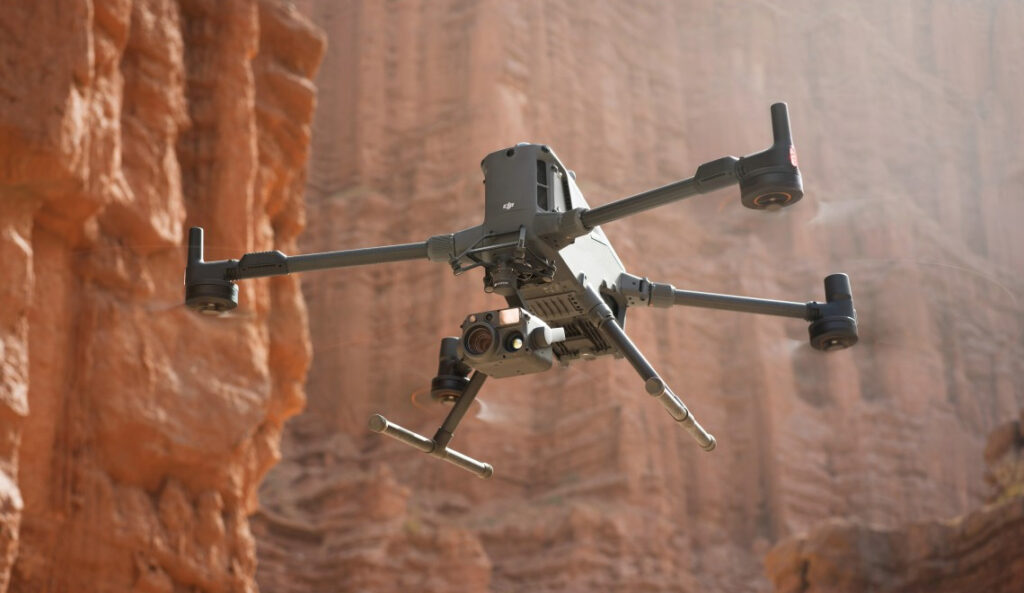
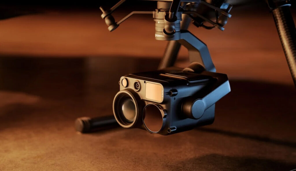
That combination is useful because finding a person is only the first step. The operator can detect a possible target thermally, inspect it with the zoom camera, and then use the aircraft’s positioning and range information to determine where the person is relative to the terrain. Those coordinates can then be passed to the ground team and used alongside a map to plan the approach.
Water searches are difficult because there are few visual reference points. At night, an operator may have to distinguish a person from waves, floating debris and reflections.
Thermal imaging can provide another way to look at the scene. A suspected target can then be examined with a visible-light or zoom camera before the rescue team commits to an approach.
Endurance becomes increasingly important as the search area grows. A drone may need to remain over the water while a rescue boat changes position, or cover a long section of coastline before a target is found. In such cases, the aircraft is more than a camera in the sky: it becomes a persistent aerial observer, continuously monitoring the search area while boats and rescue teams move below.
For larger search zones, this is where long-endurance VTOL platforms become useful. Unlike a compact multirotor, they can spend much more time in the air and cover greater distances without requiring frequent battery changes. The JOUAV CW-25, for example, is a hybrid VTOL fixed-wing platform with a stated endurance of up to six hours and a payload capacity of up to 6 kg.
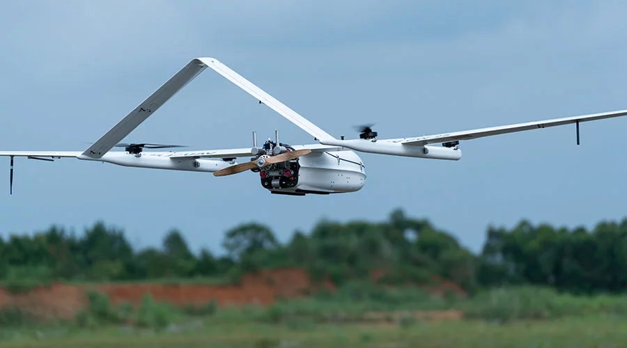
For example, in July 2025, a fishing vessel capsized off the coast of Gulei, Zhangzhou, China. A JOUAV autonomous VTOL system reached the scene in about six minutes and used a dual-sensor payload with 30× optical zoom and thermal imaging to locate two people clinging to the wreckage. The two survivors were rescued 57 minutes after the accident was reported.
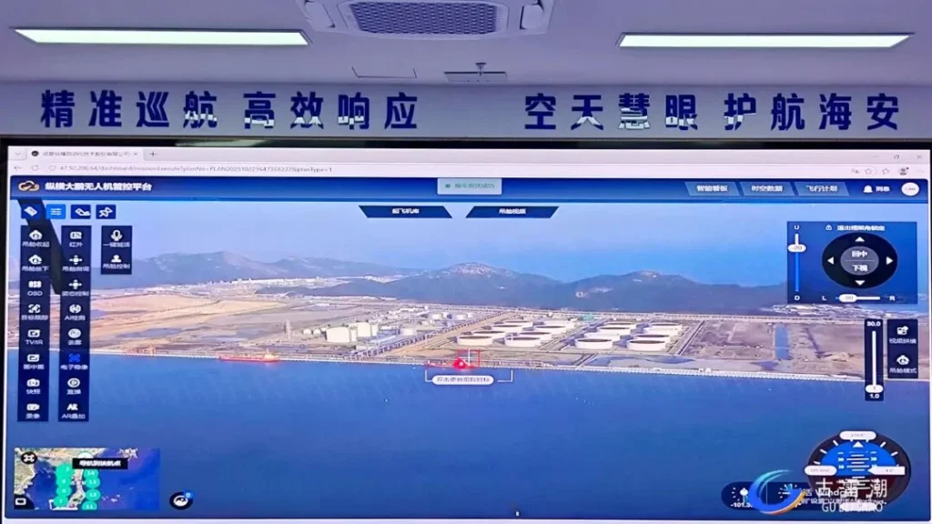
A nighttime road accident can involve several tasks at once. Responders may need to locate vehicles, check the surrounding area for injured people and establish a safe working zone.
A drone can provide an immediate aerial view of the scene, helping responders understand the position of vehicles, the condition of the road and the areas that need closer inspection. An optical zoom camera is particularly useful for examining the accident from a safe distance without putting rescuers directly next to moving traffic or damaged vehicles.
Once the situation is understood, lighting becomes important.
A small searchlight mounted on the aircraft can illuminate a vehicle or roadside area without waiting for portable lighting equipment to be positioned. The DJI AL1 Spotlight, for example, can illuminate subjects from up to 100 meters and can follow the movement of the gimbal so that the illuminated area stays aligned with the camera view.

CZI offers another approach with the GL60 Mini and other searchlight systems. This matters when a response team already operates compatible aircraft and wants to add dedicated illumination rather than replace the drone itself.
After a flood or landslide, the first challenge is often not finding people but understanding what has happened to the area. Roads may be blocked, bridges damaged and previously safe routes cut off.
A drone can provide a rapid overview before ground teams move in: where people may be stranded, which access routes remain usable and which structures or areas appear unsafe.
Thermal imaging can help detect people in low-visibility conditions, while an optical zoom camera allows operators to inspect suspected locations more closely. Using both together is important: thermal can indicate where to look, while visible-light imagery helps confirm what is actually there.
The search can also continue after the first detection. A drone can monitor changing water levels, damaged areas or unstable terrain and provide updated information as the rescue operation develops.
For example, in 2024, after Hurricane Helene hit North Carolina, StormPoint used DJI drones to support search and disaster assessment. A Mavic 3 Enterprise mapped more than 3,700 acres of flood-affected areas, while Matrice 30T drones used thermal imaging to help locate stranded people and guide responders through areas with blocked access.
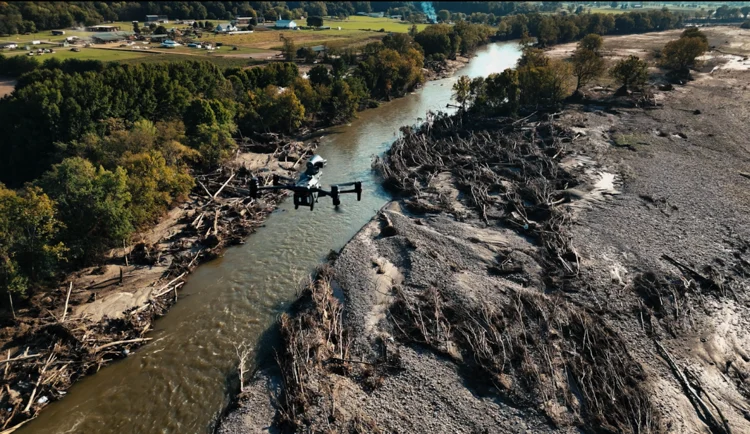
In remote areas, the main constraint may not be visibility but distance. The search site can be hours from the nearest road or settlement, so the aircraft needs to cover large areas without spending most of its flight time simply reaching the search zone.
That makes the choice of platform a question of scale.
A portable multirotor such as the Mavic 3 Thermal is well suited to small teams that need to deploy quickly and inspect a defined area from relatively close range. It can be carried to the search site, launched within minutes and used to investigate terrain, tracks or suspected locations.
A long-endurance VTOL such as the JOUAV CW-20E serves a different purpose. It can cover much larger areas and carry heavier payloads while retaining the ability to launch and land vertically in field conditions.
The CW-25 extends this further, with up to six hours of endurance and a 6 kg payload capacity. For wide-area searches, that difference can be significant: a smaller drone may be excellent for detailed inspection, but a long-endurance aircraft can spend far more of its mission time actually searching.
The key is therefore not simply which aircraft is more capable, but which platform matches the size, distance and logistics of the search operation.
The equipment is most useful when it is treated as part of a workflow rather than as a collection of separate accessories.
A typical operation might look like this:
Search → Detect → Verify → Locate → Communicate → Illuminate → Guide → Rescue
The sequence changes depending on the incident. A missing hiker may require extensive thermal scanning first. At a road accident, the priority may be scene assessment and lighting. After a flood, responders may need to survey a broad area before identifying individual targets.
The aircraft and payload should therefore match the job.
A compact thermal drone may be the right choice for rapid deployment. A multi-sensor platform can provide more flexibility when the mission becomes complex. A long-endurance VTOL can cover much larger areas, while dedicated searchlights, speakers and tethered systems can extend what the aircraft can do once it reaches the scene.
Nighttime search and rescue requires more than simply locating a person. Thermal cameras can help detect targets, while zoom cameras, positioning and live video give rescuers the information needed to assess the situation and plan an approach.
Speakers and searchlights extend the drone’s role after detection, helping teams communicate with people and work safely in poor visibility. Compact thermal drones suit rapid response, while larger multi-sensor platforms and long-endurance VTOLs are better for complex or wide-area missions.
The most effective setup depends on the operation, but the goal is the same: find faster, understand the situation, and give the rescue team better information before and during the response.
It depends on the mission. Compact thermal drones suit rapid response, while larger multi-sensor platforms are better for complex terrain and wide-area searches. DJI’s Matrice 4T and Matrice 400 with the Zenmuse H30T are examples of platforms designed for SAR applications.
Yes. Drone-mounted spotlights can illuminate people, trails and work areas, helping ground teams operate more safely at night. The CZI GL60 Mini, for example, provides up to 6,000 lumens of illumination.
Thermal and optical cameras can be combined with GNSS and laser rangefinders to determine a target’s position and share coordinates with ground teams.
Yes. Thermal and optical cameras can help search rivers, lakes and coastal waters, while long-endurance platforms such as the JOUAV CW-25 can cover larger areas and stay airborne for longer periods.