Drones are already widely used for mapping, inspection, agriculture, public safety and industrial monitoring. But some of the most interesting developments in the UAV sector are now happening beyond the familiar combination of an aircraft, a camera and a remote pilot.
Researchers and technology companies are working on systems that can search for people in difficult environments, detect objects beneath the ground, coordinate several aircraft without satellite positioning, monitor livestock and even manipulate clouds above solar farms. At the same time, new heavy-lift platforms are pushing UAVs into roles that traditionally required helicopters or specialized aircraft.
Here are six developments that offer a glimpse of where drone technology is heading.
Finding a person in the water from an aircraft is much harder than it sounds. At high altitudes, a swimmer may occupy only a few pixels in the image, while waves, foam, reflections and sun glare create a constantly changing background that can easily confuse a computer-vision system.
Researchers from Anna University in Chennai, India, have developed a detection and tracking framework designed specifically for this problem. The system, described in a paper published in Scientific Reports on August 28, 2026, combines a modified YOLO detector called YOLO-SR with a tracking system named GeoTrack.
YOLO-SR is based on YOLOv8-L. The researchers added a lightweight high-resolution refinement branch working with P3 feature maps. The idea is to preserve spatial details that are often lost as an image is progressively downsampled. That is particularly important when the target is a swimmer, rescue raft or other small object occupying only a very small part of the frame.
The second component, GeoTrack, is designed to reduce false tracks caused by the sea surface. It extends ByteTrack with geometric filtering and motion-consistency analysis. The system can reject detections with implausible shapes and use the movement of a target across consecutive frames to determine whether it is likely to be a real object rather than a wave pattern or reflection.
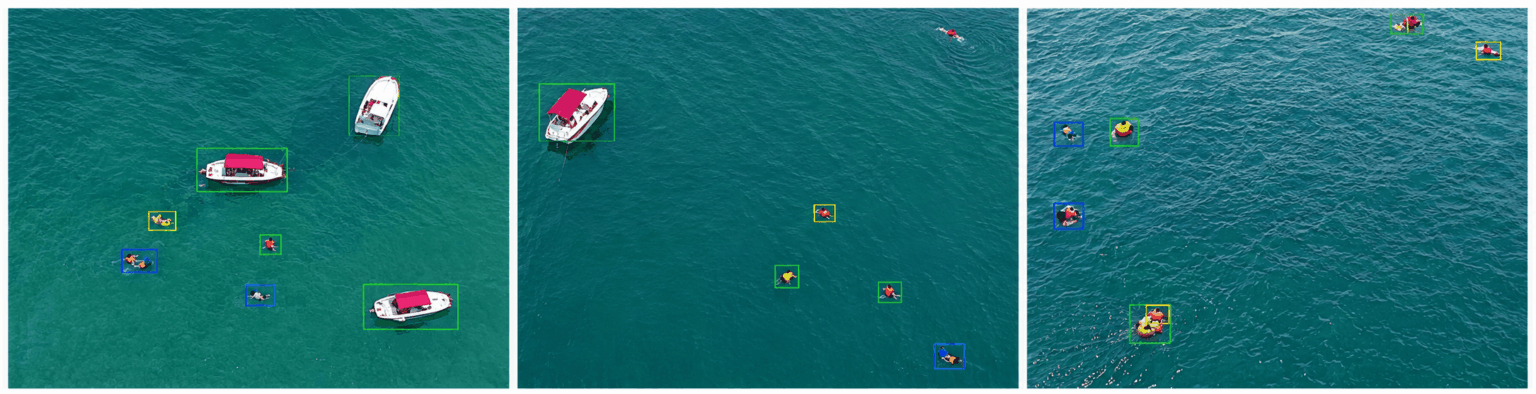
On the SeaDronesSee dataset, YOLO-SR achieved:
The work illustrates an important shift in UAV applications. The objective is no longer simply to collect images and leave the interpretation to an operator. The aircraft is increasingly expected to identify a small target, determine whether it is real and maintain its track while the surrounding scene changes.
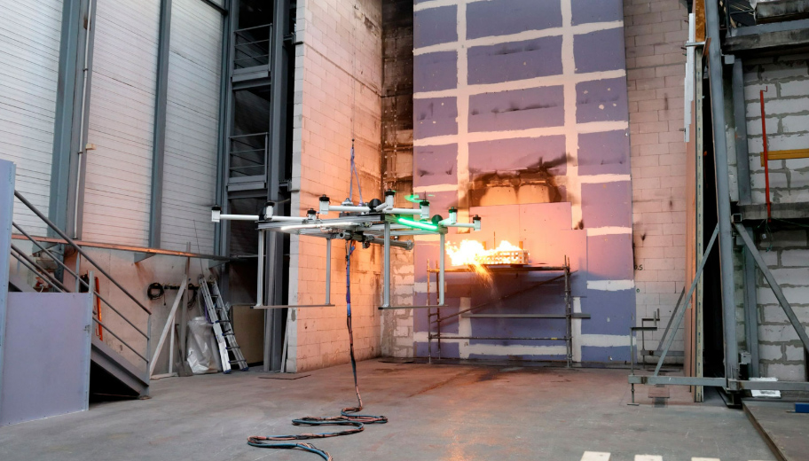
Spanish applied research and technology center TECNALIA has developed a high-capacity electric UAV under the EXTINCIA project, which focuses on using unmanned aircraft and artificial intelligence for rural and forest firefighting. The aircraft is designed to carry and discharge up to 600 kg of water.
Unlike a conventional payload release system, it can deliver the water both vertically and horizontally.
The distinction matters in firefighting. A system capable of dropping a large load vertically can work against a fire from above, while horizontal discharge can be useful when approaching an area from a different angle or when the aircraft needs to operate closer to the edge of a fire.
The project includes flight-control systems designed to compensate for disturbances, LiDAR-assisted techniques related to aircraft operability, and integration of a firefighting cannon. The organization has also built a full-scale prototype and conducted validation flights in its laboratory using real fire.
TECNALIA says the system is particularly suited to attacking smaller fires close to populated areas and critical infrastructure, where an unmanned platform could provide a rapid response without putting a crewed aircraft and its crew directly into the most dangerous part of the operation.
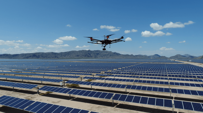
One of the most unusual UAV projects comes from Meteoric, a startup founded in 2026 by engineers with backgrounds at the University of Cambridge and backed by Y-Combinator.
The company’s idea is to use fleets of autonomous drones to fly into low- and mid-altitude clouds, roughly 1–5 km above the ground, and alter the water droplets inside them. The goal is to reduce cloud reflectivity and allow more sunlight to reach solar panels below. Meteoric says the aircraft would do this without spraying chemicals.
According to the company’s model, the approach could increase annual energy generation from existing utility-scale solar farms by approximately 10–30%, depending on the region and the cloud conditions.
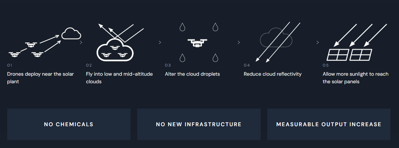
The company says it has already built a working prototype that dissipated an artificial cloud by 13% in a cloud-chamber test. The next major step is a large-scale atmospheric demonstration targeted for 2027.
Meteoric is aiming at something much bigger in the longer term. Its stated goal is to use the same general approach to reduce the intensity of severe storms and hurricanes, with a first storm operation targeted for late 2028.
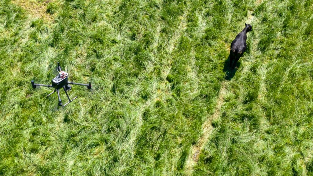
The University of Kentucky is running a five-year USDA-funded project called Precision Livestock Management: Cattle Monitoring and Herding Using Cooperative Drones. The project started in July 2024 and received $910,000 in funding.
Its goal is to develop methods for using multiple small UAVs to monitor cattle and eventually assist with herding.
One of the project’s central technical problems is coordination. The researchers are developing a decentralized control approach that uses situational awareness and RTK-level GNSS positioning to allow multiple UAVs to operate in close proximity without relying on a dedicated observer drone.
The work also goes beyond simply locating animals. The team is studying computer-vision methods for monitoring fence lines and gates, as well as ways to estimate cattle mass from remotely measured body volume. The latter could provide a way to collect useful physical measurements without requiring animals to be individually handled and weighed.
Animal behavior is another part of the research. A drone may be technically capable of approaching a cow, but that does not mean the operation is useful if the aircraft causes excessive stress or disrupts the animals’ normal behavior. The project therefore includes research into cattle reaction to UAVs and the conditions under which drones can safely interact with livestock.
What makes the project notable is the combination of UAV control, GNSS positioning, computer vision and agricultural science.
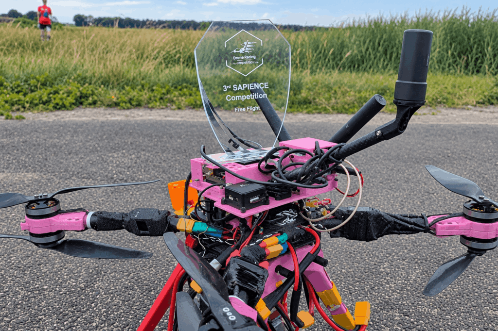
The limits of GNSS are another area attracting significant research. In emergency situations, satellite positioning may be unavailable, unreliable or deliberately disrupted. A drone that depends on continuous GNSS navigation can quickly lose much of its autonomy under those conditions.
NATO’s SAPIENCE project is addressing this problem by developing cooperative multi-UAS systems capable of performing search-and-rescue tasks without satellite positioning. The program brought together research teams from City St George’s, University of London, the University of Klagenfurt, the University of Alabama in Huntsville and Delft University of Technology.
The final stage of the three-part SAPIENCE competition took place on July 14–15, 2026, at the Unmanned Valley test site in the Netherlands. Teams had to operate in a simulated disaster environment combining indoor and outdoor areas. The drones were expected to cooperate autonomously, communicate and divide tasks, avoid obstacles, terrain and other aircraft, identify survivors and deliver supplies according to the urgency of the situation.
That combination is considerably more demanding than simply programming several drones to follow the same route. Each aircraft has to contribute to a shared mission while retaining enough autonomy to keep operating when conditions change.
During the demonstration, researchers highlighted the need for the rest of the fleet to continue the mission when one aircraft loses communication or can no longer be operated. The objective is a system that remains useful even when individual elements fail.
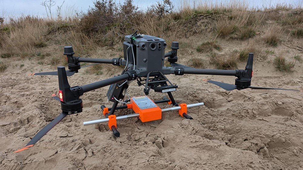
Researchers published the work in the Journal of Applied Geophysics in July 2026. Their system is designed for situations where ground-based GPR is difficult or unsafe to deploy, such as hazardous areas or locations that are hard for personnel to access. Instead of moving the radar antenna across the ground, the UAV carries the radar above the survey area and follows a predefined autonomous path.
The main technical difference is the use of software-defined radio (SDR). The researchers built the radar around a USRP B210 platform and used GNU Radio to handle waveform generation, storage and synchronization.
Unlike conventional GPR systems with a largely fixed signal chain, an SDR-based architecture allows parameters such as the center frequency and bandwidth to be changed through software rather than by modifying the hardware. This gives the system more flexibility when the survey conditions or detection requirements change.
The radar unit is mounted beneath the UAV, while its antennas are integrated into the landing gear. The researchers first tested the system in a laboratory sand tank using targets placed at different depths, then moved to tests on the UAV platform. The experiments demonstrated detection of underground targets in the tested conditions and showed that the combination of GPR, autonomous navigation and a reconfigurable radar architecture is technically feasible.
These projects show a clear shift in UAV technology. Drones are moving beyond simple remote-controlled data collection toward systems that can detect, analyze and respond to their surroundings.
AI is taking over more sensing and decision-making tasks, new payloads are expanding what drones can measure, and cooperative systems allow multiple UAVs to work together. At the same time, GNSS-denied navigation and highly specialized platforms are opening up applications that were previously difficult or unsafe to perform.
The technology is at different stages of development, from laboratory research to field-tested prototypes. But the direction is clear: future UAVs will be more autonomous, more specialized and increasingly capable of performing complete missions rather than simply following commands from an operator.
Recent developments include AI-powered detection, autonomous drone teams, GNSS-denied navigation, new UAV payloads and specialized drones for applications such as firefighting, search and rescue, agriculture and geophysics.
AI allows drones to detect and track objects, analyze sensor data, navigate autonomously and support decision-making with less input from a human operator.
Yes. Researchers are developing autonomous UAV systems that can navigate and cooperate in GNSS-denied environments using alternative positioning, onboard sensors and distributed control.
In addition to RGB cameras, UAVs can carry thermal, multispectral, hyperspectral, LiDAR, radar and ground-penetrating radar (GPR) systems, depending on the application.
Emerging applications include maritime search and rescue, wildfire suppression, livestock monitoring, autonomous disaster response, subsurface surveying and experimental atmospheric applications.