Railway infrastructure requires regular inspection to detect track defects, structural damage, obstacles, and vegetation encroachment before they become safety risks. Traditional inspections remain essential, but covering long railway corridors and hard-to-access structures can be time-consuming and labor-intensive.
Drones provide a complementary way to collect inspection data from the air. This article examines how UAVs are used for railway track, bridge, tunnel, and vegetation monitoring, with a focus on the technologies behind these applications.
The answer depends largely on the sensor carried by the UAV.
A conventional RGB camera is suitable for many visible defects. LiDAR provides information about geometry and elevation. Thermal cameras reveal temperature differences. Multispectral sensors can support vegetation and environmental monitoring.
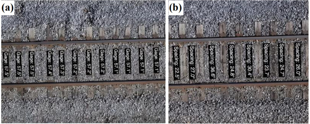
High-resolution aerial imagery can be used to reconstruct railway tracks and analyze elements such as alignment, gauge, sleeper spacing, and other geometric characteristics.
Photogrammetry is particularly useful here. Multiple overlapping images are processed using techniques such as Structure from Motion (SfM) and Multi-View Stereo (MVS) to reconstruct the three-dimensional geometry of the scene.
This can produce a digital representation of the railway corridor that can be measured and compared over time.
The literature contains examples of UAV-based systems being used to detect rail boundaries, measure track gauge, reconstruct 3D track models, and identify sleeper positioning.
However, there is an important distinction between mapping the railway and measuring railway geometry to a safety-critical standard. A drone survey can provide valuable data, but the achievable accuracy depends on the sensor, flight parameters, positioning system, image quality, processing workflow, and ground control or RTK/PPK methodology. For high-precision applications, GNSS positioning becomes an important part of the workflow.
RGB imaging remains one of the most useful technologies for railway inspection because many infrastructure defects are fundamentally visual.
A high-resolution camera can capture:
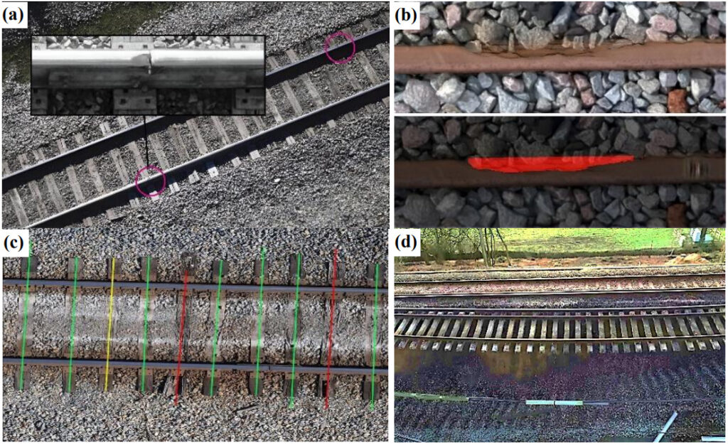
The aerial perspective allows inspectors to cover long sections of track while also providing detailed imagery of specific areas of interest.
Another advantage is that the imagery creates a permanent digital record. Instead of relying solely on inspection notes, operators can return to the original images and compare them with data from later missions to track changes over time.
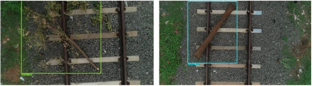
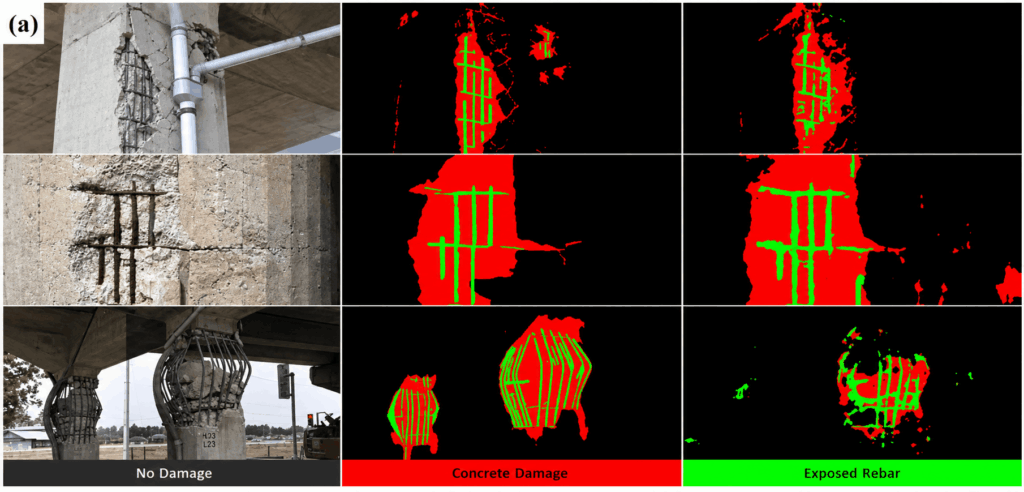
Image analysis can also be automated. Computer vision and machine learning are increasingly used to analyze UAV imagery, helping identify rails, obstacles, vegetation, and visible infrastructure defects. This can reduce the amount of imagery that inspectors need to review manually and help flag areas that require closer examination.
The resulting workflow can be summarized as:
Drone → imagery → AI detection → inspection result → maintenance decision
The drone collects the data, while computer vision helps turn that data into actionable information.
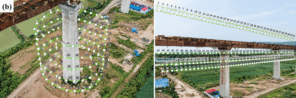
A photograph can show that vegetation is growing close to a railway, for example, but it does not directly provide the precise three-dimensional relationship between the vegetation, track and surrounding structures.
LiDAR emits laser pulses and measures their return time to determine distances. By combining these measurements with precise positioning and orientation data, the system can generate a 3D point cloud of the surveyed environment.
For railway infrastructure, this can support:
The L3 combines a 1535 nm LiDAR system with dual 100 MP RGB mapping cameras and a high-precision positioning and orientation system. DJI specifies a LiDAR detection range of up to 950 m under defined conditions, while the system is capable of generating high-accuracy point clouds.
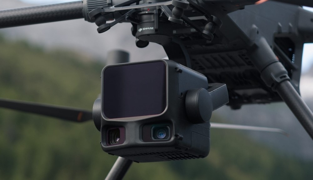
For railway applications, the important point is not simply the maximum ranging distance. The value comes from combining:
LiDAR geometry + RGB imagery + precise positioning
This allows the same flight to capture both the physical structure of the railway environment and visual information about it.
For example, a corridor survey could produce a 3D point cloud showing the track, embankments, vegetation and surrounding structures, while the RGB cameras provide high-resolution imagery that helps interpret the features identified in the point cloud. The resulting dataset can then be processed into a digital representation of the railway corridor.
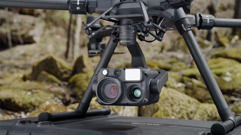
Thermal cameras measure infrared radiation emitted by objects and translate differences in temperature into thermal images. This makes them useful for identifying anomalies associated with heat.
In railway environments, thermal imaging can potentially support the inspection of electrical and mechanical components, identify abnormal heating, and highlight areas that require closer investigation.
This is particularly relevant to overhead electrical infrastructure and equipment where a temperature anomaly may indicate an underlying problem.
Thermal data can also complement conventional visual inspection. An RGB image might show that a component appears normal, while a thermal image can reveal an abnormal temperature pattern.
For this type of mission, the DJI Zenmuse H30T combines a wide-angle camera, a high-resolution zoom camera, an infrared thermal camera, a laser rangefinder and an NIR auxiliary light. DJI specifies a 1280 × 1024 thermal sensor and a temperature measurement range extending from -20°C to 1600°C, depending on operating conditions and measurement mode.
For railway inspections, that could mean surveying a section of infrastructure, identifying a potential anomaly, and then using the zoom or thermal channel to investigate it.
Trees, branches, bushes and other vegetation can encroach on railway corridors, reduce visibility, obstruct signals, interfere with overhead infrastructure, or create obstacles following storms.
Instead of simply determining whether vegetation exists, a LiDAR dataset can help assess its height, density and relationship to the railway corridor. This is especially useful when the objective is to identify vegetation that is approaching a defined clearance envelope.
The combination of LiDAR and imagery can therefore support a more structured vegetation management workflow:
Survey → classify vegetation → identify clearance risks → prioritize locations → maintenance → resurvey
After vegetation has been removed or trimmed, a subsequent UAV survey can provide a new baseline for future monitoring.
Knowing where each image or LiDAR point was captured is essential when UAV data is used for mapping and measurement.
For a quick visual check, standard GNSS positioning may be enough to locate an area of interest. More demanding tasks — such as track mapping, deformation monitoring, clearance measurements, or surveys that need to be compared over time — require more precise georeferencing.
RTK and PPK can provide centimeter-level positioning and reduce the amount of ground control needed for many UAV mapping workflows. The DJI Matrice 400, for example, supports RTK positioning and provides compatibility with DJI’s D-RTK 3 Multifunctional Station. DJI specifies RTK positioning accuracy in the centimeter range under its stated conditions.
For railway surveys, this positioning information links the collected data to a specific point along the track corridor. That makes it possible to:
Positioning accuracy therefore affects not only where the drone flies, but also how reliably the resulting data can be measured, compared, and used later.
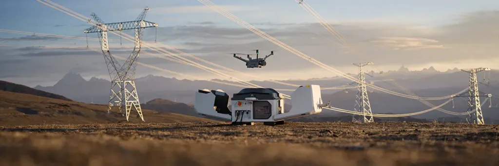
Docking stations can turn drone inspections from individual flights into a more continuous monitoring process. For railways, systems such as DJI Dock 3 can support scheduled and remotely operated missions for monitoring tracks, bridges, stations, and vegetation.
This is particularly useful for repetitive inspections: the same area can be surveyed at regular intervals, allowing operators to compare data over time and identify changes that require attention.
For long railway networks, multiple docking stations could be deployed at strategic locations, creating a distributed network of automated inspection points.
The raw files need to be processed into maps, point clouds, 3D models, or other datasets that can be measured and reviewed.
The choice of software depends on the sensor and the inspection task. Photogrammetry platforms can process overlapping RGB images into orthomosaics, digital surface models, and 3D models. LiDAR software works with point clouds to extract terrain information, generate DEMs, and analyze the geometry of the surveyed area. Some platforms support both types of data, allowing imagery and LiDAR to be combined in the same project.
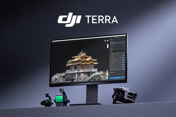
For example, DJI Terra supports 2D and 3D reconstruction from aerial imagery as well as processing of DJI LiDAR data. Its LiDAR workflow includes point cloud processing, point cloud and RGB data fusion, ground point extraction, and DEM generation.
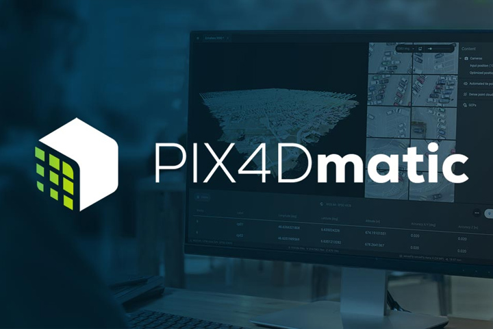
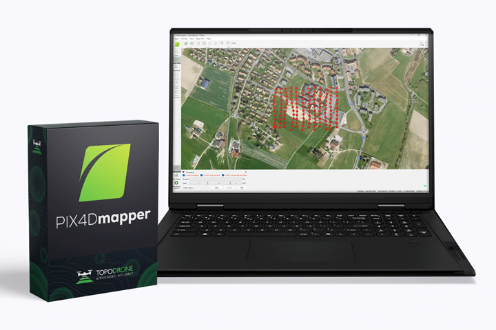
Other platforms are designed for larger or more specialized datasets. PIX4Dmatic, for example, is built to process thousands of images and includes workflows for corridor and large-scale mapping. Pix4Dmapper can process RGB, thermal, and multispectral imagery and convert it into georeferenced maps and 3D models.
For railway inspection, corridor mapping is particularly relevant. A processing workflow can turn a series of overlapping images collected along the track into a continuous georeferenced model of the railway corridor. The resulting data can then be measured, inspected, compared with previous surveys, or imported into other GIS and engineering systems.
Drones can cover large sections of railway infrastructure while collecting data that is difficult or time-consuming to obtain during conventional inspections.
RGB cameras document visible defects and infrastructure condition. LiDAR provides 3D data for track and terrain mapping, clearance checks, and vegetation assessment. Thermal sensors can reveal temperature anomalies, while RTK and PPK provide accurate positioning for mapping and repeat surveys.
A platform such as the DJI Matrice 400 can combine these capabilities with different payloads, including the Zenmuse L3 for LiDAR mapping and the Zenmuse H30T for visual and thermal inspection.
Drones do not replace engineers or conventional inspection methods. They provide another way to collect, process, and compare infrastructure data — helping inspection teams cover more ground, locate areas that need attention, and plan maintenance based on current site information.
Drones are used to survey railway tracks, bridges, tunnels, and surrounding areas. They can collect RGB, LiDAR, thermal, and multispectral data for detecting visible defects, mapping infrastructure, monitoring vegetation, and identifying potential hazards.
Yes. UAVs can capture detailed imagery and 3D data for track mapping, rail condition assessment, sleeper and fastening inspection, obstacle detection, and monitoring changes over time.
LiDAR creates a 3D point cloud of the railway corridor. It can be used for terrain and track mapping, clearance analysis, vegetation assessment, and detecting changes in terrain or infrastructure.
Yes. Thermal cameras can identify temperature differences that may indicate electrical, mechanical, or structural problems. Thermal data is typically used alongside visual imagery and other inspection methods.
UAV imagery and LiDAR can identify vegetation growing close to tracks and other railway infrastructure. Repeated surveys can also help monitor vegetation growth and identify areas that require maintenance.
RTK provides more accurate positioning of aerial imagery and LiDAR data. This is particularly useful for railway mapping, clearance measurements, deformation monitoring, and comparing surveys collected at different times.