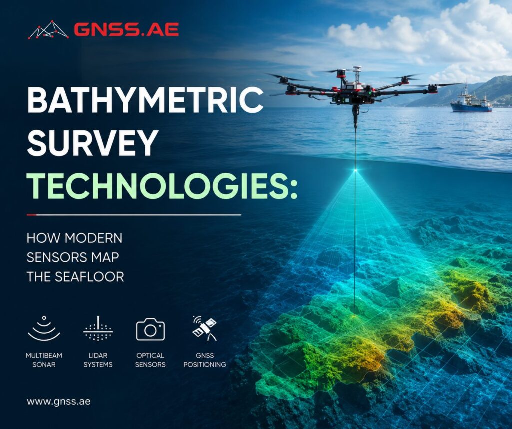
Accurate information about underwater terrain is essential for a wide range of marine projects, from dredging and offshore construction to coastal monitoring and ecosystem research.
Bathymetric surveys provide that information by measuring water depth and mapping the shape of the seafloor. Today, surveyors can choose from several technologies—including echo sounders, multibeam sonar, and bathymetric LiDAR—each suited to different environments and project requirements.
In this article, we explore how modern bathymetric surveys work, compare the main survey technologies, and examine how depth data is used in engineering, environmental monitoring, and marine research.
Bathymetry is the measurement and mapping of underwater depth and the shape of the seafloor or riverbed. Often described as the underwater equivalent of topographic surveying, it reveals depth variations, slopes, channels, sandbars, submerged structures, and other features hidden beneath the water’s surface.
The results of a bathymetric survey are typically presented as bathymetric maps, contour charts, or digital elevation models (DEMs). These datasets form the basis for a wide range of engineering, environmental, and scientific applications.
Unlike land surveying, mapping underwater terrain presents unique challenges. GNSS provides precise positioning above the water but cannot measure the bottom directly because radio signals do not penetrate water. Instead, surveyors rely on acoustic systems, laser-based sensors, or a combination of complementary technologies to determine water depth while accurately positioning every measurement.
The choice of survey technology depends on several factors, including water depth, clarity, survey area, required accuracy, and the type of information the project aims to collect.
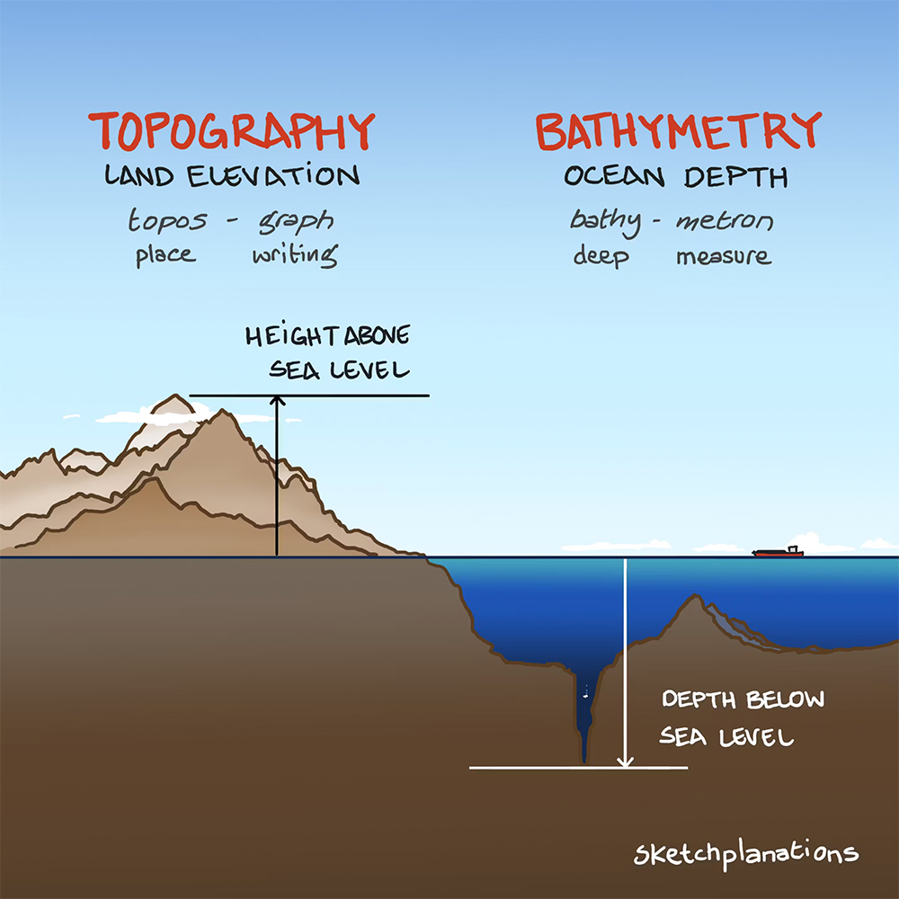
Bathymetric data is used for much more than producing nautical charts. It supports infrastructure development, environmental management, hydrographic surveying, and scientific research across both coastal and inland waters.
Some of its most common applications include:
Because underwater environments vary significantly from one project to another, no single survey technology is suitable for every situation.
Modern bathymetric surveys rely on several sensing technologies. Most fall into two categories: acoustic systems, which measure depth using sound waves, and optical systems, which use laser pulses to map underwater terrain.
The best choice depends on the survey environment. Water depth, turbidity, bottom composition, required resolution, and project scale all influence which technology delivers the most reliable results.
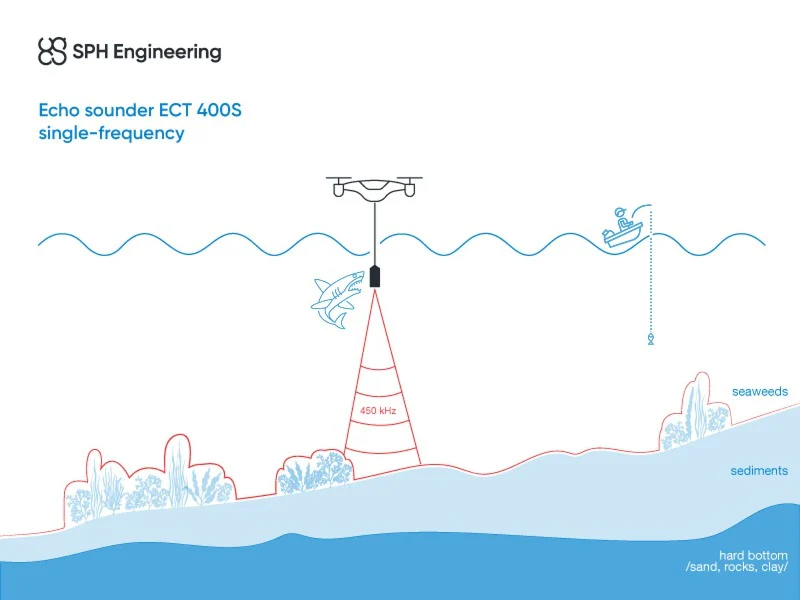
Single-beam echo sounders are among the most widely used instruments for measuring water depth. An acoustic pulse is transmitted from a transducer toward the seafloor, and the system measures the time it takes for the reflected signal to return. Knowing the speed of sound in water allows it to calculate the distance to the bottom.
Because the sensor records depth at a single point directly beneath the survey platform, single-beam systems are straightforward, reliable, and relatively inexpensive. They are commonly used for:
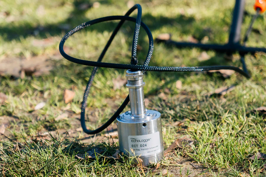
Their main limitation is coverage. Since each measurement represents only one point on the seabed, surveyors must run multiple parallel lines to build a complete depth model. As a result, mapping large areas takes considerably longer than with wide-swath systems such as multibeam sonar.
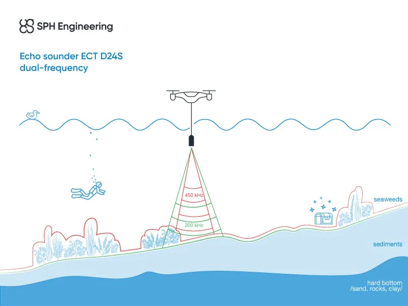
Dual-frequency echo sounders build on the same measurement principle but operate at two acoustic frequencies instead of one. Because each frequency interacts differently with the seabed and underlying sediments, the survey provides more than depth measurements alone.
High frequencies produce sharper detail, making them well suited to shallow water and hard-bottom mapping. Lower frequencies penetrate deeper into soft sediments, revealing subsurface layers and variations in bottom composition.
This additional information is valuable for applications such as:
For example, the EchoLogger ECT D24S operates at 200 kHz and 450 kHz, a combination designed for shallow-water surveys that require detailed bottom definition. Typical applications include bathymetric mapping, hydrological studies, and sediment monitoring.
The EchoLogger ECT D052S combines 50 kHz and 200 kHz frequencies. The lower frequency improves sediment penetration, while the higher frequency delivers accurate depth measurements, making the system well suited to projects where both bathymetry and subsurface conditions need to be evaluated.
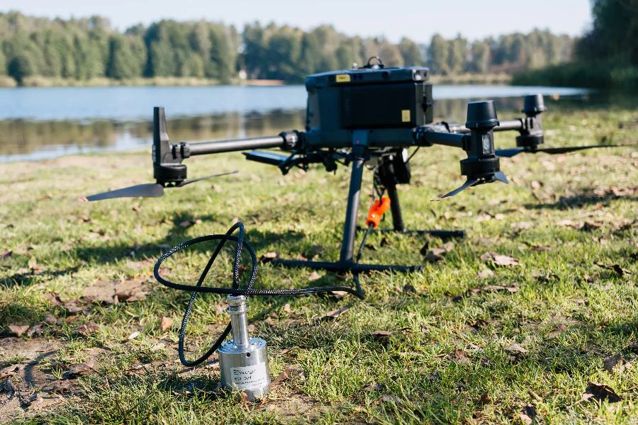
Compared with single-frequency instruments, dual-frequency echo sounders provide a more complete picture of the underwater environment without significantly increasing system complexity. Their compact size also makes them well suited for integration with unmanned survey platforms.
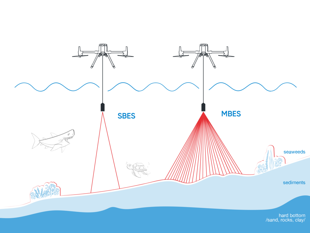
Multibeam echo sounders are the standard choice for high-resolution hydrographic surveys over large areas. Instead of measuring depth at a single point, they transmit hundreds of acoustic beams that cover a broad swath of the seafloor with every pass.
The result is a dense point cloud that can be processed into detailed bathymetric models, making multibeam systems well suited for:
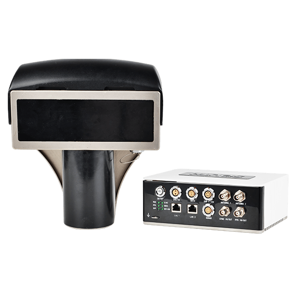
Their greatest advantage is coverage. Because a single pass captures a wide section of the seabed, fewer survey lines are needed, reducing field time while maintaining high data density.
The trade-off is greater system complexity. Accurate results depend on careful calibration, precise motion compensation, and regular sound velocity measurements throughout the survey.
Bathymetric LiDAR measures underwater terrain with laser pulses rather than sound waves. Mounted on an aircraft or UAV, the sensor emits a green laser toward the water surface. Part of the pulse reflects immediately from the surface, while the remainder travels through the water and reflects from the bottom.
By comparing the return times of these two signals, the system calculates water depth and generates a three-dimensional model of the underwater landscape.
Most bathymetric LiDAR systems operate at a wavelength of 532 nm. Green light penetrates water far more effectively than the near-infrared wavelengths used in conventional topographic LiDAR, allowing the sensor to detect the seafloor in clear, shallow water.
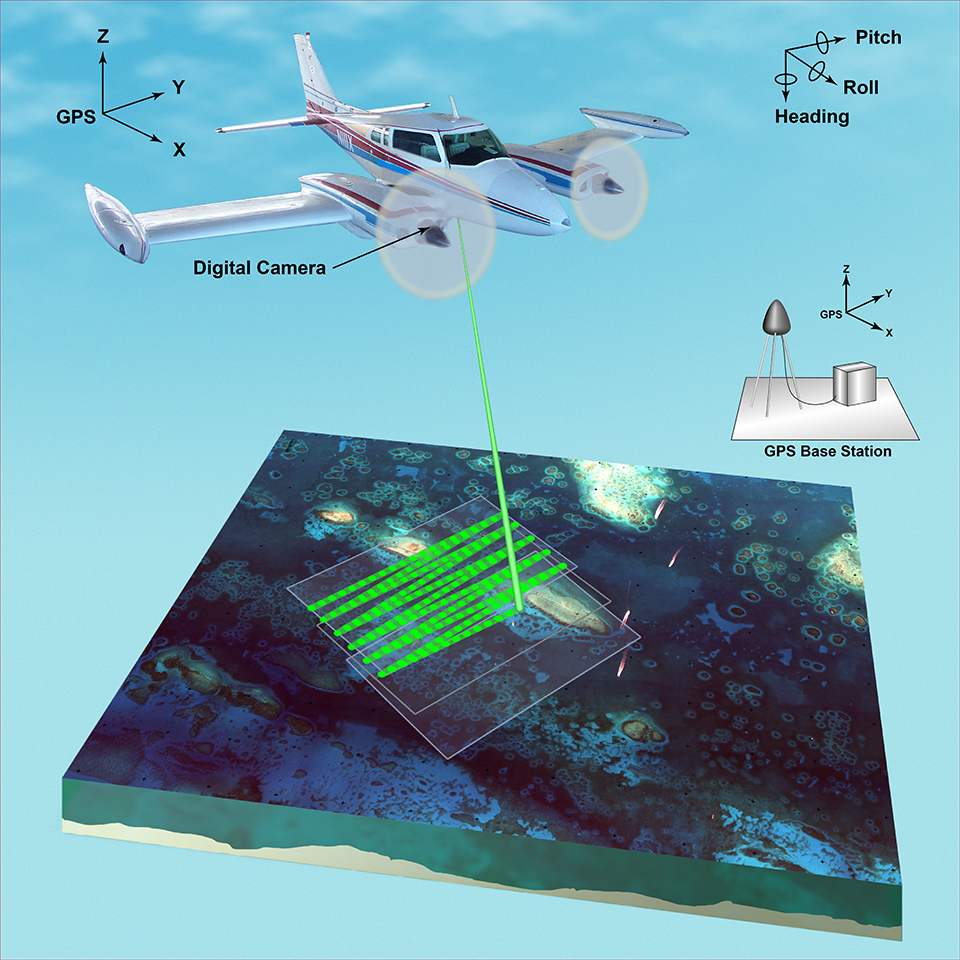
Typical applications include:
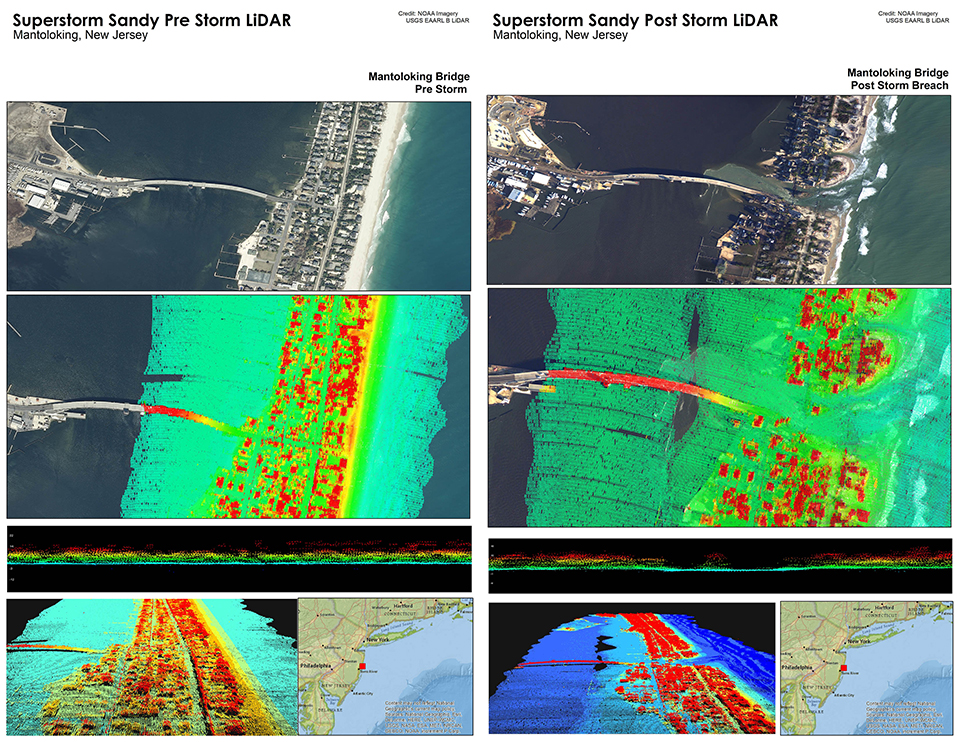
Bathymetric LiDAR can collect data over large areas in a relatively short time and, unlike sonar, captures both dry land and shallow underwater terrain during the same flight. This makes it especially useful for coastal mapping projects.
Its effectiveness, however, depends heavily on water conditions. Turbidity, suspended sediment, wave action, and increasing depth all reduce laser penetration. In murky or deep water, acoustic survey methods generally deliver more reliable results.
No single bathymetric technology is suitable for every survey environment. The right approach depends on the purpose of the project, water conditions, required level of detail, and available survey platform.
For example, a small reservoir inspection and a large-scale coastal mapping project have very different requirements. A compact dual-frequency echo sounder may provide all the necessary information for one task, while an offshore development project may require a full multibeam or airborne LiDAR workflow.
The table below summarizes the main differences between common bathymetric survey technologies.
Technology | How it works | Best suited for | Main advantages | Limitations |
Single-beam echo sounder | Measures depth using a single acoustic beam directed below the sensor | Small-scale surveys, rivers, lakes, routine depth measurements | Simple operation, cost-effective, reliable | Limited coverage per survey line |
Dual-frequency echo sounder | Uses two acoustic frequencies to measure depth and analyze bottom characteristics | Sediment studies, reservoirs, shallow waters, dredging surveys | Provides information about both depth and seabed conditions | Smaller coverage area compared with multibeam systems |
Multibeam echo sounder | Collects multiple acoustic measurements across a wide swath | Hydrographic surveys, ports, offshore construction | High-resolution mapping of large areas | More complex setup and data processing |
Bathymetric LiDAR | Uses green laser pulses to measure water depth and underwater terrain | Clear shallow waters, coastal zones, reef mapping | Rapid large-area coverage, captures land and shallow-water terrain together | Limited by water clarity and penetration depth |
In practice, many projects combine several data sources rather than relying on a single technology. For example, a coastal survey may use airborne LiDAR for rapid shoreline mapping and acoustic systems for areas where laser penetration is limited.
Monitoring coral reefs requires more than documenting the condition of individual coral colonies. To understand how entire reef systems evolve, researchers also need to measure changes in the underlying seafloor.
A recent study by the U.S. Geological Survey (USGS) analyzed bathymetric changes across 234.2 km² of the Upper Florida Keys Reef Tract, covering the area from Triumph Reef to Pickles Reef. Instead of relying on a single survey, researchers compared historical hydrographic surveys collected in 1934–1935 with airborne bathymetric LiDAR datasets acquired in 2001–2002 and 2016–2017.
Using more than 25,000 elevation measurements, the team quantified how the reef structure changed over two distinct periods. Between 1935 and 2002, the study recorded an average seafloor elevation change of −0.1 ± 0.8 m, corresponding to a net volume loss of approximately 13.6 million cubic meters. During the later period (2002–2016), elevation changes were much smaller (0.0 ± 0.3 m), with a modest net gain of 1.6 million cubic meters.
The results also revealed that reef change was far from uniform. Some sections experienced erosion, while others showed localized sediment accumulation or limited reef accretion. At the same time, biological observations indicated continued declines in hard coral cover, despite the reduced rate of physical change in the later survey period. This demonstrated that monitoring reef elevation alone is not enough—bathymetric data becomes far more valuable when interpreted alongside ecological observations.
One of the study’s key conclusions was that large-scale bathymetric surveys provide insights that cannot be obtained from localized field measurements alone. By comparing georeferenced datasets collected decades apart, researchers were able to quantify long-term changes in reef morphology, identify spatial patterns of erosion and accretion, and establish a regional baseline for future conservation and restoration efforts.
Bathymetric surveys have become an essential tool for understanding underwater environments. They support applications ranging from coastal mapping and dredging to offshore construction, habitat monitoring, and scientific research.
No single technology is ideal for every project. Single- and dual-frequency echo sounders remain practical solutions for many hydrographic surveys, multibeam systems provide detailed coverage of large areas, and bathymetric LiDAR offers an efficient way to map shallow, clear-water environments from the air.
Advances in compact sensors, UAVs, and USVs are making these technologies more accessible while expanding the range of environments that can be surveyed efficiently.
As bathymetric data is combined with photogrammetry, LiDAR, imagery, and environmental observations, it becomes part of a broader digital workflow. Together, these datasets provide a richer understanding of underwater environments and support better-informed decisions in engineering, conservation, and marine science.
Bathymetry is the measurement and mapping of underwater depth and the shape of the seafloor or riverbed. Similar to topographic mapping on land, bathymetric surveys create detailed models of underwater terrain, including depth variations, slopes, channels, and submerged features.
Bathymetric data is used in many applications, including hydrographic charting, marine construction, coastal monitoring, environmental research, and infrastructure planning.
Topography describes the elevation and shape of land surfaces above water, while bathymetry focuses on underwater terrain. Both produce elevation models, but the methods used to collect the data are different.
Because GNSS signals cannot penetrate water, underwater mapping requires specialized technologies such as echo sounders, sonar systems, or bathymetric LiDAR.
A bathymetric echo sounder measures depth by sending acoustic pulses toward the bottom and recording the time required for the signal to return after reflecting from the seafloor.
The system calculates water depth using the travel time of the sound wave and the known speed of sound in water. Dual-frequency echo sounders use two different frequencies to provide additional information about bottom characteristics, sediment layers, or underwater structures.
Bathymetric LiDAR uses green laser light because wavelengths around 532 nm can penetrate water more effectively than the infrared wavelengths used in conventional LiDAR systems.
This makes green laser systems suitable for mapping shallow coastal zones, rivers, lakes, and coral reef environments. However, performance depends on water clarity, depth, and environmental conditions.
Dual-frequency echo sounders are often preferred for environments where water clarity is limited or where information about bottom materials is important. They are commonly used for rivers, reservoirs, dredging projects, and sediment monitoring.
Bathymetric LiDAR is better suited for rapidly mapping large areas of clear, shallow water, especially in coastal environments where both land and underwater terrain need to be captured.
These digital models allow researchers and engineers to analyze changes over time, monitor ecosystems, inspect underwater infrastructure, and support long-term management decisions.