In today’s era of digital infrastructure and precision mapping, elevation data plays a crucial role in shaping how engineers, urban planners and environmental scientists interact with the earth’s surface. Three key elevation models – Digital Elevation Models (DEM), Digital Terrain Models (DTM) and Digital Surface Models (DSM) – form the backbone of this geospatial revolution.
Each of these models provides a different lens through which we can interpret terrain. Understanding their distinctions and applications is essential for anyone working with topographic data.
A Digital Elevation Model (DEM) is a gridded digital representation of the Earth’s surface elevation. Each cell in the grid contains an elevation value, forming a continuous surface that can be visualized and analyzed within a Geographic Information System (GIS).
While the term DEM is often used broadly, it may include either a bare-earth surface or surface features such as vegetation and structures. Its primary purpose is to abstract topographic information from a continuous spatial dataset. DEMs typically have coarser resolutions (e.g., >20 meters), making them ideal for regional and continental-scale applications.
Beyond gridded data, DEMs can also be structured as Triangulated Irregular Networks (TINs), which store elevation points at critical terrain locations, offering storage efficiency while preserving detail. With advancements in LiDAR and photogrammetry, point clouds have become a popular DEM format, offering high-resolution 3D data directly collected from sensors.
DEMs serve a wide range of functions across industries:
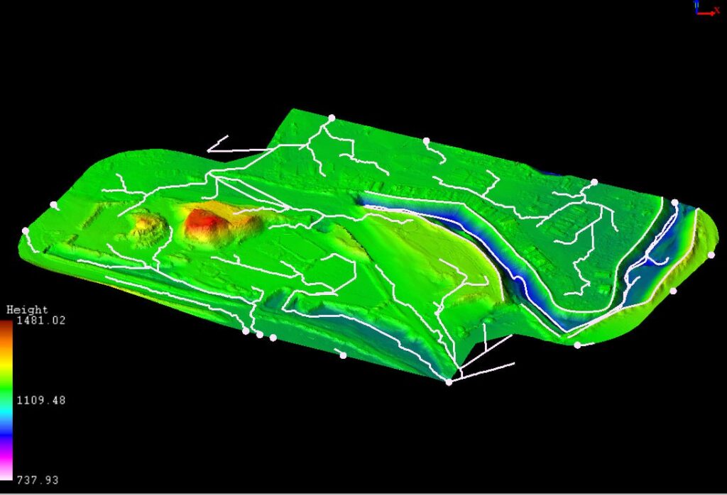
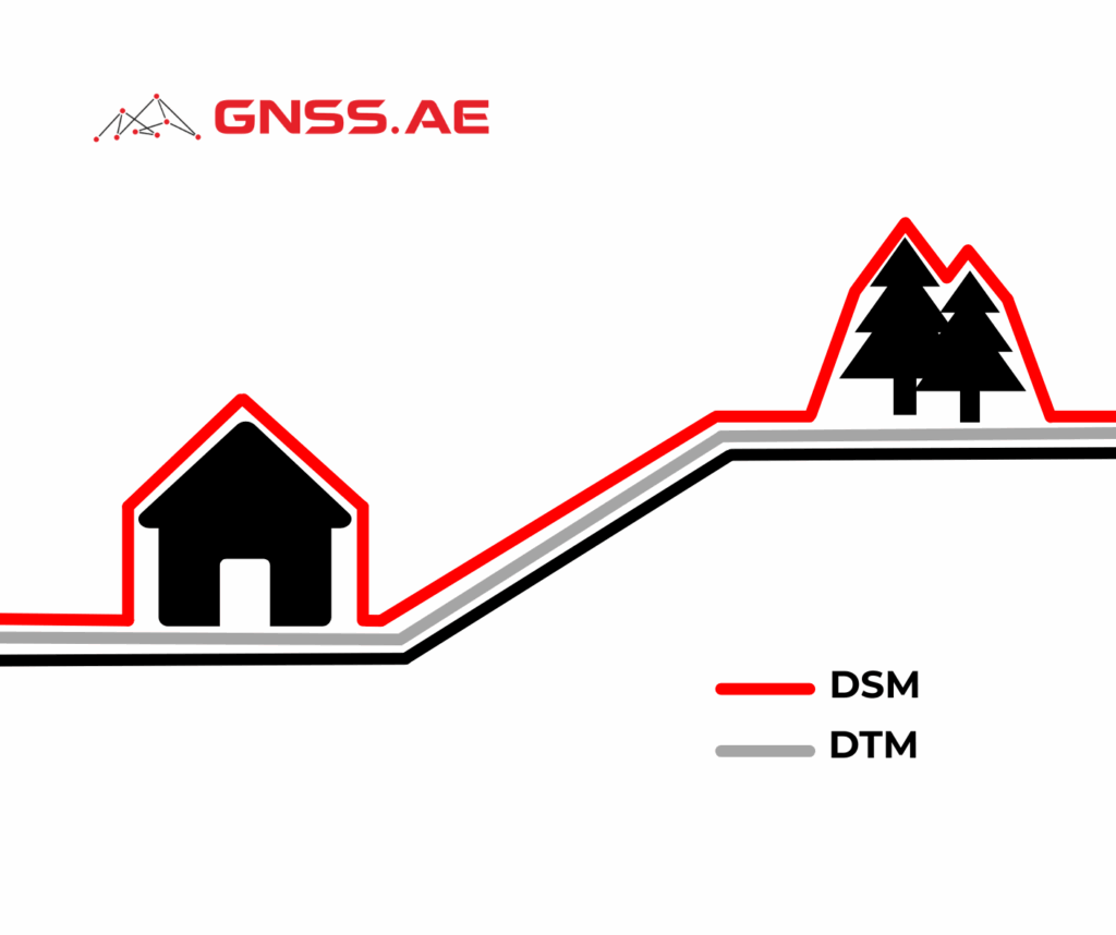
A Digital Terrain Model (DTM) is a refined, bare-earth representation of the terrain. Unlike a DEM, which may include buildings, vegetation and other surface artifacts, a DTM strips away these features to focus solely on the natural landscape.
Some interpretations treat DTMs as enhanced DEMs that incorporate breaklines, ridges and other terrain discontinuities to improve model accuracy. In vector format, these features help define the topography more precisely, especially in rugged or detailed terrain.
DTMs are generated through various techniques:
DTMs are indispensable in projects where understanding the ground surface is critical:
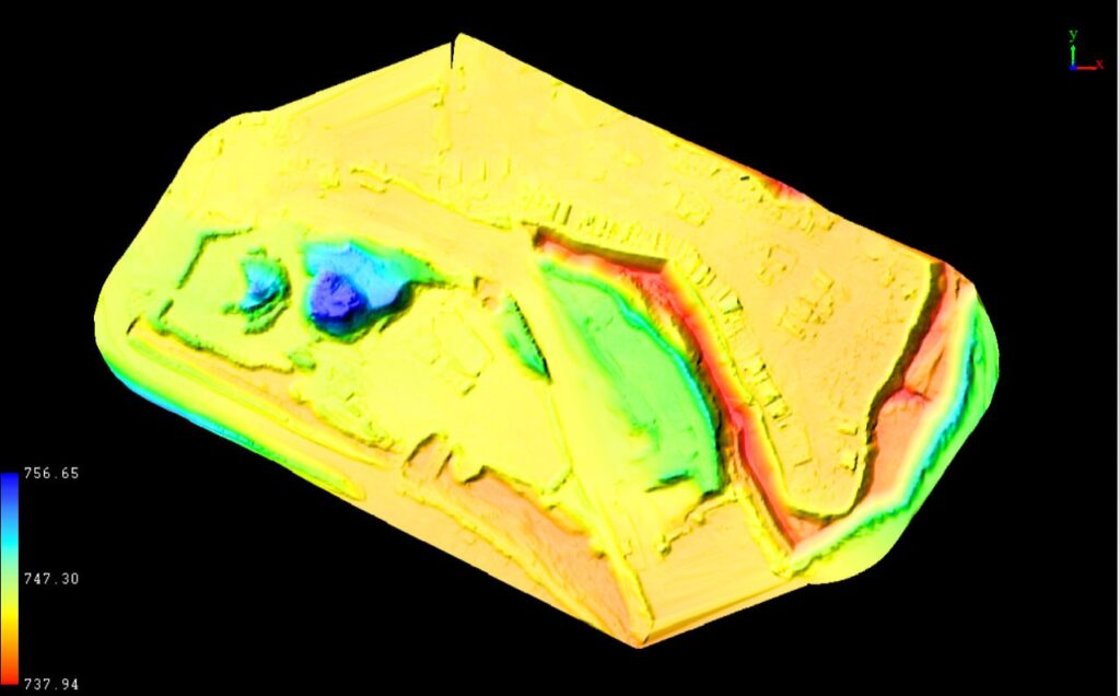
A Digital Surface Model (DSM) captures the elevations of everything on the Earth’s surface, including vegetation, buildings, towers and other structures. It reflects the first return data from LiDAR or the visible tops of objects in stereo imagery, making it invaluable in urban and vegetation-rich areas.
Where DTMs remove the clutter to highlight the ground, DSMs preserve this clutter to represent the full surface profile.
DSM production typically uses high-precision methods:
The richness of DSM data lends itself to advanced applications:
| Model | Represents | Includes Structures? | Common Uses |
|---|---|---|---|
| DEM | General elevation (can be bare-earth or include objects) | Sometimes | Terrain analysis, hydrology, GIS |
| DTM | Bare-earth surface with refined features | No | Flood modeling, slope analysis |
| DSM | Surface including buildings and vegetation | Yes | Urban modeling, telecom, disaster planning |
Despite their utility, these models come with limitations:
Accuracy of elevation models is typically assessed in two ways:
Factors influencing accuracy include terrain complexity, sensor resolution, sampling density and interpolation methods.
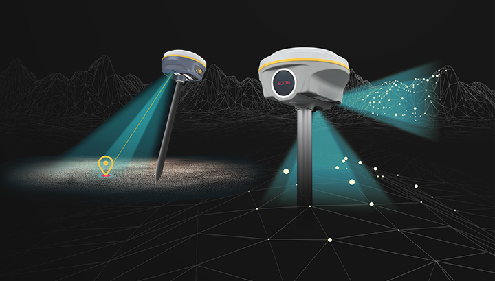
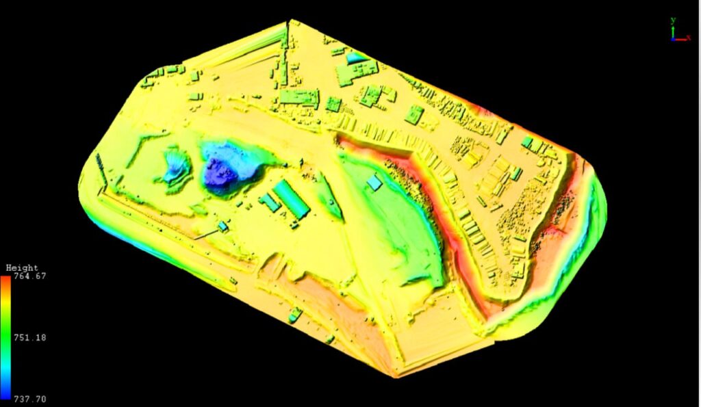
Unmanned Aerial Vehicles (UAVs), commonly known as drones, have transformed the elevation data collection. Equipped with LiDAR sensors or high-res cameras, UAVs generate dense point clouds that can be processed into DSMs, DTMs or DEMs.
For DSMs, UAVs capture the surface elements like rooftops and tree canopies. DTMs are generated by filtering out these features to reveal the bare-earth terrain. DEMs can be derived from either, depending on the desired abstraction level.
UAV-based mapping is particularly useful in areas that are difficult to access, such as mountainous terrain, disaster zones or urban canyons, offering a flexible, cost-effective alternative to satellite or manned aerial surveys.
Choosing between DEM, DTM and DSM depends on your project’s requirements.
As technology continues to evolve, so too will the accessibility and accuracy of these foundational geospatial models. Understanding their distinctions ensures more informed, effective and innovative applications across industries.