The oil and gas industry stands as a global powerhouse, fueling the engines of modern civilization. Yet this essential sector faces mounting challenges: environmental pressures, safety risks, remote operational complexities, and aging infrastructure demands. Drone technology offers a revolutionary solution that’s reshaping how the industry operates, delivering enhanced safety, unprecedented efficiency, and reduced environmental impact.
Commercial drones are fundamentally changing the operational landscape of oil and gas facilities. This transformation brings measurable efficiency gains while significantly mitigating operational risks. Industry leaders are already experiencing substantial value from strategic drone deployment, setting new standards for operational excellence.
Drones provide unprecedented access to challenging and previously inaccessible locations, enabling comprehensive remote inspections while dramatically reducing personnel exposure to hazardous environments such as confined spaces and elevated structures.
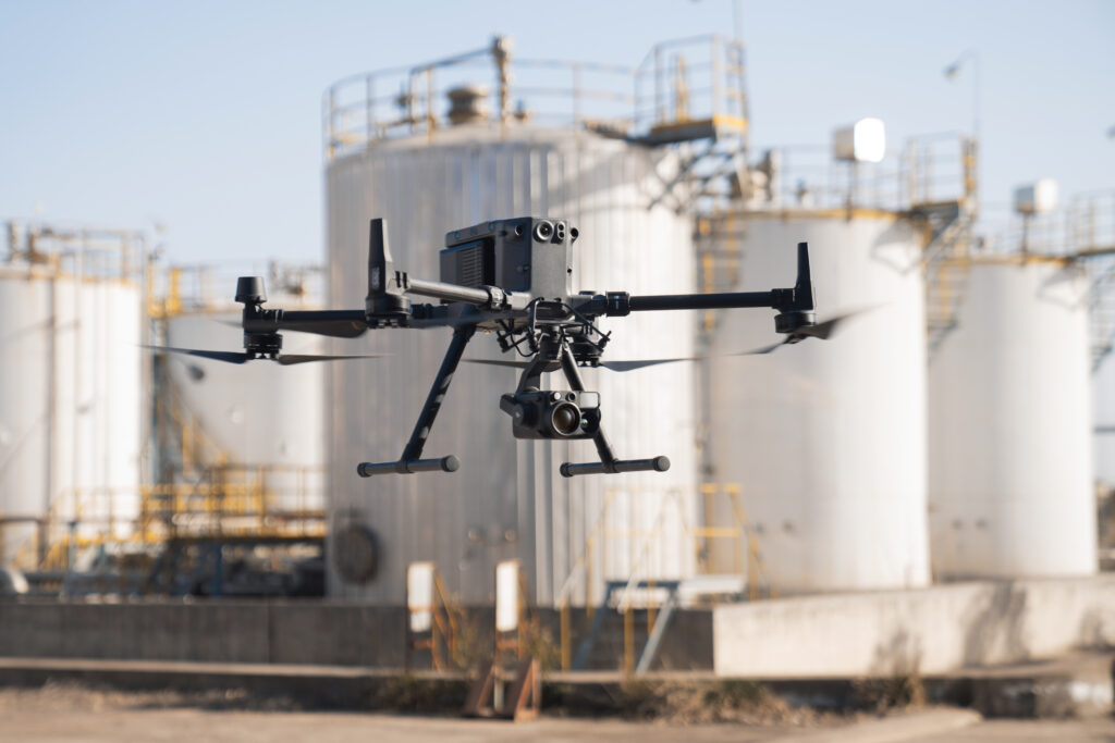
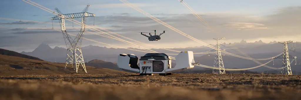
Energy companies leverage DJI’s Dock 3 as a comprehensive “drone-in-a-box” solution, autonomously inspecting flares, tanks, power lines, pipelines, and wells while generating digital twins, panoramas, maps, and comprehensive perimeter documentation.
Drone inspections deliver remarkable time savings by accelerating inspection processes and automating data collection workflows. The efficiency gains are substantial: drones equipped with Optical Gas Imaging (OGI) cameras can inspect five tanks in approximately 20 minutes, compared to 100 minutes using traditional methods. This efficiency not only reduces downtime and minimizes disruptions to critical infrastructure but also optimizes resource allocation across operations.
Drones capture high-quality, precision data that enables detailed analysis and generates accurate 3D models and comprehensive maps. This enhanced visualization and planning capability enables proactive maintenance strategies and informed decision-making, allowing for swift identification and resolution of issues like leaks and structural anomalies.
Saudi Arabian Aramco has emerged as a regional leader in drone deployment, beginning operations in 2015 across seven facilities and now deploying more than 100 drones across most of its major facilities. Aramco uses drones as a quick and cost-effective way to inspect and monitor oil and gas assets, reducing maintenance costs and inspection times across their facilities. Drones are also playing a pivotal role in monitoring company’s facilities for potential methane leaks.
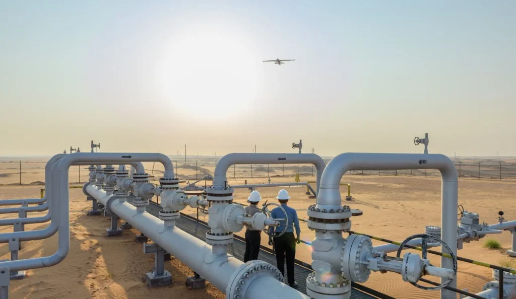
For instance, at Aramco’s Khurais field, a battery-powered drone maps desert areas, surveys field infrastructure, and detects potential leaks and other issues related to the field’s infrastructure, feeding real-time data into a specialized control room with precision and in far less time compared to manual inspections. To put the efficiency gains in perspective, if field inspections were carried out manually, two field operators in a car would take about an hour to check two wells. Using the drone, Aramco can now check 70 wells in four hours. When inspecting storage tanks, Aramco’s traditional process required extensive scaffolding setup over a two to three week period, while automated drone inspection platforms significantly reduce this timeframe while improving safety protocols.
Effective drone program implementation requires carefully defined workflows aligned with specific operational needs and objectives.
Oil and gas companies deploy drones for comprehensive inspection programs including asset monitoring, flare assessments, tank inspections, power line surveillance, pipeline monitoring, and well evaluations. These workflows emphasize operational efficiency, data consistency, and proactive maintenance strategies, with particular focus on gas detection for enhanced safety and environmental compliance.
Understanding specific data requirements and selecting appropriate drone payloads and software solutions is crucial for ensuring data accuracy and meeting operational objectives. Organizations often require diverse data types, from high-resolution imagery and thermal analysis to precise measurements and detailed 3D modeling.
Strategic payload selection includes sensors such as OGI cameras, thermal imaging systems, LiDAR units, and multispectral sensors. Compatible software solutions enable efficient data processing, comprehensive analysis, and effective visualization, facilitating informed operational decision-making.
Determining optimal drone operation frequency depends on various factors including regulatory requirements and specific operational needs. Regular inspections ensure compliance with industry standards, monitor equipment health, and enable early issue detection. Organizations can establish inspection schedules that balance data collection requirements with operational efficiency and cost-effectiveness.
GNSS.AE provides extensive options for various operational requirements, offering comprehensive hardware and software solutions utilized by oil and gas partners in the Middle East and Africa.
| Drone Hardware | Key Features |
|---|---|
| DJI Matrice 400 |
Zenmuse H30 Series |
| DJI Matrice 350 RTK |
|
| DJI Matrice 30 Series |
|
| DJI Matrice 4E and Matrice 4T |
|
| Drone-in-a-Box (DJI Dock 3) |
|
DJI Terra
DJI Terra represents powerful 3D model reconstruction software utilizing advanced photogrammetry to create accurate 2D and 3D models from drone imagery. Compatible with DJI Enterprise drones and payloads, it supports data processing from both visible light and LiDAR sensors, serving industries including land surveying, power transmission, emergency services, and agriculture.
DJI FlightHub 2
FlightHub 2 revolutionizes fleet management through advanced live mission monitoring and comprehensive data sharing capabilities. This all-in-one cloud-based drone operations management platform provides comprehensive real-time situational awareness, enabling effective mission planning, fleet supervision, and data management from a secure cloud-based environment.
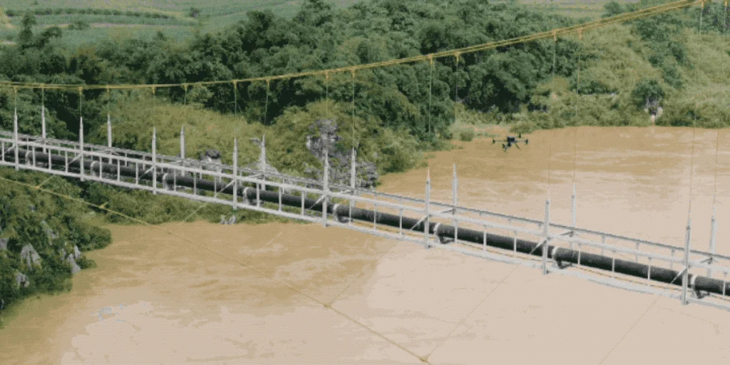
Drones are revolutionizing pipeline inspections by providing safer, more efficient, and cost-effective alternatives to traditional methods. High-resolution cameras capture detailed pipeline imagery from multiple angles, enabling inspectors to identify corrosion, damage, and leaks. Thermal imaging capabilities detect temperature variations revealing potential issues like leaks and insulation failures, while LiDAR sensors create precise point clouds for detailed analysis and change detection.
Traditional Workflow Challenges: Before drone technology, pipeline inspections were labor-intensive and risk-laden endeavors. Inspectors meticulously planned routes using maps and markers, navigated challenging terrain using off-road vehicles or helicopters, then walked pipeline routes conducting visual assessments. This approach posed significant safety risks, provided limited remote area access, and relied heavily on subjective observations while consuming substantial time.
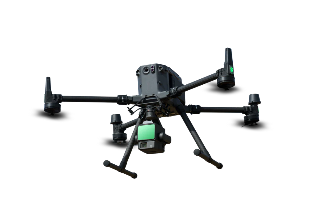
DJI Solution Excellence: The DJI Matrice 350 RTK provides comprehensive pipeline inspection capabilities with extended flight times and advanced safety features. Equipped with H30T payload systems, it enables detailed visual inspections, wide-area surveillance, and thermal reporting for leak detection. The M350 RTK with L2 payload generates highly accurate 3D models through detailed LiDAR data collection.
Third-party payload options include Optical Gas Imaging (OGI) systems and Tunable Diode Laser Absorption Spectroscopy (TDLAS) for enhanced pipeline safety and efficiency. For specialized applications, the DJI Mavic 3M utilizes multispectral imaging for detecting saltwater pipeline leaks by identifying stressed vegetation indicating potential leak presence.
UAS Workflow Optimization: The UAS workflow begins with understanding specific inspection objectives and configuring appropriate payload systems. Waypoint missions enhance efficiency through pre-planned flight paths and automated actions, reducing human error while saving time and resources. Digital twins provide virtual environments for mission visualization and optimization before deployment.
Data and Reporting Excellence: Data processing focuses on extracting actionable pipeline integrity insights through orthomosaic creation, thermal analysis, and 3D modeling. Comprehensive inspection reports include annotated orthomosaics highlighting problem areas, thermal reports showing temperature variations, and 3D models illustrating pipeline geometry. All data is securely archived within geospatial information systems for future analysis and regulatory reporting.
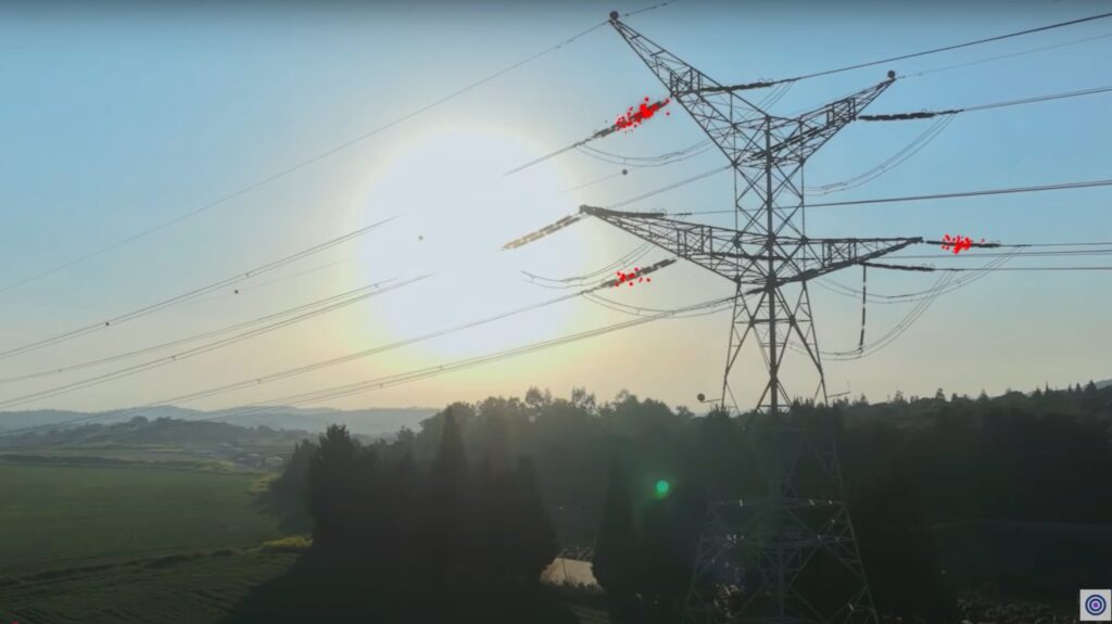
Traditional flare stack monitoring relies on fixed cameras and temperature sensors to monitor flare ignition status. Identifying issues like extinguished flares requires time-consuming shutdowns and potentially hazardous manual inspections.
Drones offer safer, more efficient solutions by quickly confirming issues using advanced temperature sensing and clear damage imagery, enabling faster repairs without designated area shutdowns for prior inspection.
Traditional gas detection methods involve time-consuming manual inspections using handheld detectors, posing safety risks and providing limited hard-to-access area coverage.
Drones equipped with advanced gas detection sensors like the Sniffer4D Gas Detection System offer transformative solutions. Sniffer4D Drone Based Multi-Gas Detection System accurately measures and visualizes real-time gas concentrations with dedicated methane detection capabilities, powerful spatiotemporal data analysis, and built-in connectivity options.
LiDAR technology enables comprehensive topographic mapping and wetland identification through high-resolution 3D terrain mapping. Applications include detailed terrain analysis revealing elevation changes and slopes, wetland delineation for environmental compliance, and contour generation for fluid flow prediction and containment structure design.
Traditional Limitations vs. UAS Solutions: Traditional ground-based LiDAR involved time-intensive data collection using tripod-mounted scanners with accessibility and safety challenges. UAS workflows utilize M350 RTK drones with DRTK 2 base stations, creating efficient LiDAR flight plans through DJI Pilot 2 software while maintaining continuous telemetry monitoring and real-time data quality control.
UAVs with LiDAR provide significant ROI through reduced survey time and costs, increased efficiency and safety, and improved environmental protection and decision-making capabilities.
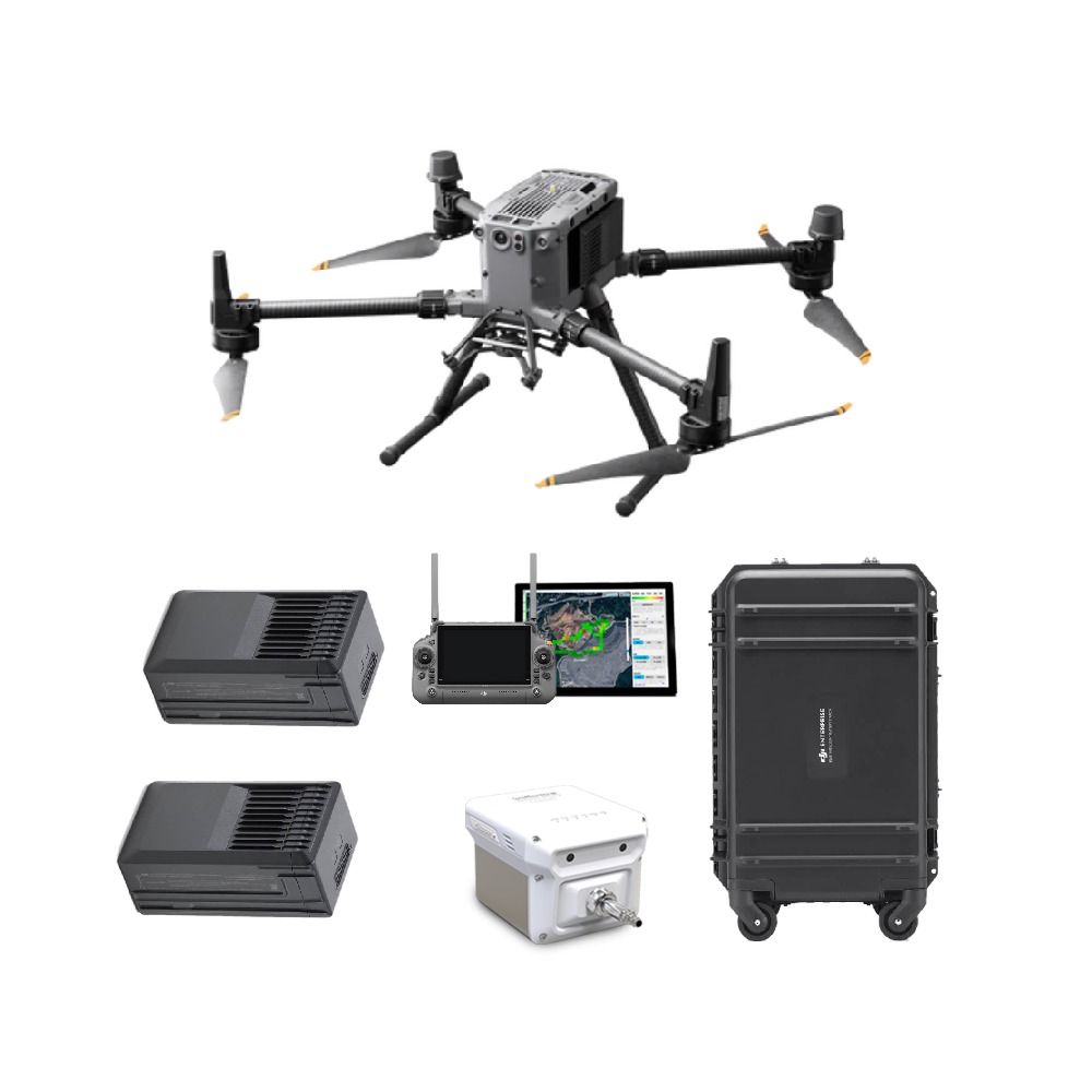
The DJI Matrice 350 RTK LiDAR Pack represents the optimal solution for complex operations and LiDAR inspections. This comprehensive package includes the DJI Matrice 350 RTK drone and Zenmuse L2 LiDAR system, providing 55 minutes of flight time with 2.7 kg payload capacity.
The oil and gas industry continues evolving toward enhanced safety, improved efficiency, and environmental responsibility. Drones serve as key catalysts in this evolution, offering versatile platforms for comprehensive operations ranging from inspections and maintenance to leak detection and emergency response.
By integrating drone technology into operations, companies optimize performance, reduce costs, and strengthen their commitment to safety and sustainability. As the industry continues innovating, drones will undoubtedly play increasingly crucial roles in shaping its future.
Taking oil and gas operations to the next level requires embracing innovation. An in-house drone program can unlock a new era of efficiency and safety. With appropriate equipment, comprehensive training, and ongoing support, teams can harness the transformative power of drone technology to revolutionize their operational capabilities.