
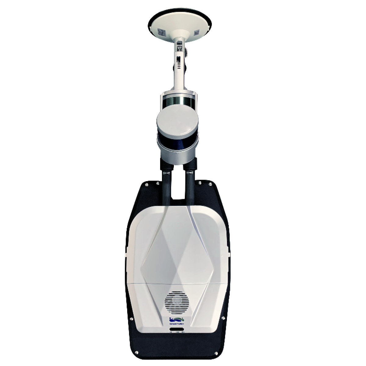
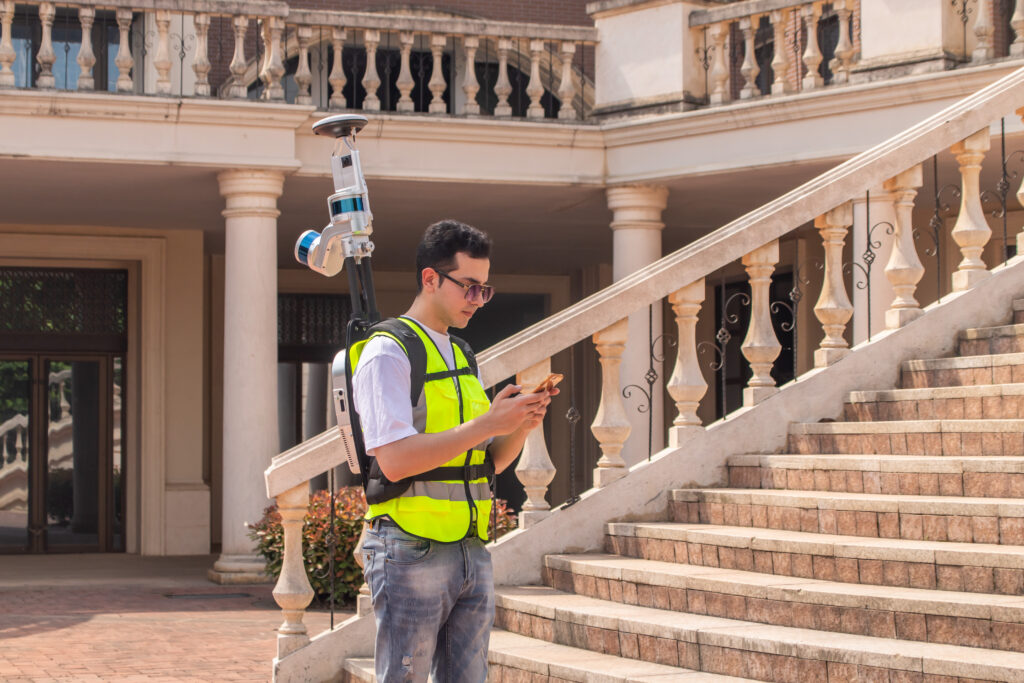
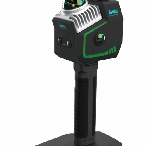
The Libackpack DGC50H backpack LiDAR scanning system is an upgraded version of the Libackpack Product Series. The integrated SLAM technology, regardless of whether there is GNSS information in the scanning environment, can obtain high-precision 3D points within the scanning range, exquisite, double the efficiency! It can be used in the fields of power patrol, forestry survey, mining measurement, underground space information acquisition, building facade measurement, BIM, and other fields.


Dual Laser

Relative Accuracy ± 3 cm

Scan Rate 640,000 pts/s

Camera Resolution 5760 × 2880

DGC50H provide a 2.5 hours long life battery. You can finish a 20,000 Square meter park scanning in 30mins.
DGC50H can directly acquire point cloud data with absolute coordinates when used with self-racked base stations. The laser point cloud data within 5cm of absolute accuracy can be output to meet the requirements of high-precision mapping.

Dual laser heads with scanning frequencies of up to 640,000 points per second.
DGC50H adopt a high-resolution panoramic camera, and support 5.7K delay photography, the panoramic view is clearer and more realistic. The video size is reduced by 30-40 times.
| Size | 1135*318*315mm (extended) 960*318*315mm (closed) | ||
| Scan Rate (Single return) | 640,000pts/s (single return) | ||
| Accuracy | 1cm* | Internal Storage | 512GB |
| Weight (Without battery)) | 8.6kg | Power Consumption | 50W |
| Work Mode | Backpack Scanner | ||
LiDAR Sensor |
|||
| Number of Channels | 16 channels | FOV | Horizontal: 360° Vertical: 180°(-90~90) |
| Number of Returns | 2 | LiDAR Accuracy | ±1cm |
| Number of Sensors | 2 | Scan Range | 120m |
GNSS |
|||
| Satellites | GPS: L1 C/A, L1C, L2C, L2P, L5 GLONASS: L1 C/A, L2C, L2P, L3, L5 Galileo: E1, E5a, E5b, E5 Alt BOC,E6 BeiDou: B1, B2 |
Positioning | 1cm+1ppm |
Camera |
|||
| Video Resolution | 5760*2880 | Video Recording Method | Time-lapse, 2s/frame |
| 360° panorama | Pixels | 1800w | |
Pay securely with your Card, Apple Pay, or Google Pay via Paymob.
![]()
A payment link, also known as a checkout link, is a shareable URL that allows customers to make payments online.
Cash/Cheque payment/Bank transfer
Inquire price for GreenValley LiBackpack DGC50H GNSS+Panoramic Camera+Dual Laser Scanners Integration