Photogrammetry: Bringing Images to Life
As the Middle East pushes the boundaries of innovation, from smart cities and agricultural megaprojects to massive infrastructure developments, the need for precise, reliable surveying solutions is more critical than ever.
With rapid growth across the region, choosing the right geospatial technology has become a strategic decision. Often, it comes down to two powerful options: Photogrammetry and LiDAR. While both offer impressive capabilities, understanding their differences is key to delivering successful, future-proof projects.
Both technologies have proven their value across industries like construction, mining, land management, and forestry. Let’s explore how each method brings unique advantages to the table and how the right choice can drive better project outcomes.
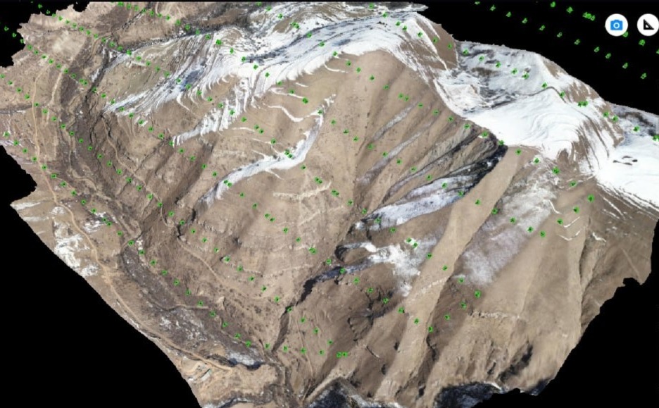
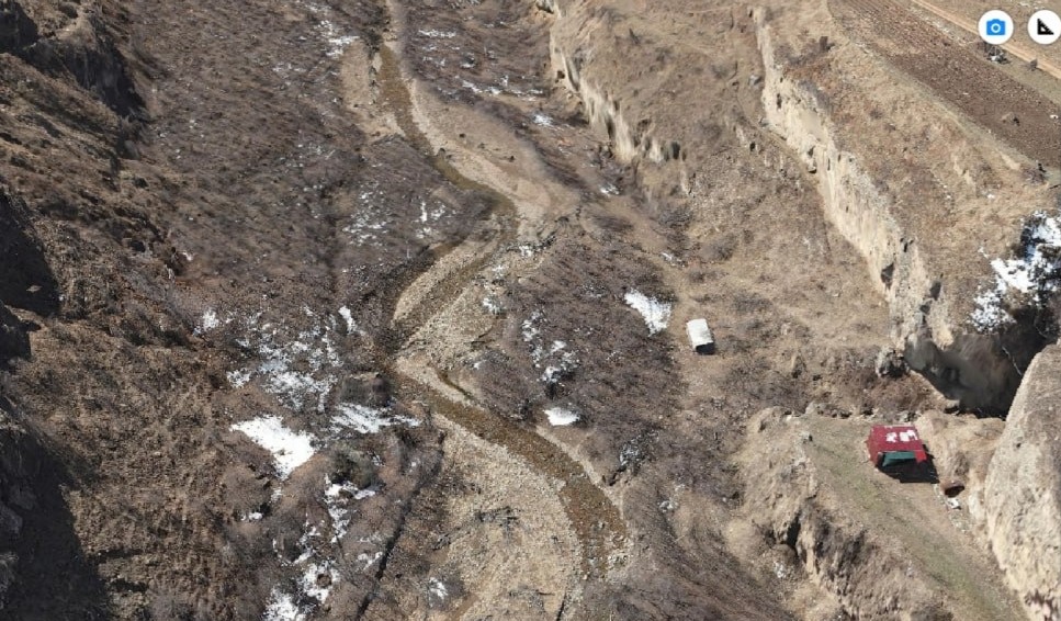
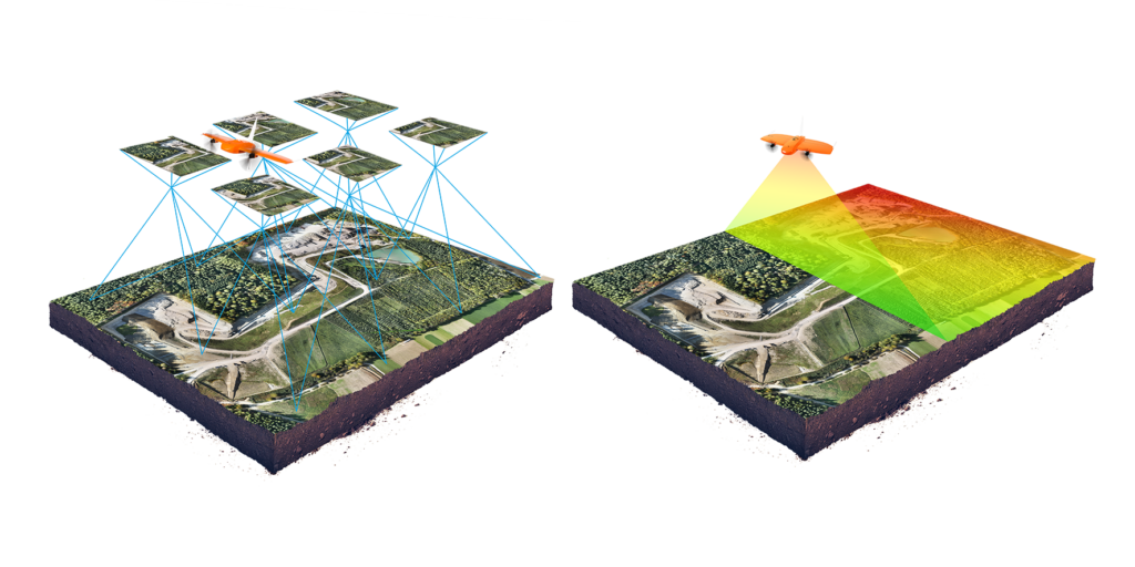
Photogrammetry transforms 2D images into detailed 3D models by stitching together hundreds, sometimes thousands, of high-resolution photographs captured by drones. The result? A vivid, visual replica of the surveyed site, accurate enough for a wide range of applications, from planning to inspections.
However, photogrammetry has its limitations. It can struggle in areas with dense vegetation, uniform surfaces or poor lighting conditions. Moreover, the achievable imagery resolution is limited by the camera’s resolution and distance from the captured object, which can be a limitation for large-scale projects or high-detail requirements.
Photogrammetry has come a long way since its early use during World Wars I and II, where it played a vital role in military mapping and planning. The technology itself has evolved dramatically: from its early use in World Wars I and II for military mapping, to the computer-driven breakthroughs that made automated 3D modelling possible.
Today, photogrammetry is widely used across fields such as:
- Cartography and Mapping: Transforming images into precise 3D models and GIS data for accurate mapping.
- Architecture and Construction: Documenting building projects and inspecting structures with precise 3D representations.
- Archaeology: Capturing detailed 3D models of archaeological sites and artefacts without physical contact, aiding in virtual reconstructions and long-term site monitoring.
- Road Construction: Utilizing photogrammetry to generate detailed surface models and orthophotos for planning, monitoring, and quality control of roadworks.
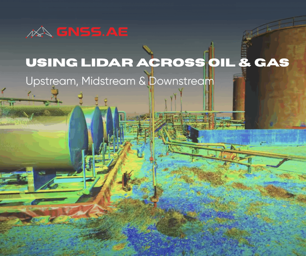
LiDAR: Precision at Its Best
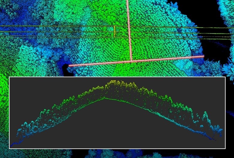
LiDAR, short for Light Detection and Ranging, measures distances by sending rapid laser pulses and calculating how long they take to return. This method delivers centimetre-level precision, making it ideal for critical infrastructure surveys and detailed topographic mapping.
While LiDAR systems require a higher investment and operational costs (for example, for hiring skilled personnel), the accuracy they provide is unmatched, particularly when projects demand data under challenging conditions.
LiDAR technology advanced significantly through the 1970s and 1980s, becoming more practical and portable. By the 1990s, improvements in accuracy, resolution and commercial adoption laid the foundation for its widespread use today.
Today, LiDAR is essential across industries like:
- Forestry: Measuring tree height, canopy structure and biomass to create detailed 3D forest models, supporting conservation and sustainable management.
- Agriculture: Optimising planting, monitoring crop growth and enhancing yield prediction through detailed 3D terrain models.
- Environmental Monitoring: Producing highly detailed maps to identify risks such as erosion, deforestation and habitat loss.
- Cartography and Mapping: Using LiDAR to transform aerial scans into precise 3D models and GIS data for highly accurate topographic mapping.
- Architecture and Construction: Applying LiDAR to monitor construction progress and inspect structures with high-resolution 3D scans.Documenting building projects and inspecting structures with precise 3D representations.
Choosing the Right Tool for the Job
| Task | Photogrammetry | LiDAR |
|---|
| Data Collection | Passive sensing through photographs, reliant on ambient light | Active sensing with laser pulses, effective even in darkness |
| Visuals | Produces colour-rich 3D models using RGB imagery | Produces 3D point clouds with high spatial accuracy |
| Deployment | Lower cost, more accessible, longer data processing times | Higher cost, specialised expertise required, faster data processing |
| Best Use Cases | Construction progress, mapping, visual documentation | Infrastructure inspection, vegetation penetration, precision mapping |
Across the Middle East, both photogrammetry and LiDAR are already shaping the future of development. In Saudi Arabia’s NEOM project – one of the world’s largest smart city initiatives – LiDAR is being used to create ultra-precise 3D models of the landscape, critical for sustainable urban planning and infrastructure design. In the UAE, photogrammetry plays a vital role in documenting construction progress on megaprojects like Expo City Dubai and Dubai Creek Harbour, offering stakeholders accurate visual updates and facilitating better decision-making. Meanwhile, in agricultural hubs across Egypt and Saudi Arabia, LiDAR’s ability to penetrate dense vegetation is helping optimise irrigation planning and monitor crop health, driving efficiencies vital for food security. These real-world applications show how combining both technologies can deliver superior outcomes across the region’s ambitious, fast-moving projects.