Bathymetry is the science of measuring water depths and mapping underwater landforms. Bathymetric surveys, also known as fathometric surveys, are a specialized discipline dedicated to uncovering the topography that lies beneath the surface of water bodies. This process, known as underwater topography mapping, plays a pivotal role in environmental and engineering applications. These studies use advanced technologies and methodologies to produce detailed maps of the underwater terrain, identifying variations in the sea floor and capturing the unique elevations and contours that exist out of sight.
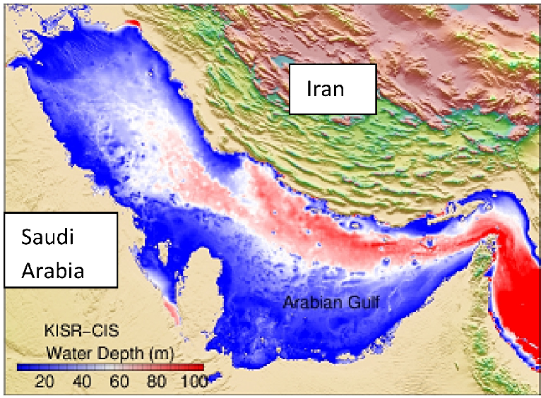
Bathymetric data plays a crucial role in several domains. It is foundational for climate change assessments, aiding in the monitoring of beach erosion, sea level rise, and land subsidence (National Ocean Service, 2024). Beyond scientific exploration, bathymetric surveys are essential for safe navigation, dredging operations, offshore energy projects, and marine construction. By providing a clear picture of underwater morphology—whether in oceans, rivers, lakes, or estuaries—these surveys inform environmental impact assessments and construction planning, while also ensuring navigational safety.
Traditionally, bathymetric surveys have relied on physical access to water. In deep waters, multibeam echo sounders (MBES) are deployed using crewed or uncrewed boats, while single-beam echo sounders (SBES) serve smaller water bodies. For very shallow waters, surveyors often resort to measurement poles equipped with GPS receivers. These instruments work by emitting a sound beam (or a laser pulse in LiDAR systems) that travels to the seafloor and reflects back. The time delay between emission and return allows for the calculation of depth.
However, conventional methods come with limitations. They are often impractical in surf zones or hazardous environments like contaminated water bodies or steep coasts, where deploying boats or equipment can be dangerous or unfeasible.
The significance of bathymetric surveys lies in their wide-ranging applications:
These diverse applications have led to the increasing adoption of UAV bathymetric surveys, particularly in areas difficult to access by traditional methods. These UAV-based methods are enabling rapid and safe bathymetric mapping in both urban and remote environments.
In recent years, the rise of drone bathymetry and drone-based hydrographic surveys has revolutionized the field. Drones provide a safe, fast, and highly accurate alternative for collecting underwater data, especially in environments that are difficult or dangerous to access.
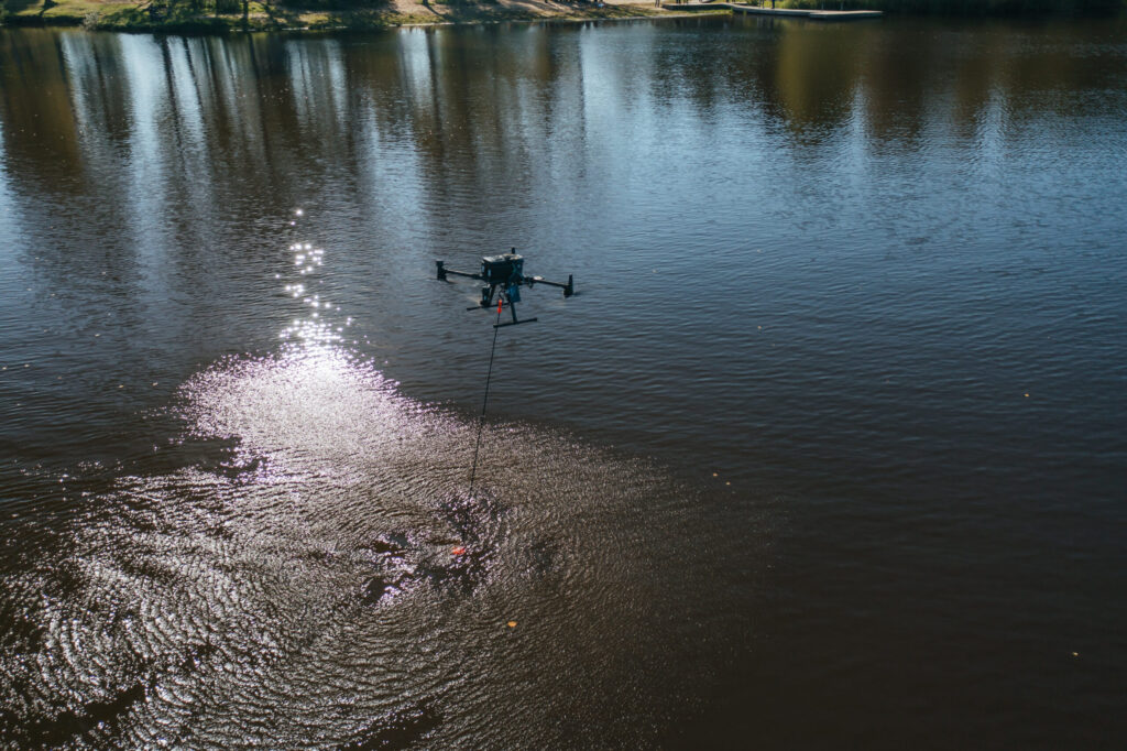
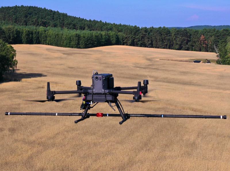
Drone bathymetry typically involves a UAV equipped with an echo sounder and high-precision RTK GNSS positioning. One example is SPH Engineering’s UgCS bathymetric system, which integrates with DJI’s Matrice 300 RTK drone. This echo sounder drone setup enables dual-frequency GPS bathymetry with high-resolution results. The system supports drone-based hydrographic survey missions in lakes, rivers, and coastal zones. The system also includes the SkyHub onboard computer, which logs and geotags sensor data using GPS information from the drone’s autopilot. Precise terrain-following is enabled via an altimeter and the UgCS software.
For ice-covered water bodies, SPH Engineering’s system supports the integration of a ground-penetrating radar (GPR) sensor, allowing bathymetric measurements without direct water contact.
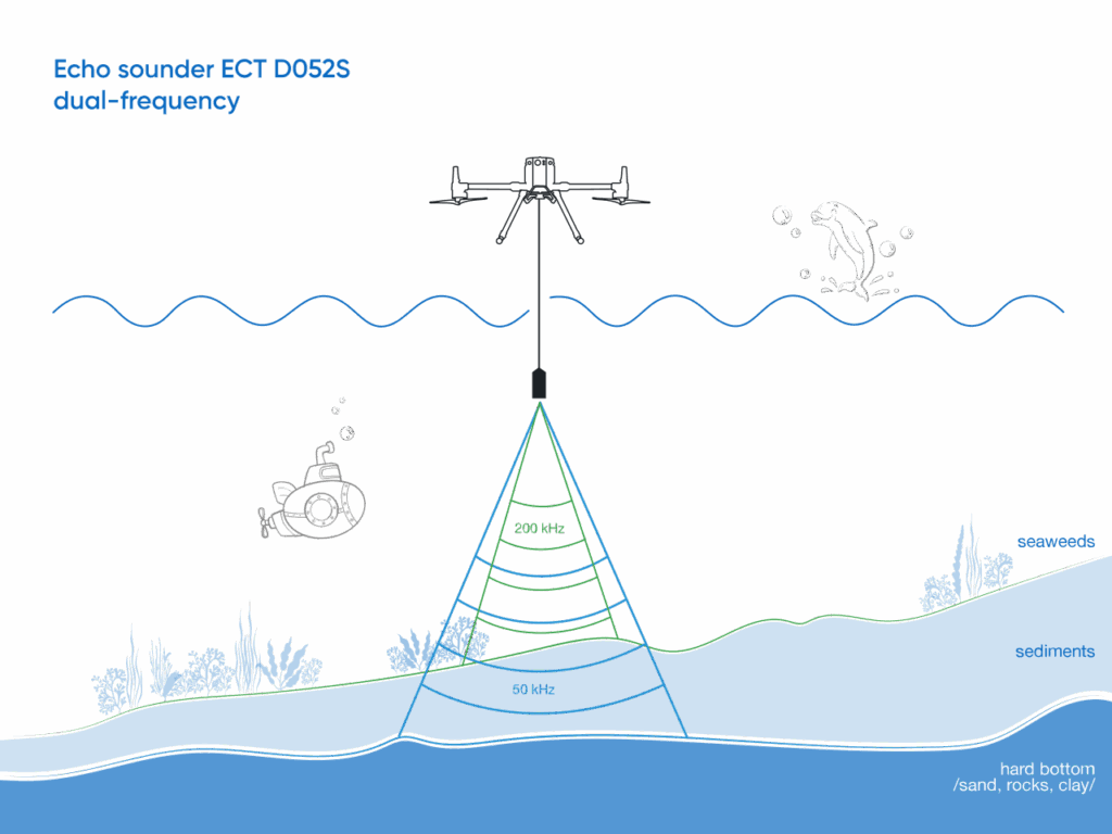
When conducting a UAV water depth measurement, selecting the right type of echo sounder is essential. They emit sound pulses that bounce off the seafloor and return to the sensor, with the travel time used to calculate depth. There are two main types:

The effectiveness of drone bathymetry has been demonstrated across numerous applications worldwide. City planners and surveyors have used it for:
Drone bathymetry marks a significant evolution in underwater surveying. By replacing traditional boat-based methods with UAV bathymetric mapping, surveyors can now access remote or hazardous locations with greater speed, safety, and precision. Choosing between single and dual-frequency echo sounders depends on the needs of the project’s depth measurement and environmental conditions. SPH Engineering’s offerings, whether single or dual frequency, are designed to give you robust, precise data for any bathymetric challenge. With companies like SPH Engineering advancing drone-integrated echo sounder systems, the future of bathymetric surveys is not only more efficient and cost-effective but also environmentally sustainable.