The SDK development library and Demo program are completely open source, providing developers with comprehensive development materials and convenient development
methods.
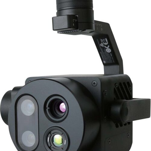
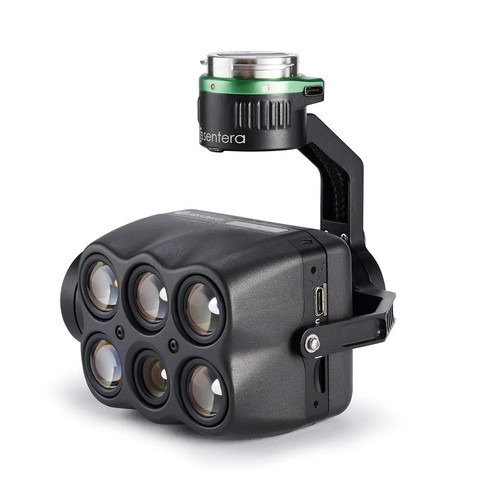
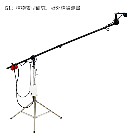
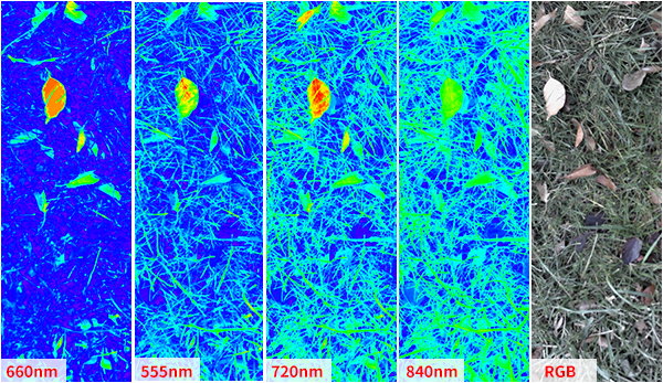
Close-range observation of plant growth and simultaneous multispectral/visible light imaging comprehensively capture plant shape, texture, spectrum, and other physiological characteristics, providing a data foundation for plant phenotyping research.

Based on spectral differences between crops and the surrounding environment, such as weeds and soil, this system accurately identifies and segments crop seedlings, quantitatively assesses the area of crop plants within a unit area, and calculates regional seedling emergence rates, providing data support for scientific research, breeding, and agricultural seedling replacement.
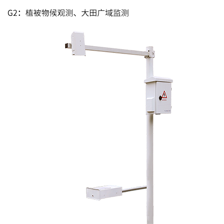
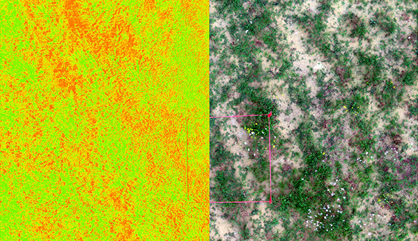
Based on different vegetation cover scenarios, appropriate vegetation remote sensing indices are selected to analyze growth and cover status, and plant health is assessed based on growth uniformity.
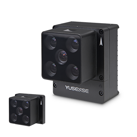
| Band configuration | 4 MS & 1 RGB |
| Target surface size | MS:1/4″;RGB:1/4″ |
| Effective pixels | MS:1.3Mpx;RGB:8.0Mpx |
| Shutter type | MS:Global shutter;RGB:Shutter |
| Quantitative figures | MS:12bit;RGB:8bit |
| Viewing Angle | MS:36.7°×31.3° ; RGB:37.5°×28.6° |
| GSD | – |
| Image size | MS:2.0m×1.7m@3m; RGB:2.0m×1.5m@3m(G0&G1) |
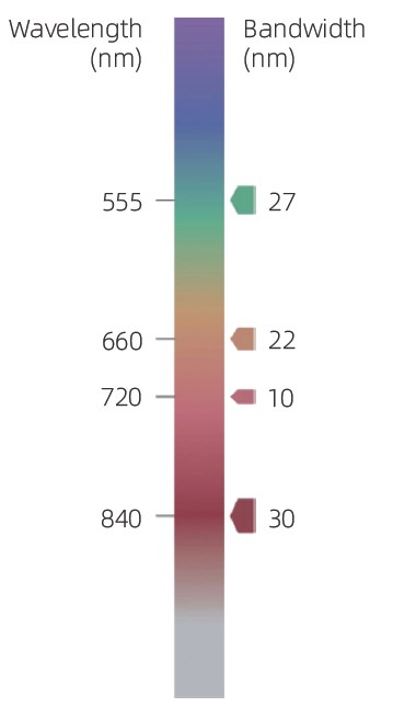
| Spectral band [1] | 555nm@27nm,660nm@22nm, 720nm@10nm,840nm@30nm, RGB |
| Optical window | Optical-grade glass window |
| Size | ≤55mm×65mm×50mm(G0&G1) |
| Weight | ≤175g |
| Installation interface | 7×M3 |
| Power supply model [2] | 12V |
| Power consumption | ≤7W@12V |
| Image format | Multispectrum: 16 bit original TIFF & 8 bit reflectance JPEG;RGB: 8bit JPEG (including GPS and ambient light information) |
| Storage medium | Standard with 64GB,A maximum of 128GB is supported(The transfer speed of the SD card needs to be U3 or higher) |
| Data processing | Yusense Map、Yusense Map Plus |
| software | WIFI (WEB interface access)/Ethernet/UART /Yusense net |
| Shoot trigger | External trigger, timing trigger, overlap rate trigger |
| Frequency of taking [3] pictures |
1Hz |
| Operating ambient temperature | -10℃~+50℃ (Relative wind speed≥1m/s) |
| Storage Environment Temperature |
-30℃~+70℃ |
| Environmental humidity | RH(%)≤85% (Non condensation) |
| Product certification | CE、FCC、RoHS |
[1]Standard wavelength, The following 19 wavelengths are allowed to be assembled and customized: Panchromatic Band、410nm @ 20nm、450nm @ 30nm、490nm @ 25nm、530nm @ 27nm、 555nm @ 27nm、570nm @ 32nm、610nm @ 30nm、650nm @ 27nm、660nm @ 22nm、 680nm @ 25nm、720nm @ 10nm、720nm @ 15nm (high pass)、750nm @ 10nm、780nm @ 13nm、 800nm @ 35nm、840nm @ 30nm、900nm @ 35nm、940nm @ 30nm、(tolerance ± 5 nm).
[3] Test results of storage media with data transmission speed rating of U3 and above (read and write
speed ≥ 60MB/s).
Pay securely with your Card, Apple Pay, or Google Pay via Paymob.
![]()
A payment link, also known as a checkout link, is a shareable URL that allows customers to make payments online.
Cash/Cheque payment/Bank transfer
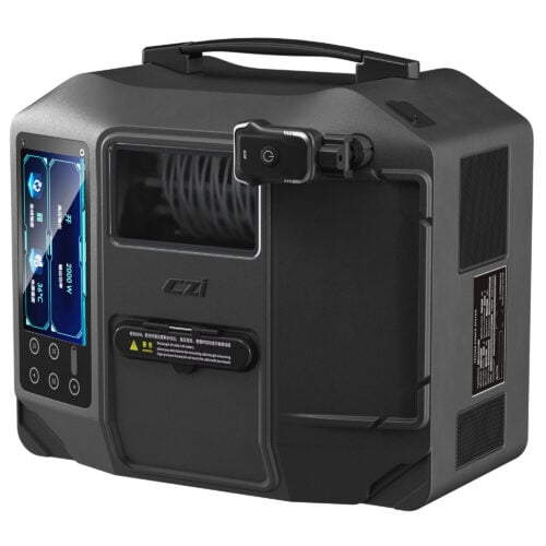
Inquire price for Yusense MS400G