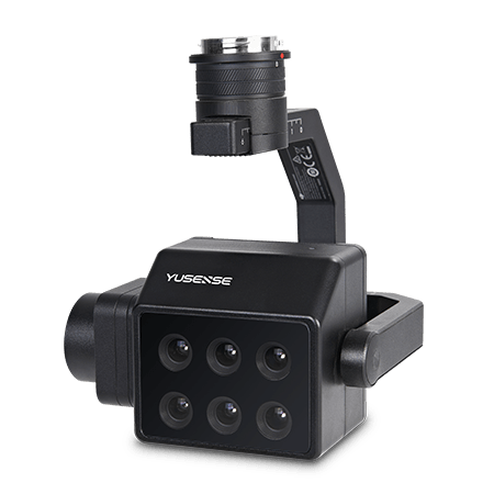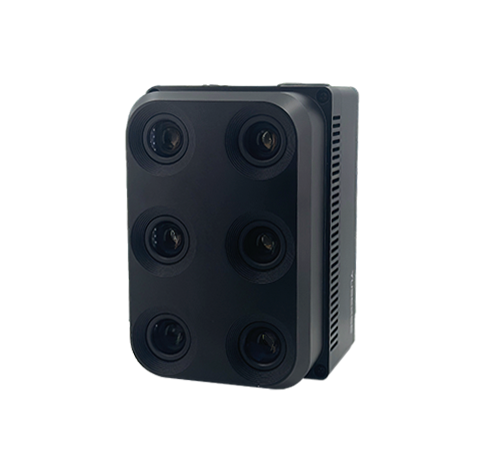
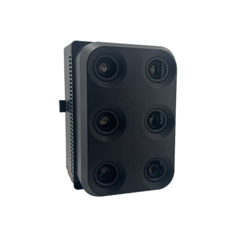
Yusense HR600, a 6-band, high-precision, survey-grade, 6-band, survey-grade multispectral aerial camera.
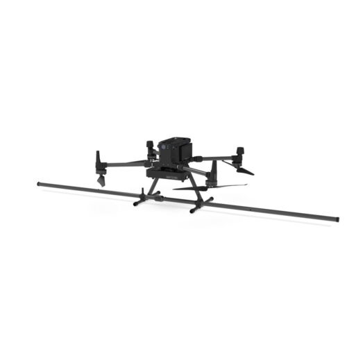
Six 12M pixel multispectral channels in a classic band configuration. High radiometric and geometric resolution, high operational efficiency. Compatible with a variety of aircraft types, including multirotors, compound wings, and helicopters, it provides a comprehensive, cost-effective low-altitude remote sensing monitoring solution. It supports 1:2000 scale image-control-free surveying and mapping, providing a more efficient solution for large-scale applications such as smart cities, agricultural surveys, forestry monitoring, ecological protection, and target identification.
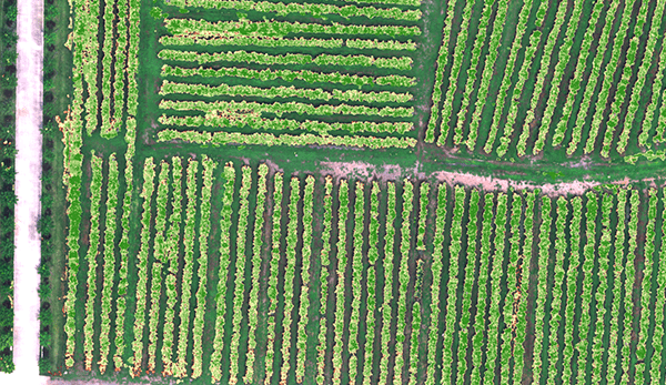
Using vegetation factors such as NDVI and LAI, we quantitatively describe the consistency of vegetation canopy status at different spatial scales. This helps us identify the characteristic spectra of vegetation at different health states and quantitatively assess vegetation growth, providing data support for irrigation, fertilization, plant protection, and yield assessment.
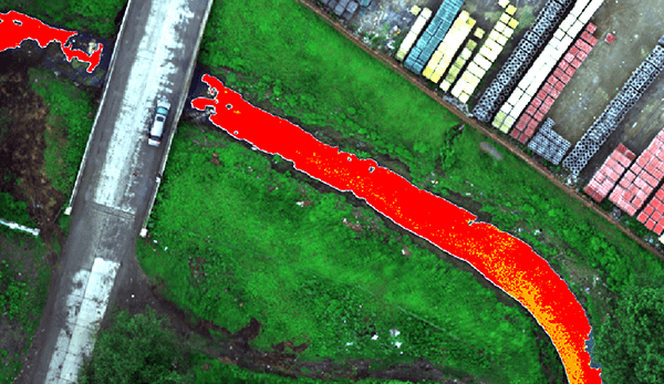
Based on the evaluation standards for surface black and odorous water, this system uses characteristic spectra to construct a classification index, enabling hierarchical inversion and spatial information statistics of black and odorous water bodies. This assists in analyzing the impact of domestic sewage, industrial wastewater, and other wastewater on surrounding water bodies, facilitating pollution source investigation and water environment assessment.
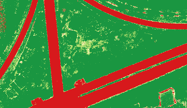
Based on vegetation fingerprints, a vegetation index is constructed to calculate the spatial distribution and area of target vegetation within a specified area. This provides quantitative vegetation cover data for research and production in agriculture, forestry, grassland, and ecology.
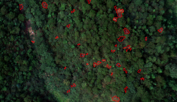
This system utilizes spectral and texture information to effectively suppress environmental backgrounds such as soil and dead grass, and accurately identify discolored standing trees. It also accurately extracts information such as the location, spatial distribution, and canopy area of discolored standing trees, providing data support for diseased tree management.
| Indicator name | Yusense HR600 |
| Combination method [1] | 6 multispectral |
| Target size | 1.1″ |
| Effective pixels | 12.0Mpx |
| Shutter type | Global |
| Quantization bit number | 12bit |
| Field of view | 40.4°×29.7° |
| Ground resolution | 2.07cm@h120m; 8.63cm@h500m |
| Coverage width | 85m×62m@h120m; 353m×259m@h500m |
| Spectral channel [2] | 450nm@30nm,555nm@27nm,660nm@22nm, 720nm@10nm,750nm@10nm,840nm@30nm |
| Optical window | – |
| Host size | ≤155mm×105mm×100mm |
| Host weight | ≤1070g |
| Installation interface | 4×M4 |
| Power supply [3] | Typical 12V |
| Power consumption | ≤25W@12V |
| Image Format | 16-bit raw TIFF |
| Video Format | – |
| Storage media [4] | CFexpress Type B memory card with a standard 1TB capacity and a maximum support of 2TB capacity |
| Processing software | Yusense Map, Yusense Map Plus |
| Parameter settings | WIFI (WEB interface access) /Ethernet/UART |
| Shooting trigger | External trigger, timing trigger, overlap rate trigger, cascade trigger |
| Shooting frequency | ≤1Hz |
| Working environment temperature | -10℃~+45℃(relative wind speed ≥1m/s) |
| Storage temperature | -30℃~+70℃ |
| Ambient humidity | RH(%)≤85%(non-condensing) |
| Product Certification | CE, FCC, RoHS |
Note: [1] HR600 supports polarization version customization; [2] Standard wavelength, the following 19 wavelength combinations are provided free of charge: full color, 410nm@20nm, 450nm@30nm, 490nm@25nm, 530nm@27nm, 555nm@27nm, 570nm@32nm, 610nm@30nm, 650nm@27nm, 660nm@22nm, 680nm@25nm, 720nm@10nm, 720nm@15nm (Qualcomm), 750nm@10nm, 780nm@13nm, 800nm@35nm, 840nm@30nm, 900nm@35nm, 940nm@30nm, (tolerance ±5nm).
Pay securely with your Card, Apple Pay, or Google Pay via Paymob.
![]()
A payment link, also known as a checkout link, is a shareable URL that allows customers to make payments online.
Cash/Cheque payment/Bank transfer
Inquire price for Yusense HR600