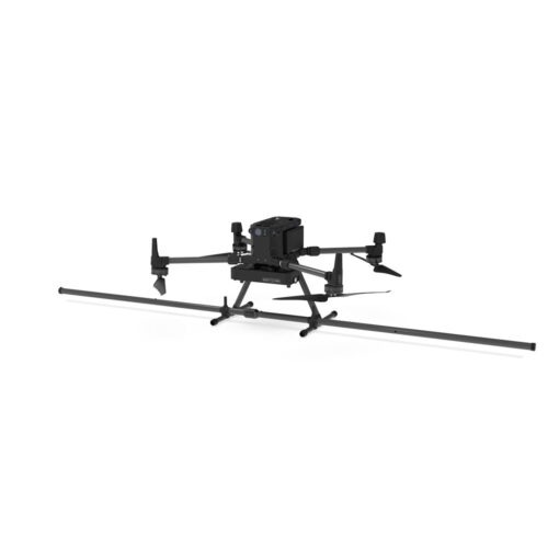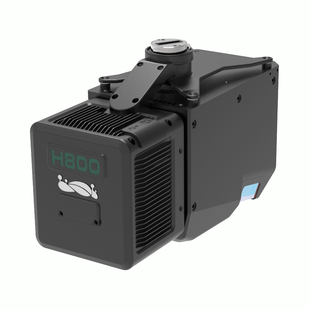
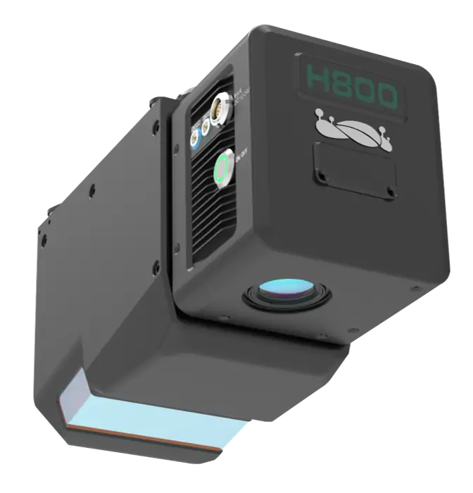

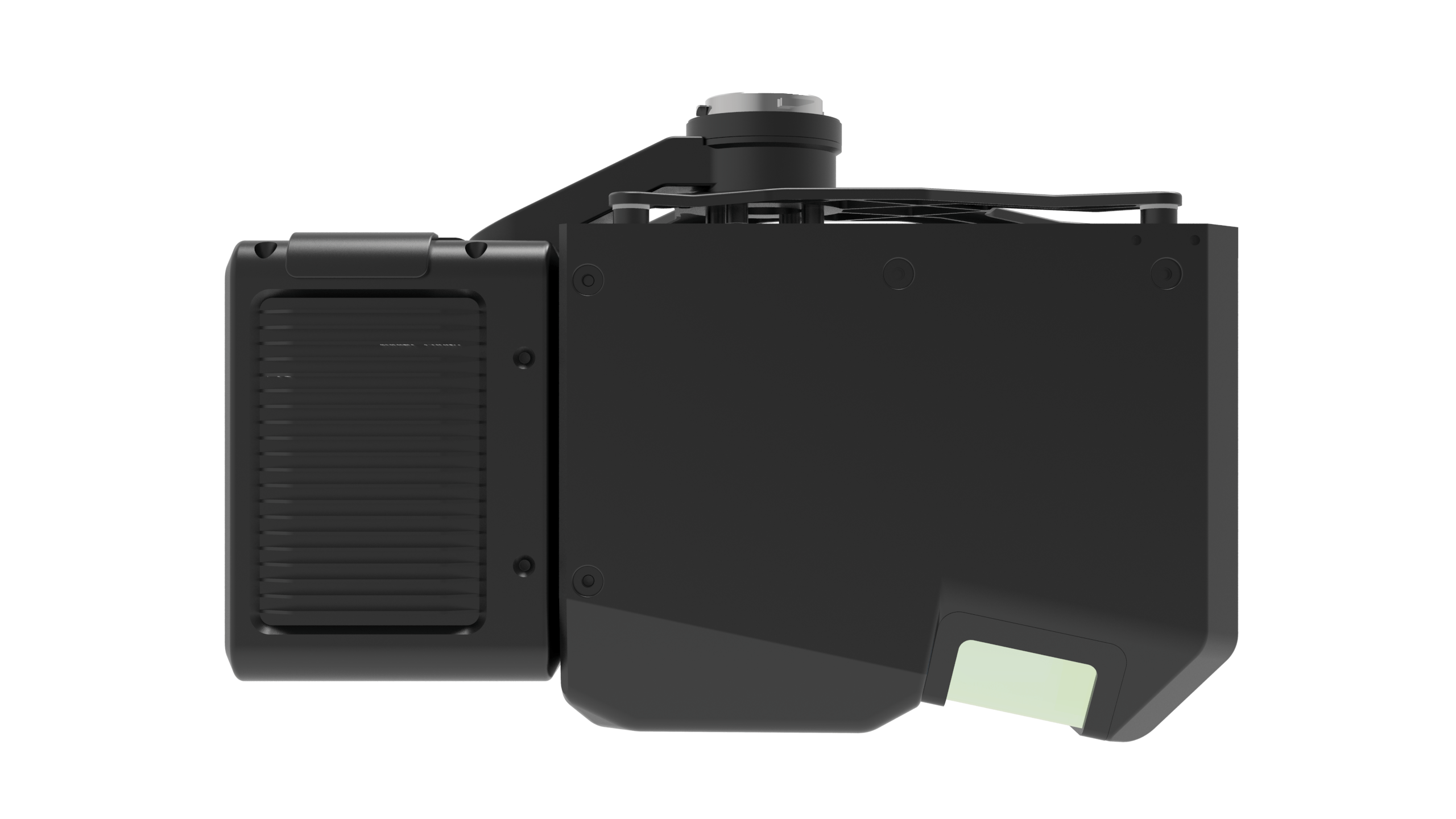
LiAir H800 has light weight design, and can be carried by DJI M300 or M350. With longer scanning range, better penetration ability, it performs better than mini-LiDAR systems in forestry, emergency disaster surveys, and long-range powerline inspections, etc.

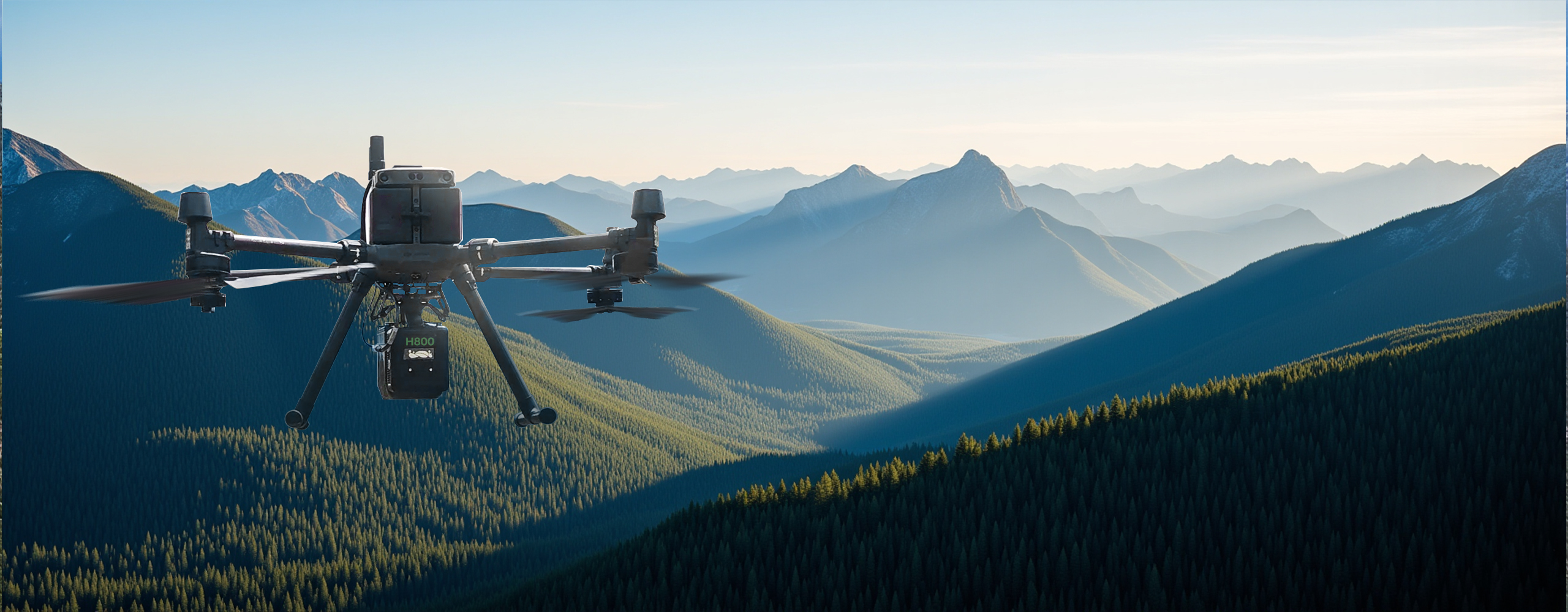


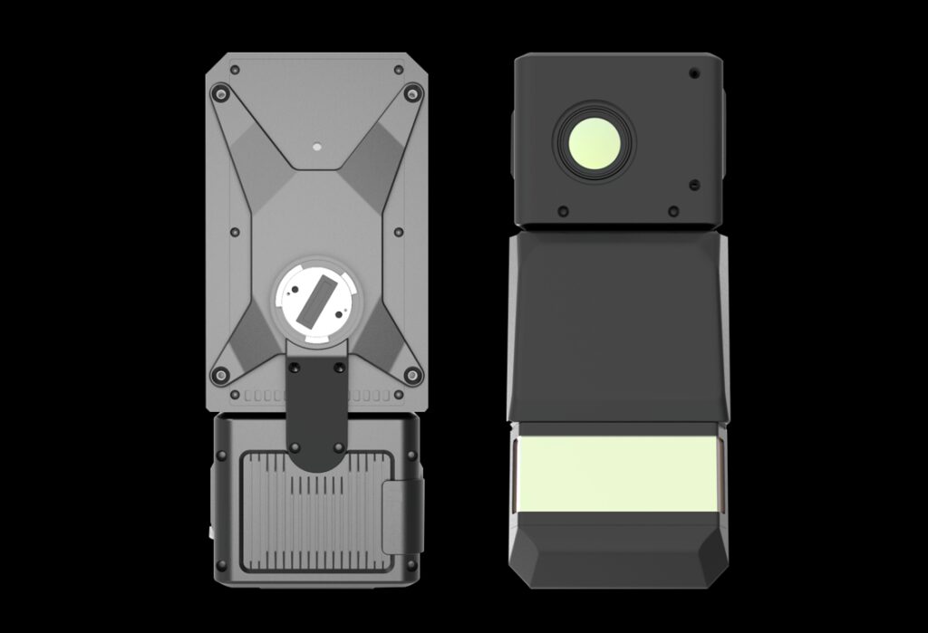
Light and small, can be carried by DJI M350 / M300 RTK
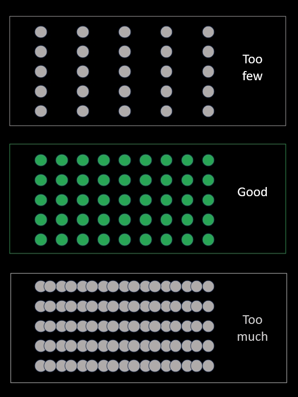
Automatically adjust the point frequency and rotation speed according to the height to ensure that the line spacing and point spacing are always consistent under different height and speed combinations, ensuring that the point cloud is evenly distributed and better retaining the spatial characteristics of ground objects.
The laser spot is small and the energy is more concentrated, and it has stronger penetration ability for dense forest areas.
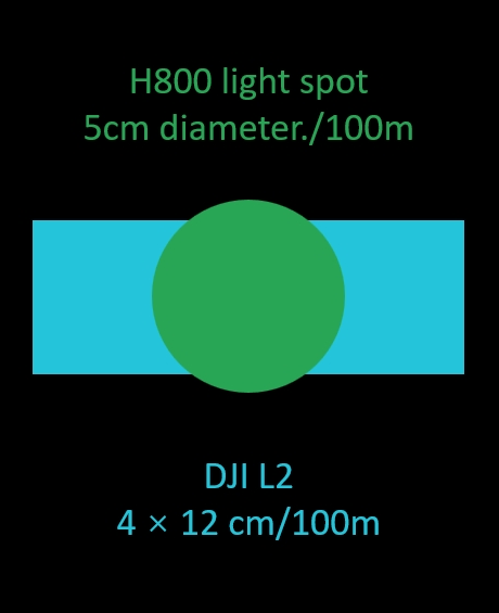
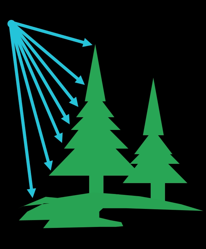
Better performance in dense forest
*The theoretical maximum number of returns can only be achieved under specific conditions and is constrained by the actual test scenario.
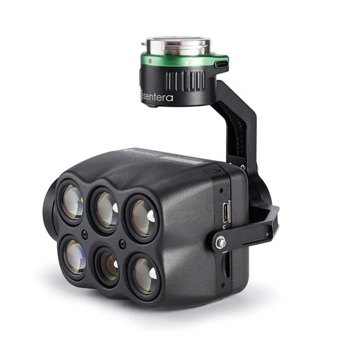
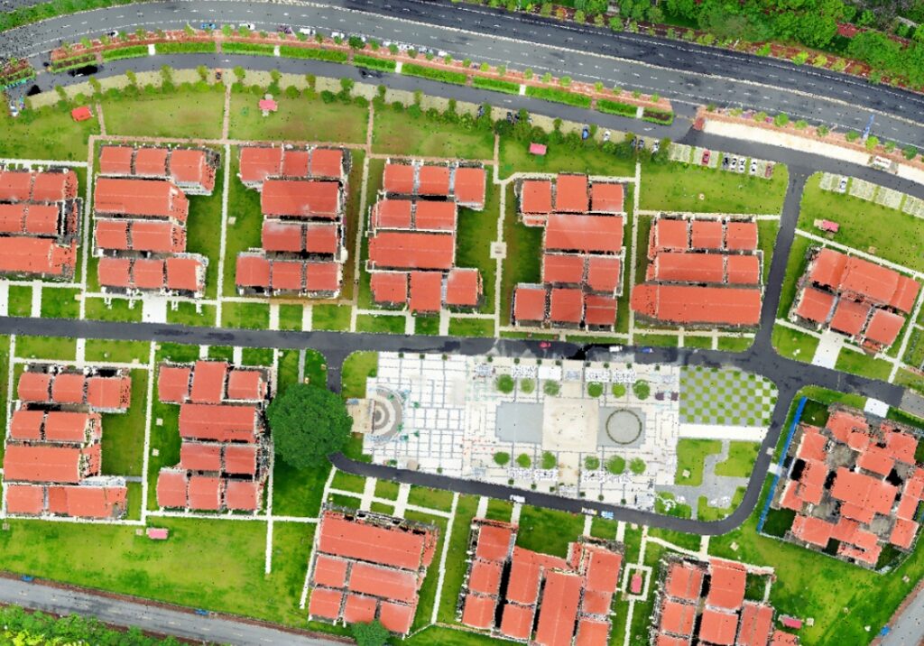
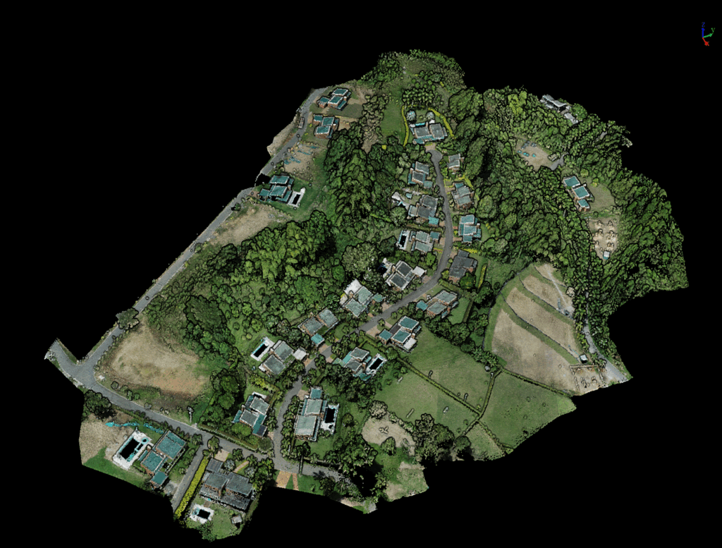
Built-in 26-megapixel high-resolution mapping camera, can obtain 4.7cm resolution images in 200m altitude, and can generate high-quality color point clouds after colorization.
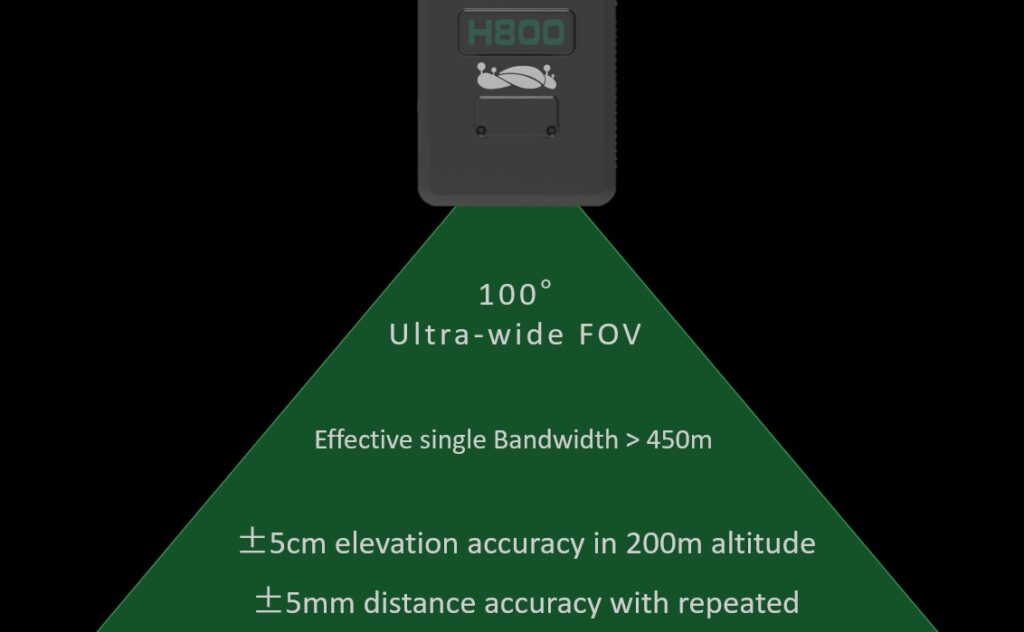
Wide bandwidth, high precision
| Detection Range | 350 m @ 10% reflectivity 790 m @ 50% reflectivity 1000 m @ 80% reflectivity |
Dimensions | 249×102×163.3 mm |
| Weight | 2.25 kg | System Accuracy (Vertical) | ±5 cm |
| Voltage | 18~24 V | Storage | 256 GB TF Card |
| Power Consumption | 61 W | Storage Temperature | -30~60 ℃ |
| Communication | WiFi | Operating Temperature | -20~50 ℃ |
| LiDAR Sensor Parameters | |||
| Wavelength | 1535 nm | Repeatability Accuracy | 3 mm @100 m |
| FOV | 100° | Scan Rate | 100,000~2,000,000 pts/s |
| Number of Returns | Unlimited Waveform Returns [1] | ||
| Inertial Navigation System | |||
| GNSS | GPS, GLONASS, Galileo, BDS | Azimuth Accuracy | 0.019° |
| IMU Data Frequency | 1000 Hz | Attitude Accuracy | 0.006° |
| Camera Parameters | |||
| Pixels | 26 MP | Focal Length | 16 mm / 24 mm ( Equiv. Focal Length ) |
| Camera Parameters | 6252×4168 | ||
| Software | |||
| Control Software | GreenValley | Pre-processing | LiGeoreference |
| Post-Processing | LiDAR360 / LiPowerline (Optional) | ||
| [1] The theoretical maximum number of returns can only be achieved under specific conditions and is constrained by the actual test scenario. | |||
Pay securely with your Card, Apple Pay, or Google Pay via Paymob.
![]()
A payment link, also known as a checkout link, is a shareable URL that allows customers to make payments online.
Cash/Cheque payment/Bank transfer
Inquire price for GreenValley LiAir H800 Medium-to-Long Range Airborne Laser Scanning System