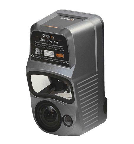
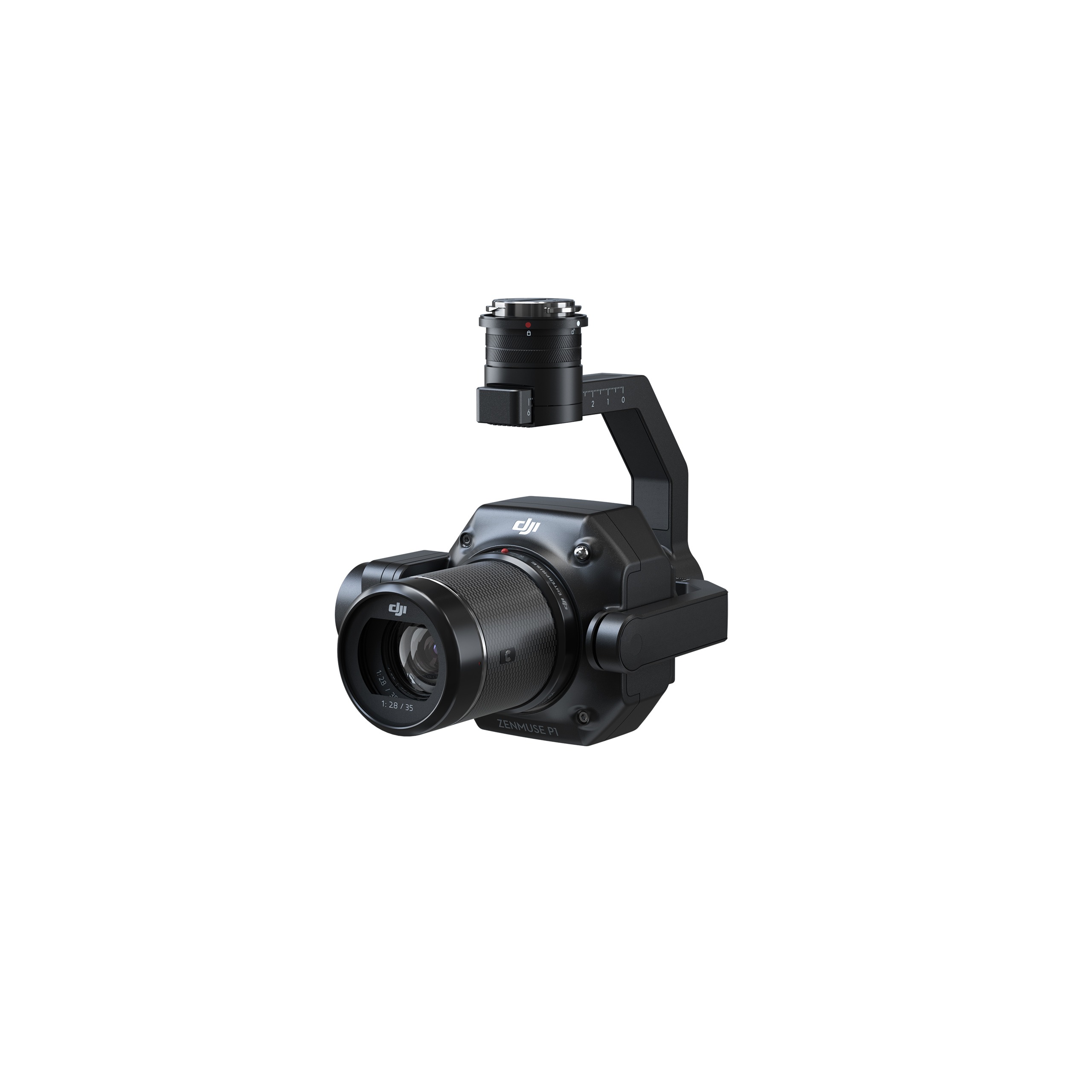
Professional Airborne LiDAR + RGB System
The AlphaAir 10 is an advanced aerial surveying solution that seamlessly integrates LiDAR and RGB sensors to meet the needs of professional UAV LiDAR mapping and drone photogrammetry. Leveraging CHCNAV’s cutting-edge LiDAR technology, the AA10 flawlessly integrates high-precision LiDAR, accurate GNSS positioning, IMU orientation and an industrial-grade full-frame orthophoto camera. Combined with
CHCNAV point cloud and image fusion modeling software, the AA10 provides a survey-grade, efficient and cost-effective approach to 3D data acquisition and processing. The AA10 Airborne LiDAR + RGB System accelerates accurate 3D data collection within a single mission and simplifies the process of capturing 3D reality through a streamlined workflow.
The AA10’s high-precision navigation algorithm in conjunction with the CHCNAV scanner provides 5 mm repeated range accuracy and achieves exceptional absolute precision in the range of 2 to 5 cm, even in complex environments.
The AA10 LiDAR system is impressively
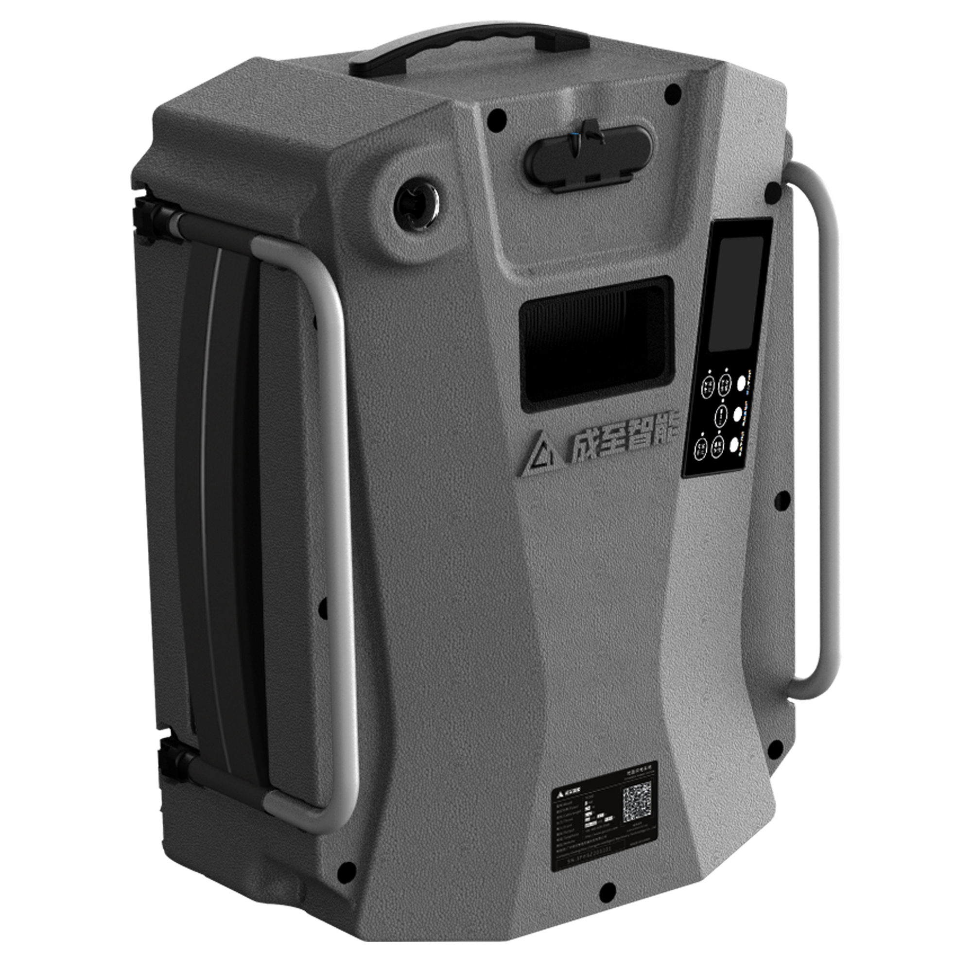
lightweight and compact, weighing in at just 1.55 kg and provides a 30-minute operating time when integrated with drones such as the DJI M350. The installation process is simplified with Alphaport’s convenient one-click connection to the UAV’s power source.
The AA10 accelerates the creation of mesh
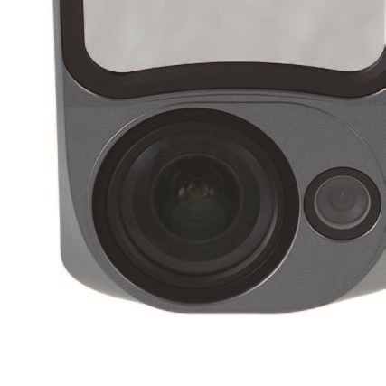
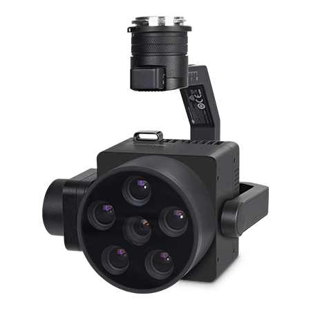
models by generating high-quality point clouds. Powered by a 45 MP orthographic internal camera, the system provides high resolution image mapping tex tures for ef f icient 3D model reconstruction with realistic point cloud colorization.
The AA10 IP64-rating ensures the system’s
resilience, allowing it to deliver consistent, reliable performance in varying operating conditions.
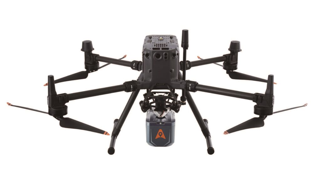
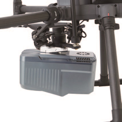
Compact and lightweight, the AA10 LiDAR can be easily mounted on a wide range of drones, including the CHCNAV BB4, the popular DJI Matrice, and various third-party UAV platforms.
The AA10’s high-precision LiDAR and industrial-grade cameras enable users to generate accurate and realistic 3D models and high-resolution Digital Orthomosaic (DOM) outputs.
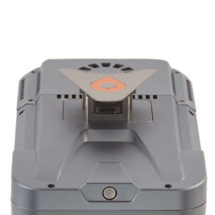
CHCNAV's exclusive Alphaport interface provides wireless power and drone telemetry connectivity.
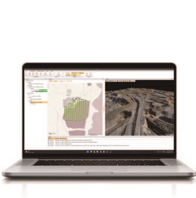
CHCNAV's CoPre software efficiently handles all essential processing steps, in addition to data alignment and generation of accurate 3D models and DOMs.
The AlphaAir 10 (or AA10) is an advanced aerial surveying solution that seamlessly integrates LiDAR and RGB sensors to meet the needs of professional UAV LiDAR mapping and drone photogrammetry.
Leveraging CHCNAV’s cutting-edge LiDAR technology, the AA10 flawlessly integrates high-precision LiDAR, accurate GNSS positioning, IMU orientation, and an industrial-grade full-frame orthophoto camera. Combined with CHCNAV point cloud and image fusion modeling software, the AA10 provides a survey-grade, efficient, and cost-effective approach to 3D data acquisition and processing.
The AA10 Airborne LiDAR + RGB System accelerates accurate 3D data collection within a single mission and simplifies the process of capturing 3D reality through a streamlined workflow.
General system performance |
|
| Absolute Hz accuracy | 2 cm ~ 5 cm RMS (1) |
| Absolute Z accuracy | 2 cm ~ 5 cm RMS (1) |
| Mounting | Quickly install & release design, easily switch between various UAV platforms |
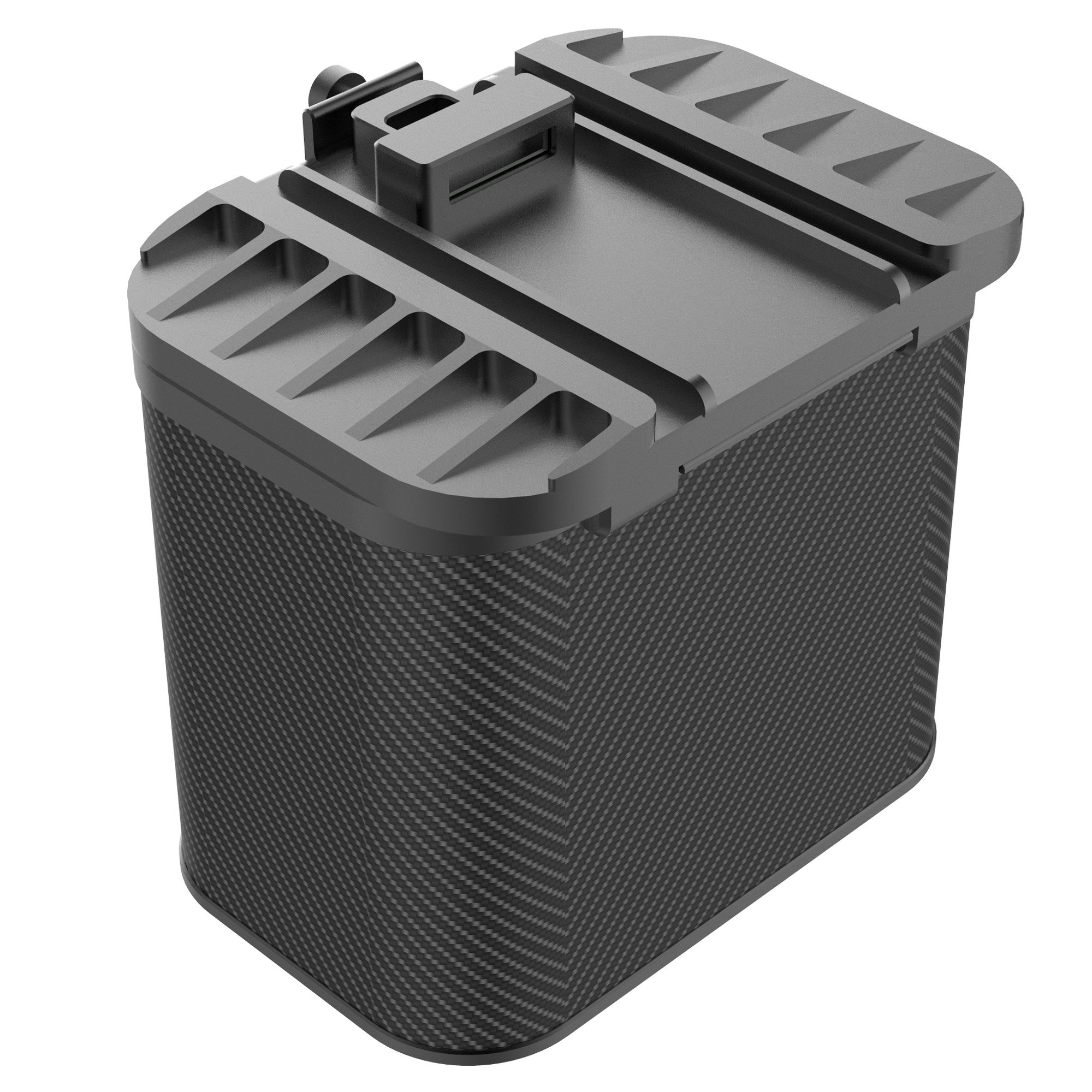
| Weight of instrument | 1.55 kg |
| Dimensions of instrument | 210 mm x 112 mm x 131 mm |
| Data storage | 512 G*2 |
| Coping speed | 80 Mb/s |
Positioning and orientation system |
|
| GNSS system GPS: |
|
| IMU update rate | 500 Hz |
| Attitude accuracy after post-processing |
0.006° RMS pitch/roll 0.019° RMS heading |
| Position accuracy after post-processing |
0.010 m RMS horizontal 0.020 m RMS vertical |
Imaging system |
|
| Resolution | 45 MP |
| Focal length | 21 mm |
| Sensor size | 36 × 24 mm (8184 × 5460) |
| Pixel size | 4.4 μm |
| Min photoing interval | 1 s |
| FOV | 81.2° × 59.5° |
Environmental |
|
| Operating temperature | -20°C to +50°C |
| Storage temperature | -20°C to +60°C |
| IP rating | IP64 |
| Humidity (operating) | 80%, non-condensing |
Electrical |
|
| Input voltage | DC 24 V (13 ~ 27 V) |
| Power consumption | 40 W |
| Power source | Depending on UAV battery or by Skyport (DJI M300/M350) |
Equipped software |
|
| CoPre pre-processing software | Data copy, POS solve, point cloud and images creation, strip adjustment & GCP refine, noise optimization, DOM and 3D model generation |
| CoProcess point cloud processing software | Terrain module, road module, extraction module, volume module |
* Specifications are subject to change without notice.
(1) According to CHCNAV test condition :150 m AGL with 8m/s speed. (2) Typical values for average conditions. (3)
Accuracy is the degree of conformity of a measured quantity to its actual (true) value. (4) Precision is the degree to
which further measurements show the same results.
Laser scanner |
|||||
| Laser product classification | Class 1 (in accordance with IEC 60825-1:2014) | ||||
| Laser Pulse Repetition Rate (PRR) | 100 kHz | 300 kHz | 500 kHz | ||
| Max.Measuring Range@ρ> 20% (2) | 400 m | 275 m | 215 m | ||
| Max.Measuring Range@ρ> 80% (2) | 800 m | 480 m | 280 m | ||
| Max.Operating Flight Altitude AGL @ρ>20% |
317 m | 218 m | 170 m | ||
| Laser divergence angle | 0.032° | ||||
| Minimum range | 10 m | ||||
| Accuracy (3) | 15 mm (1σ,@150m) ;10 mm (1σ,@100m) | ||||
| Precision (4) | 5 mm (1σ,@150m) | ||||
| Field of view | 75° | ||||
| Max. Effective measurement rate | 500 000 meas / sec | ||||
| Scan speed (selectable) | 50 ~ 250 scans/sec | ||||
| Max. Number of return pulses | Up to 8 | ||||
| Angular resolution | 0.001° | ||||
Inquire price for CHCNAV AlphaAir 10