SurveyTools™ for BricsCAD® is an all-in-one solution for surveying specific workflows.
Combining industry-leading technology that accelerates productivity while ensuring data integrity.
AED 2,650.00 – AED 10,900.00Price range: AED 2,650.00 through AED 10,900.00
SurveyTools for BricsCAD is a specialized toolkit that transforms BricsCAD into a robust platform for surveying professionals. By combining the power of BricsCAD with industry-specific tools, SurveyTools streamlines workflows, boosts productivity, and ensures data integrity. From data collection to design and analysis, this integrated solution offers a comprehensive set of features tailored to the unique needs of surveyors.
Import and automate much of the drafting process with seamless integration.
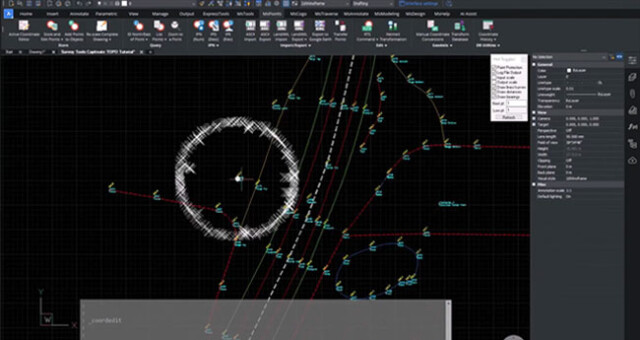
Survey software with a TOPO (Topographic) routine provides numerous advantages. It automates the creation of detailed topographic maps by extracting elevation data from survey measurements, significantly reducing manual effort. This feature improves accuracy, speeds up the mapping process, and enhances visualization, enabling surveyors to make informed decisions and deliver precise topographic representations for various applications.
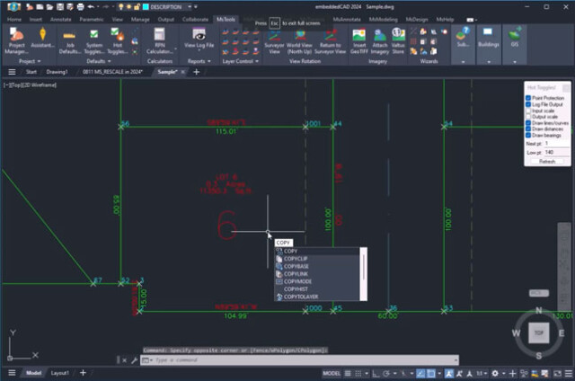
Simplify and Accelerate Project Setup: Seamlessly Create and Define Surveys with SurveyTools™ for Efficient Land Surveying
Setting up a project in SurveyTools™ is a simple and efficient process, allowing users to quickly input project details such as site coordinates, survey parameters, and coordinate systems with ease and swiftly define survey boundaries by adding control points, benchmarks, and other necessary reference data, ensuring a fast and streamlined project setup experience.
DTM creation with a reliable, dynamic TIN surface modeling, with all the specific tools needed.
In BricsCAD® BIM, design decisions come first, and machine learning algorithms automate the laborious tasks of manipulating BIM data, documentation, and levels of detail.
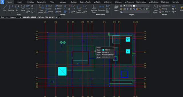
Civil design capabilities in the BricsCAD® platform provide a solid basis for civil engineering, with tools to manipulate TIN Surfaces, TIN Volume Surfaces, Grid Surfaces, Alignments (both Alignments by PI and Alignments by Elements), Profile Views, and Profiles (Vertical Alignments).
Import large point-clouds and use BricsCAD® tools to filter unnecessary points and create a workable TIN surface.
You can find a flexible, direct building-modeling tools and a professional CAD product in the same DWG platform. Design geometry can directly be converted into BIM elements.
BricsCAD® uses an improved data representation to speed up the performance of point cloud display, using half the disk space versus the point cloud source files.
OPTIMIZE corrects your drawing issues by automatically finding and healing inconsistancies such as gaps and misalignments which may otherwise be difficult to see, improving drawing accuracy and giving you a cleaner, more efficient result.
| Type of License | 1-Year Nod-Locked License, 1-Year Floating License, Perpetual Nod-Locked License, Perpetual Floating License |
|---|
Software workflows can be disjointed and simple tasks can be overcomplicated by using solutions not built with surveyors in mind.
SurveyTools™ for BricsCAD® combines the powerful surfacing and point cloud tools from BricsCAD® with a complete suite of survey tools for land surveyors from MicroSurvey.
Inquire price for Microsurvey SurveyTools™ for BricsCAD®