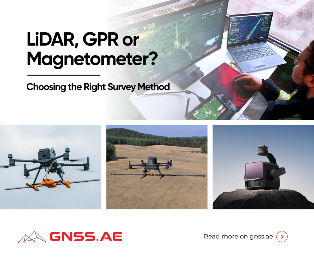
A site can look perfectly ordinary at ground level while concealing pipes, soil layers, steel tanks or unexploded ordnance. Different targets require different survey methods because each technology measures a different physical property.
LiDAR maps the surface and terrain. Ground-penetrating radar records reflections from subsurface objects and material boundaries. Magnetometers detect changes in the local magnetic field caused by ferromagnetic materials and geological features.
This article compares what LiDAR, GPR and magnetometers can detect, where each method has limitations, and when magnetic surveying provides information the other technologies may miss. We will also look at the SENSYS MagDrone R3 and R4 and examine a large-scale UXO survey that used drone magnetometry in real field conditions.

LiDAR measures the time taken for laser pulses to travel to a surface and return to the sensor. Those measurements form a three-dimensional point cloud representing terrain, vegetation, buildings and other visible features.
The technology is particularly useful for topographic surveys, stockpile measurements, vegetation mapping and monitoring changes in terrain. According to the U.S. Geological Survey, airborne LiDAR can produce ground-elevation models with vertical accuracy of around 10 centimeters.
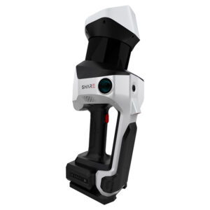
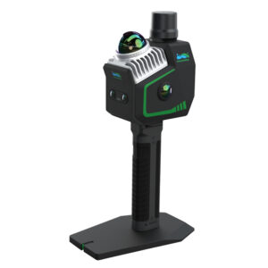
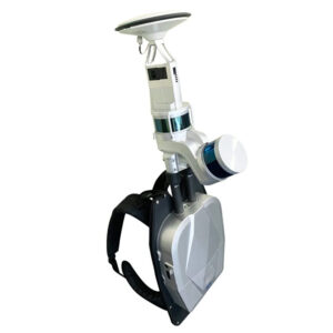
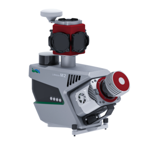
The term “LiDAR scanner” covers several quite different types of equipment. Some systems are carried by drones, others are operated by hand, worn as a backpack, mounted on a vehicle or set up on a tripod.
| LiDAR system | Survey format | Typical applications |
|---|---|---|
| DJI Zenmuse L3 | Drone-mounted aerial payload | Topographic, corridor and forestry mapping |
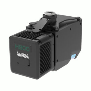
| GreenValley LiAir H800 | Medium-to-long-range UAV system | Forestry, disaster mapping and power-line inspection |
| SHARE SLAM S100 | Handheld imaging SLAM scanner | Buildings, tunnels and GPS-denied sites |
| GreenValley LiGrip O2 Lite | Handheld multi-sensor SLAM scanner | Airports, beaches, riverbanks and feature-poor sites |
| GreenValley LiBackpack DGC50H | Backpack system with dual laser scanners, GNSS and a panoramic camera | Forestry, mining, underground mapping, façades and BIM |
| GreenValley LiMobile M2 Ultra | Vehicle-based mobile mapping system | Roads, GIS assets, HD maps and digital twins |
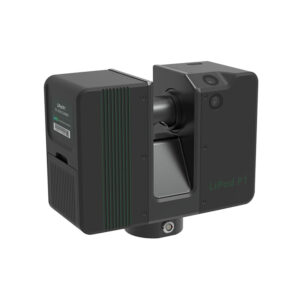
| GreenValley LiPod P1 | Terrestrial scanner used from fixed positions | Detailed structural and complex-site surveys |
Whichever platform carries the sensor, the same basic limitation remains. Some laser pulses can pass through gaps in vegetation and reach the ground, allowing surveyors to reconstruct terrain beneath a forest canopy. They do not normally continue through the soil. A buried shell, steel pipe or storage tank can therefore remain completely invisible to LiDAR unless it has disturbed the surface above it.
GPR is sometimes described as a tool for finding nonmetallic targets, but that definition is too narrow. It can detect metallic and nonmetallic objects. Metal usually produces a strong reflection, while plastic pipes, voids, foundations, soil layers and changes in moisture may also appear when their electrical properties differ sufficiently from the surrounding material.
The U.S. Environmental Protection Agency explains that GPR returns are controlled mainly by contrasts in dielectric permittivity. In practical terms, the radar is looking for changes rather than a specific material.
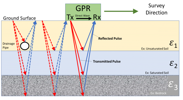
Ground conditions have a major effect on the result. Dry sand, gravel and other electrically resistive materials can allow relatively deep penetration. Conductive clay, saline water and some mineral-rich soils absorb radar energy much faster. At one site, GPR may reveal several meters of clear subsurface structure; at another, useful penetration may stop within the first meter.
GPR also requires careful movement across the survey area and good contact or consistent spacing between the antenna and the ground. Rough terrain, dense vegetation and hazardous land can make collection difficult, although drone-mounted GPR systems are expanding the range of accessible sites.
A magnetometer works passively. It does not send a signal into the ground. Instead, it records small variations in the Earth’s magnetic field.
Iron, steel, nickel and magnetic minerals can distort that field. By recording these changes across a survey area, operators can map anomalies associated with buried utilities, steel tanks, unexploded ordnance, industrial debris or geological structures.
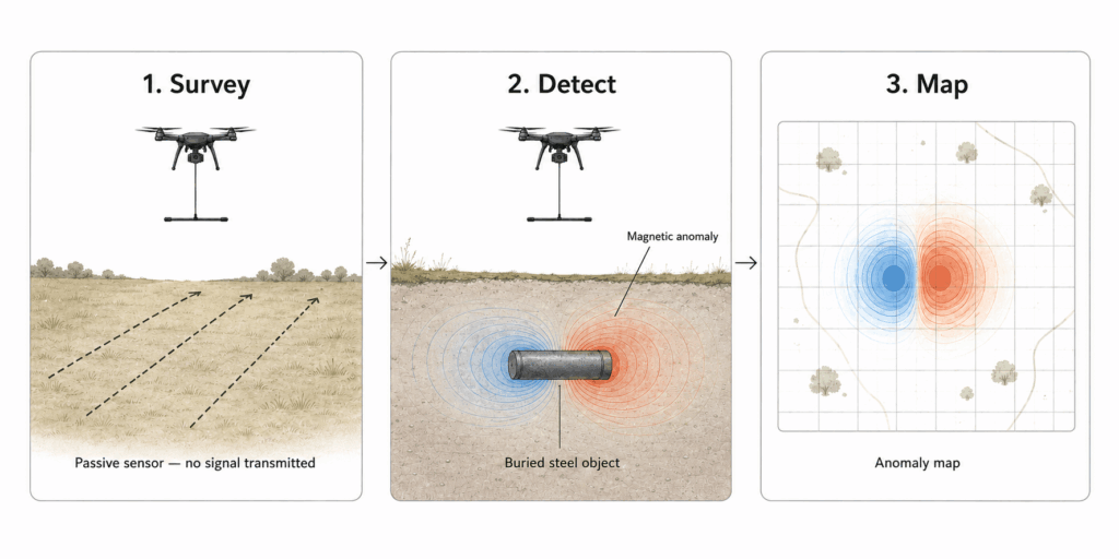
This can be valuable where the target has no surface expression and where conductive soil limits GPR. A sufficiently large steel object may still produce a measurable anomaly through several meters of soil, rock or sand.
The method has clear boundaries. Plastic pipes, concrete voids and most non-ferrous metals will produce little or no useful magnetic response. A magnetometer also cannot identify an object from its anomaly alone. A buried tank, several steel drums and a collection of scrap metal can create similar patterns.
Nearby vehicles, fences, reinforced concrete, power infrastructure and the drone itself may add noise. Survey height is particularly important because the magnetic response of a compact target falls rapidly as the distance between the sensor and object increases. Low and stable flight is therefore central to drone magnetometry.
GPR and magnetometers can both locate buried targets, but they respond to different physical properties.
GPR | Magnetometer | |
How it works | Sends radio waves into the ground and records reflections | Passively measures variations in the Earth’s magnetic field |
What creates a response | Changes in electrical properties between materials | Ferromagnetic materials and magnetic minerals |
Typical targets | Metal and plastic utilities, voids, foundations, soil layers and moisture boundaries | Steel pipes, tanks, UXO, industrial debris and geological structures |
Main environmental limitation | Conductive clay, saline water and mineral-rich soil can reduce penetration | Fences, vehicles, reinforced concrete and other magnetic sources can add noise |
What the data shows | Subsurface profiles and reflections at different depths | The position and strength of magnetic anomalies |
Best suited to | Sites where the target material is unknown or subsurface structure matters | Searches focused on iron or steel targets, particularly across large or difficult areas |
GPR provides a broader picture of subsurface structure, while a magnetometer is more selective. If the target is likely to contain iron or steel, magnetometry can cover ground quickly and remain effective where conductive soil limits radar. If the survey must also account for plastic pipes, voids or soil layers, GPR is usually more informative. On complex sites, the two methods can be used together.
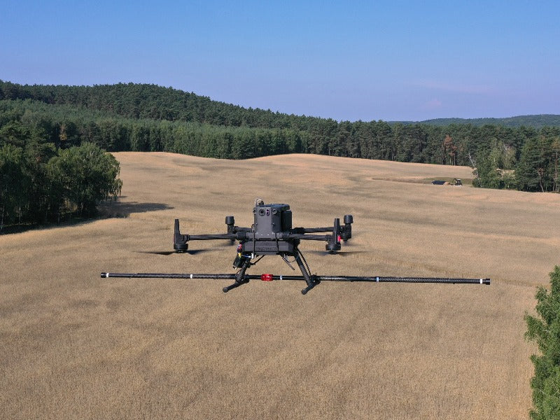
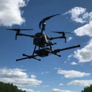
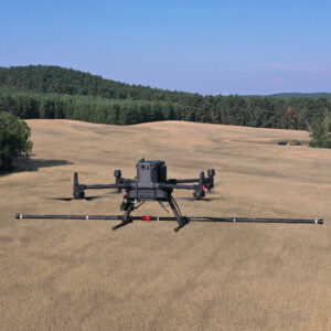
The SENSYS MagDrone R3 and R4 use the same basic sensing technology, but they are designed for different survey priorities. The R3 favors lower weight and maneuverability, while the R4 uses a wider sensor array to collect more closely spaced measurements in each pass.
Feature | ||
Sensor array | Two three-axis fluxgate sensors | Five three-axis fluxgate sensors |
Sensor spacing | 1 meter | 25 or 50 centimeters |
Recording rate | 200 Hz | 200 Hz |
Weight with battery | Approximately 884 grams | Approximately 3 kilograms |
Survey advantage | Lower payload weight and easier operation around constrained terrain | Greater spatial density across each flight line |
Typical applications | UXO detection, mineral exploration and searches for buried industrial debris | High-resolution UXO surveys, archaeological mapping and systematic coverage of large areas |
Reported coverage | Depends on the drone, terrain and line spacing | Around 3–4 hectares per hour with 50-centimeter sensor spacing and flight lines 2.5 meters apart, according to SENSYS |
A large UXO project in northern Poland shows how aerial magnetometry works outside a controlled test field.
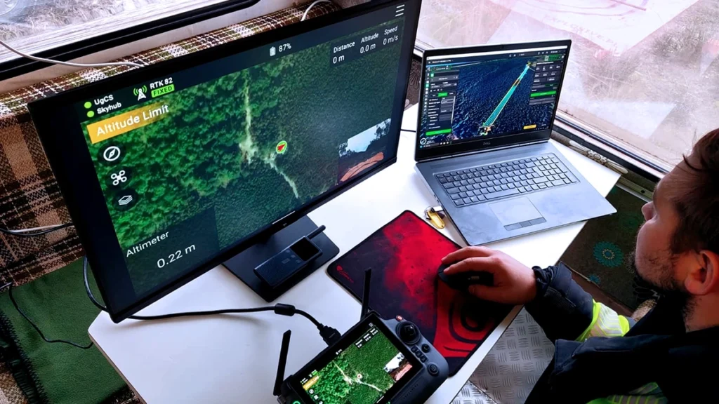
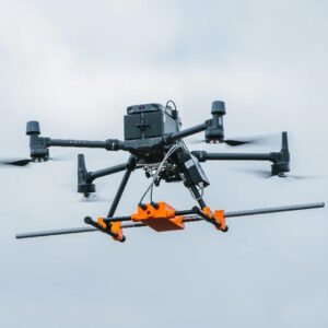
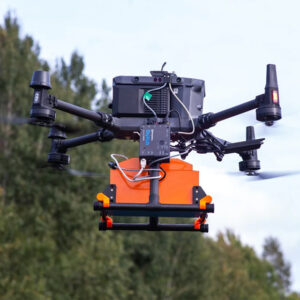
According to a case study published by SPH Engineering on 21 May 2026, Explosive.pl surveyed 302 hectares of coastal terrain using a DJI Matrice 350 RTK carrying a SENSYS MagDrone R4.
A three-person crew spent 120 days on site and accumulated around 1,000 flight hours. The sensor was flown approximately one meter above beach sections and 1.7 meters above slopes. Flight speeds ranged from 0.5 meters per second on difficult ground to four meters per second across open beach, with survey lines spaced 2.5 meters apart.
The resulting data contained approximately 3,000 magnetic anomalies. Many were scrap metal, but ground verification also found mortar grenades, small-arms ammunition and artillery shells ranging from 75 to 150 millimeters.
One of the most notable targets was a 150 mm artillery shell buried about three meters below the surface. The magnetometer detected it while flying two meters above the ground, giving a total sensor-to-target distance of approximately five meters.
Use LiDAR when the surface is the main source of information. Common applications include terrain models, stockpile volumes, erosion monitoring, vegetation structure, construction progress and archaeological earthworks visible through gaps in forest cover.
Use GPR when subsurface structure and material boundaries matter. It is widely used for locating metallic and nonmetallic utilities, mapping concrete reinforcement, finding voids, identifying pavement layers and investigating archaeological features. Results depend heavily on soil conductivity, moisture and antenna frequency.
Use a magnetometer when the target is ferromagnetic or creates a magnetic anomaly. Suitable scenarios include UXO screening, abandoned steel well casings, buried tanks, pipelines, mining debris, geological mapping and some archaeological surveys.
On complex sites, the methods often work best together. LiDAR supplies terrain and surface context. Magnetometry rapidly identifies areas with unusual magnetic responses. GPR can then provide additional information about depth, shape or nearby subsurface layers where ground conditions allow.
A sensor is most useful when its measurement matches the physical property of the target. For buried ferrous objects, a magnetometer may reveal what surface mapping cannot see and what radar cannot reliably reach. For voids, plastic utilities or soil stratigraphy, GPR remains the stronger option. The technologies overlap, but they do not replace one another.
A magnetometer an detect ferromagnetic targets such as steel pipes, tanks, UXO and industrial debris, as well as magnetic minerals and geological structures.
There is no fixed depth. Large steel objects can be detected deeper than small fragments, while sensor height, soil conditions and magnetic noise also affect the result.
No. Magnetometers respond mainly to iron, steel and nickel; most copper, aluminum and other non-ferrous objects produce little useful response.
LiDAR maps the surface, GPR detects electrical contrasts underground, and magnetometers record anomalies caused by magnetic materials.
It depends on the target. GPR is useful for utilities, voids and subsurface layers, while magnetometers are more effective for ferrous objects.
The drone follows parallel flight lines while recording magnetic and position data. The readings are then processed into an anomaly map.