Industrial drone projects are no longer built around a single aircraft. Surveying, inspection, and emergency response increasingly rely on complete ecosystems that combine UAVs, sensors, flight planning software, and automated workflows.
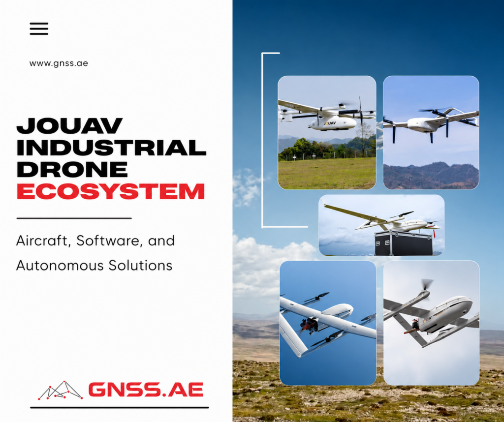
JOUAV is one of the manufacturers that has focused on this approach from the beginning. Rather than developing consumer drones, the company specializes in industrial VTOL (Vertical Takeoff and Landing) platforms for mapping, infrastructure inspection, public safety, and other professional applications.
Today, the JOUAV ecosystem extends well beyond the aircraft itself. It includes mapping software, interchangeable payloads, autonomous drone stations, and UAV platforms ranging from the compact CW-15 to larger systems built for long-range missions and heavier payloads. Together, these components allow organizations to select a configuration that matches their operational requirements rather than relying on a one-size-fits-all solution.
Founded in 2010 in Chengdu, China, JOUAV specializes in industrial unmanned aircraft systems. Unlike manufacturers that divide their attention between consumer and enterprise products, the company has focused almost exclusively on professional UAV solutions for surveying, infrastructure inspection, public safety, energy, and environmental monitoring.
Its product lineup is centered on VTOL fixed-wing aircraft, which combine the flexibility of vertical takeoff and landing with the endurance and efficiency of conventional fixed-wing flight. This design allows operators to survey large areas without the need for runways, catapults, or other launch equipment.
As the product range has expanded, JOUAV has added electric and hybrid VTOL aircraft, specialized payloads, mission planning and data processing software, and autonomous drone-in-a-box systems. Instead of offering a single platform for every application, the company provides multiple options optimized for different operational requirements.
The latest generation includes the CW-15 for routine surveying and inspection, as well as the newer CW-20E, which offers higher payload capacity and onboard AI computing for more demanding missions.
JOUAV’s aircraft lineup covers a wide range of mission requirements, from routine mapping projects to long-range inspections and heavy-payload operations. While all platforms are designed for professional use, they differ significantly in endurance, payload capacity, and intended applications.
The current portfolio can be broadly divided into three categories: compact electric VTOL drones, larger long-endurance platforms, and multirotor systems.
The CW-15 is the most compact VTOL aircraft in JOUAV’s fixed-wing portfolio and serves as an entry point into professional long-range drone operations. Designed primarily for surveying, mapping, and environmental monitoring, it combines vertical takeoff with efficient fixed-wing flight, making it suitable for projects where multirotor endurance is no longer sufficient. Its relatively simple deployment also makes it an attractive option for small survey teams and engineering companies.
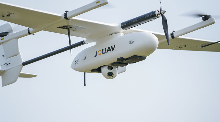
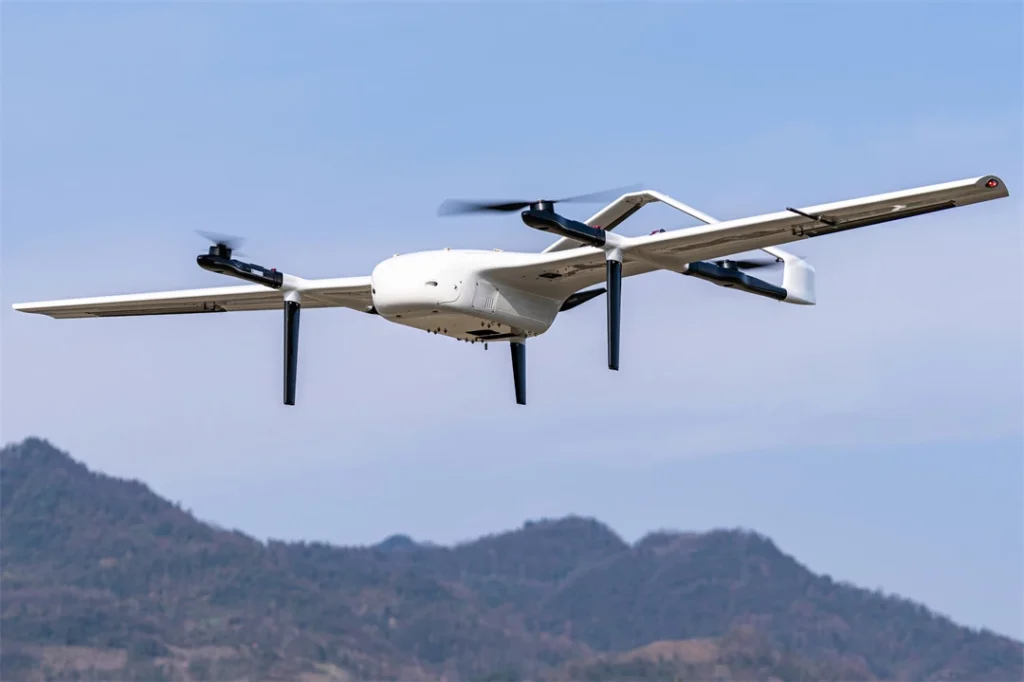
Introduced in 2026, the CW-20E represents the next generation of JOUAV’s electric VTOL platforms. Compared with the CW-15, it supports larger payloads, longer flight times, onboard AI computing, and enhanced obstacle sensing. These improvements make it suitable for more demanding inspection, public safety, and corridor mapping missions while maintaining the operational simplicity of an all-electric aircraft.
The CW-25E is designed for projects where endurance becomes a higher priority. Its hybrid propulsion system allows it to remain airborne considerably longer than electric platforms, making it well suited for surveying large territories, inspecting long pipeline sections, or monitoring remote infrastructure. It bridges the gap between compact survey drones and larger enterprise UAVs.
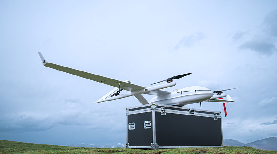
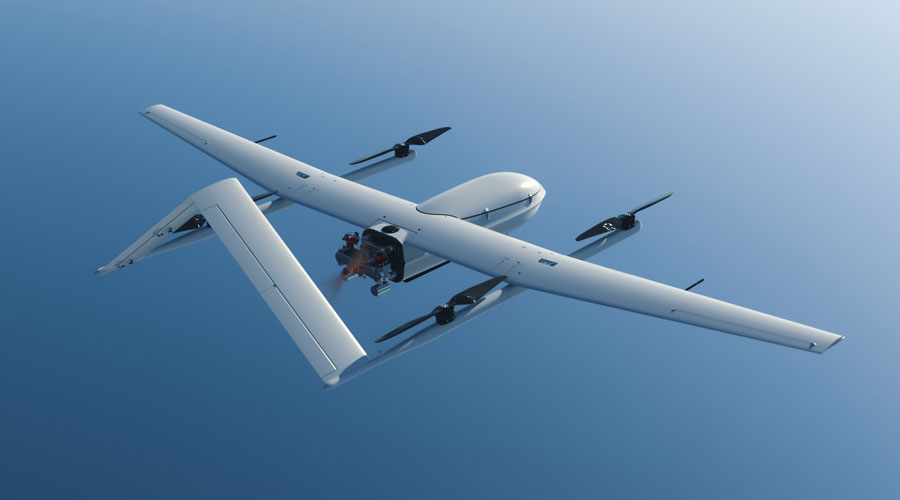
The CW-30E is built for long-range industrial operations that require extended flight times and heavier payloads. It is commonly positioned for applications such as power line inspection, oil and gas infrastructure monitoring, maritime operations, and large-scale mapping. The aircraft is intended for organizations that regularly perform BVLOS missions or need to maximize area coverage during a single flight.
The CW-80E is JOUAV’s heavy-lift VTOL platform. Unlike the smaller mapping-oriented aircraft, it is designed to carry substantially larger payloads for specialized industrial applications, including logistics, emergency response, and custom sensor integration. Its capabilities make it suitable for missions where payload capacity is more important than compact size.
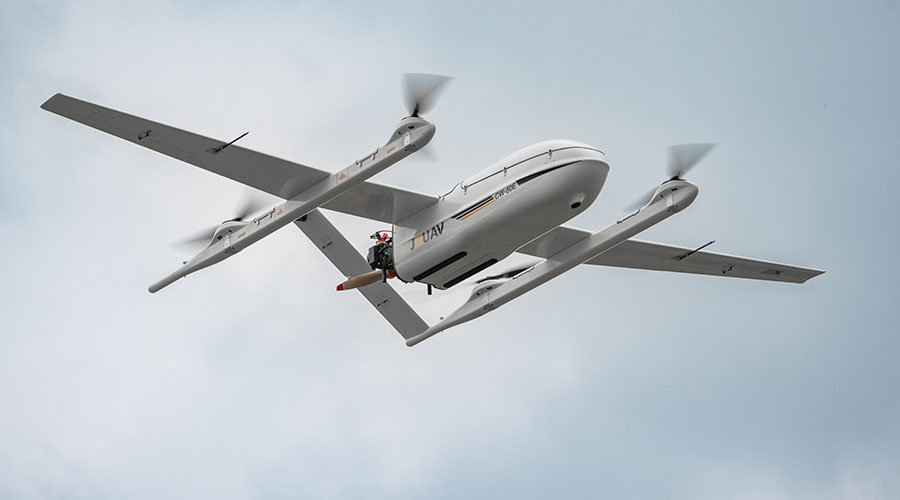
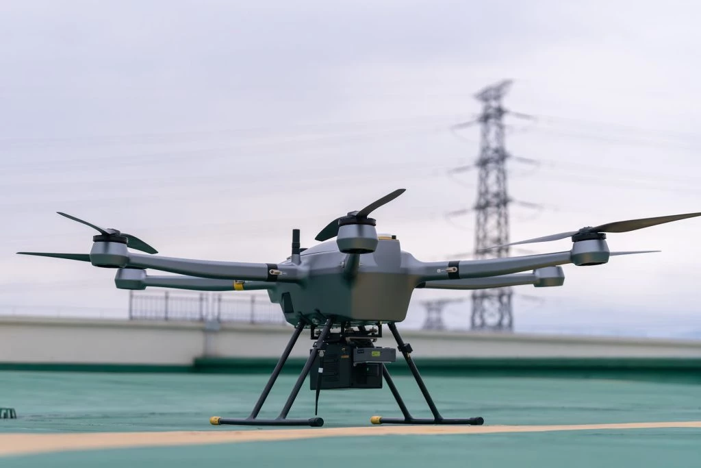
Unlike the fixed-wing platforms, the PH-10 is a multirotor UAV intended for close-range operations. It offers the maneuverability needed for detailed inspections, emergency response, public safety, and other missions that require precise hovering or work in confined spaces. Rather than replacing VTOL aircraft, it complements them by covering tasks where fixed-wing flight is not practical.
Platform | Type | Typical Applications |
Electric VTOL | Surveying, mapping, environmental monitoring | |
Electric VTOL | Mapping, corridor inspection, public safety, oil & gas | |
Hybrid VTOL | Long-range inspection, large-scale mapping, maritime operations | |
Heavy-lift VTOL | Logistics, heavy payload missions | |
Multirotor | Close-range inspection, public safety, emergency response |
Depending on the platform, operators can equip drones with RGB mapping cameras, oblique imaging systems for 3D reconstruction, thermal sensors, LiDAR scanners, multispectral cameras, or customized payloads developed for specific inspection tasks.
This flexibility allows the same aircraft to be adapted for different workflows. For example, a mapping mission may use a high-resolution RGB camera to generate orthomosaics and digital surface models, while the same platform can later be equipped with a thermal camera for infrastructure inspection or search-and-rescue operations.
The modular payload approach also makes it easier for organizations to expand their capabilities over time. Instead of purchasing a new aircraft for every application, operators can often add new sensors as project requirements evolve, helping protect long-term equipment investment.
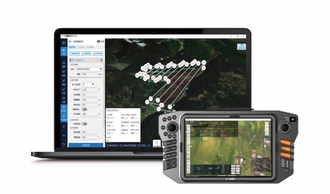
JOUAV has developed its own software ecosystem. The company’s solutions cover flight planning, autonomous mission management, and data processing, allowing operators to manage projects from mission preparation through to data delivery.
For mapping applications, EagleMap provides tools for flight planning, automated image processing, point cloud generation, orthomosaic creation, and 3D model reconstruction. By combining mission planning and data processing within the same ecosystem, it helps reduce the number of software packages required during a typical surveying workflow.
For larger organizations operating multiple aircraft, JOUAV also offers fleet management and remote operation tools that simplify mission scheduling, aircraft monitoring, and data management across distributed teams.
Like many industrial drone manufacturers, JOUAV has expanded beyond manually operated aircraft into autonomous drone operations.
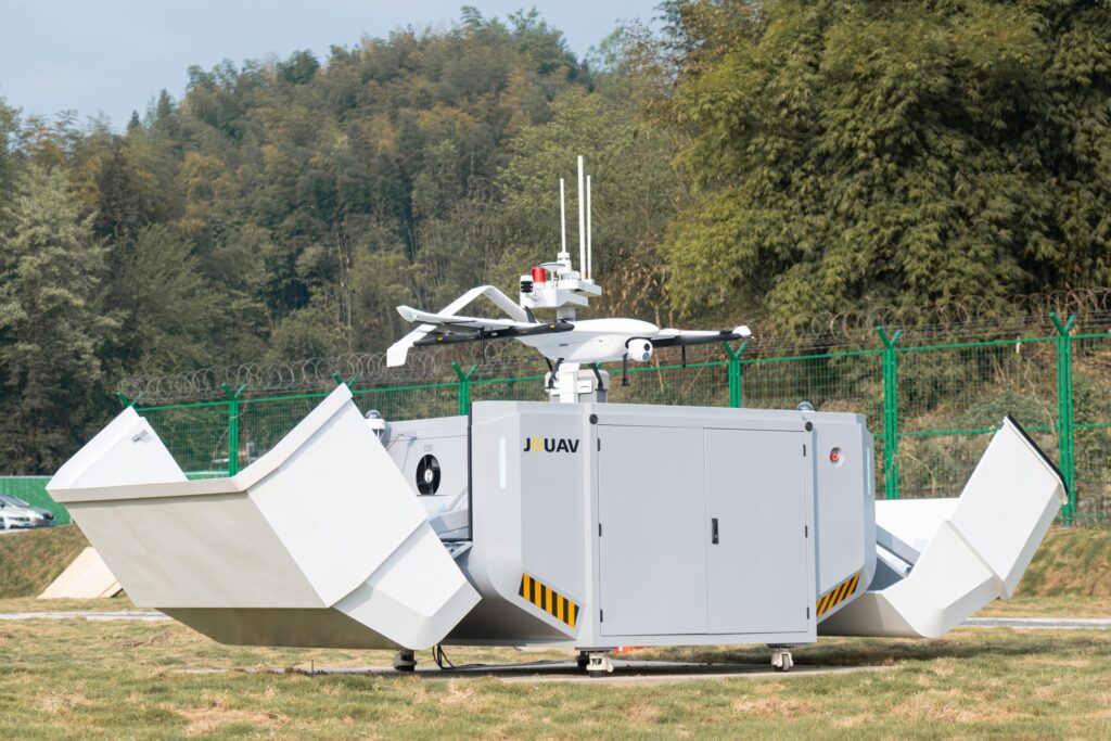
Its Drone-in-a-Box solutions combine an aircraft, docking station, charging system, and remote management software into a single platform capable of performing scheduled or on-demand missions with minimal operator involvement. After completing a flight, the drone automatically returns to the dock, where it recharges and prepares for the next mission.
These systems are designed for applications that require frequent or continuous monitoring, such as industrial facilities, power infrastructure, construction sites, ports, and security operations. Instead of sending a field crew for every inspection, operators can schedule recurring flights or launch missions remotely when needed.
Industry | Common Tasks | Recommended Platforms |
Surveying & Mapping | Topographic surveys, corridor mapping, construction monitoring | CW-15, CW-20E |
Oil & Gas | Pipeline inspection, right-of-way monitoring | CW-25E, CW-30E |
Utilities | Power line inspection, vegetation management | CW-20E, CW-30E |
Public Safety | Search and rescue, incident monitoring | PH-10, CW-20E |
Environmental Monitoring | Coastal surveys, forestry, wetlands | CW-15, CW-20E, CW-30E |
Rather than focusing on a single flagship aircraft, JOUAV has built a product portfolio that covers different operational requirements. Organizations can choose between compact electric VTOL platforms for routine mapping, hybrid aircraft for long-range missions, or multirotor systems for close-range inspections, while continuing to use the same ecosystem of software and supporting technologies.
Another defining characteristic is the company’s emphasis on complete workflows. Aircraft, payloads, mission planning software, data processing tools, and autonomous drone stations are designed to work together, reducing the need to integrate components from multiple vendors.
The growing focus on autonomous operations also reflects the direction of the industrial drone market. As more organizations adopt scheduled inspections, remote asset monitoring, and BVLOS operations where regulations permit, integrated ecosystems are becoming increasingly important alongside aircraft performance itself.
Over the past decade, JOUAV has evolved from a manufacturer of industrial VTOL aircraft into a provider of integrated UAV solutions. Its portfolio now spans electric and hybrid drone platforms, mission-specific payloads, software for flight planning and data processing, and autonomous drone-in-a-box systems.
This ecosystem approach gives organizations the flexibility to select equipment based on operational requirements, whether the priority is large-area mapping, infrastructure inspection, public safety, or long-endurance monitoring.
JOUAV primarily develops VTOL fixed-wing drones that combine vertical takeoff and landing with the longer flight endurance of fixed-wing aircraft. Its product portfolio includes compact electric platforms such as the CW-15, larger electric models like the CW-20E, long-endurance hybrid VTOL aircraft including the CW-25E and CW-30E, as well as multirotor systems such as the PH-20.
Yes. JOUAV drones are widely designed for professional surveying and mapping workflows. Models such as the CW-15 and CW-20E can be equipped with mapping payloads to support topographic surveys, corridor mapping, construction monitoring, and large-area data collection.
The choice depends on project requirements. The CW-15 is designed for compact surveying operations where easy deployment and efficiency are priorities. The CW-20E provides additional payload capacity and endurance for more demanding mapping and inspection workflows, while larger platforms such as the CW-25E and CW-30E are better suited for extensive territories and long-range missions.
Yes. Depending on the aircraft model, JOUAV platforms can support different payload types, including RGB cameras, LiDAR sensors, thermal cameras, multispectral cameras, and other specialized equipment. This allows the same drone platform to be adapted for different industries and data collection requirements.
Yes. In addition to aircraft, JOUAV develops software tools for mission planning, autonomous operations, and aerial data processing. Its ecosystem is designed to support the workflow from flight preparation and data collection to analysis and final deliverables.