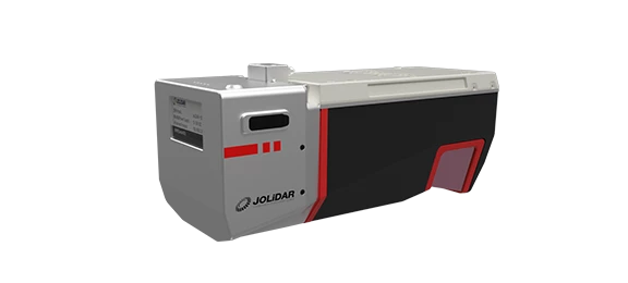
The JoLiDAR-120 is an advanced geospatial solution featuring Nadir-Forward-Backward (NFB) Scanning LiDAR, a high-accuracy Inertial Measurement Unit (IMU), and a 26MP RGB camera. With a wide 100-degree field of view and an exceptional pulse repetition rate of up to 2400 MHz, it excels in high point density corridor mapping applications.


Provides detailed point cloud representation for accurate mapping.

Accuracy of 10mm and precision of 5mm for detailed mapping.

Up to 18km² coverage per flight (with 50% overlap) on JOUAV CW-15 drone.

Captures ground points under dense foliage for comprehensive data.

Covers up to 1430m at 80% target remission for extensive mapping.

Ensures precise positioning and orientation data for accurate georeferencing.

Fully integrated with JOUAV’s flight control system and GCS for simplified workflows.

Offers ample space for storing large datasets from surveys.
The system boasts a measuring accuracy of 10mm and repeatability of 5mm, ensuring highly precise measurements and reliable data analysis. This remarkable consistency enhances data reliability and facilitates change detection analysis.
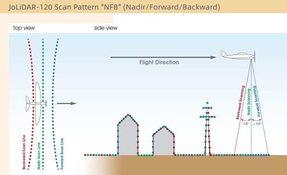
The JoLiDAR-120 utilizes a sophisticated scan pattern alternating between strict nadir and ±10 degrees forward and backward scanning angles. This ensures comprehensive 3D data capture, accurately sampling vertical surfaces and enabling reliable data acquisition in narrow canyons.
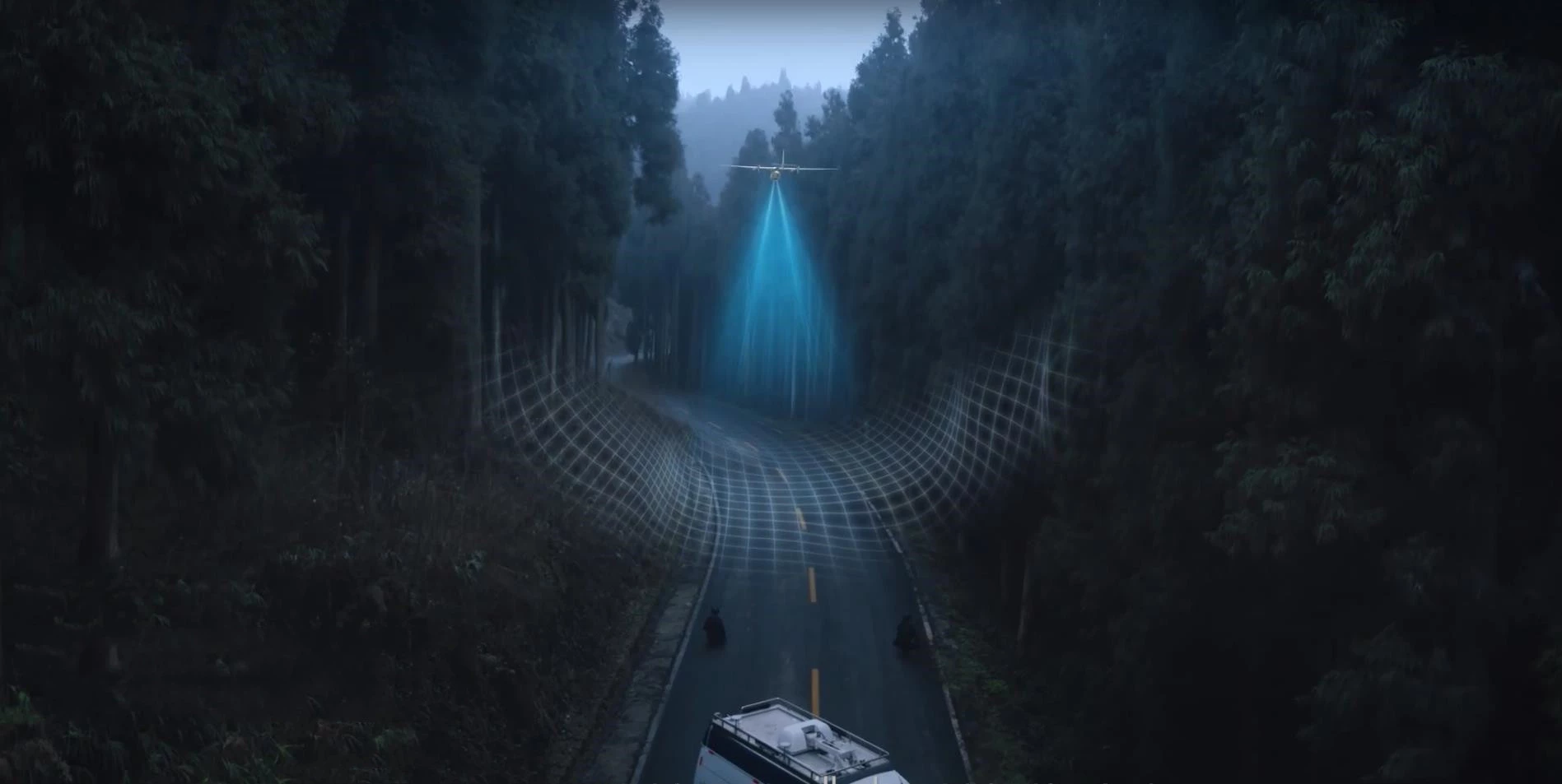
JoLiDAR-120’s capacity to generate 1.8 million points per second surpasses traditional LiDAR systems, enabling it to capture richer, more detailed point clouds in less time. This high-resolution data is ideal for applications such as 3D mapping, object detection, and terrain analysis.
The JoLiDAR-120 offers rapid scanning speed, allowing for the quick coverage of large areas while maintaining high data density. This increases efficiency and productivity, particularly beneficial for applications requiring extensive data collection such as topographic mapping and corridor inspection.
The JoLiDAR-120 boasts a maximum scanning range of 1,430 meters, allowing it to effectively operate at an operational range of up to 720 meters (2,350 feet). This extended range makes it particularly suitable for fixed-wing UAVs, enabling efficient surveying of vast areas from greater distances.
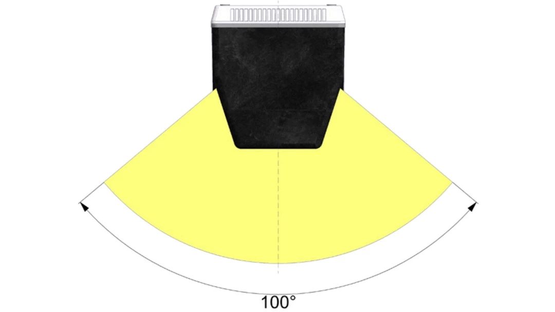
Featuring a field of view of up to 100°, the JoLiDAR-120 captures a broad swath of data in a single scan, minimizing the need for overlapping scans and maximizing efficiency. This expansive coverage is particularly beneficial for applications requiring rapid and comprehensive data collection.
Our intelligent fusion process combines highly accurate positional data from RTK with dynamic motion data from the IMU in real-time. This ensures accurate georeferencing even in challenging environments, without the need for external reference points.
* All performance data in the foregoing pages are theoretical values obtained by JOUAV® internal laboratories through tests carried out under particular conditions. For more information on the specific testing conditions, refer to the aforementioned product details. Actual performance may vary owing to differences in individual product configuration, software versions, application conditions, and environmental factors. All data is subject to actual usage.
Inquire price for JOUAV JoLiDAR-120