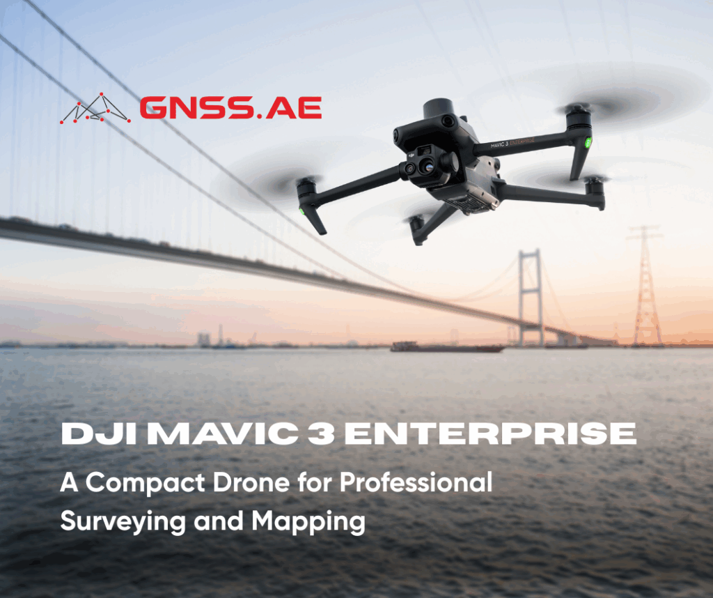
DJI Mavic 3 Enterprise represents the next step in compact drone technology, redefining efficiency in surveying, mapping, and inspection workflows. Engineered for precision and reliability, it delivers professional-grade results across industries where data accuracy is critical, from construction and infrastructure to agriculture and disaster management.
DJI M3E is designed specifically for high-accuracy geospatial applications. Its advanced imaging, positioning, and flight systems make it one of the most capable drones in its class.
Equipped with a 20MP 4/3 CMOS wide-angle camera and a mechanical shutter, DJI Mavic 3E captures sharp, distortion-free images, even during high-speed flight. This eliminates motion blur and enables survey-grade results without extensive reliance on Ground Control Points (GCPs), streamlining large-scale data collection.
The secondary 12MP zoom camera with 56× hybrid zoom makes the DJI Mavic 3E highly effective for inspections. From detecting fine cracks in concrete to assessing critical infrastructure networks, operators can observe minute details remotely, minimizing the need for manual access in hazardous or hard-to-reach areas.
With RTK (Real-Time Kinematic) positioning, DJI M3E delivers centimeter-level accuracy essential for land surveying, precision agriculture, and infrastructure development. This capability ensures reliable geospatial data for large-scale projects such as road construction, utility mapping, and agricultural soil analysis.
A maximum flight duration of up to 45 minutes allows DJI Mavic 3E to survey areas of up to 2 km² per mission. This endurance makes it especially valuable for agricultural monitoring and environmental analysis, where wide coverage is critical for actionable insights.
The Smart Oblique Capture mode enables automated multi-angle image collection, optimized for photogrammetry and 3D modeling. By reducing the number of required flight paths and capture time, this feature enhances productivity while improving the geometric accuracy of 3D reconstructions.
DJI Mavic 3E is a versatile platform that improves operational efficiency while ensuring safety and precision across multiple domains:
Construction and Infrastructure
Enables rapid site surveys, structural health monitoring, and progress documentation. Frequently used for bridge, tower, and utility inspections to maintain structural integrity.
Precision Agriculture and Forestry
Supports crop health assessment, vegetation analysis, irrigation planning, and disease detection. In forestry, it assists in monitoring forest health, mapping erosion risks, and detecting changes in vegetation patterns.
Disaster Response and Emergency Management
In post-disaster scenarios, DJI M3E provides real-time aerial situational awareness for first responders, enabling efficient search, damage assessment, and recovery planning.
Environmental Monitoring
Deployed to evaluate environmental parameters such as water quality, industrial pollution, and waste leakage. DJI M3E’s precision mapping aids in impact studies and compliance monitoring.
The DJI Mavic 3 Enterprise integrates several cutting-edge systems to maximize efficiency and flight safety:
Omnidirectional Obstacle Avoidance – Ensures collision-free navigation across complex terrains.
O3 Enterprise Transmission – Provides a stable, high-bandwidth connection, essential for missions such as thermal inspections of pipelines and industrial facilities.
Real-Time Terrain Follow – Automatically adjusts altitude relative to ground variations, making it highly effective for mapping in undulating or mountainous regions.
DJI Mavic 3 Enterprise combines compact design with advanced imaging, positioning, and safety systems, making it a powerful solution for mapping, inspection, and monitoring applications across multiple industries. With its mechanical shutter, 56× zoom, RTK module, and Smart Oblique Capture, it delivers professional-grade accuracy and efficiency in diverse operational scenarios.
DJI Mavic 3 Enterprise is available through GNSS.AE, the official DJI Enterprise dealer in the Middle East and Africa. GNSS.AE provides comprehensive training, expert technical support, and reliable after-sales service, ensuring that users maximize the full potential of DJI’s professional solutions. With strong expertise in geospatial and drone technologies, GNSS.AE is committed to driving innovation and operational success for its clients.