Multispectral imaging has become an essential part of modern UAV workflows. It allows professionals to go beyond simple visual inspections and extract quantitative data about vegetation, terrain, and environmental conditions.
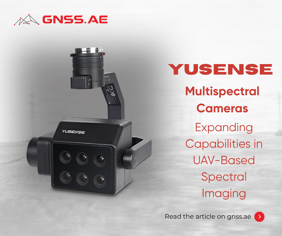
Among the emerging manufacturers in this field, Yusense has established itself as a developer of advanced spectral imaging systems for both industrial and research use. With a range of payload options, the company offers flexible tools for data collection across agriculture, environmental monitoring, and geospatial applications.
Founded through research linked to the Chinese Academy of Sciences, Yusense focuses on spectral imaging and remote sensing technologies. The company develops:
Yusense positions itself as an alternative to solutions such as MicaSense and integrated platforms like DJI Phantom 4 Multispectral.
Unlike fully integrated systems, Yusense focuses on modular payloads. This means the cameras can be installed on different UAV platforms depending on project requirements. As a result, users get more flexibility in terms of configuration and deployment.
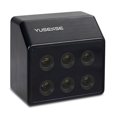
The MS600 series are at the heart of Yusense’s multispectral solutions. With six spectral channels, this system gathers consistent data across both visible and near-infrared ranges.
Each channel operates at 1.2 MP and uses a global shutter, ensuring that images are captured without distortion, even when the camera is in motion. One of the key advantages of this platform is fully synchronized capture across all channels, which is important for accurate index calculations such as NDVI and NDRE.
In practice, the MS600 is a balanced solution for routine mapping and vegetation monitoring tasks, for example:

The MS600 Pro builds on the base model with improved calibration and data consistency. It supports radiometric correction and includes compatibility with a Downwelling Light Sensor (DLS), ensuring accuracy even when lighting conditions change.
The camera also integrates with enterprise UAV platforms such as DJI M300 and M350. The MS600 Pro is perfect for precision agriculture, research projects, and professional UAV operation.

For advanced applications, the MS600 Dual offers 12 simultaneous multispectral channels. This extended spectral range enables in-depth vegetation index analysis (NDVI, LAI) and detailed environmental monitoring.
In practice, the MS600 Dual is ideal for research-grade projects requiring maximum spectral detail and analytical flexibility.

The HR600 focuses on high spatial and radiometric precision, making it suitable for detailed mapping, smart city surveys, and ecological monitoring. With 12 MP channels and high geometric accuracy, it supports 1:2000 scale mapping without ground control points.
Compared to MS600, HR600 provides more detailed analysis of:

The FD500 Pro focuses on portability and operational efficiency. Its lighter weight and compact design make it easier to work with UAV platforms, particularly when payload capacity is limited.
This design allows for quick deployment in the field which is perfect for fast-paced survey missions. At the same time, it captures important spectral data, ensuring that performance is not sacrificed for convenience.
FD500 Pro is a good option for:

The AQ600 Pro combines multispectral sensing with a high-resolution RGB camera to capture both analytical and visual data in a single flight.
In addition to capturing five multispectral bands, the system includes a 12.3 MP RGB sensor and supports video output. This makes it possible to assess conditions in real time while collecting data for further analysis.

The AQ300 Pro adds SWIR and LWIR channels to standard multispectral imaging, which allows the camera to detect thermal variations and moisture content. Fast 0.5s imaging across all channels makes it suitable for environmental monitoring and industrial inspection.
This type of system is particularly relevant for environmental monitoring, water analysis, and industrial inspection tasks where standard optical sensors may be limited.
Multispectral and multi-sensor UAV imaging is widely used across different industries. With Yusense cameras, professionals can go beyond just looking at things visually and start working with data that’s measurable and actionable.
In agriculture, multispectral imaging is primarily used to assess crop health and optimize field management. By analyzing vegetation indices such as NDVI and NDRE, operators can quickly identify stress zones, nutrient deficiencies, or irrigation issues.
This allows for targeted actions—such as variable-rate fertilization or irrigation—reducing costs while improving yield. Cameras like the MS600 Pro and MS600 Dual are especially effective here, providing stable and repeatable data across large areas.

In forestry, multispectral data helps identify early disease symptoms, track the health of vegetation, and estimate biomass, especially in large or hard-to-reach areas where ground surveys can be quite challenging.
High-resolution solutions such as the HR600 enable more detailed canopy analysis and mapping, supporting long-term forest management and environmental monitoring.

Multispectral imaging is widely used to monitor water bodies and ecosystems. It helps identify of issues such as eutrophication, pollution, and changes in vegetation health.
With advanced sensors like SWIR and LWIR (AQ300 Pro), operators can also analyze moisture levels and temperature variations, which makes these systems especially valuable for environmental research and compliance monitoring.

In surveying and inspection workflows, multispectral data adds analytical depth to standard UAV mapping. It can be used for land cover classification, terrain analysis, and monitoring of infrastructure corridors such as roads, pipelines, and power lines.
Hybrid systems like the AQ600 Pro combine RGB and multispectral data, allowing operators to perform visual inspection and analysis in a single flight, improving efficiency in field operations.
Model | Spectral Channels | Key Advantage | Best Use Case |
MS600 / V2 | 6 | Balanced performance | General agriculture |
MS600 Pro | 6 | Radiometric accuracy | Precision farming |
HR600 | 6 | High spatial resolution | Detailed mapping |
FD500 Pro | 5–6 | Lightweight design | Rapid deployment |
AQ600 Pro | 5 + RGB | Hybrid imaging | Inspection + analysis |
AQ300 Pro | Multi + SWIR/LWIR | Advanced sensing | Environmental monitoring |
MS600 Dual | 12 | Maximum spectral data | Research applications |

MicaSense is known for its impressive radiometric accuracy and reliability. Their cameras are a go-to choice in agriculture and research, providing stable and well-calibrated datasets. For those interested in a deeper dive into MicaSense systems, we have covered them in one of our previous articles — you can check it out here.
However, MicaSense systems are typically built around fixed spectral configurations, most commonly in the 5–7 band range. While this works well for many standard applications, it can feel a bit limited for projects that need custom spectral setups or more in-depth analysis.
Yusense takes a different approach. Its cameras offer:
In practice: MicaSense is an excellent choice for those looking for standardized, high-precision workflows, while Yusense is better suited for projects that require more flexibility and extensive spectral analysis.
| Aspect | Yusense | MicaSense |
|---|---|---|
| Spectral Configurations | Highly flexible (6–12+ bands, SWIR/LWIR options) | Typically fixed (5–7 bands, up to 10 with dual systems) |
| Modularity | Strong (multi-platform integration) | Moderate (primarily standardized integrations) |
| Advanced Sensors | SWIR, LWIR, SIF available | Thermal available (select models) |
| Radiometric Accuracy | High (with DLS support) | Industry benchmark |
| Cost Efficiency | Generally more competitive | Higher price segment |

The DJI Phantom 4 Multispectral represents a completely different category of solution. It’s a fully integrated drone that comes with a built-in multispectral camera, making it super easy to use and quick to deploy.
This approach has clear advantages:
However, this simplicity comes with limitations. The system is:
In contrast, Yusense provides:
In practice: DJI is ideal for routine agricultural monitoring and quick deployment scenarios, while Yusense is better suited for advanced, customizable, and large-scale projects.
| Aspect | Yusense | DJI Phantom 4 Multispectral |
|---|---|---|
| System Type | Modular payload | Fully integrated drone |
| Flexibility | High (custom UAV platforms) | Limited to built-in system |
| Spectral Capability | Expandable (multi-sensor options) | Fixed 6-band system |
| Deployment | Requires setup and integration | Ready to fly out of the box |
| Scalability | Suitable for complex workflows | Best for standardized operations |

Sentera is all about providing multispectral solutions for agriculture, focusing on crop health analytics and user-friendliness. Their systems are reliable and well-optimized for standard vegetation index workflows.
Compared to Sentera, Yusense offers:
Sentera, on the other hand, provides a more streamlined and agriculture-focused experience, which can be a real advantage for users who don’t need those advanced sensing features.
In practice: Sentera is well-suited for focused agricultural workflows, while Yusense becomes the preferred option for projects that require multi-domain analysis and advanced spectral data.
| Aspect | Yusense | Sentera |
|---|---|---|
| Sensor Variety | Wide (including SWIR, LWIR, SIF) | More limited |
| Application Focus | Industrial + research | Agriculture-focused |
| Flexibility | High (modular payloads) | Moderate |
| Data Depth | Advanced spectral analysis | Standard vegetation indices |
| Price-to-Performance | Competitive | Competitive |
From an overall perspective, Yusense consistently proves to be a flexible and scalable solution for professional UAV operations.
The Yusense ecosystem reflects the shift toward flexible, application-specific UAV imaging solutions. From compact, fast-deployable cameras to high-resolution, multi-sensor platforms, these tools enable professionals to adapt workflows to project-specific requirements.
Whether it’s precision agriculture, environmental monitoring, forestry, or geospatial mapping, Yusense cameras provide high-quality, actionable data that can transform decision-making in the field.
Contact GNSS.AE to discover Yusense’s multispectral solutions and take your UAV imaging capabilities to the next level.