
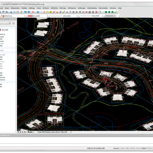
PIX4Dsurvey cuts out the steps between photogrammetry and CAD, allowing you to extract only the most critical vector data information from point clouds of any size. Offering TIN and breakline analysis, PIX4Dsurvey is ready to integrate your projects into any CAD or GIS software with the customizations that suit your work. Merge multiple point clouds in one project, using both Lidar and photogrammetry data.
Inquire Now

Use the combined power of images and point clouds to extract key elements from photogrammetry, laser scanning or LiDAR data. Survey curbs, building footprints, walls, catenary curves and more.
Work 50% faster when you vectorize from point clouds and verify in images, while the Smart Grid saves 1,000s of clicks creating spot elevations.
Include layers and properties for a smooth transition to CAD or GIS and reduce file size when exporting your projects as vector files.

Create and measure the volume of any object, even against a wall or in a corner, with fast, simple steps.
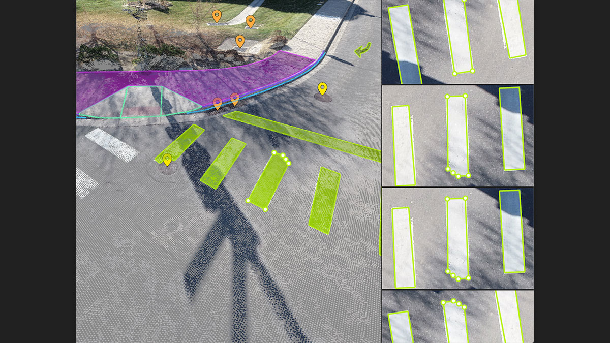
Vectorize your project using points, polylines, polygons and catenary curves with just a few clicks.
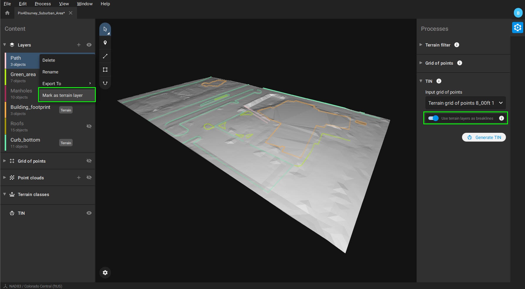
Model the ground with a TIN from points and breaklines to represent the topography of your project. Automate the creation of spot elevations and allow drastic simplification of the number of point cloud points.
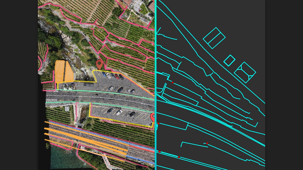
Every surveyed object can be assigned to a layer and edited. Layers can be exported separately or together for a smooth transition to your preferred CAD or GIS software.


| Save standardization for drawings/maps | Drawing layers |
| Spatial reference system | From data source |
| Security options for access | Y |
| Points | Point |
| Lines | Line segment, Polyline |
| Surfaces | Polygon |
| License or freeware | License |
| Training | Y |
| Main users | Surveyors, Quantity Surveyors, Topographers |
| Main applications | Topography |
| Distinguishable features | Easy handling of large datasets, either from photogrammetry or LiDAR. Vectorization using original images. Deliverables suitable for GIS or CAD software. |
| Related products | Pix4Dmapper, Pix4Dmatic |
| Select | Spatial selection, Multiple select |
| Remove | By select, By layer |
| Graphic transformations | Drag and drop |
| Coordinate transformations | Coordinate systems are automatically detected when importing the data |
| Positioning in relation to other element | |
| Positioning by coördinates | Y |
| Positioning by snapping | Y |
| Type of data storage | File |
| Input formats | Dxf, Jpg, Others |
| Export formats | Dxf, Shape, Others |
| Native storage format | *.p4s, *.bpc |
| Types | Color |
| Change view | Zoomfactor, Target point |
| Merge | |
| Measurement | Area, Length, Others |
| Topology | |
| Tools to detect errors | Automatic detection of outliers |
| Web standards | |
| Spatial database management systems | |
| Messaging protocols | |
| Extensions |
| Year of introduction | 2020 |
| Year of last update | 2021 |
| Supported operation system | Windows, Mac OS X |

Inquire Now
Read more

Inquire Now
Read moreInquire price for PIX4Dsurvey