
Pix4Dmapper turns your images into highly precise, georeferenced 2D maps and 3D models. They’re customizable, timely, and complement a wide range of applications and software.
Inquire Now
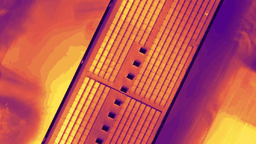
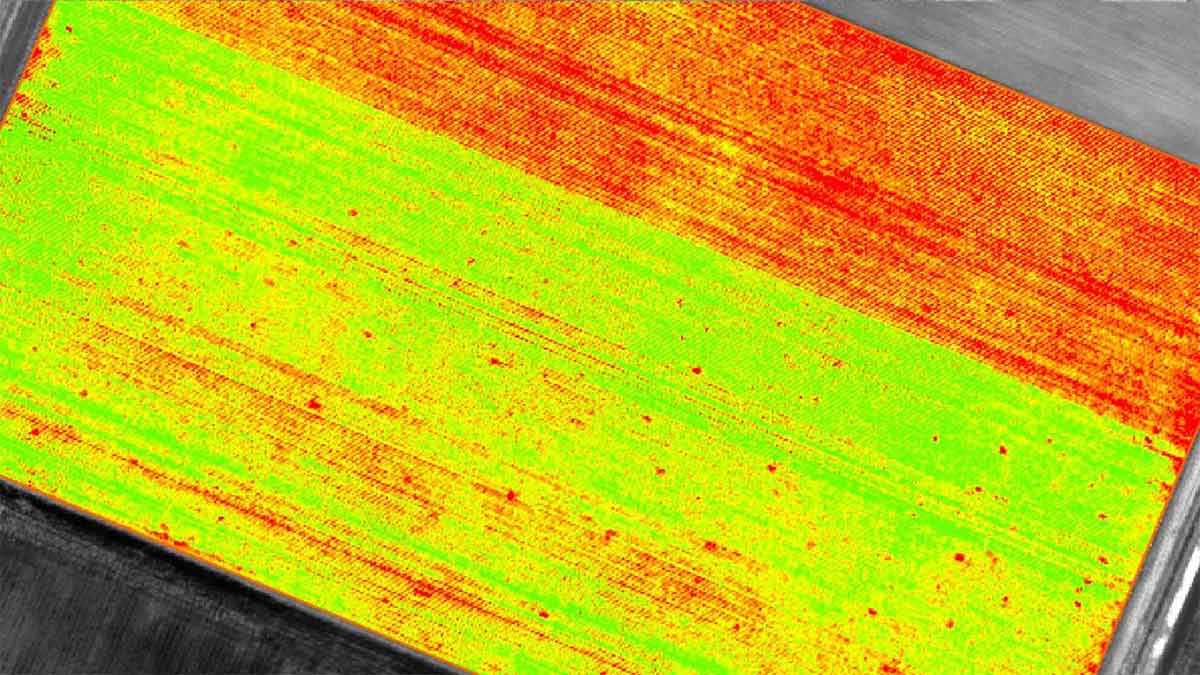
Capture RGB, thermal, or multispectral images with any camera or drone and import them to PIX4Dmapper.
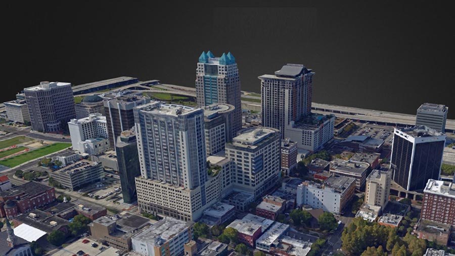
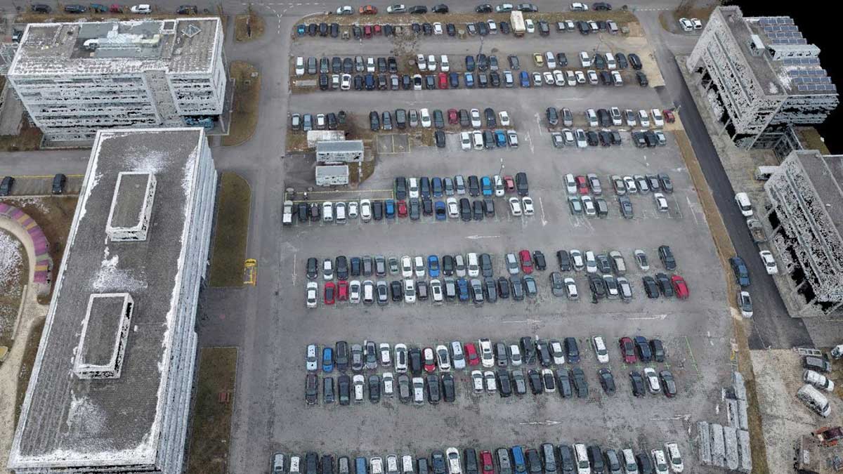
PIX4Dmapper’s photogrammetry algorithms transform your ground or aerial images in digital maps and 3D models.
Seamlessly process your projects on your desktop using our photogrammetry software, or bundle with PIX4Dcloud for online processing.
Use the power of photogrammetry in the rayCloud environment to assess, control and improve the quality of your projects.
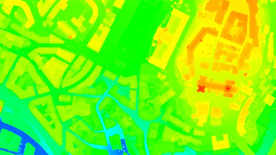
Use the quality report to examine a preview of the generated results, calibration details, and many more project quality indicators.
Accurately measure distances, areas, and volumes.
Streamline project communication and teamwork.
Selectively and securely share project data and insights, with your team, clients, and suppliers, using standard file formats.
Obtain results with sub-centimetre accuracy thanks to photogrammetric analysis. 1-2 pixel GSD in X, Y directions 1-3 pixels GSD in the Z direction.
Define an area of interest, select processing options, add ground control points or edit point clouds, DSMs, meshes, and orthomosaics.
Use default templates for automatic processing of your projects, or create your own with custom settings for full control over the data and quality.
Any camera. Any drone. Any imagery. As long as it’s a .jpg or a .tif.
| System includes hardware | N |
| Operating system(s) | Windows 7, 8, 10 64 bits |
| CPU (min.) | Any CPU (Intel i5/ i7/ Xeon recommended) |
| CPU (preferred) | Intel i7/Xeon CPU quad-core or hexacore |
| Min. RAM memory [Mb] | 4000 |
| Preferred RAM memory [Mb] | 16000 |
| Min. data storage capacity [Gb] | 10 |
| Preferred data storage capacity [Gb] | 100 |
| Min. graphic card | Any GPU that is compatible with OpenGL 3.2 |
| Supported special hardware | All cameras supported |
| User definable operations and extensions | Command line |
| 64-bit version of software available | Y |
| Distributed processing capacity | N |
| GPU based calculations | Y |
| Hardware handling of big data sets | GeForce GPU with at least 2 GB RAM |
| Source data | Any camera – Metric cameras, Multispectral cameras, Fisheye cameras, Camera rigs, DSLR cameras, Thermal cameras, 360° cameras, Smartphone cameras… |
| Input image formats | JPG / TIFF, RGB / NIR / Thermal / single or multi band / MP4 video |
| Export data formats |
|
| Scanned analogue Aerial Photos | Y |
| Digital Aerial Nadir Frames | Y |
| Oblique Images | Y |
| Linear array sensors | N |
| Optical Satellite Images | Y |
| UAS Images | Y |
| Radar Images | N |
| Automatic matching | Dense matching, 3D points computed up to every pixel of each original image. |
| Automatic breakline extraction | N |
| Checking facilities (DEM editing) | Y |
| Automatic contour generation | Y |
| Mosaicing of orthoimages | Y |
| True orthoimage generation | Y |
| Dense DSM creating capability | Y |
| DSM to DTM filtering | Y |
| Automatic seam line creation | N |
| Dense Image Matching | Y |
| Min. display memory [Mb] | 16 |
| Pref. display memory [Mb] | 2000 |
| Resolution | Any |
| Method of stereo image separation | rayCloud(tm) combining 3D point cloud with original input images for multi-ray matching. |
| Year of introduction | 2014 |
| Year of last update | 2019 |
| Modular | The software package includes both desktop and cloud processing, with different commercial options: Buy (one-time-charge license) or rent (monthly or yearly subscription plans). 2 devices. |
| License configuration | Yes |
| Regional settings available | Yes |
| Automatic interior | Y |
| Relative | Y |
| Automatic aerotriangulation | Y |
| Automated blunder detection | Y |
| Self calibration | Y |
| Automatic Relative | Y |
| images simultaneously processed | Y |
| Length | Y |
| Area | Y |
| Volume | Y |
| Automatic contrast manipulations | N |
| Spatial convolution | Y |
| Radiometric corrections | Y |
| Radiometric adjustment for mosaicing | Y |
| Main applications | Surveying, Mining, Inspection, Forensics, Public Safety, Emergency Response, Environmental Monitoring, Earthworks… |
| Distinguishable features | Automatic self-calibration || Machine-learning point cloud classification || Any camera || All imagery and video support (aerial, oblique and terrestrial || rayCloud™ combining 3D points with original input images || Mosaic Editor, Cloud-based processing and support || Rental options |
Pay securely with your Card, Apple Pay, or Google Pay via Paymob.
![]()
A payment link, also known as a checkout link, is a shareable URL that allows customers to make payments online.
Cash/Cheque payment/Bank transfer
Inquire price for Pix4DMapper