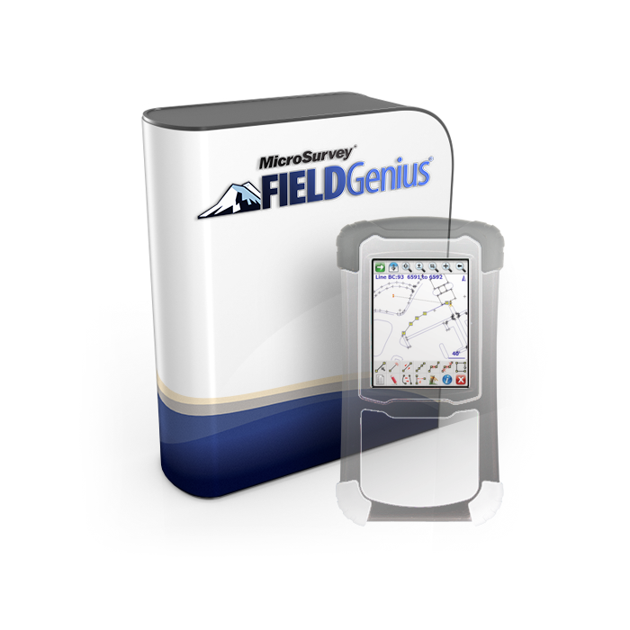
FieldGenius delivers powerful yet intuitive data collection, specifically designed for the demanding workflows of Land Surveyors and Construction Professionals. Experience streamlined essential fieldwork combined with seamless integration across your preferred devices and platforms.
Inquire Now
Enhance productivity with our user-friendly design. FieldGenius offers logical menus and clear workflows, minimizing training time and maximizing efficiency in the field.
Instantly visualize your project. Our dynamic map-based view displays points and linework graphically, providing crucial spatial context and clarity directly on your handheld.
Simplify field-to-finish. Effortlessly create accurate lines, curves, and figures directly in the field with intuitive tools, reducing drafting time back in the office.
Streamline your stakeout process. Create, manage, and easily navigate to design points using organized lists with clear graphical guidance and cut/fill indicators.
Powerful Coordinate Geometry in the field. Solve intersections, offsets, traverses, and more on-site, ensuring accuracy and reducing trips back to the office.
Introducing FieldGenius, the ultimate data integration hub for land surveyors. Seamlessly import ASCII files, leverage DXF for compatibility, and export your data in KMZ format for easy visualization and sharing. Back up and restore your projects effortlessly, ensuring data integrity and peace of mind. FieldGenius streamlines your workflow, giving you more time to focus on what matters most – accurate surveying.
FieldGenius adapts to your unique hardware needs, offering unparalleled flexibility for land surveyors and construction professionals. Seamlessly integrate your equipment, whether utilizing Total Station Resection, GNSS Rover RTK, or establishing a base via GNSS Reference Averaging. Ensure project accuracy with robust Grid to Ground GNSS Localization, maximizing the potential of your specific instrument setup
FieldGenius empowers land surveyors and construction profesionals with powerful in-field calculation and reporting tools. Efficiently run Traverse Calculations, compute Offset Line Intersections, and generate comprehensive GNSS Survey Reports directly on your data collector. Easily manipulate your project data using Translate, Rotate, and Scale functions for precise adjustments and deliverables.
Go beyond basic surveying with FieldGenius’ advanced capabilities. Efficiently execute complex tasks like Surface Staking and on-the-fly Volume Calculations, enhance your deliverables with integrated GIS Attribute Collection, and achieve precise site control using GNSS Local Transformation. FieldGenius equips you with the sophisticated tools needed for today’s most demanding projects.

Inquire Now
Read more

Inquire Now
Read more
Inquire Now
Read morePay securely with your Card, Apple Pay, or Google Pay via Paymob.
![]()
A payment link, also known as a checkout link, is a shareable URL that allows customers to make payments online.
Cash/Cheque payment/Bank transfer
Inquire price for MicroSurvey FieldGenius