MicroSurvey embeddedCAD is a Desktop Survey and Design Program Created for Surveyors, Contractors and Engineers that is Powered by Autodesk Technology™
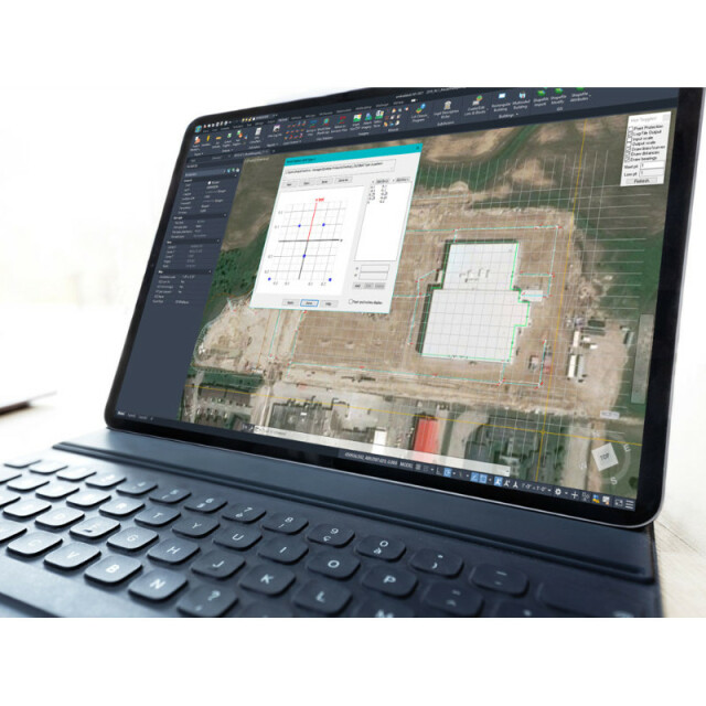
MicroSurvey embeddedCAD provides users with unencumbered survey drafting and calculation workflows in a familiar AutoCAD working environment, including COGO, point tools for gridline-based projects, traverse input and adjustment, misclosure reporting, common data collector support, 3D surface representation and computation, corridor design, and more.
AED 19,100.00
MicroSurvey embeddedCAD provides users with unencumbered survey drafting and calculation workflows in a familiar AutoCAD® working environment, including COGO, point tools for gridline-based projects, traverse input and adjustment, misclosure reporting, common data collector support, 3D surface representation and computation, corridor design, and more.
These utilities and the integrated AutoCAD® drafting tools are perpetually licensed and are designed to complement the professional land surveyor and their desire for maximum efficiency. With two product tiers, embeddedCAD allows the avid professional to choose precisely the features and price point they need to produce the quality deliverables they want. MicroSurvey embeddedCAD opens and saves the latest AutoCAD® drawing files, facilitating collaboration with existing AutoCAD® environments.
MicroSurvey offers free trial versions for all of its major software – download MicroSurvey embeddedCAD today.
|
Data management |
|
| Save standardization for drawings/maps | |
| Spatial reference system | Selectable |
|
Geometry types |
|
| Points | Point, Symbol, Text, Others |
| Lines | Line segment, Polyline, Multiline, Arc, B-spline, Others |
| Surfaces | Polygon, Others |
|
Other |
|
| License or freeware | License |
| Training | Y |
| Main users | Land Surveyors, Geomatics Technicians, Mapping Professionals |
| Main applications | Drafting, Plan Checking, Plan Calculation, Data Adjustment |
| Distinguishable features | Ease of Use, COGO, Lot Closures, Top-Notch Helpdesk, AutoCAD OEM Engine, Legal Description Writer, Database-linked Linework, Automatic Labeling, Direct support for most common Data Collector export formats, Traverse adjustments, Point Cloud support, and many more. |
| Related products | MicroSurvey CAD, MicroSurvey inCAD, MicroSurvey STAR*NET, MicroSurvey FieldGenius, MicroSurvey FieldGenius for Android |
|
2D Editing |
|
| Select | By drawing attributes, Select by administrative attributes, Within buffer, Spatial selection, Multiple select, Others |
| Remove | By select, By attributes, By layer, Others |
| Graphic transformations | Scale, Copy, Move, Rotate, Mirror, Align, Stretch, Others |
| Coordinate transformations | Points and associated lines are easily transformed between hundreds of coordinate systems, and can be adjusted using helmert’s transformations, least squares adjustments, and several others. |
|
2D Construction |
|
| Positioning in relation to other element | Extend, Perpendicular, Particular angle, Tangent, Others |
| Positioning by coördinates | Y |
| Positioning by snapping | Y |
| Positioning by Dimensions | Y |
|
Storage |
|
| Type of data storage | Database |
| Input formats | Dwg, Dxf, Shape, KML, GeoTiff, Jpg, Others |
| Export formats | Dwg, Dxf, KML, Jpg, Others |
| Compression | Y |
|
Visualisation |
|
| Types | Color, Pattern, Hatch, Gradient color |
| Change view | Zoomfactor, Target point, Twist angle |
|
Data analysis |
|
| Merge | Attribute table to geometry |
| Measurement | Area, Length, Others |
| Topology | Build, Check, Others |
| Clip | Y |
| Tools to detect errors | CAD Audit, Database Audit, Crash Recovery Wizard |
|
Interoperability |
|
| Web standards | |
| Spatial database management systems | |
| Messaging protocols | |
| Extensions | |
|
General |
|
| Supported operation system | Windows |
| Year of introduction | 2012 |
| Year of last update | 2022 |
| Supported hardware | PC, Laptop |
Inquire Now
Read more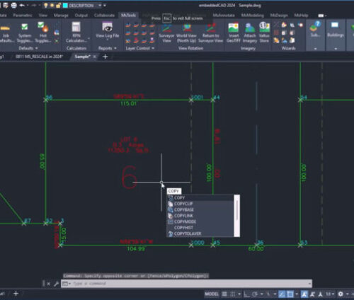


Inquire Now
Read more
Inquire Now
Read morePay securely with your Card, Apple Pay, or Google Pay via Paymob.
![]()
A payment link, also known as a checkout link, is a shareable URL that allows customers to make payments online.
Cash/Cheque payment/Bank transfer
Inquire price for MicroSurvey embeddedCAD