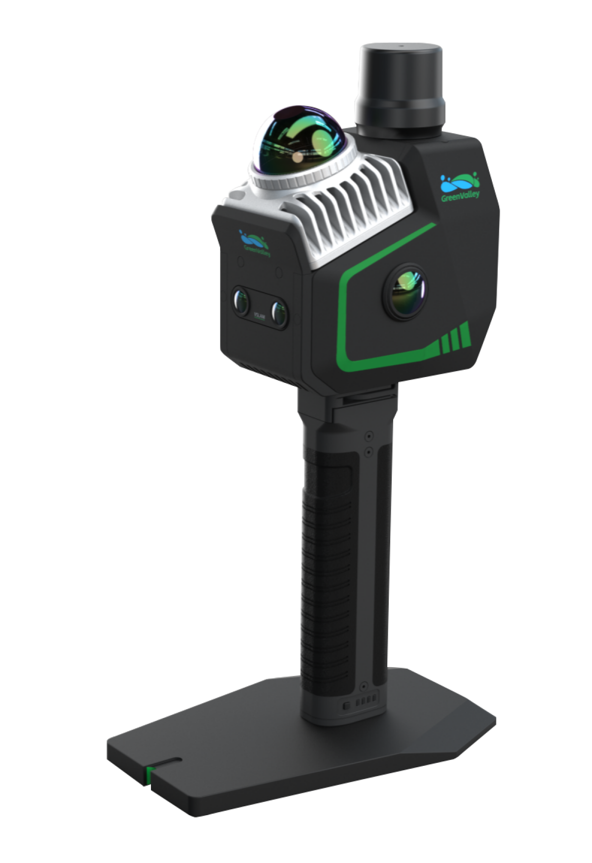
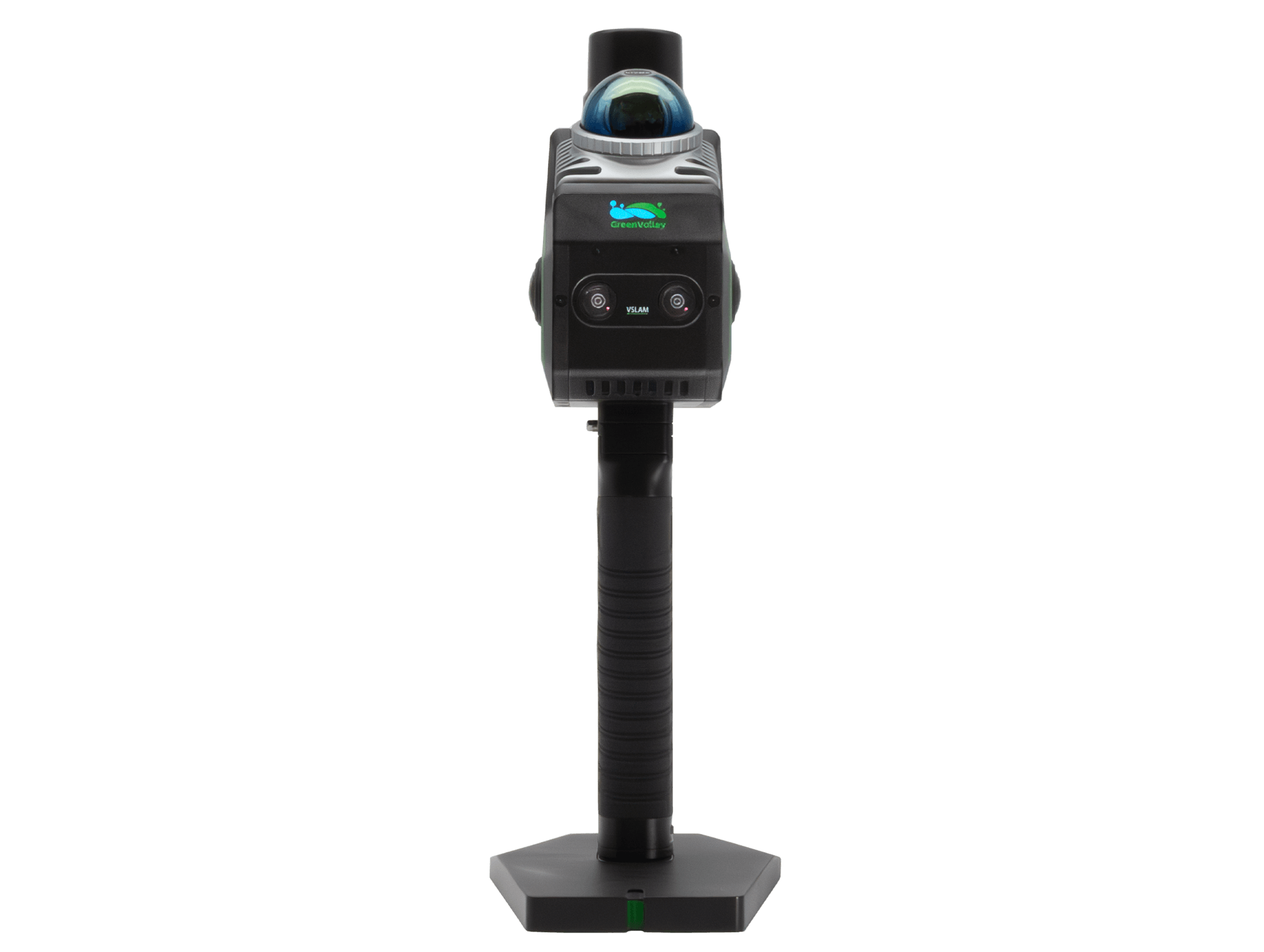
LiGrip O2 Lite is the latest-generation handheld SLAM product from GreenValley International (GVI), utilizing MLF-SLAM (Multiple Localization Fusion-SLAM) multi-sensor fusion positioning technology. It overcomes mapping challenges in featureless environments such as airports, beaches, and rivers, achieving centimeter-level data collection in all scenarios.

Weight
1.3 kg
Absolute Accuracy
<3 cm
LiDAR Scan Rate
200,000 pts/s
Maximum Detection Range
70 m
Panoramic Camera
12 MP x 2
VSLAM
1.3 MP x 2
Storage Capacity
512 GB SSD
Horizontality/Verticality
<0.025°
Innovatively developed MLF-SLAM algorithm.
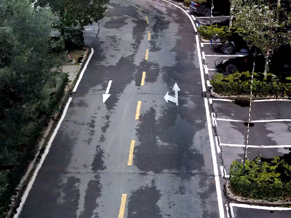
Effortlessly captures data in weak or featureless environments such as airports, beaches, and water surfaces.
3 cm accuracy with precise horizontal & vertical alignment.
Meets surveying-grade standards and streamlines fieldwork.
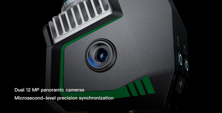
Dual 12 MP panoramic cameras: Microsecond-level synchronization to realistically restore scenes.
Visual SLAM (VSLAM) and LiDAR-SLAM deep fusion algorithm: Enables precise mapping in complex environments.
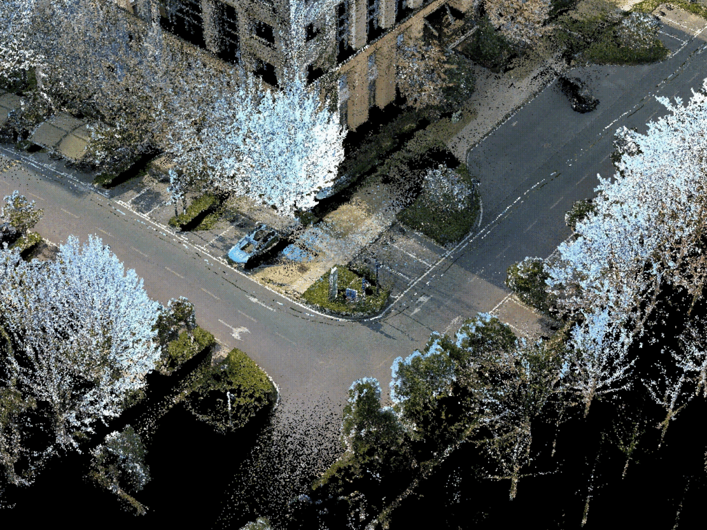
Real-time true-color point cloud mapping, ready for instant export.
Supports diverse applications like earthwork calculation, tree segmentation, and topographic mapping.
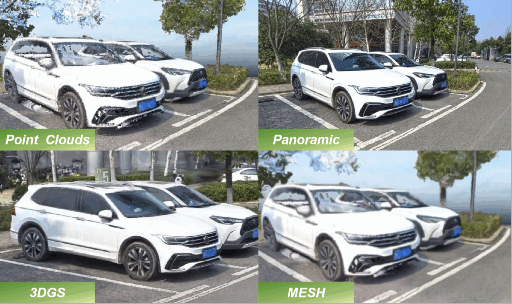
Integrated solution for multi-source data collection.
Outputs point clouds, images, 3DGS, MESH, and more—boosting efficiency and cutting costs.
Self-developed RTK-SLAM technology.
With a telescopic pole, enables full range high-precision RTK data collection.
Achieves <5 cm accuracy in 1 minute, even without GNSS.
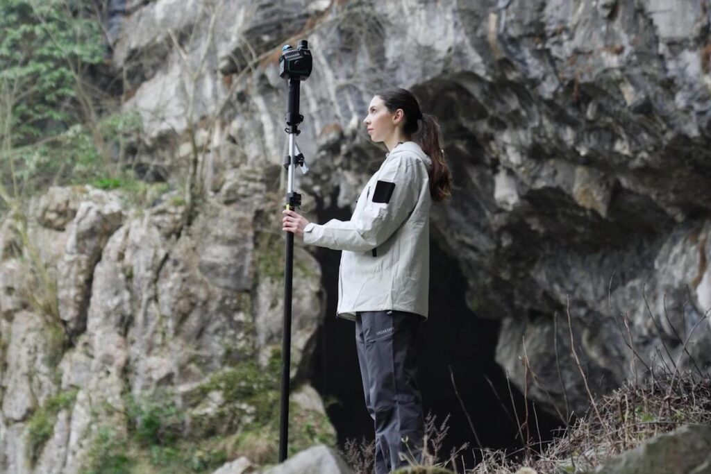
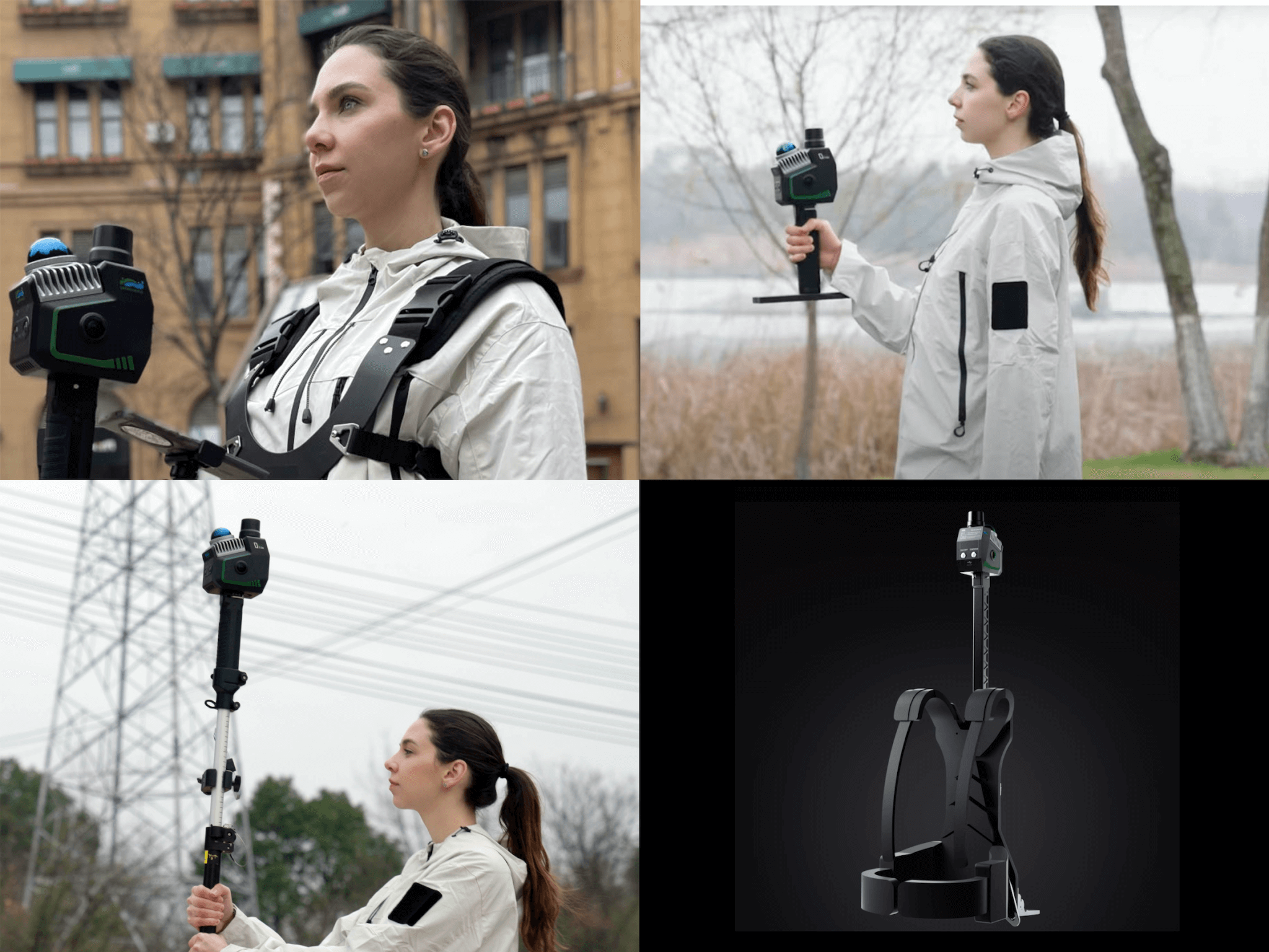
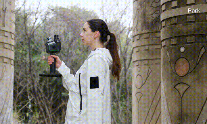
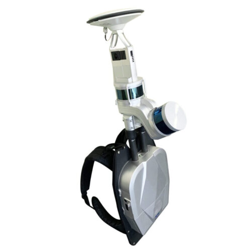
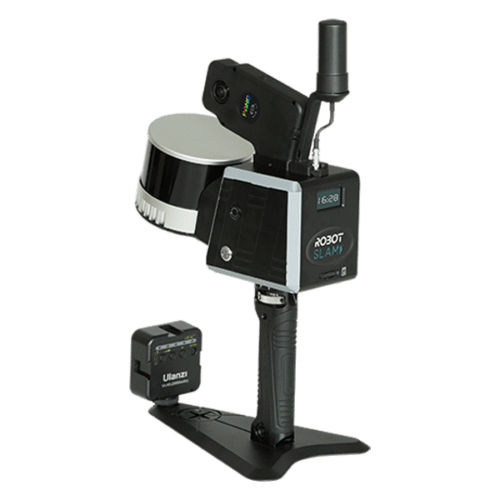
In addition to Handheld form, it supports various data collection configurations, including Backpack, Frontpack, and Telescopic Pole, enabling flexible adaptation to diverse customer collection scenarios.
| System Parameters | |||||
| Absolute Accuracy | <3 cm [1] | Protection Level | IP64 | ||
| Relative Accuracy | <2 cm [2] | Storage Capacity | 512 GB SSD | ||
| Repeat Accuracy | <2 cm [3] | Port | Type-C | ||
| Horizontality/Verticality | <0.025° [4] | Control Method | APP, Button | ||
| Power Supply Method | Lithium Battery Powered | Firmware Upgrade Method | OTA, Offline | ||
| Battery Capacity | 3450 mAh | Operating Temperature | -20℃ ~40℃ | ||
| Single Battery Life | 2 h [5] | Device Storage Temperature | -40℃ ~70℃ | ||
| Weight | 1.3 kg (with base, battery, and RTK module) | Battery Storage Temperature | Recommended Storage Temperature: 22℃ ~ 30 ℃ [6] | ||
| Dimensions | 345×187×120 mm | ||||
| LiDAR Sensor Parameters | |||||
| Laser | Mid360 | Laser Wavelength | 905 nm | ||
| Scan Rate | 200,000 pts/s | Detection Range | 40 m @ 10% reflectivity; 70 m @ 80% reflectivity |
||
| LiDAR Accuracy | 2 cm | FOV | Horizontal 360 ° , Vertical -7 ° ~ 52 ° | ||
| Safety Level | Class 1 (Eye-safe) | ||||
| Camera Parameters | |||||
| Number of Cameras | 4 | Panoramic Camera | 12MP ×2 | ||
| Visual Camera | 1.3MP×2 | Frame Rate | Adjustable | ||
| RTK Parameters | |||||
| Satellite Systems | BDS B1I, B2I, B3I, B1C, B2b; GPS L1C/A, L2C, L2P(Y), L5; GLONASS G1, G2; Galileo E1, E5a, E5b, E6*; QZSS L1C/A, L2C, L5 ; SBAS L1C/A |
RTK Accuracy | Horizontal: 0.8 cm + 1 ppm Vertical: 1.5 cm + 1 ppm |
||
| Channels | 1408 | Differential Data | RTCM V3.X | ||
| RTK Differential Protocol | NTRIP | RTK Data Format | .rtk | ||
| IMU Parameters | |||||
| Output Frequency | 200 Hz | Post-Processing Position Accuracy | Horizontal: 0.01 m, Vertical: 0.02 m | ||
| Post-Processing Attitude Accuracy | Roll/Pitch: 0.005°, Heading: 0.01° | ||||
| Mapping Method | |||||
| Mapping Principles | MLF-SLAM, PPK-SLAM, RTK-SLAM, SLAM | Real-Time Processing | Supported | ||
| Real-Time Colorization | |||||
| Output Specifications | |||||
| Colored Point Cloud | LAS, LiData | Panoramic Image | imglist + JPG | ||
| MESH | LOD-OSGB | Gaussian Splatting | lisplat, ply | ||
| Telescopic Pole Adapter | |||||
| 300 g | Supported Telescopic Pole Diameter | 25-25.5 mm [7] | |||
| Compatibility | LiGrip O Series (includes O1 Lite and O2 Lite) | ||||
| Frontpack Kit Parameters | |||||
| 2.1 kg | Outer Packaging Dimensions | 560×340×160 mm | |||
| LiGrip H Series and O Series | |||||
| Backpack Kit Parameters | |||||
| 3.9 kg | 580×303×145 mm | ||||
| Dual battery power display | Hot Swap | ||||
| LiGrip O2 Series | |||||
[1] [2]: Measured in GreenValley’s precision field; deviations may occur in some scenarios.
[3]: Two scans with GNSS, with GNSS disconnection not exceeding 100 meters.
[4]: Requires measurement of absolutely horizontal and vertical objects such as building walls and interiors.
[5]: Battery life tested at 20°C without camera recording or RTK connection.
[6]: -20°C to 45°C for <1 month; -20°C to 35°C for >1 month.
[7]: Only supports the outer diameter of the telescopic part in the range of 25-25.5 mm for RTK telescopic poles; The locking device does not support RTK telescopic poles with a protruding circular ring on the top contact surface.
Pay securely with your Card, Apple Pay, or Google Pay via Paymob.
![]()
A payment link, also known as a checkout link, is a shareable URL that allows customers to make payments online.
Cash/Cheque payment/Bank transfer
Inquire price for GreenValley LiGrip O2 Lite All-Scenario Handheld SLAM LiDAR Scanner