Gamma-ray spectrometry has become an indispensable tool for environmental science, mining, agritech, and contamination assessment. By measuring the energy and intensity of gamma rays emitted by naturally occurring or anthropogenic radionuclides, a gamma-ray spectrometer (GRS) can accurately identify elements such as potassium, uranium, thorium, and cesium. Each of these isotopes emits radiation at specific energy levels, allowing users to map soil composition, detect contamination, and characterize geological formations with exceptional precision.
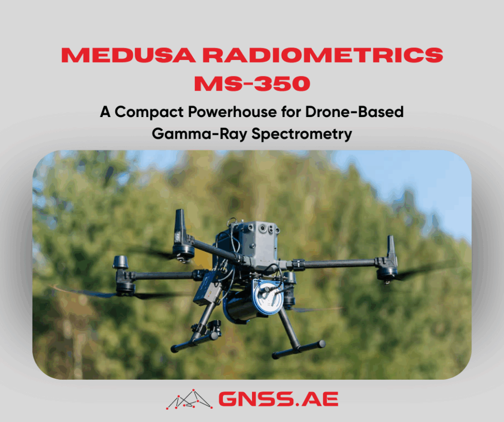
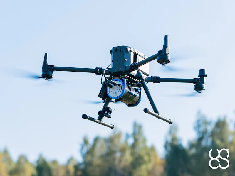
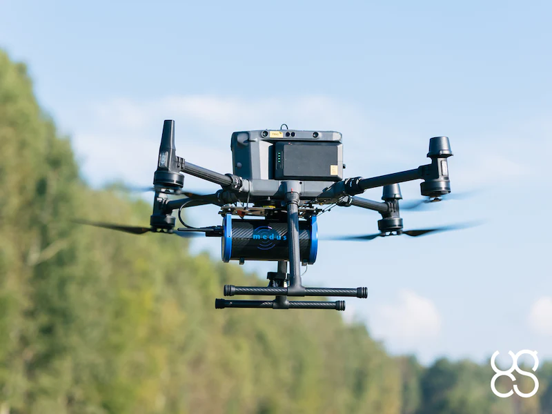
Among the leading technologies in this space is the Medusa Radiometrics MS-350—a lightweight, rugged, and highly efficient gamma-ray spectrometer engineered for seamless drone integration.
Designed for flexibility and field performance, Medusa Radiometrics MS-350 stands out as a perfectly balanced solution for UAV-based gamma-ray surveys. Weighing just 2.7 kg, it is compact enough to be mounted on the most popular industrial drones, including DJI Matrice 350 RTK.
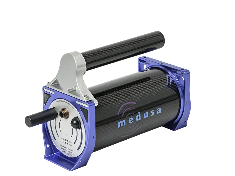
Despite its compact size, the MS-350 houses a durable 350 ml CsI scintillator crystal, ensuring high-quality gamma-ray detection across diverse environments. MS-350 is widely considered the most practical and popular sensor for drone-borne topsoil mapping. It delivers the right combination of performance, size, and operational efficiency—especially when paired with the DJI Matrice 350 RTK.
Medusa Radiometrics drone-integrated gamma radiation solution leverages the MS-350 to detect gamma-ray emissions from soil and geological formations. As the drone flies over an area, the sensor captures emissions from key radionuclides:
The result is highly precise radiometric data that reveals even subtle variations in radionuclide concentrations—essential for soil mapping, environmental analysis, and mineral exploration. When paired with optimized flight parameters (altitude, speed, and line spacing), the MS-350 produces survey-grade results comparable to much larger, heavier systems.
Typical mapping speed: up to 15 km/h
Outputs: JSON, NMEA, CSV
Modes: Drone-borne or handheld
Features: On-board processing, integrated data storage, continuous firmware updates
Lightweight & Compact:
At only 2.7 kg, the sensor is easy to integrate across a broad range of drones and can also be used for handheld surveys.
Rugged Construction:
Equipped with a 350 ml CsI scintillator crystal, the MS-350 ensures reliable performance in challenging field conditions.
User-Friendly Operation:
Designed for straightforward deployment with simple setup, intuitive operation, and seamless software integration.
Future-Proof:
Offers on-board processing, integrated data storage, and lifetime feature updates for long-term usability.
The MS-350 expands the reach of gamma-ray surveys into environments where traditional ground-based measurements are slow, risky, or impractical. Its lightweight design and drone integration make it ideal for:
Environmental & Safety-Critical Applications
Mineral Exploration
Agritech & Soil Science
Remediation & Land Restoration
By enabling surveys over rocky terrain, wetlands, swamps, steep pits, and large hazardous zones, the MS-350 dramatically increases efficiency and operator safety. Drone integration allows users to gather high-resolution radiometric data from areas previously unreachable by ground teams.
As environmental monitoring, mineral exploration, and agritech increasingly rely on fast, accurate, and non-invasive data collection, Medusa Radiometrics MS-350 has emerged as a market-leading solution. Its exceptional balance of size, sensitivity, and operational simplicity combined with the adaptability of modern drone platforms makes it the preferred tool for professionals conducting topsoil mapping and radiometric surveys worldwide.
Compact, capable and field-proven, the MS-350 continues to redefine what’s possible in airborne gamma-ray spectrometry.