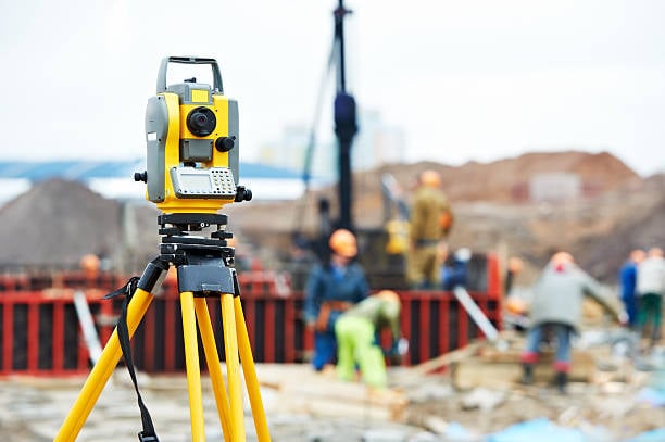
Across multiple industries, drone technology has reshaped how professionals collect data, conduct surveys, and monitor the environment. What once felt like science fiction—a flying robot capturing high-precision images—has become a standard part of modern workflows. Today, specialists in agriculture, civil construction, topographic surveying, and environmental monitoring rely on drone platforms to generate accurate maps and detailed 3D terrain models.
Aerial mapping with drones is conceptually simple: the UAV follows a predefined route at consistent altitude and speed, capturing a sequence of overlapping images. Photogrammetry software then stitches these photos into precise geospatial products. However, behind this seemingly straightforward process lies sophisticated imaging technology that determines whether the results will be reliable, distortion-free, and suitable for professional use.
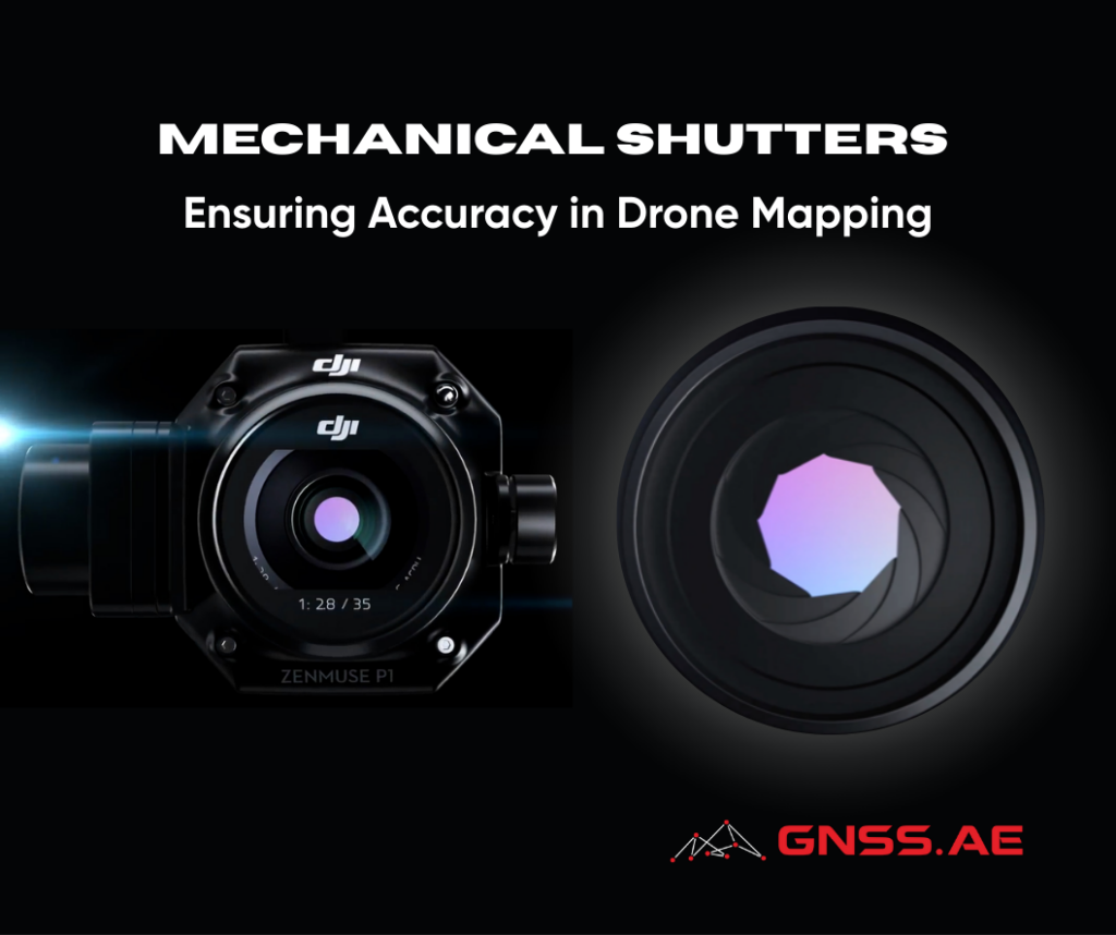
One of the most important components in professional mapping drones is the mechanical shutter. This article explores what mechanical shutters are, how they differ from other shutter types, and why they are essential for achieving the image quality required in surveying and mapping missions.
To understand the value of mechanical shutters, it is useful to review how modern drone cameras operate.
When light enters a camera, it strikes an image sensor composed of millions of pixels made from CMOS (Complementary Metal-Oxide Semiconductor) materials. Each pixel converts incoming light into an electrical signal, forming the basis of the captured image.
The shutter controls the exposure—how long the CMOS sensor receives light.
While this process sounds simple, the method by which the shutter exposes the pixels dramatically affects image accuracy, especially when the camera or the environment is in motion, as is typical in drone mapping missions.

Mechanical shutters physically expose the entire sensor at once.
This means every pixel captures the same moment in time, eliminating exposure delays across the frame.
Professional mapping drones such as:
all use mechanical shutters for this reason.
Electronic shutters expose the sensor line-by-line, from top to bottom.
This creates a slight time lag between the first row of pixels and the last.
Under normal conditions, this produces acceptable results. However, when capturing fast-moving objects—or when the camera itself moves rapidly, as in high-speed drone flights—the delay introduces distortions such as:
For mapping flights, where the drone is constantly moving, these distortions can negatively affect photogrammetric accuracy.
Surveying, photogrammetry, and GIS workflows demand centimeter-level accuracy, especially when paired with RTK-enabled drones. Any distortion in source images can reduce the reliability of orthomosaics, point clouds, and 3D models.
Mechanical shutters help ensure:
Although rolling shutters can work in controlled, low-motion environments, mechanical shutters remain the gold standard for aerial mapping.
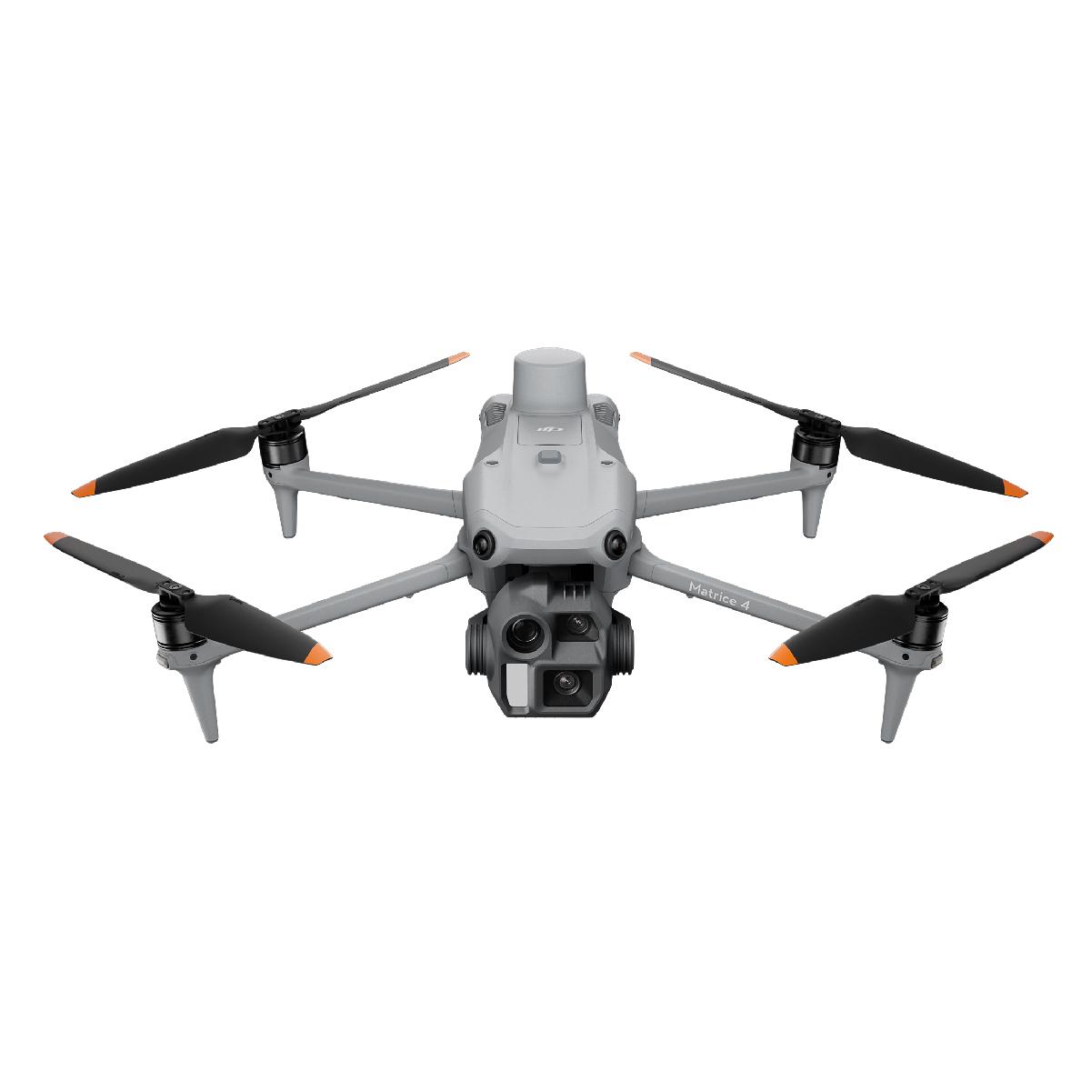
A compact yet highly capable mapping drone, DJI M3E features:
Its fast capture rate reduces total flight time and increases mission productivity.
DJI Matrice 4E supports high-speed capture with 0.5-second intervals in both orthophoto and oblique modes.
With mapping speeds up to 21 m/s, it offers exceptional efficiency for large-scale surveys.
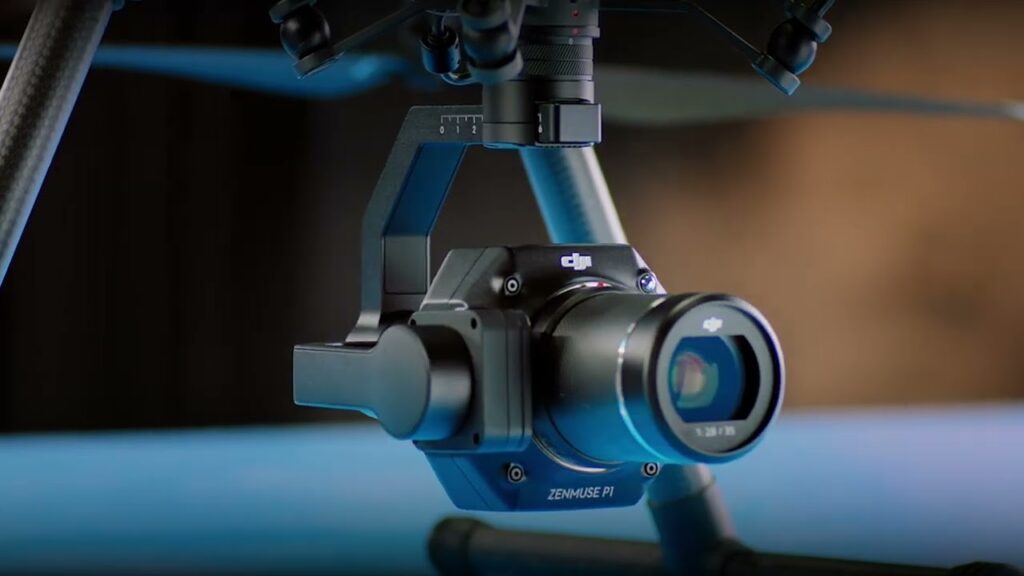
DJI Zenmuse P1 is DJI’s flagship photogrammetry payload, featuring:
Mounted on DJI Matrice 350RTK, Zenmuse P1 enables highly accurate, large-scale data capture with unmatched reliability.
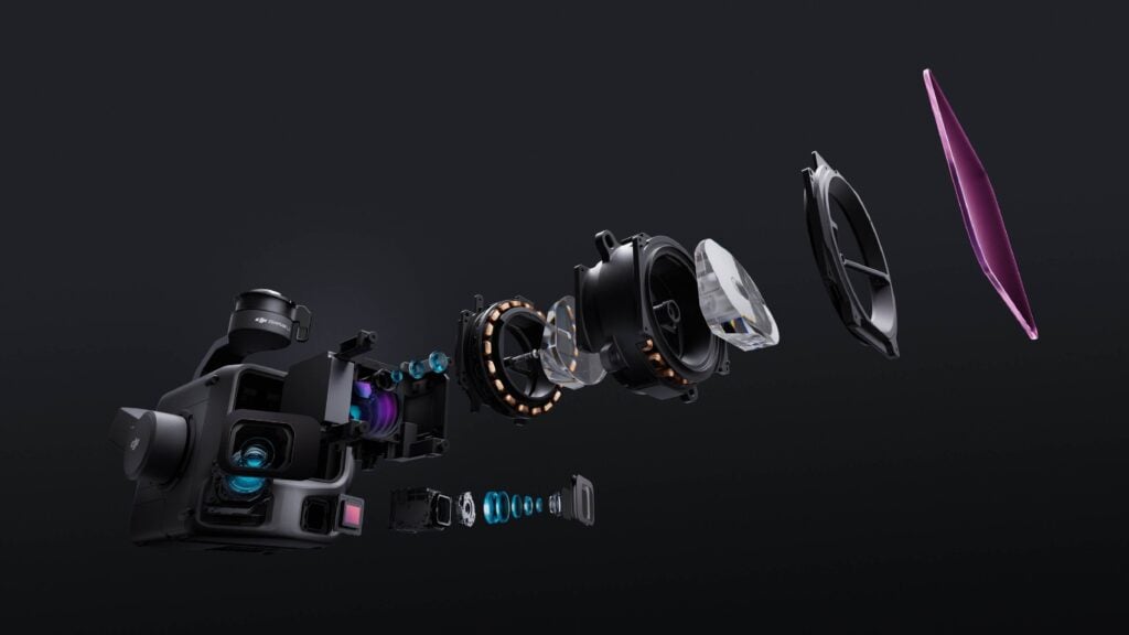
DJI Zenmuse L3 sets a new standard for high-precision geospatial data acquisition, combining a powerful LiDAR sensor with dual 100 MP RGB cameras and a high-accuracy POS system. This integration enables surveyors to generate multiple mapping deliverables in a single flight, significantly accelerating field productivity.
A key advantage of the Zenmuse L3 is that its mapping cameras utilize both a mechanical shutter and an electronic shutter, giving operators superior control over image capture during high-speed flights and in dynamic lighting conditions.
The dual 4/3 CMOS RGB sensors offer:
Mechanical Shutter:
• 2–1/1500 s at f/2.0
• 2–1/2000 s at f/2.8–f/11
With this versatile shutter system, DJI Zenmuse L3 delivers distortion-free captures, maintains exposure accuracy across different apertures, and supports high-speed mapping without rolling-shutter artifacts.
Combined with DJI Matrice 400, Zenmuse L3 delivers a complete, end-to-end mapping workflow.
For aerial mapping, a mechanical shutter is not just a feature, it is an operational requirement.
Choosing a drone with a mechanical shutter camera ensures distortion-free images, consistent accuracy, and better performance during dynamic flight conditions.
DJI Enterprise platforms, including DJI Matrice 4E, Mavic 3 Enterprise, Zenmuse P1, and Zenmuse L3, provide the advanced imaging capabilities that surveying, engineering and geospatial professionals depend on.
At GNSS.AE, we offer the most advanced DJI Enterprise solutions, along with expert technical support to help integrate these systems into your surveying, mapping and engineering workflows.
Our team can guide you in selecting the ideal drone based on your project requirements, ensuring that every mission is efficient, precise and reliable.
Contact us today and take your aerial operations to the next level.