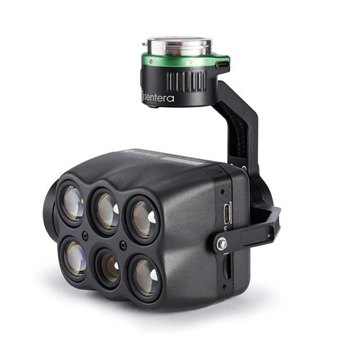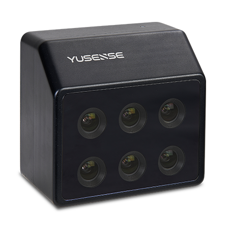

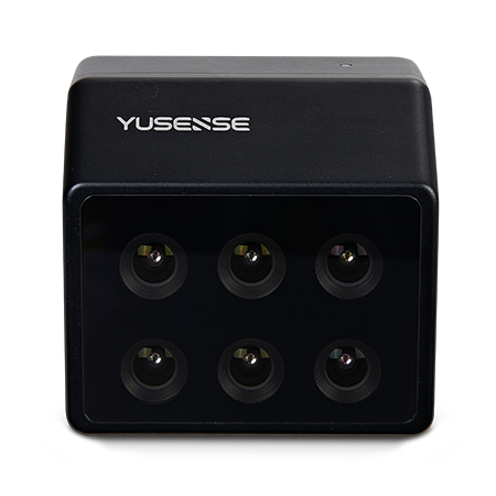
6-band universal multispectral camera Yusense MS600 V2:
Vegetation index was constructed based on the fingerprint spectrum of vegetation to complete the spatial distribution and area statistics of target vegetation in the designated area, and to provide quantitative vegetation canopy density data for scientific research and production inagriculture, forestry and grass, ecology and other fields.

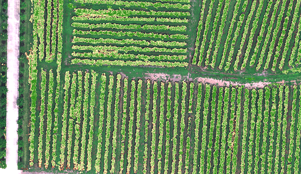
By using vegetation factors such as NDVI and LAI, quantifying the consistency of vegetation canopy status at different spatial scales, and using characteristic spectra of vegetation in different health states to quantitatively assess ve-getation growth,which can prov-ide data support for irrigation, fe-rtilization, plant protection, yield evaluation and other work.
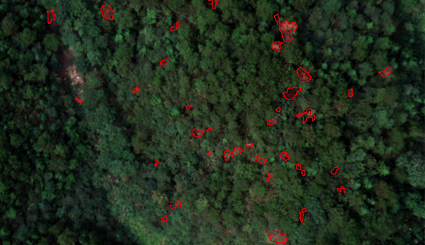
Using spectrum and texture information to achieve efficient suppression of the environmental background of soil, withered grass and other objects and high-precision identification of colorchange pine. By accurately extracting the location, spatial distribution and canopy area of color-changing pine trees, we can provide data support for the management of diseased trees.
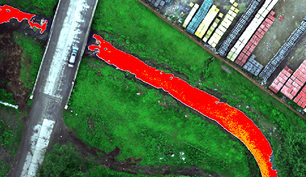
With reference to the relevant documents of national ecological environment standards, the classification index is constructed by using the characteristic spectrum to realize the hierarchical inversion of eutrophication/black and odorous water body on the water surface and the auxiliary analysis of spatial information statistics on the impact of domestic sewage, industrial wastewater, farmland wastewater, fishery and aquaculture on the surrounding water body, so as to assist the investigation of pollution sources
| Combination method | 6 multispectral channels |
| Target size | 1/3” |
| Effective Pixels | 1.2Mpx |
| Shutter type | Global |
| Quantization bit number | 12bit |
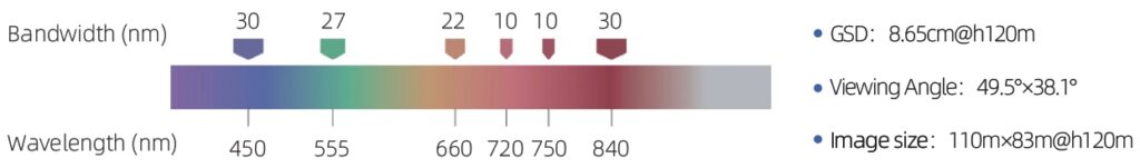
| Field of view | 49.5°×38.1° |
| Ground resolution | 8.65cm@h120m |
| Coverage Width | 110m×83m@h120m |
| Spectral channel [1] | 450nm@30nm,555nm@27nm, 660nm@22nm,720nm@10nm,750nm@10nm, 840nm@30nm |
| Optical Window | Sapphire optical glass window |
| Host size | ≤130mm×160mm×150mm (optical axis vertical to the ground) |
| Host weight | ≤670g |
| Mounting interface | X-Port |
| powered by | X-Port |
| Power consumption | ≤25W |
| Image Format | 16-bit raw TIFF & 8-bit reflectivity JPEG (including GPS, ambient light information) |
| Video Format | — |
| Storage Media | Standard 64G, maximum support 128G capacity (transmission speed U3 and above rating) micro SD card |
| Processing software | Yusense Map/Yusense Map Plus |
| parameter settings | DJI Pilot |
| Shooting trigger | Overlap rate trigger, timing trigger |
| Shooting frequency | 1Hz (related to the actual reading and writing speed of the storage medium) |
| Working temperature | -10℃~+50℃(Relative wind speed≥1m/s) |
| Storage temperature | -30℃~+70℃ |
| environment humidity | RH(%)≤85%(non-condensing) |
| certified product | CE, FCC, RoHS |
Note: [1] Standard wavelengths allow customization of the following 18 wavelength combinations: 410nm@35nm, 450nm@30nm, 490nm@25nm, 530nm@27nm, 555nm@27nm, 570nm@32nm, 610nm@30nm, 650nm@27nm, 660nm@22nm, 680nm@25nm, 720nm@10nm, 720nm@15nm (Qualcomm), 750nm@10nm, 780nm@13nm, 800nm@35nm, 840nm@30nm, 900nm@35nm, 940nm@35nm (tolerance ±5nm).
Pay securely with your Card, Apple Pay, or Google Pay via Paymob.
![]()
A payment link, also known as a checkout link, is a shareable URL that allows customers to make payments online.
Cash/Cheque payment/Bank transfer
Inquire price for Yusense MS600 V2