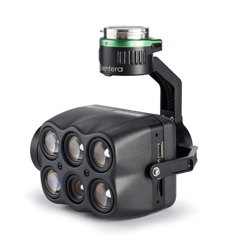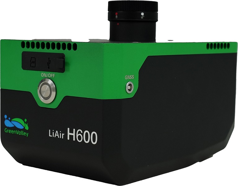
The LiAir H600 is the latest-generation lightweight, medium-range LiDAR scanning system developed by GreenValley International (GVI). It integrates compact mapping-grade LiDAR, proprietary high-precision inertial navigation system, and a high-resolution mapping camera. The entire system weighs only 1.3 kg and can measure distances up to 750 meters.

Detection Range
750 m
Weight
1.3 kg
Scan Rate
550 kHz
Accuracy (Vertical)
±5 cm @ 200 m
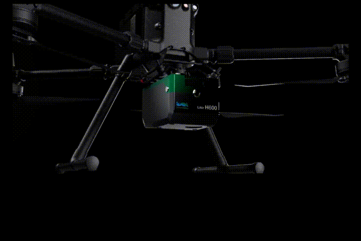
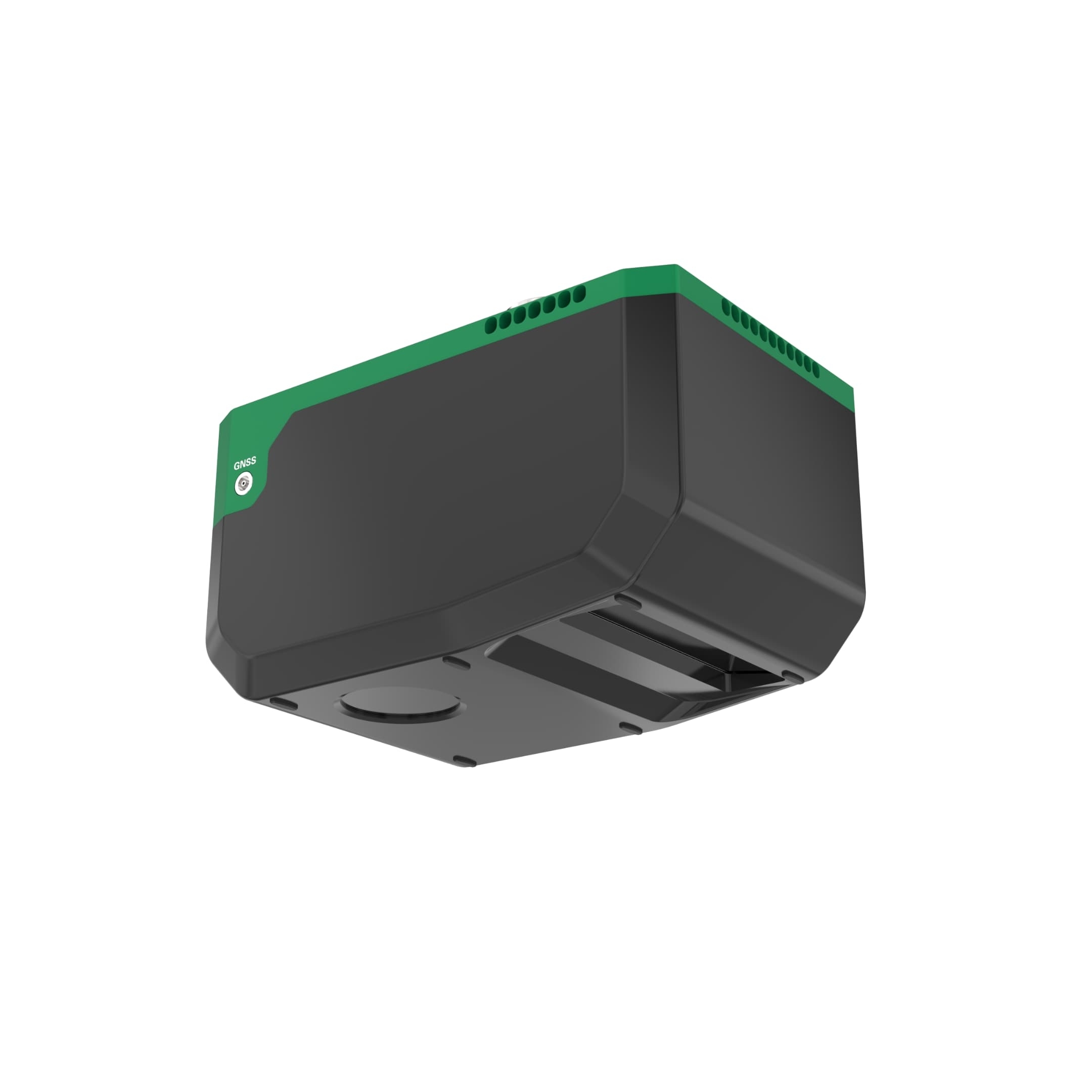
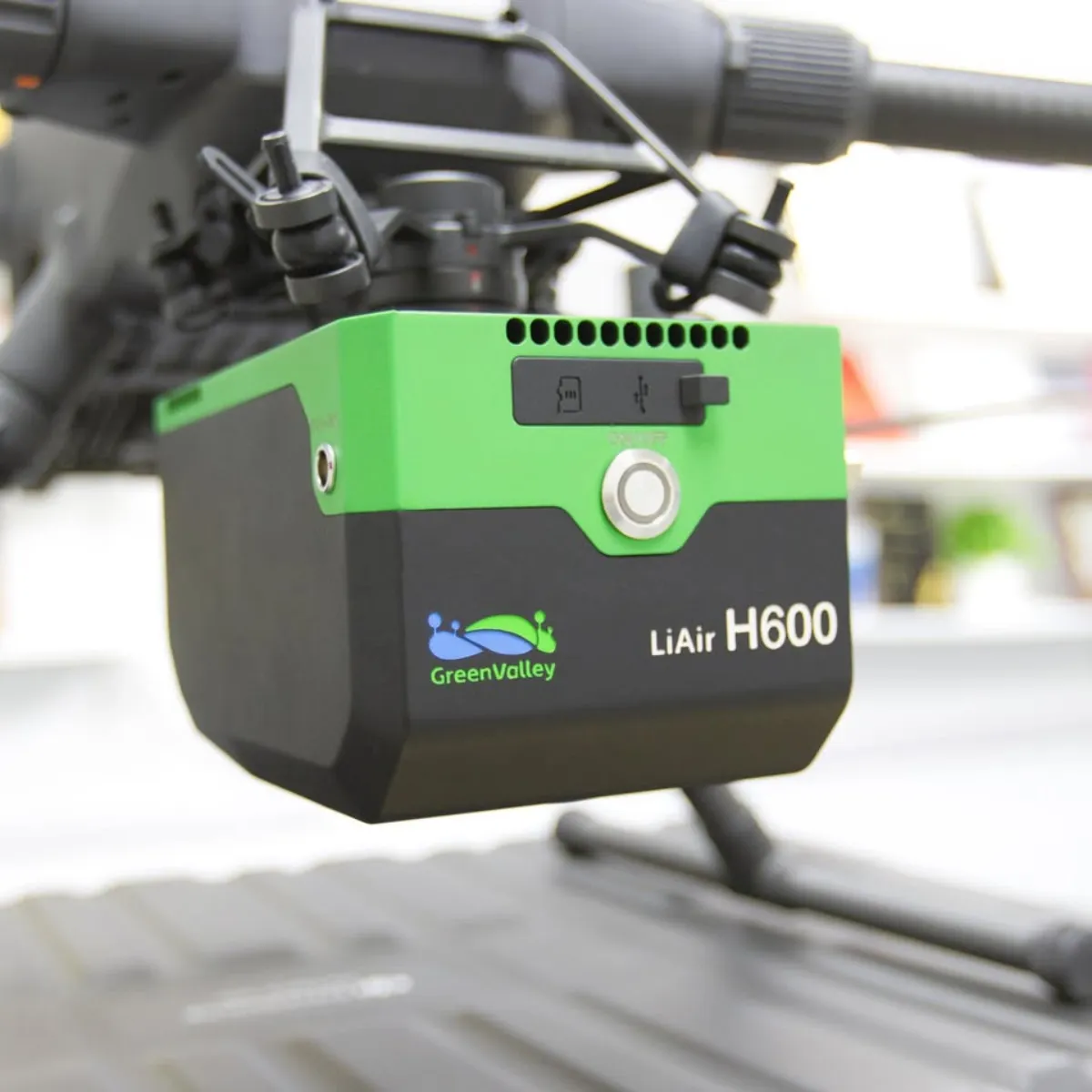
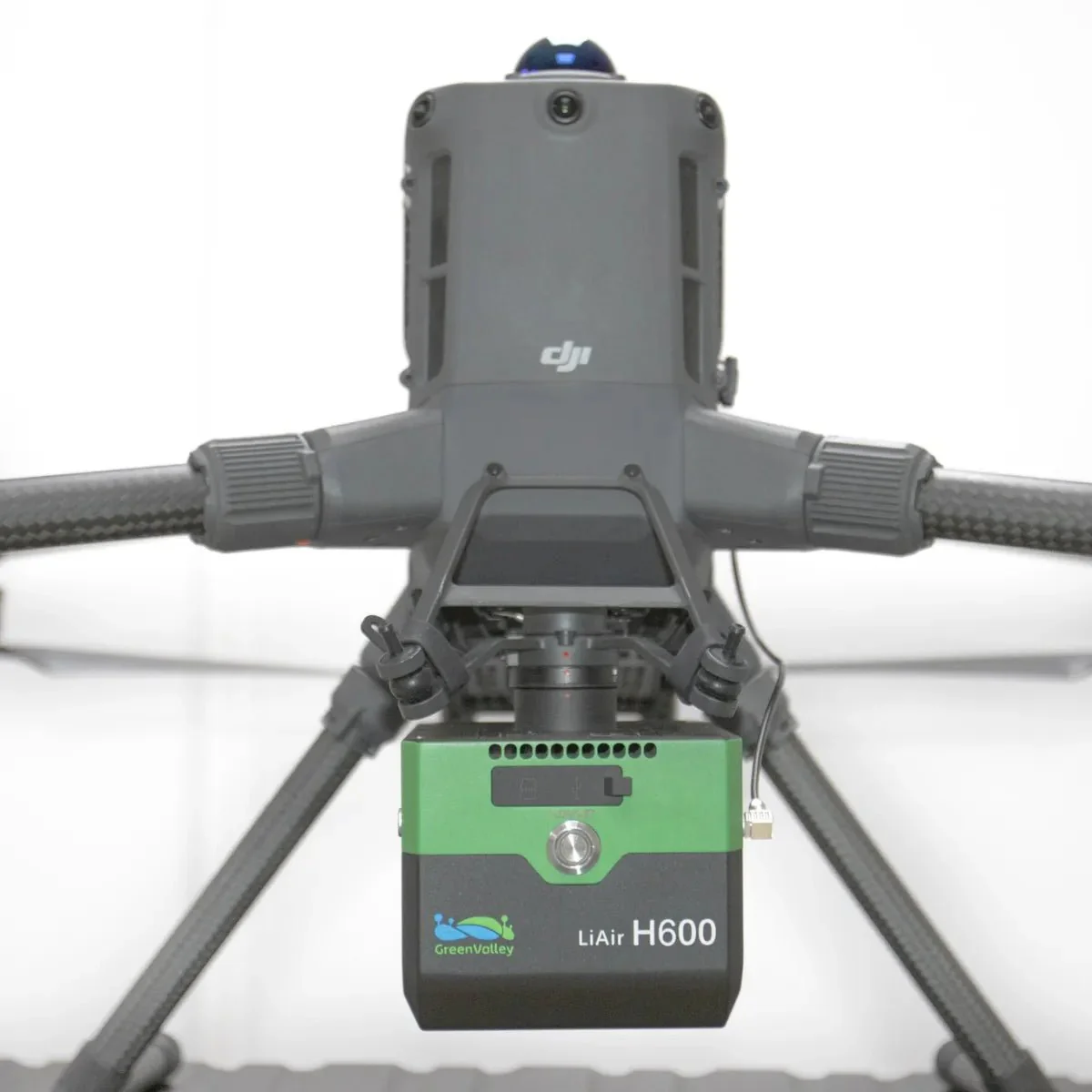
LiDAR, IMU, camera, and storage integrated into a 1.3 kg compact unit, compatible with most rotorcraft and fixed-wing aircraft.
High-performance LiDAR enables a maximum ranging distance of 750 meters.
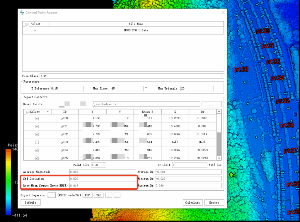
Integrated mapping-grade LiDAR with <5 cm elevation accuracy and <3 cm point cloud thickness at 200 meters.
Features maximum 550 kHz point frequency, 80° horizontal FOV, and over 350 m swath width at 200 meters.

Offers 7 configurable settings for flight height, data frequency, and energy.
Automatically adjusts scan speed to maintain consistent point cloud distribution and accuracy.
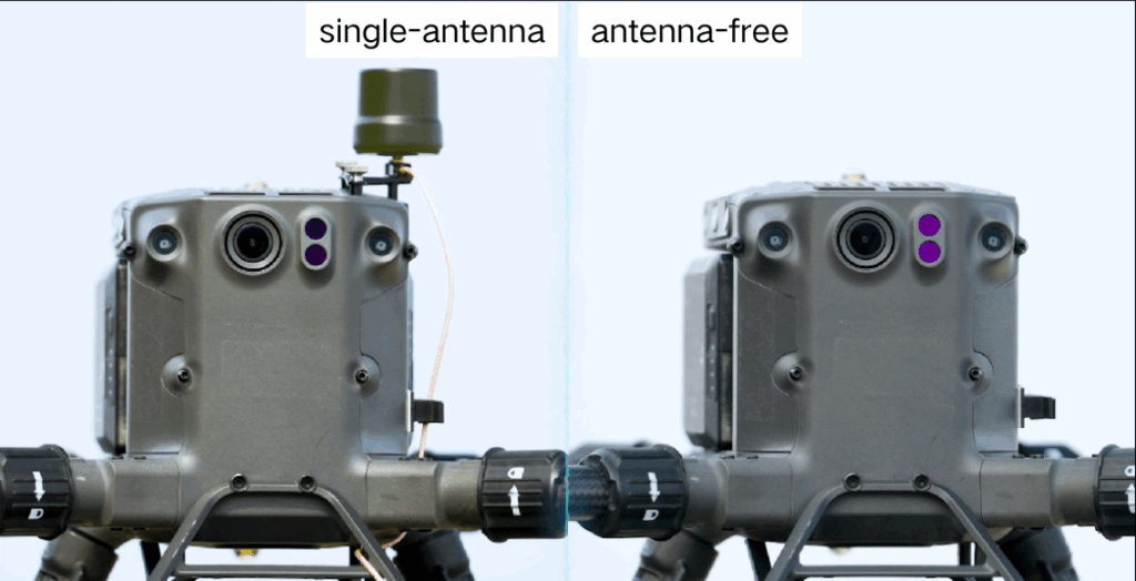
Mounts directly on DJI M300/M350RTK with no external antennas needed.
Captures high-precision GNSS data for centimeter-level point cloud generation.
Built-in 26 MP mapping camera captures 4.7 cm resolution from 200 m altitude.
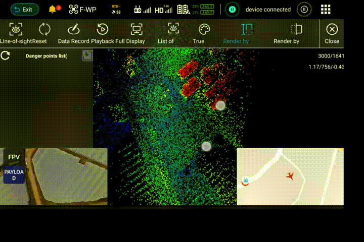
Supports 720P/30FPS live video for real-time monitoring and enhanced operational control.
| System Accuracy (Vertical) | ±5 cm @ 200 m | Weight | 1.3 kg |
| Dimensions | 179×114×127.2 mm | Storage | 256 GB TF Card |
| Voltage | 14~24 V, 2.34 A @ 24 VDC Power Consumption | About 50 W | |
| Communication | WiFi / USB-C Operating Temperature | -20~50 ℃ | |
| Protection Class | IP64 | Storage Temperature | |
| LiDAR Sensor Parameters | |||
| Wavelength | 1535 nm | Detection Range | 267 m @ 10% reflectivity 750 m @ 80% reflectivity |
| FOV | 80° | Repeatability Accuracy | 5 mm @ 100 m |
| Number of Returns | Unlimited Waveform Returns[1] | Scan Rate | 100,000~550,000 pts/s |
| Inertial Navigation System | |||
| GNSS | GPS, GLONASS, BDS, Galileo | Azimuth Accuracy | 0.019° |
| IMU Data Frequency | 500 Hz | Attitude Accuracy | 0.006° |
| Camera Parameters | |||
| Pixels | 26 MP | Focal Length | 16 mm / 24 mm ( Equiv. Focal Length ) |
| Image Resolution | 6252×4168 | ||
| Software | |||
| Control Software | GreenValley Pre-Processing | LiGeoreference | |
| Post-Processing | LiDAR360 / LiPowerline (Optional) | ||
| [1] The theoretical maximum number of returns can only be achieved under specific conditions and is constrained by the actual test scenario. | |||
Pay securely with your Card, Apple Pay, or Google Pay via Paymob.
![]()
A payment link, also known as a checkout link, is a shareable URL that allows customers to make payments online.
Cash/Cheque payment/Bank transfer
Inquire price for GreenValley LiAir H600 Compact Long Range UAV LiDAR System