AED 31,499.00
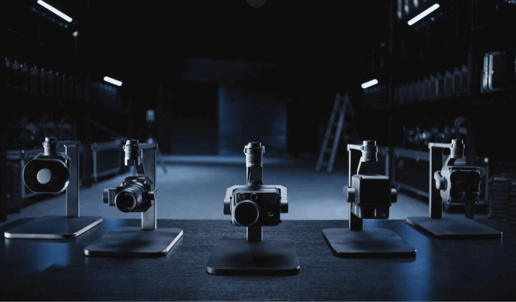
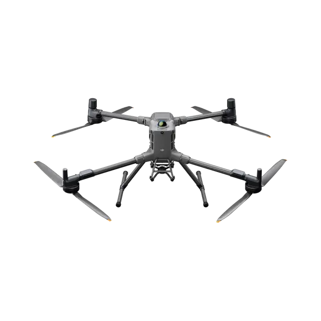
DJI Matrice 400, the enterprise flagship drone platform, boasts an impressive 59-minute flight time [1], a payload capacity of up to 6 kg [2], and integrated rotating LiDAR and mmWave radar for power-line-level obstacle sensing [3]. It also supports the O4 Enterprise Enhanced Video Transmission and Airborne Relay Video Transmission [4], ensuring safer handling and easier operations. Combining Smart Detection with visible and thermal imaging, AR projection, ship-based takeoff/landing, and advanced automation, Matrice 400 excels in emergency response, power inspections, mapping, and AEC.
The Matrice 400’s advanced obstacle sensing system integrates rotating LiDAR, high-precision mmWave radar, and full-color low-light fisheye vision sensors [13], pushing detection capabilities to unprecedented levels. The system detects even small obstacles like high-voltage power lines across mountainous terrain — even in darkness [3]. It can penetrate rain and fog to sense its surroundings, providing enhanced safety in challenging weather conditions.
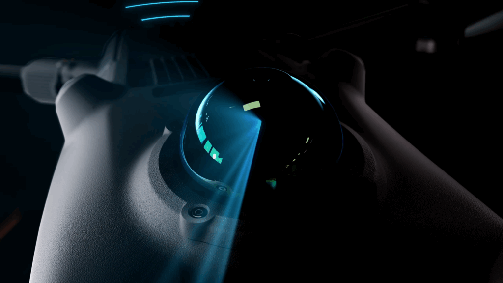
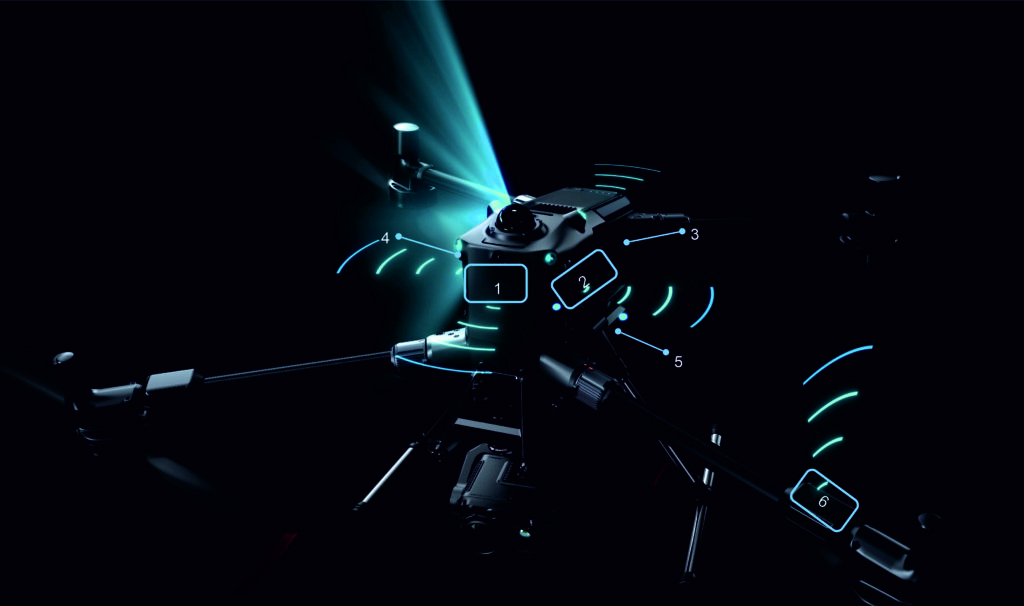
The four full-color low-light fisheye vision sensors on the aircraft provide Full-Color Vision Assist [13] to ensure safer flight.
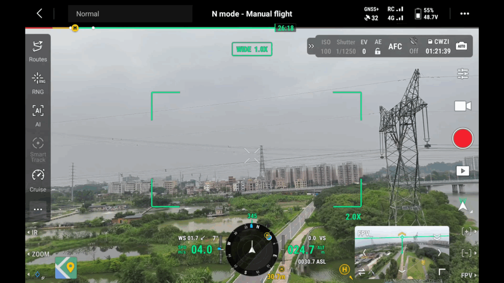

Matrice 400 supports Real-Time Terrain Follow flight in any horizontal direction [15]. This feature can be enabled during both manual flight and automated flight routes, ensuring stable relative height to the ground.
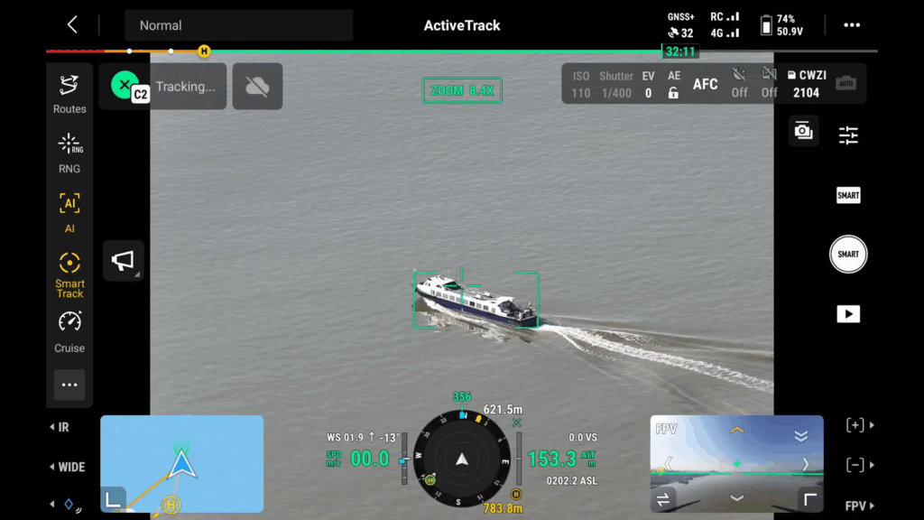
During large-scale search and rescue operations, the size of ground subjects can be kept consistent on the remote controller screen, reducing the need for frequent zoom adjustments and improving efficiency. During mapping missions, a consistent ground sampling distance (GSD) can be maintained to obtain high-precision mapping data.
To address the needs of offshore operations such as maritime patrol and wind turbine inspection, Matrice 400 is equipped with the capability to take off from and land on ships, supporting takeoff from stationary vessels and landing on moving vessels. By detecting landing point patterns on the deck, it can achieve safe and precise landings.
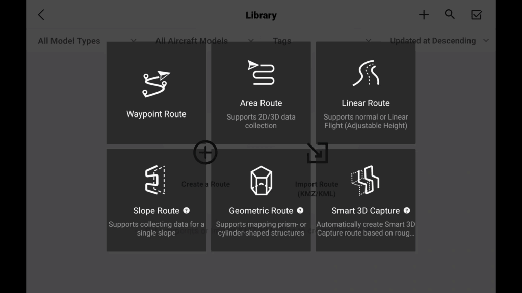
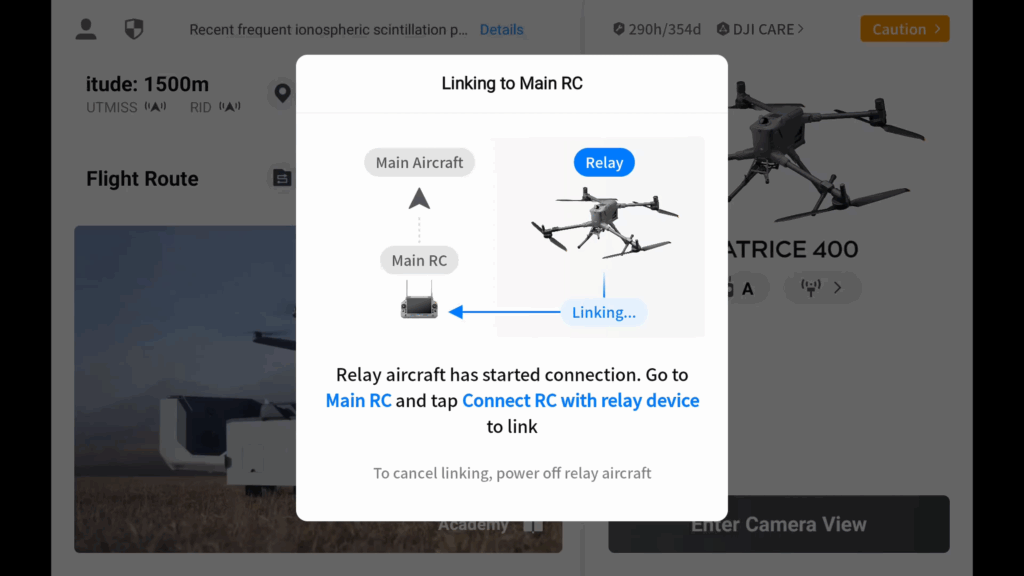
Specifically for the Matrice 400, DJI FlightHub 2 has been upgraded to enable cloud-based remote control, allowing operators to control the aircraft’s flight attitude and official payloads, as well as to perform remote takeoff, landing, and Live Flight Controls. In addition, it supports a wide range of flight route planning functions, including slope routes, geometric routes, and other advanced route types. During multi-drone operations, operators can remotely synchronize and display multiple livestreams across screens, creating a new, efficient air-ground integrated operation experience.
* Users who purchase Matrice 400 and bind it to FlightHub 2 upon activation will receive allocated live streaming minutes, map imagery quotas, and cloud storage space.
DJI Terra is a 3D model reconstruction software that has photogrammetry as its core technology. It supports accurate and efficient 2D and 3D reconstruction using visible light data, as well as point cloud data reconstruction and processing with DJI Zenmuse L2. DJI Terra is an ideal match for DJI Matrice 400 and its payloads. It works in conjunction to build a complete application solution that caters to vertical scenarios such as land surveying and mapping, power line inspection, emergency response, construction, and forestry.
DJI Modify provides intelligent 3D mesh and point cloud model editing. When paired with the Matrice 400 and DJI Terra, it can create an integrated solution covering aerial surveying, modeling, model repair, and sharing.
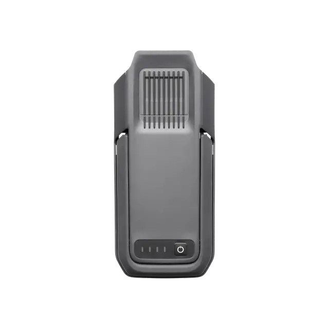

The TB100 Intelligent Flight Battery uses high-performance, high-energy cells and can be charged up to 400 cycles, reducing the cost per flight. It also features enhanced heat dissipation and is equipped with a self-heating system for improved reliability.
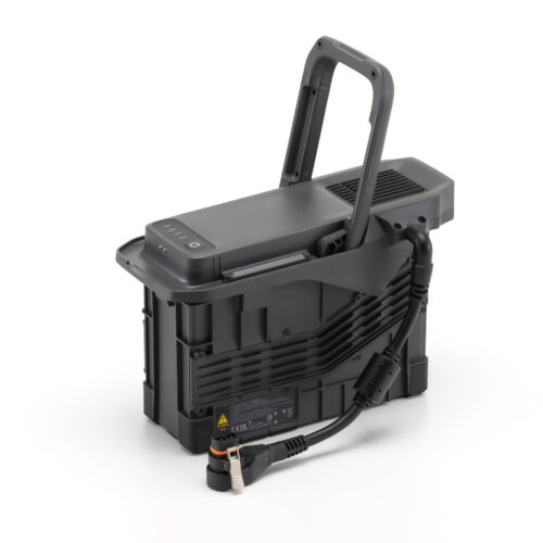
The TB100C Tethered Battery is compatible with third-party tethered lighting and communication products, enabling long-duration aerial lighting and communication base station functions via cable. Reserved ports are available to support third-party development of automated recharging station products, such as drone docks.
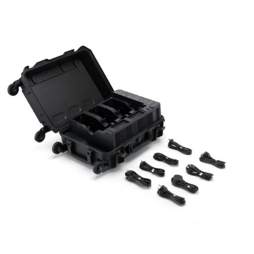
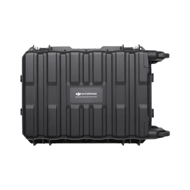
The intelligent battery station is a one-stop solution for battery charging, storage, and transport. It can charge up to three TB100 batteries and two WB37 batteries sequentially. With a fast charging time of just 45 minutes per TB100 battery, it ensures seamless, uninterrupted flight operations. In Silent Mode, noise levels are as low as 36 dB.
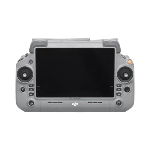
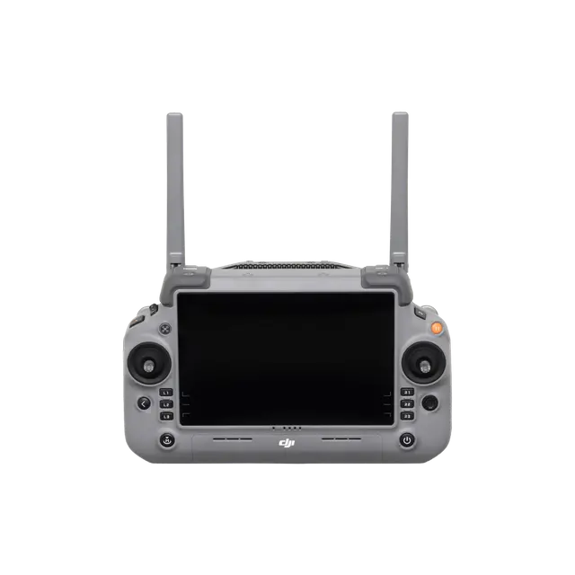
DJI RC Plus 2 Enterprise Enhanced Remote Controller features a new high-brightness screen that remains clearly visible even in direct sunlight. It has an IP54 protection rating and can operate in temperatures ranging from -20° to 50° C (-4° to 122° F). Equipped with the O4 Enterprise Enhanced Video Transmission, it features a built-in high-gain antenna array, providing strong performance. It also supports the sub2G module and 4G hybrid transmission solutions, ensuring stable and smooth video feeds in both urban high-rise and mountainous environments.
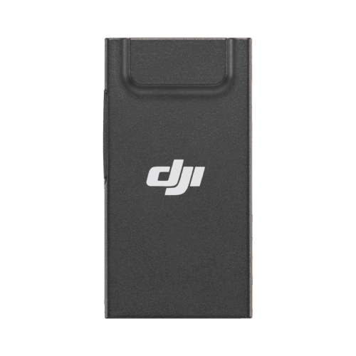
The DJI Cellular Dongle 2 offers 4G network video transmission and can work together with the O4 Enterprise Enhanced Video Transmission System, ensuring safe flights in complex environments. Additionally, it provides mobile network connectivity for the remote controller.
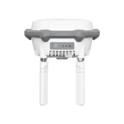
The D-RTK 3 Multifunctional Station can serve as a base station to provide centimeter-level positioning for multiple drones simultaneously. Additionally, the new Rover Station Mode, combined with the DJI Enterprise app and DJI Terra, provides a comprehensive solution for high-precision aerial surveying applications, ensuring accurate operations.
| Takeoff Weight (with propellers) |
The actual product weight may vary due to differences in batch materials and external factors. |
| Max Takeoff Weight | 15.8 kg |
| Dimensions |
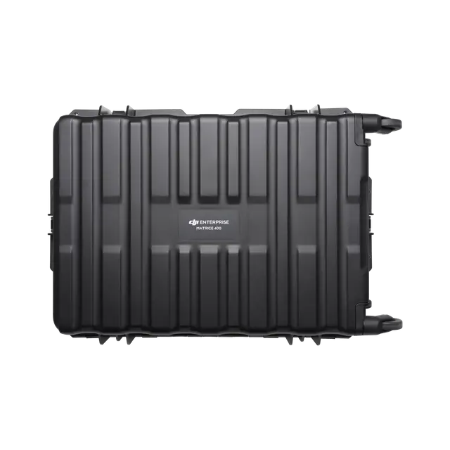
Maximum dimensions excluding propellers. Aircraft carrying case dimensions: 779×363×528 mm (L×W×H) |
| Max Payload | 6 kg
The 6 kg payload is measured at the third gimbal connector under sea level conditions. Payload capacity decreases as altitude increases. For details, refer to the official user manual. |
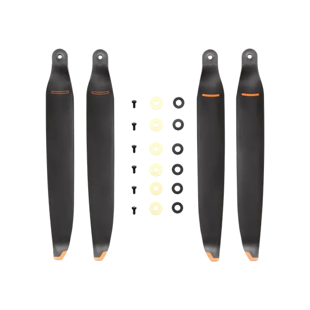
| Propeller Size | 25 inches |
| Diagonal Wheelbase | 1070 mm |
| Max Ascent Speed | 10 m/s |
| Max Descent Speed | 8 m/s |
| Max Horizontal Speed (at sea level, no wind) | 25 m/s |
| Max Takeoff Altitude | 7000 m |
| Max Flight Time (no wind) | 59 minutes
Measured with the aircraft flying forward at a constant speed of 10 m/s in a windless environment at sea level, carrying only the H30T (total weight 10,670 g), and from 100% battery level until 0%. Data is for reference only. Actual experience may vary depending on the environment, usage, and firmware version. |
| Max Hover Time (no wind) | 53 minutes
Measured with the aircraft hovering in a windless environment at sea level, carrying only the H30T (total weight 10,670 g), and from 100% battery level until 0%. Data is for reference only. Actual usage time may vary depending on the flight mode, accessories, and environment. |
| Max Flight Distance (no wind) | 49 km
Measured by the aircraft flying forward at a constant speed of 17 m/s in a windless environment at sea level, without external payloads, and from 100% battery level until 0%. Actual experience may vary depending on the environment, usage, and firmware version. |
| Max Wind Speed Resistance | 12 m/s
Max wind speed resistance during takeoff and landing. |
| Max Yaw Angular Velocity | Yaw: 100°/s |
| Max Pitch Angle | 35° |
| Operating Temperature | -20° to 50° C (-4° to 122° F) (without solar radiation) |
| Global Navigation Satellite System (GNSS) | GPS + Galileo + BeiDou + GLONASS**
GLONASS is supported only when the RTK module is enabled. Equipped with standard airborne ADS-B In receiver and dual antennas, supporting reception up to 20 km. |
| Hovering Accuracy Range (with moderate or no wind) | Vertical:
Horizontal:
|
| RTK GNSS Accuracy | RTK Fix: 1 cm + 1 ppm (horizontal), 1.5 cm + 1 ppm (vertical) |
| RTK Heading | Supports RTK heading with an accuracy better than 2° |
| Airborne ADS-B In | Equipped with standard airborne ADS-B In receiver and dual antennas, supporting reception up to 20 km. |
| Internal Storage | N/A |
| Ports |
|
| Propeller Model | 2510F |
| Beacon | Built into the aircraft |
| Ingress Protection Rating | IP55
The rating is not permanently effective and may decrease due to product wear and tear. |
| Maximum Payload for Single Gimbal Connector | 1400 g
If exceeds, the gimbal damper lifespan will decrease from 1000 hours to 400 hours. |
| Maximum Payload for Dual Gimbal Connector | 950 g |
| Maximum Payload for Third Gimbal Connector | 3 kg for quick-release port, 6 kg for screw lock fastening |
| Sensing Type |
|
| Forward |
|
| Backward |
|
| Lateral |
|
| Downward |
|
| Operating Environment |
Downward: * Sufficient lighting conditions refer to an illuminance not lower than that of a nighttime city light scene. |
| Rotating LiDAR |
|
| Upper LiDAR (3D ToF) | 0.5-25 m at night (reflectivity > 10%) The FOV to the up and down is 60° and 60° to the right and left. |
| Downward 3D Infrared Range Sensor | Measurement Range: 0.3-8 m (reflectivity > 10%) The FOV to the front and rear is 60° and 60° to the right and left. |
| mmWave Radar | Measurement Range for Power Line:
The mmWave radar function is unavailable in some countries/regions. |
| Resolution | 1080p |
| Field of View (FOV) |
|
| Frame Rate | 30fps |
| Night Vision | Starlight Grade |
| Video Transmission System | DJI O4 Enterprise Enhanced Video Transmission System |
| Live View Quality | Remote Controller: 3-channel 1080p/30fps |
| Operating Frequency and Transmitter Power (EIRP) |
Operating frequency allowed varies among countries and regions. Refer to local laws and regulations for more information. |
| Max Transmission Distance (unobstructed, free of interference) |
Measured in an unobstructed environment free of interference. The above data shows the farthest communication range for one-way, non-return flights under each standard. During your flight, please pay attention to RTH reminder on the DJI Pilot 2 app. |
| Max Transmission Distance (with interference) |
Data is tested under FCC standard in unobstructed environments of typical interference. Only to serve as a reference and provides no guarantee as to the actual flight distance. |
| Max Download Speed |
The above data was measured under conditions where the aircraft and remote controller were in close proximity without interference. |
| Antenna |
|
| Others | Supports Dual Control Mode and 2-channel Cellular Dongle 2 |
| Model | TB100 |
| Capacity | 20254 mAh |
| Standard Voltage | 48.23 V |
| Max Charging Voltage | 54.6 V |
| Cell Type | Li-ion 13S |
| Energy | 977 Wh |
| Weight | 4720 ± 20 g |
| Charging Temperature | 5° to 45° C (41° to 113° F) |
| Discharging Temperature | -20° to 75° C (-4° to 122° F) |
| Battery Heating |
|
| Discharge Rate | 4C |
| Max Charging Power | 2C |
| Low-Temperature Charging | Supports low-temperature self-heating charging |
| Cycle Count | 400 |
| Model | BS100 |
| Net Weight | 11.8 kg |
| Dimensions | 605×410×250 mm (L×W×H) |
| Supported Batteries | TB100 Intelligent Flight Battery, TB100C Tethered Battery WB37 Battery |
| Operating Temperature | -20° to 40° C (-4° to 104° F) |
| Input | 100-240 V (AC), 50-60 Hz, 10 A |
| Output | USB-C:
USB-C:
|
| Number of Charging Channels | Three TB100 and two WB37 batteries |
| Charging Mode | Ready-to-Fly Mode 90%; Standard Mode 100% Supports Fast Charging Mode and Silent Mode |
| Charging Time | TB100/TB100C Battery From 0% to 100%:
Charging time is measured in a test environment with a temperature of 25° C. |
| Video Transmission System | DJI O4 Enterprise Enhanced Video Transmission System |
| Max Transmission Distance (unobstructed, free of interference) |
Measured in an unobstructed environment free of interference. The above data shows the farthest communication range for one-way, non-return flights under each standard. During your flight, please pay attention to RTH reminder on the DJI Pilot 2 app. |
| Video Transmission Operating Frequency and Transmitter Power (EIRP) |
Operating frequency allowed varies among countries and regions. Refer to local laws and regulations for more information. |
| Antenna |
|
| Enhanced Transmission | Supports DJI Cellular Dongle 2 |
| Wi-Fi Protocol |
|
| Wi-Fi Operating Frequency |
5.2 and 5.8GHz frequencies are prohibited in some countries. In some countries, the 5.2GHz frequency is only allowed for use in indoor. |
| Wi-Fi Transmitter Power (EIRP) |
|
| Bluetooth Protocol | Bluetooth 5.2 |
| Bluetooth Operating Frequency | 2.400-2.4835 GHz |
| Bluetooth Transmitter Power (EIRP) | < 10 dBm |
| Screen Resolution | 1920 × 1200 |
| Screen Size | 7.02 inches |
| Screen Frame Rate | 60fps |
| Brightness | 1400 nits |
| Touchscreen Control | 10-Point Multi-Touch |
| Built-in Battery | 2S2P High Energy Density 18650 Lithium-ion Battery (6500 mAh @ 7.2 V) 46.8 Wh |
| External Battery | Optional, WB37 (4920 mAh @ 7.6 V) 37 Wh |
| Charging Type | Supports PD fast charging, with a maximum 20V/3.25A USB Type-C charger |
| Storage Capacity | RAM 8G + ROM 128G UFS + expandable storage via microSD card |
| Charging Time | 2 hours for internal battery; 2 hours for internal plus external batteries.
When remote controller is powered off and using a standard DJI charger. |
| Internal Battery Runtime | 3.8 hours |
| External Battery Runtime | 3.2 hours |
| Output Port | HDMI 1.4 |
| Indicators | Status LED, battery level LED, connection status LED, tricolor light, brightness adjustable according to ambient light |
| Speaker | Supports buzzer |
| Audio | Array MIC |
| Operating Temperature | -20° to 50° C (-4° to 122° F) |
| Storage Temperature |
|
| Charging Temperature | 5° to 40° C (41° to 104° F) |
| Supported Aircraft Model | Matrice 400 |
| Global Navigation Satellite System | GPS + Galileo + BeiDou |
| Dimensions | 268×163×94.5 mm (L×W×H)
Width including external antenna folded, thickness including handle and controller sticks. |
| Weight | 1.15 kg (without external battery) |
| Model | TKPL 2 |
| System Version | Android 11 |
| External Interfaces | HDMI 1.4, SD 3.0, USB-C with OTG support, max 65W PD charging, USB-A with USB 2.0 support |
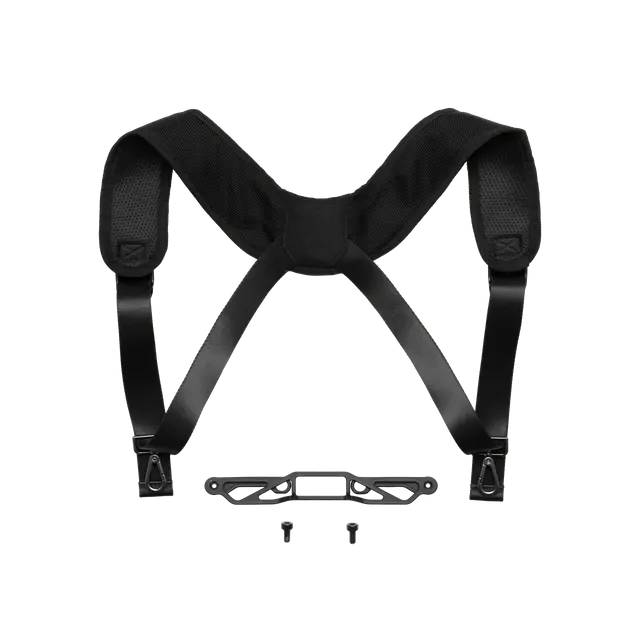
| Accessories | Strap/waist support |
| DJI Products Compatible With Matrice 400 |
|
Inquire price for DJI Matrice 400