Agriculture generates vast amounts of information. Yield monitors record harvest performance, weather stations track changing conditions, and modern machinery logs field operations in detail. Yet one challenge remains unchanged: understanding what is happening across large areas quickly enough to act on it.
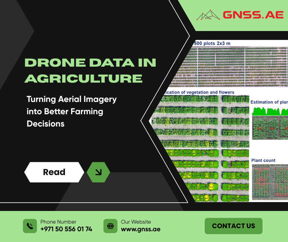
This is where drones have become an important tool in precision agriculture. They provide a detailed view of crop development, soil conditions, field variability, and emerging issues before many of them can be identified during routine field inspections. More importantly, drone surveys convert visual observations into measurable data that can support management decisions throughout the growing season.
Crop scouting has traditionally relied on field visits. However, large commercial fields often cover hundreds of hectares, making it impossible to inspect every section in detail. In practice, agronomists may only evaluate 2–10% of a field through traditional scouting.
A drone survey can provide consistent visual coverage across virtually 100% of the field. Instead of relying solely on observations from selected locations, growers can evaluate the entire field during a single flight. High-resolution RGB and multispectral imagery can reveal differences in crop vigor, emergence, moisture distribution, and stress patterns that may not be visible from ground level.
This field-wide view helps identify where potential issues are developing, how extensive they are, and which areas require closer investigation or corrective action.

Not all agricultural operations benefit from the same imaging technologies. The most useful sensor depends on the crop type, management objectives, and the information required for decision-making.
Crop Type | Primary Sensor | Typical Applications |
Corn, soybeans, wheat, potatoes, and similar field crops | Nitrogen deficiency assessment, crop vigor monitoring, emergence assessments, variable-rate application planning, mid-season crop evaluations |
Multispectral sensors capture wavelengths beyond visible light, helping growers identify variations in plant health and development before stress becomes apparent during routine field inspections.
Crop Type | Primary Sensor | Typical Applications |
Orchards, vineyards, and other permanent crops | Canopy density assessment, tree health monitoring, missing tree detection, damage assessment, pruning evaluation | |
Orchards, vineyards, and other permanent crops | Irrigation analysis, water stress detection, identification of uneven moisture distribution |
Permanent crops present different monitoring requirements due to canopy structure, plant height variation, and the need to evaluate individual trees or vines.
Sensor Type | Primary Use |
Identification of visible crop damage, stand issues, and field conditions | |
Detection of vegetation stress and crop variability | |
Irrigation assessment and water stress monitoring |
Many specialty crop operations combine multiple sensor types. RGB imagery provides detailed visual information, while multispectral and thermal datasets help identify physiological changes that may not yet be visible.
The objective is not to collect the greatest amount of data, but to acquire the information needed to answer specific agronomic questions.

The best agricultural drone is not necessarily the one with the most advanced specifications. The right choice depends on what information the operation needs to collect.
Three factors usually determine the most suitable platform.
RGB cameras remain the foundation of many agricultural workflows. They are used for mapping, visual inspections, documentation, and stand-count analysis.
Multispectral sensors add another layer of information by capturing wavelengths beyond visible light. These sensors are widely used for vegetation analysis, including crop vigor monitoring and nitrogen-related stress detection.
Thermal cameras provide additional insight by measuring temperature differences across the field. They are particularly useful for identifying irrigation problems and water stress.
Repeatable agricultural analysis requires accurate positioning.
RTK (Real-Time Kinematic) and PPK (Post-Processed Kinematic) technologies improve location accuracy, allowing growers to compare datasets collected at different stages of crop development.
This accuracy is especially important when creating prescription maps for variable-rate applications or monitoring changes over time.
Several DJI Enterprise platforms have become widely used across agricultural operations.
Drone platform | Best suited for | Key applications | Main advantages |
Routine crop monitoring and precision agriculture workflows | NDVI mapping, crop health monitoring, variable-rate application planning, field scouting | Compact and easy to deploy. Integrated RGB and multispectral sensors make it suitable for regular in-season surveys. | |
High-resolution agricultural mapping and field analysis | Orthomosaic generation, stand counts, emergence analysis, surface modeling, topographic assessments | Professional RGB mapping platform with high-quality imagery for detailed field analysis and documentation. | |
Large-scale operations, research projects, and advanced precision agriculture | Advanced multispectral analysis, research-grade imagery, large-area mapping, detailed agronomic studies | Modular payload platform offering greater flexibility, sensor options, and data quality for complex agricultural workflows. |
Collecting aerial imagery is only the first step. The real value comes from processing that data into information that can support field decisions.
Photogrammetry software combines hundreds or thousands of overlapping images into accurate maps, including:
Platforms such as DJI Terra, Pix4Dfields, and other agricultural analytics solutions help transform raw imagery into usable information.
The result is a clearer understanding of where problems exist and what actions may be required.
The value of agricultural drone technology becomes clear in everyday field operations, where aerial data supports faster and more informed decision-making.
Some of the most useful drone data can be collected shortly after planting.
Crop emergence has a direct impact on yield potential, but assessing stand establishment across large fields manually is both time-consuming and labor-intensive. Drone surveys offer a practical alternative.
In one cotton production project, a DJI Mavic 3 Multispectral was used to capture imagery over recently planted fields. The collected data was processed using AI-based plant detection software capable of identifying and counting individual seedlings automatically.
Instead of manually checking selected areas, agronomists received a complete overview of emergence performance. Areas with uneven establishment could be identified quickly, allowing field inspections to focus on locations that required attention.
Today, similar workflows are used in commercial farming, seed trials, and agricultural research.


Field trials depend on consistent, objective measurements. Yet evaluating hundreds or thousands of small plots by hand demands considerable time and effort.
Drone imagery can significantly streamline this process.
In one research project, a DJI Mavic 3 Multispectral captured imagery across agricultural microplots. After processing the data in DJI Terra, researchers used third-party platforms such as Agremo, AgroScout, and Pix4Dfields to assess:
The approach allowed researchers to compare results across large trial areas while reducing the amount of manual field assessment required.
Many crop issues begin long before they become obvious during routine field inspections.
Nutrient deficiencies, disease pressure, pest activity, and water stress often trigger physiological changes before visible symptoms appear. Multispectral imagery can detect these changes by capturing information beyond the visible spectrum.
This gives growers an opportunity to prioritize scouting and investigate potential problems before they become more widespread. Drone data does not replace agronomic judgment. Instead, it helps direct attention to the areas most likely to require intervention.
Precision agriculture aims to match inputs to actual field conditions rather than treating every hectare the same way.
Drone-derived maps can support variable-rate fertilization, targeted spraying, and other site-specific applications.
Weed management provides a practical example. In one workflow, imagery captured with a DJI Mavic 3 Multispectral was processed in DJI Terra and analyzed using third-party software to identify weed-infested areas. The resulting prescription map was then transferred to a DJI Agras spraying platform.
Instead of applying chemicals uniformly across the entire field, operators treated only the areas where weeds were detected. This reduced unnecessary input use while maintaining effective control.


Orchards present different monitoring challenges than broadacre crops. Managers often need information at the level of individual trees while also tracking canopy development and productivity over multiple seasons.
In one orchard management project, multispectral surveys conducted with a DJI Mavic 3 Multispectral helped evaluate:
The resulting georeferenced datasets provided a consistent record of orchard conditions over time. Comparing data from different seasons helped managers identify developing trends and assess the effects of management practices.
Agriculture has always depended on observation. What is changing is the scale and precision of those observations.
Drones allow growers to move from limited field checks to a more complete understanding of what is happening across their operations.
From early emergence monitoring and crop stress detection to variable-rate applications and orchard management, drone data helps transform aerial imagery into practical decisions.
The technology itself is only one part of the process. The real value comes when drone surveys become part of a consistent agricultural workflow and provide information that can be acted on.
As processing software, AI-based analysis, and precision agriculture systems continue to develop, aerial intelligence will become an increasingly important part of modern farm management.