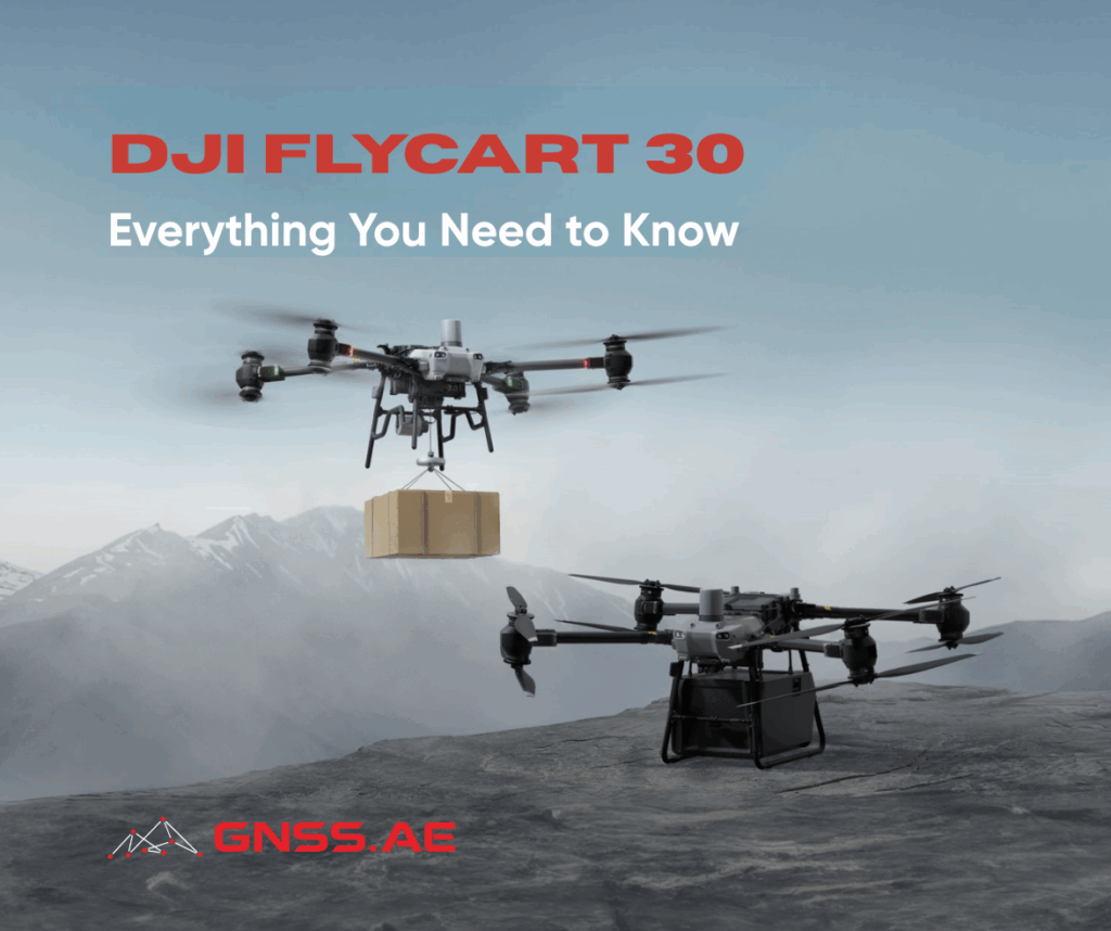
Magnetometry, i.e. the measurement of variations in the Earth’s magnetic field, has long been a cornerstone of geophysical exploration. Traditionally conducted using handheld instruments, ground-based vehicles, or manned aircraft, magnetic surveys have been crucial for mineral exploration, archaeological investigations, infrastructure mapping, and environmental monitoring. The integration of magnetometers with unmanned aerial vehicles (UAVs), commonly known as drones, marks a transformative step forward in how we conduct magnetic surveys.
UAV-based magnetometry offers a combination of precision, efficiency, safety, and cost-effectiveness that is rapidly changing the landscape of geophysical data acquisition. This article explores the technology, applications, advantages, and challenges of drone-based magnetic surveys.
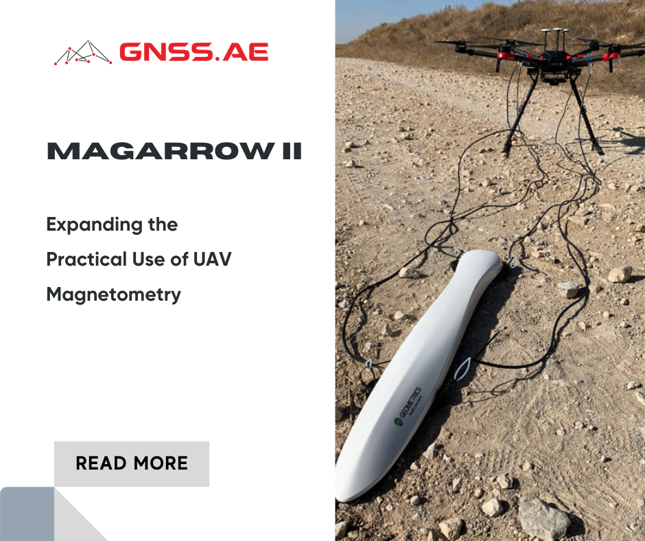
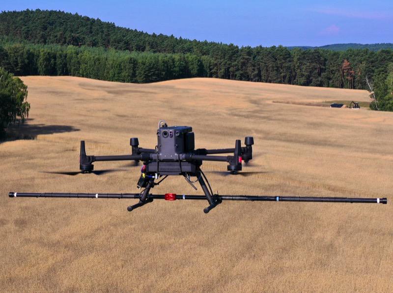
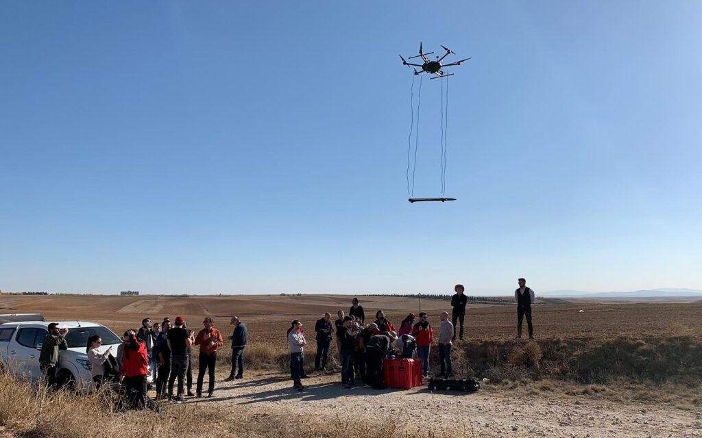
UAV-based magnetometry involves mounting a magnetometer, i.e. a sensor that detects changes in magnetic fields, onto a drone. As the UAV flies over a predefined survey area, it collects magnetic data that reflects the underlying geological or man-made features. These data are georeferenced using onboard GPS and inertial systems, allowing for the generation of detailed magnetic maps.
There are several types of magnetometers used in UAV surveys, including:
One of the most prominent uses of drone magnetometry is in the mining sector. Geophysicists use drones equipped with magnetometers to:
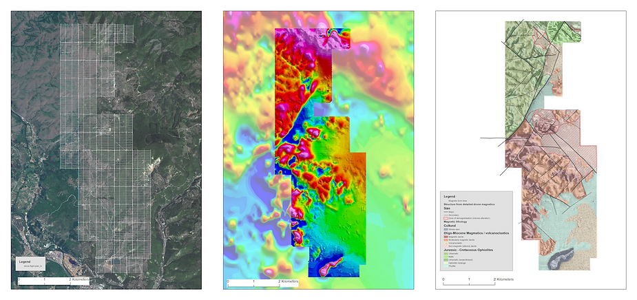
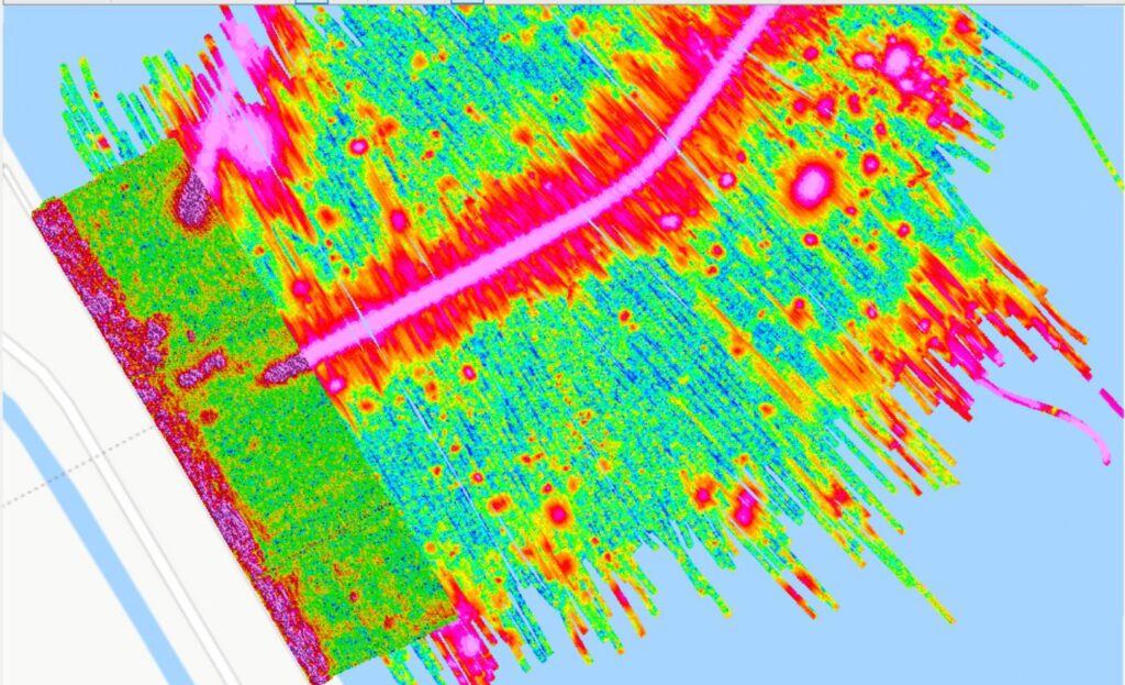
Use case: Using drone-based magnetometry for gold exploration in Guinea. The gold sits in quartzsite veins, which are non-magnetic but are associated with slightly more magnetic surrounding material.
miningmagazine.com.au
Drone-based magnetic surveys are becoming invaluable tools for non-invasive archaeological research. They help:
Use case: In 2023, researchers from Ludwig-Maximilians University in Munich carried out an archaeological survey using a drone-based magnetometer to investigate the Roman fortress at Theilenhofen, Germany. The study aimed to assess the capabilities of drone-based magnetometry for archaeological prospection, comparing its efficiency and accuracy to traditional ground-based methods. SENSYS MagDrone R4 was then tested in both ground-based and drone-based modes.
SPH Engineering
The drone-based magnetometry survey provided highly encouraging results. The data collected by the magnetometer was able to detect significant archaeological features, including ditches, pits, fireplaces, and remnants of stone foundations, which are the types of features that are critical in Roman archaeological prospection.
While the resolution of the drone-based data did not match the highest precision of the ground-based magnetometer, it was sufficient for identifying major archaeological features. The study demonstrated that drone surveys could rapidly cover large and difficult-to-access areas, providing a first-pass assessment that could guide more detailed, ground-based investigations.

The study also showed that flying at ultra-low altitudes, combined with precise GNSS positioning and effective noise filtering, greatly improved the quality of the magnetic data.
Drone-based magnetometry can also assist in:
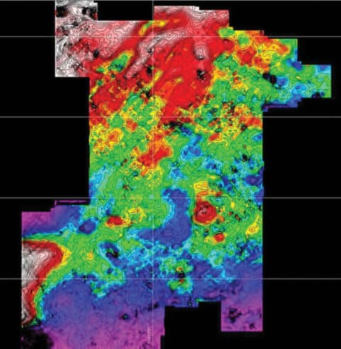
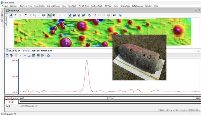
Use case: Magnetic map and plot of magnetic field strength along one survey line. The anomaly corresponds to the German WW2 Flam C-250 aerial bomb (without tail) lying 1.5m deep under the surface.
SPH Engineering
Magnetic drones are increasingly used to:
Use case: Shore Monitoring & Research undertook a new project requiring magnetic surveys along coastal areas to determine the precise location of previously laid cables and pipelines. SPH Engineering’s drone-mounted magnetometer was particularly useful on shallow waters and shorelines, where traditional tools would face significant limitations.
SPH Engineering
Sean Zandbergen from Shore Monitoring & Research commented:
“We were happy with the results based on the overlap of the two datasets. Using a UAV magnetometer in this industry is a bit new, so we and our client were also curious about the result. It’s easier to process the drone data since the positioning is so much better/more accurate.”
Drone-based magnetic surveys offer a compelling alternative to traditional methods. Key advantages include:
Despite their benefits, drone-based magnetic surveys face several challenges:
This article has demonstrated how drone-based magnetometry is transforming magnetic surveying by integrating advanced magnetometer technologies, such as fluxgate, optically pumped, and cesium vapor sensors, with UAV platforms. The combination of precise georeferencing, low-altitude data acquisition, and efficient area coverage offers significant advantages in terms of resolution, safety, and cost.
Applications across mineral exploration, archaeology, environmental monitoring, and infrastructure assessment highlight the method’s versatility and growing importance. Case studies, including surveys of Roman archaeological sites and UXO detection, confirm its practical effectiveness and ability to complement or even replace traditional techniques in many scenarios.
Despite limitations like magnetic interference, restricted flight durations, and regulatory constraints, continued advancements in sensor design, UAV capability, and data processing are addressing these challenges. Overall, drone-based magnetometry emerges from this analysis as a robust and rapidly maturing tool in modern geophysical and remote sensing practices.