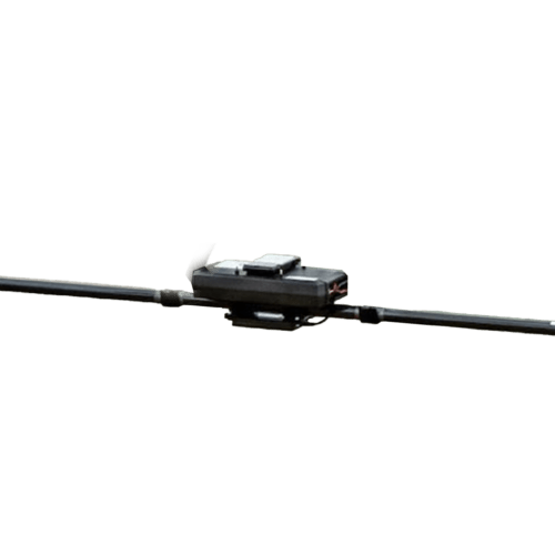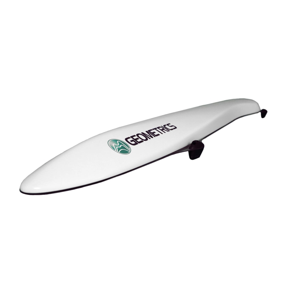

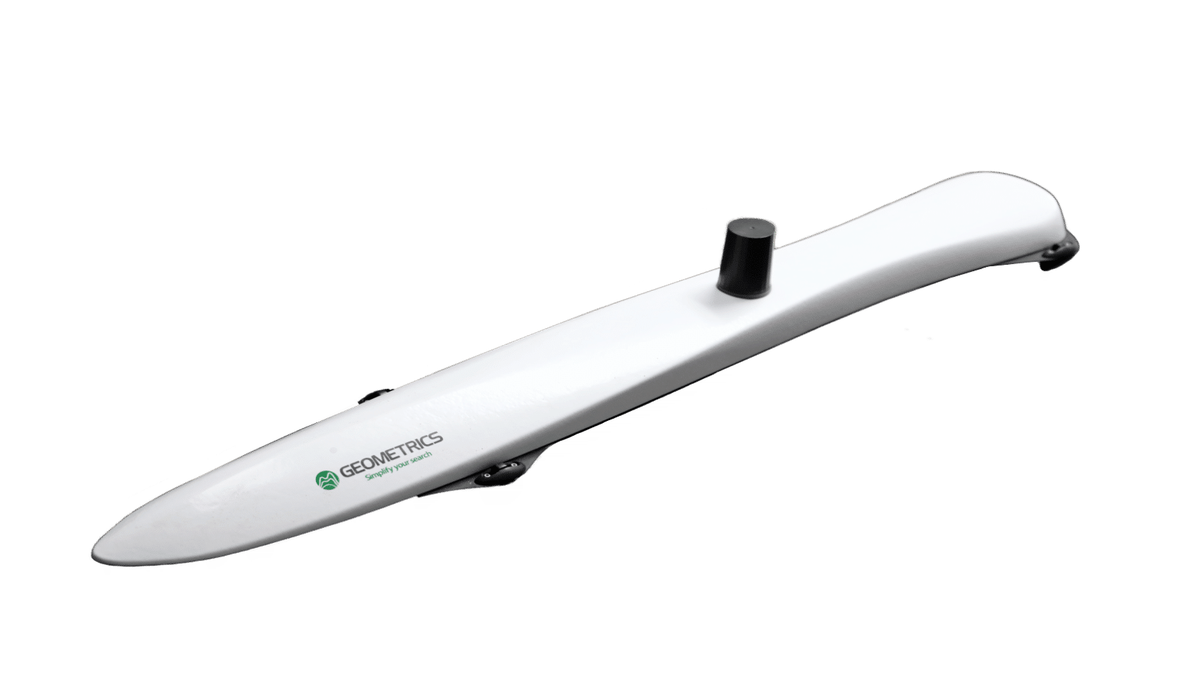
The MagArrow is engineered to simplify surveys that are difficult due to the various limitations of pilot-on-board surveys and ground surveys. The MagArrow is a robust yet flexible system that can adapt to changing field conditions and new user workflows. The MagArrow consists of an aerodynamic, light-weight carbon fiber shell with internal electronics including the MFAM™ magnetic sensors, GPS, and IMU. The MFAM™, a two sensor module inside the MagArrow is our most groundbreaking magnetometer yet, capable of highly precise measurements in an extremely lightweight and tiny package.
The MagArrow II is the second generation of our best-selling UAS-enabled magnetometer and it’s setting a new standard for UAS magnetic surveys. The MagArrow is engineered to simplify surveys that are difficult due to the various limitations of pilot-on-board surveys and ground surveys. The MagArrow is a robust yet flexible system that can adapt to changing field conditions and new user workflows.
The MagArrow consists of an aerodynamic, light-weight shell with internal electronics including the MFAM™ magnetic sensors, GPS, and IMU. The MFAM™, a two sensor module inside the MagArrow is our most groundbreaking magnetometer yet, capable of highly precise measurements in an extremely lightweight and tiny package.
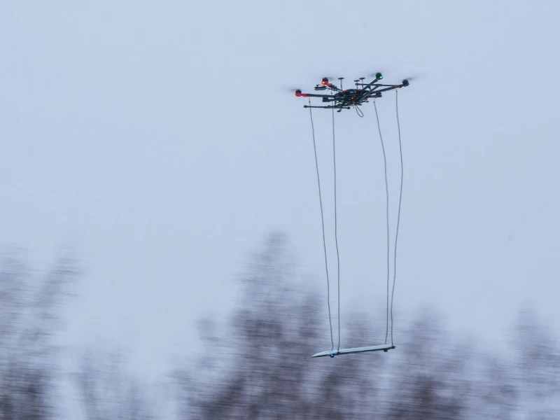
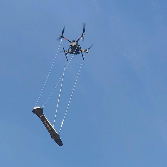
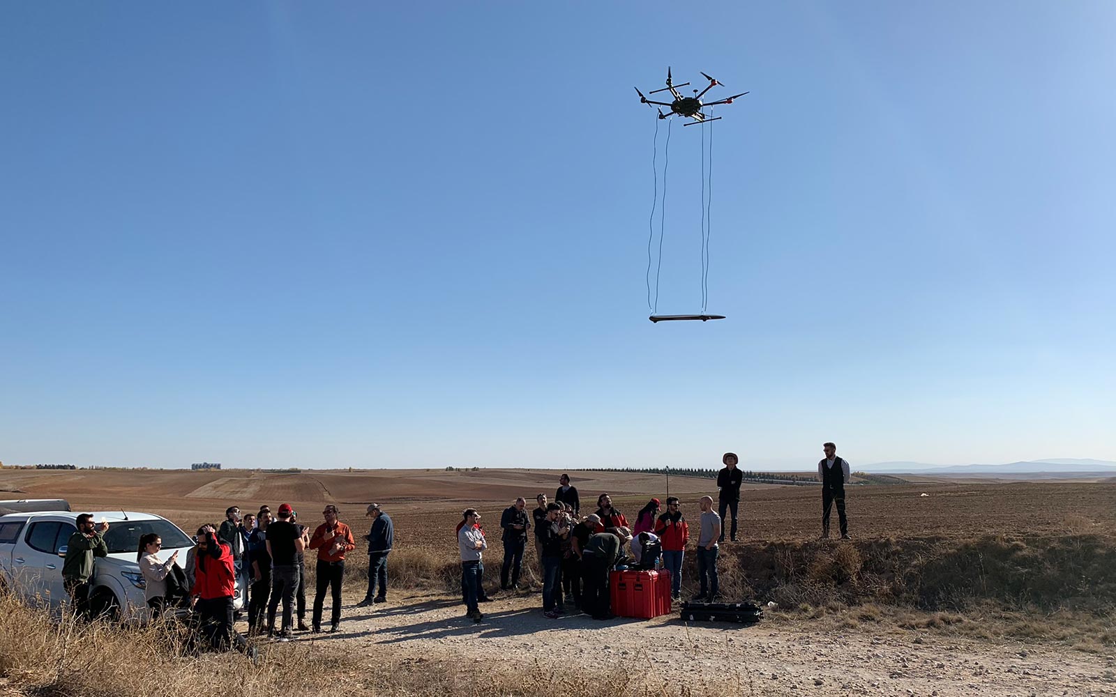
Operation in the field is simple. Survey details are programmed into the user’s UAS software of choice. The MagArrow is turned on, and once airborne, preprogrammed GPS waypoints carry the MagArrow in altitude stable survey lines. Once work is completed, data from the MagArrow can be wirelessly downloaded to a computer.
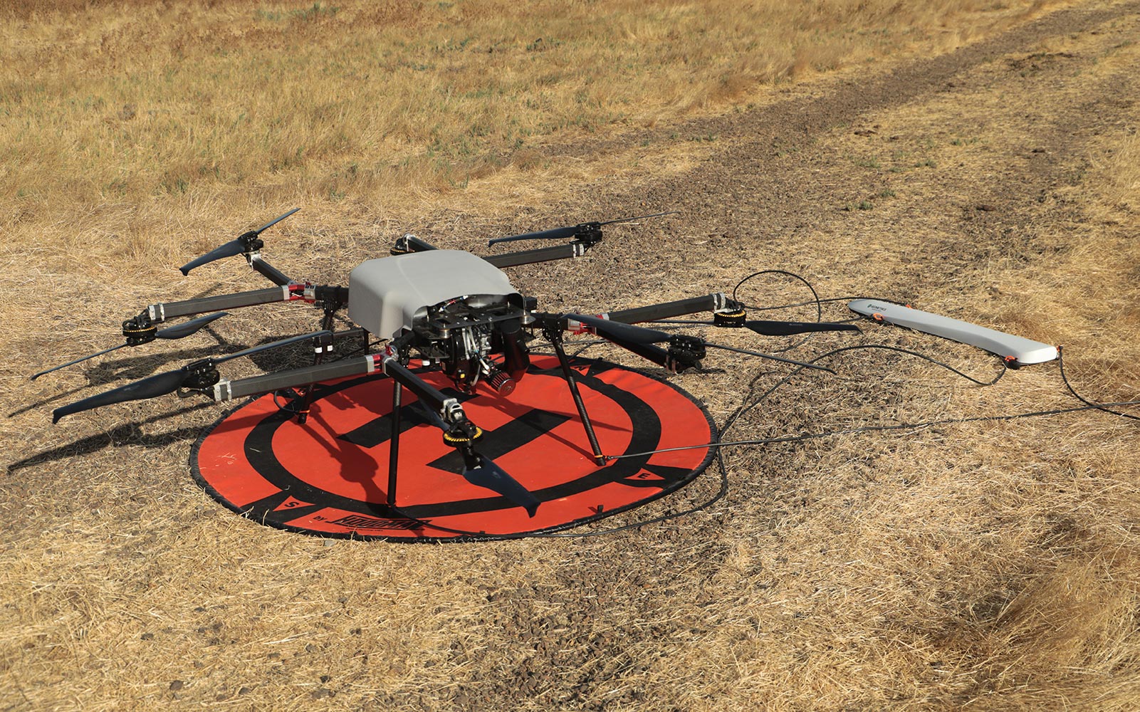
The MagArrow can be attached easily to a wide variety of enterprise UAS’s, and the MagArrow’s 1000 Hz sample rate and synchronized on-board GPS allow it to function independently of the UAS and the UAS software. With such a fast sample rate, surveys can be completed at speeds up to 10 m/s with samples collected every 1 cm. Revolutionize your magnetic surveying capabilities with the Geometrics MagArrow!
Since the MagArrow Magnetometer only weights 1.2 kg it will have little impact on your 3-5 kg payload drone flight time.
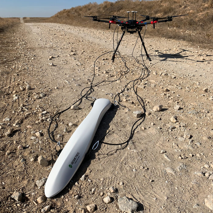
Our MagArrow uses a MFAM Sensorto provide high quality magnetic data with noise/sensitivity range of only 5 nT. Most people have suspended the system with non-magnetic cables to remove the magnetometer from the magnetic influence of the drone itself. Some customers have decided to build a fixed frame to mount the system but generally it isn’t large enough to remove the magnetometer from the drone’s magnetic effects so there will need to be advanced filtering to compensate the magnetic field readings. Either option is acceptable.
To update the firmware on your MagArrow, please follow the instructions below. These instructions are also provided in the update file.
SurveyManagerInstaller is for installing the Survey Manager on your PC.
If customers want to use commands to convert MagArrow raw data to .csv file, please install the MagArrowConverterInstaller.
The US Department of Commerce category for the cesium-vapor magnetometers is ECCN6A006. It is necessary to obtain a US export license before a magnetometer in this category can be shipping to most countries. If an export license is required, Geometrics Export Administrator will assist you in applying for this license. The export license process takes around 6 weeks, and we are not able to speed up that processes as it is the time the US Government takes to review the export license requests. A license is required for both renting and purchasing the MagArrow, so we are not able to send you the equipment for your use until we receive it.
An Export License is NOT required for shipment of cesium-vapor magnetometers to the following countries: Argentina, Australia, Austria,
Belgium, Bulgaria, Canada, Croatia, Czech Republic, Denmark, Estonia, Finland, France, Germany, Greece, Hungary, Iceland, India,
Ireland, Italy, Japan, Latvia, Lithuania, Liechtenstein, Luxembourg, Mexico, Netherlands, New Zealand, Norway, Poland, Portugal, Romania,
Slovenia, Slovakia, South Korea, South Africa, Spain, Sweden, Switzerland, Turkey, and the United Kingdom. (Updated April 2019)
Export or re-export of the quoted items to Cuba, North Korea, Iran, Rwanda, Sudan, and Syria is prohibited by the US Dept. of Commerce as these are embargoed countries.
To perform a heading error compensation flight, fly the UAV with MagArrow attached up to 100-150 meters in a low gradient area. Hover the drone in a single spot and rotate it slowly through 360 degrees while logging magnetic data the with MagArrow. By keeping the drone location stationary the mag field will be also be constant. Thus we are only left with the sensor reading as a function of orientation.

The MagArrow has two MFAM sensors, and the way they are arranged ensures that when one sensor is in its dead zone the other is at its optimum orientation, and vice versa. The readings from the two sensors are combined to produce one magnetometer reading only. The two sensor readings are weighted such that as one sensor approaches its dead zone it is weighted much less (down to zero in the dead zone) while the optimum oriented sensor is weighted more fully. Thus you get only one magnetometer reading with no dead zones whatsoever. In addition, the weighted averaging of the sensors still does partial heading error cancelling.
Magnetic contamination can be a problem, though rarely. Most often this is caused when a “permanent” magnetic component is accidentally attached to, or close to, one of the sensors. This can cause large, random shifts in the data from one or both sensors.
If you have another magnetometer, like the G-864, you can also measure the magnetic signature of the sensor part of the MagArrow with the following instructions.
There are many things that don’t work as well at high altitude. Many of these don’t apply to the MagArrow such as LCDs, can type electrolytic capacitors, hard drives, sealed keyboards, and High Voltage flashover points.What could possibly be an issue are the LiPo batteries, thermal cooling reduction at lower pressures, and the sealed MagArrow case.
There is no altitude restriction on the MagArrow, but flying at high altitudes is taken at the users risk.
Shipping Weights & DIMS
| Contents | Dimensions (L x W x H) | Weight |
|---|---|---|
| Case 1 – Pelican Case, MagArrow, Tablet, Battery Electronics, Misc. Cables |
|
|
| Operating Principle: | Laser pumped caesium vapour (Cs133 non-radioactive) total field scalar magnetometer |
|---|---|
| Operating Range: | 20,000nT to 100,000nT |
| Operating Zones: | Configurable for operating anywhere in the world without dead zones. |
| Dead Zone: | 60º Polar only |
| Noise/Sensitivity: | 0.005nT/√Hzrms |
| Max Sample Rate: | 1000Hz |
| Bandwidth: | 400Hz |
| Heading Error: | ±5nT over entire 360º equatorial and polar spins |
| Output: | WiFi data downloaded over 2.4GHz WiFi access point. |
| GNSS: | Adafruit GPS with 1m accuracy and 10μs timing |
| Connections: | Port for USB flash drive and MicroSD |
| Data Storage: | 32 Gbyte Micro SD card. Not field accessible. |
| Data format: | ASCII XYZ |
| IMU: | Bosh BMI160 Accel/Gyro – 200Hz sample rate Honeywell HML5983 Compass – 100Hz sample rate |
| Power: | Non-Magnetic 1800mAh Lithium polymer battery |
| Battery Connection: | 2 x XT60 connectors for 206 type batteries. |
| Operating Temperature: | -10ºC to +40ºC |
| Altitude: | up to 3,000m, typically limited by UAV |
| Humidity: | Non-condensing |
Inquire price for Geometrics MagArrow II UAV-Enabled Magnetometer