AED 53,100.00
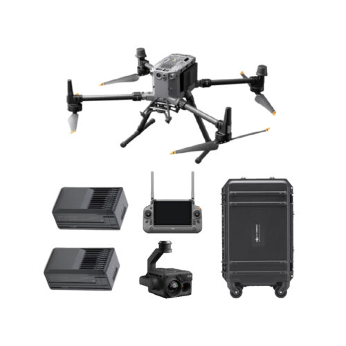
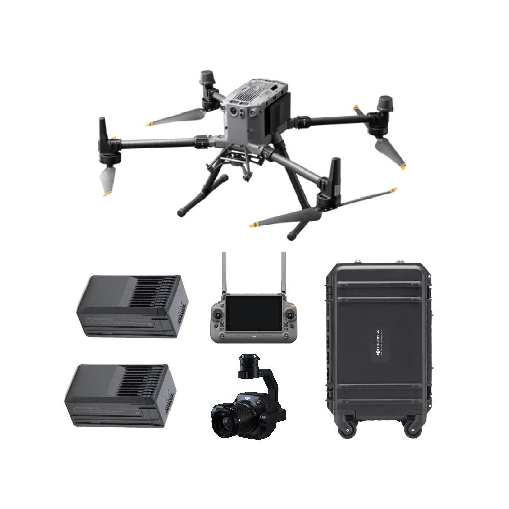
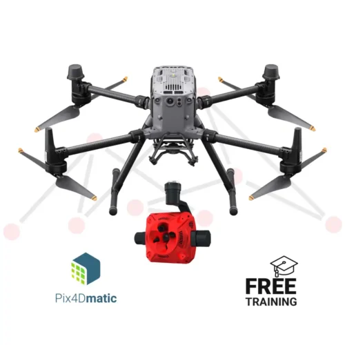
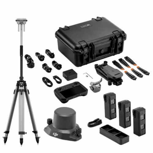
The DJI Matrice 350 RTK Photogrammetry Combo comes with all the extras you need for a high-efficiency surveying package. Including the Zenmsue P1 (45MP full-frame sensor) with 35mm lens, 1 set of TB65 batteries, ,charging station and 6 months DJI Terra Pro Subscription
The Matrice 350 RTK and Zenmuse P1 can capture 3km2 in a single flight, achieve 3cm horizontal and 5cm vertical accuracy without the need for Ground Control Points.
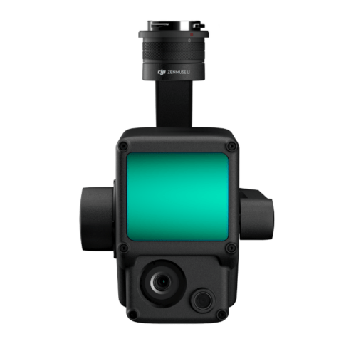
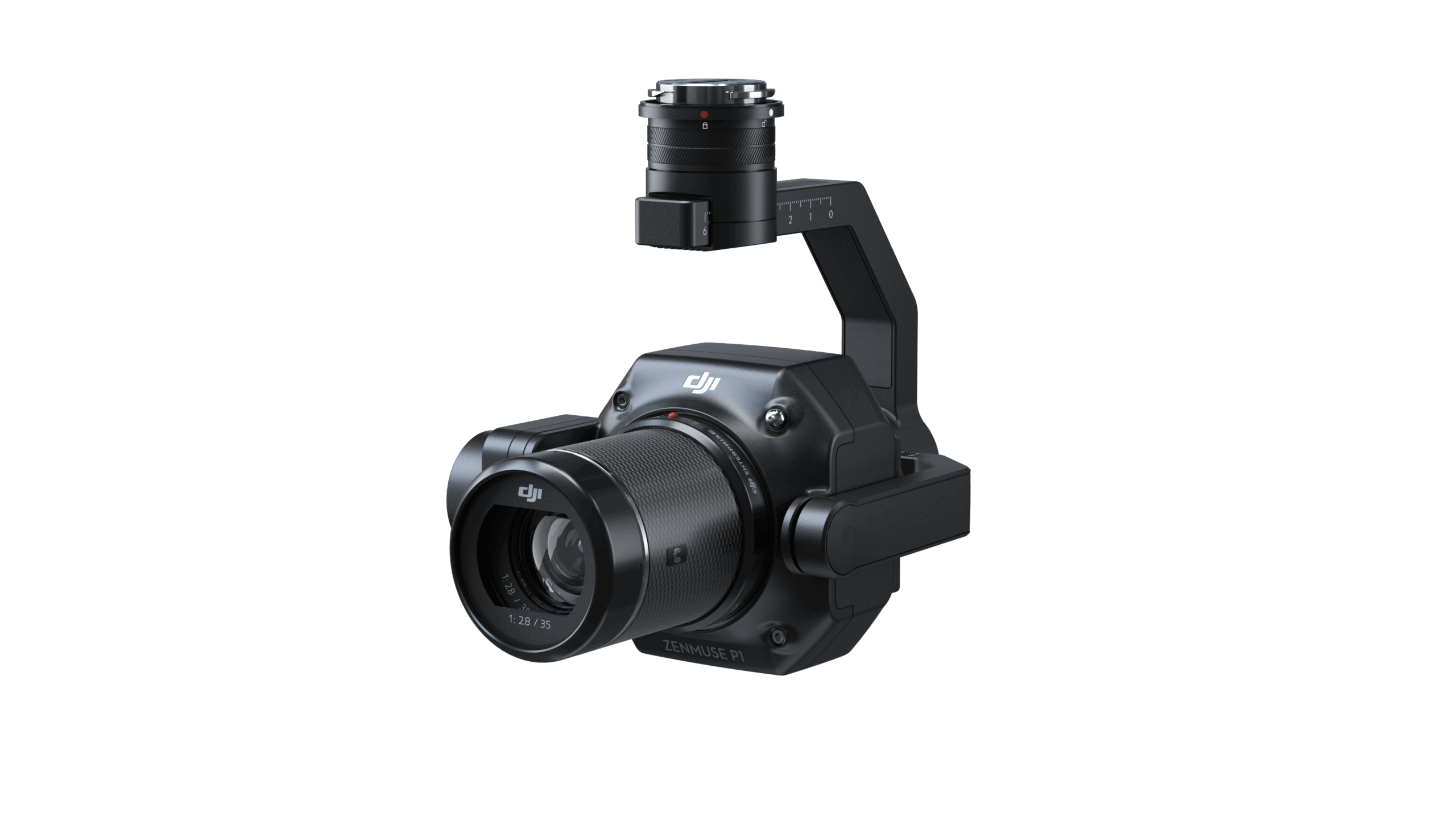
The Zenmuse P1 integrates a full-frame sensor with interchangeable fixed-focus lenses on a 3-axis stabilized gimbal. Designed for photogrammetry flight missions, it takes efficiency and accuracy to a whole new level.
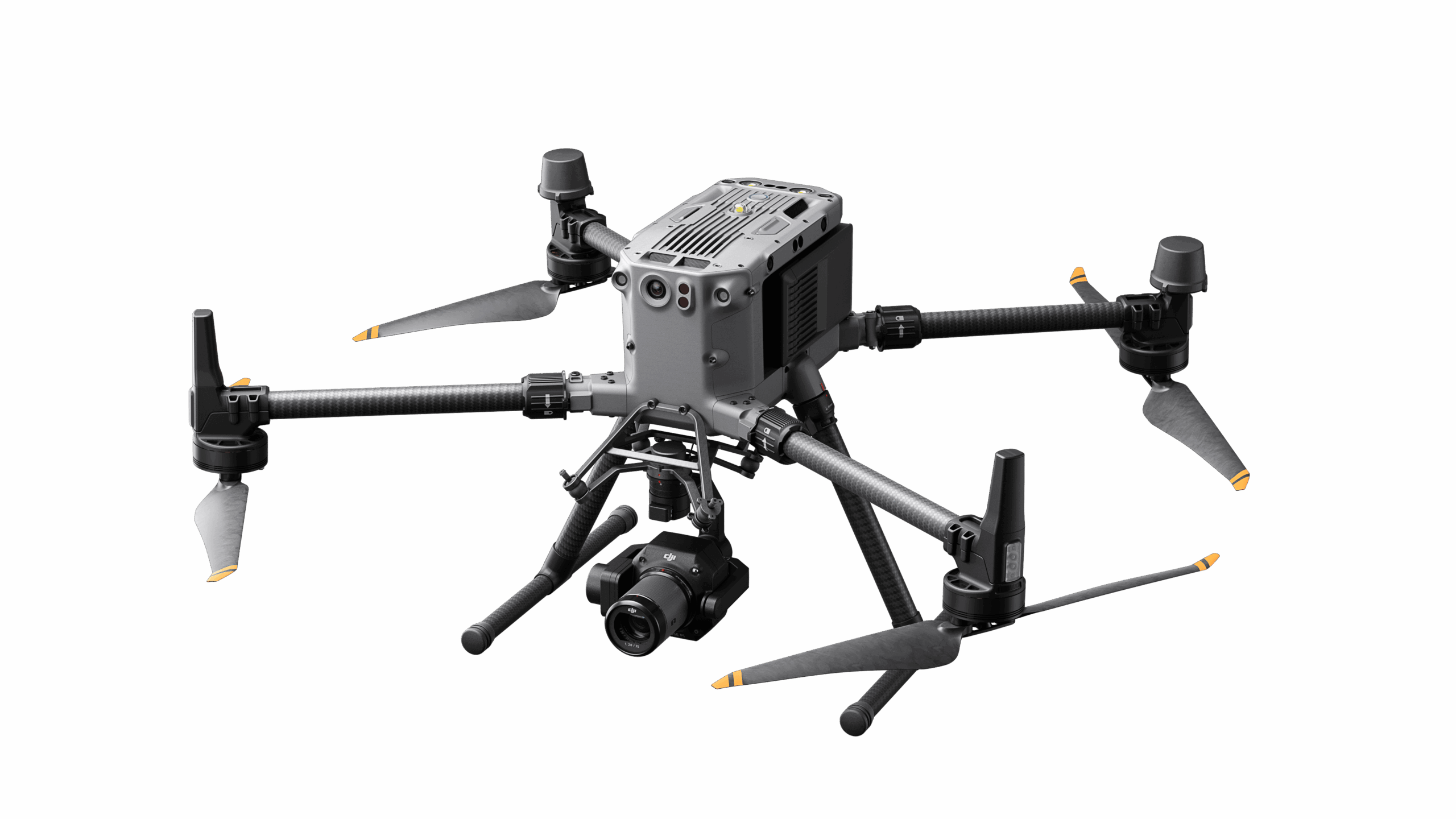
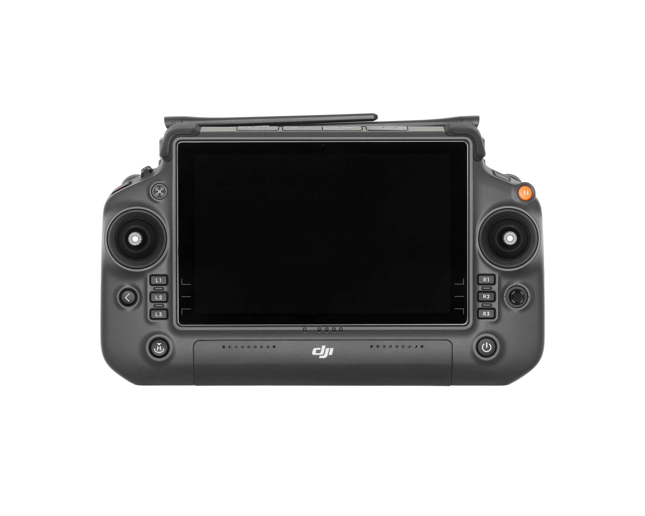
The M350 RTK incorporates a multi-layered redundancy design in both the aircraft and sensor system allowing for more confident operation in harsh environments.
The P1 includes a full-frame, low-noise high-sensitivity sensor that can take a photo every 0.7 s during the flight, and covering 3 km2 in a single flight.
Equipped with a global mechanical shutter and the all-new TimeSync 2.0 system, which synchronizes time across modules at the microsecond level, the Zenmuse P1 lets users capture centimeter-accurate data combined with the real-time position and orientation compensation technology.
Create 2D, 3D, and detailed models thanks to the integrated 3-axis gimbal that can be outfitted with 24/35/50mm lenses and the Smart Oblique Capture feature.
Global Mechanical Shutter, Shutter Speed 1/2000 Seconds
Sends the median exposure pulse in microseconds
Supports 24/35/50mm lenses with DJI DL mounts
Cover 7.5 km2 in a single workday with the P1. Elevate the efficiency of your oblique photography mission using Smart Oblique Capture, where the gimbal automatically rotates to take photos at the different angles needed. Only photos essential to the reconstruction will be taken at the edge of the flight area, increasing the efficiency of post processing by 20% to 50%.
Mission result files are automatically associated with the Mission Name and Mission Time.
A centralized storage location for photos, GNSS data, and TimeStamps.MRK files.
The image metadata contains the camera’s intrinsic and extrinsic parameters and the status of RTK.
Verify data quality immediately post-flight by checking the position data and number of the images acquired, as well as RTK status and positioning accuracy.
Effortlessly acquire oblique images from multiple angles that meet 3D modeling requirements across industries such as urban planning and centimeter-level accurate cadastral surveys to serve 3D reality models and smart city planning.
Effortlessly acquire oblique images from multiple angles that meet 3D modeling requirements across industries such as urban planning and centimeter-level accurate cadastral surveys to serve 3D reality models and smart city planning.
Acquire ultra-high resolution image data of vertical or slanted surfaces from a safe distance that faithfully recreates fine textures, structures, and features, for detailed reconstructions, geological surveys, heritage site conservation, hydraulic engineering, and more.
Gather geographic information of large areas in real-time using DJI Terra so that teams can make crucial decisions quickly on site.
Inquire price for DJI Matrice 350 RTK Photogrammetry Combo (DJI Zenmuse P1 and DJI Matrice 350 RTK)