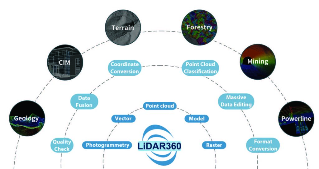
Launched in 2013, LiDAR360 is a professional processing platform for massive point cloud data developed by GreenValley International. The platform employs over ten different types of international leading point cloud algorithms, artificial intelligence, and machine learning to promote the use of LiDAR across the industry and solve users’ application problems while unlocking the full potential of their point cloud data. The software can analyze and process massive point cloud data, adapts to multiple platforms and devices, and provides more than 700 functions for efficient support of multi-industry applications. Up to now, the number of downloads has exceeded 100,000 worldwide, and the LiDAR360 is used actively in more than 130 countries and regions, receiving an array of praise from clients, contractors, governments as well as tertiary and research institutions.

Inquire Now
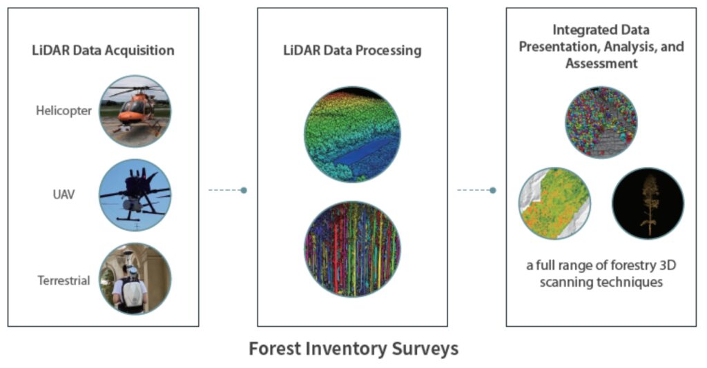
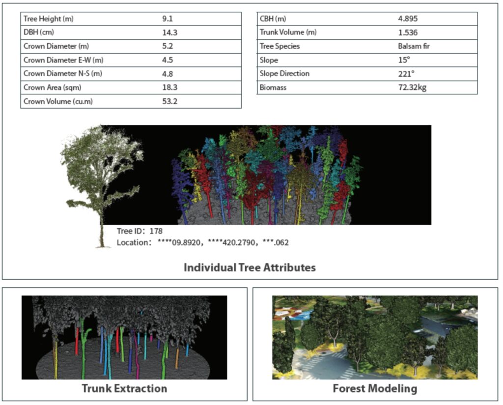
LiDAR has unique advantages in forestry surveys. LiDAR360 can automatically extract forest parameters such as canopy density and clearance rate, as well as single tree attributes such as tree height, diameter at breast height, crown width, and trunk volume based on LiDAR point cloud data and conduct intelligent statistical analysis to help sample plot surveys, carbon sink detection, and other applications, providing unparalleled support for forest resource surveys.
LiDAR technology can penetrate parts of the ground and quickly acquire a wide range of high-precision terrain point cloud data in a short period of time, enabling fast, low-cost, and
large-area ground measurements.
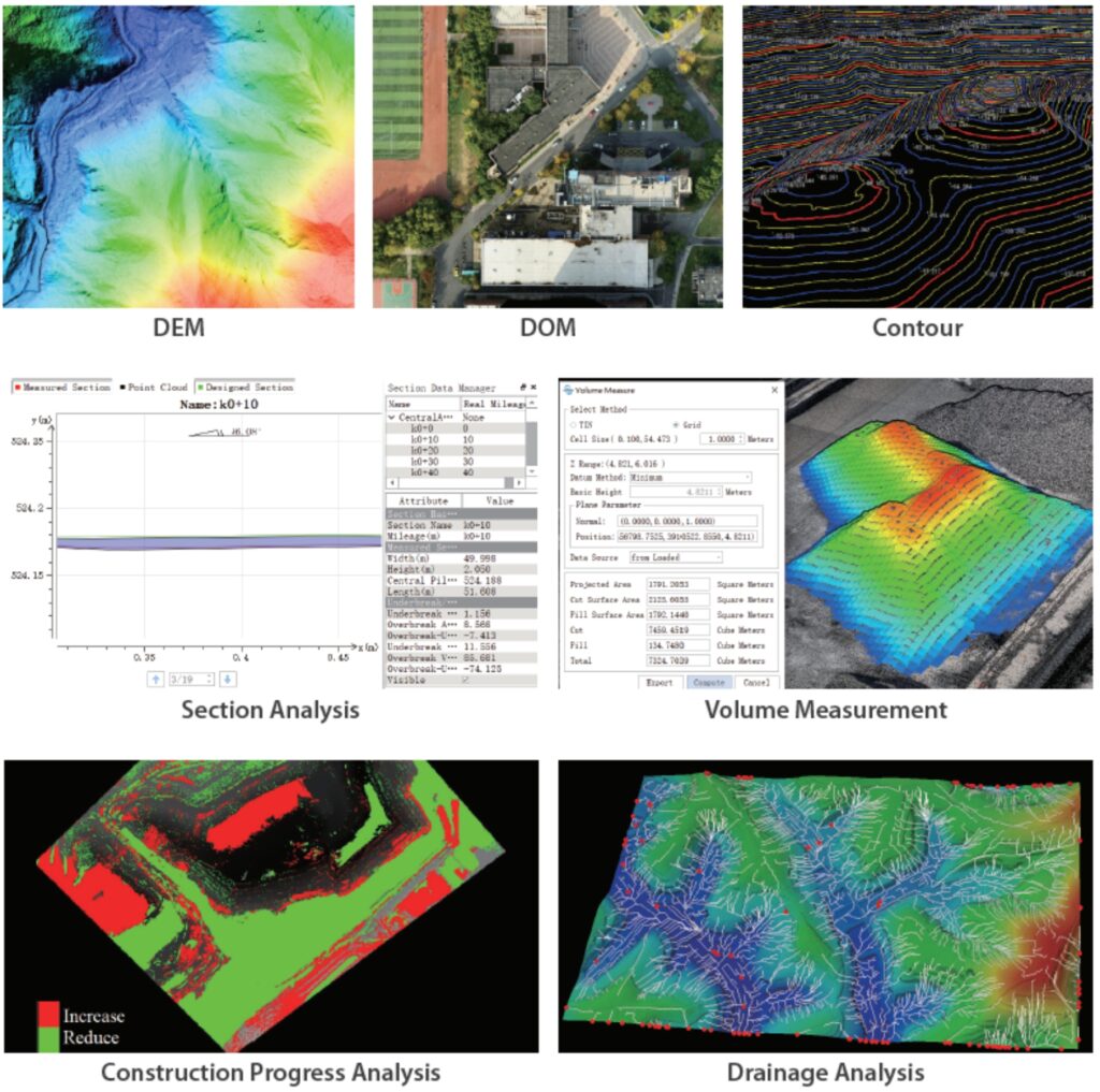
LiDAR360 can automate the processing of terrain observation data, accurately acquire terrain and landscape feature information, produce various data results and high-precision models required for industrial applications, and provide a wealth of analysis tools to help increase the quality and efficiency of terrain mapping.
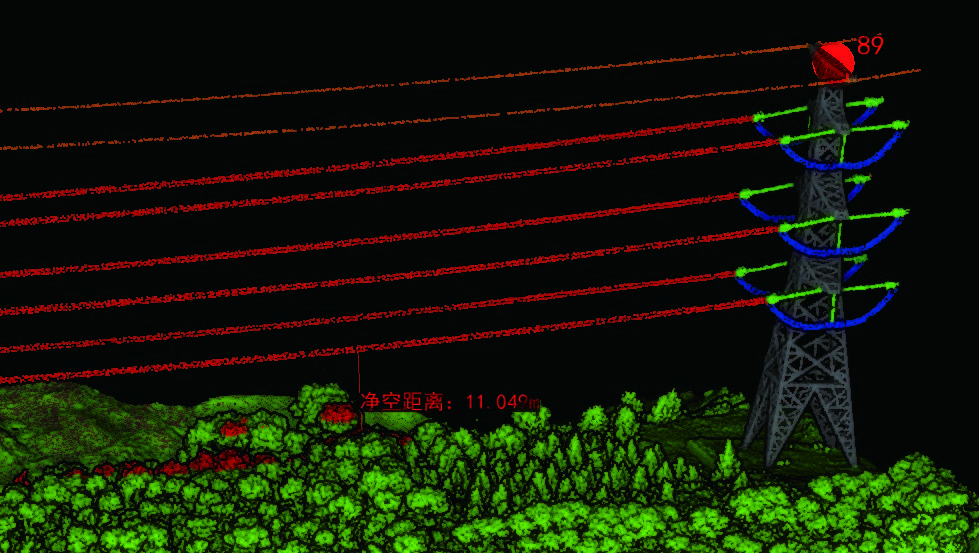
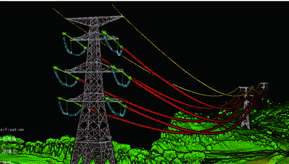
LiDAR360 enables the automatic classification of power line and pylon point clouds, real-time analysis of power line conditions, and the establishment of a sample library of machine learning classification algorithms to accurately and effectively reproduce the topography, geomorphology, and geological conditions within the transmission line corridor. The LiDAR360 software enables unified data management and analysis of transmission line cross-overs, tree barriers, and geology within the transmission line corridor in accordance with relevant transmission line operating regulations, completing a 3D visualization of the transmission line corridor, and enabling rapid and efficient power line hazard detection and identification in the power grid system.
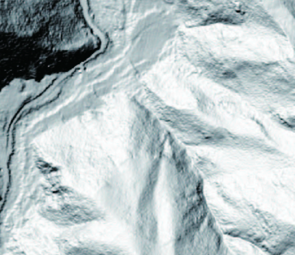
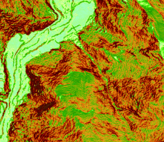
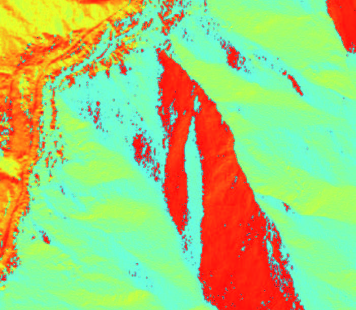
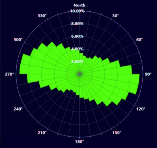
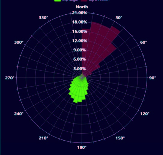
LiDAR is one of the few remote sensing technologies that can penetrate vegetation to obtain ground DEMs. LiDAR360 can accurately extract ground points from LiDAR point clouds and obtain parameters such as slope and slope direction for section and terrain change analysis, providing support for environmental surveys, disaster monitoring, and mining surveys.
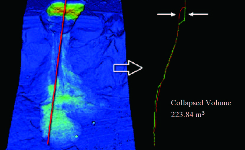
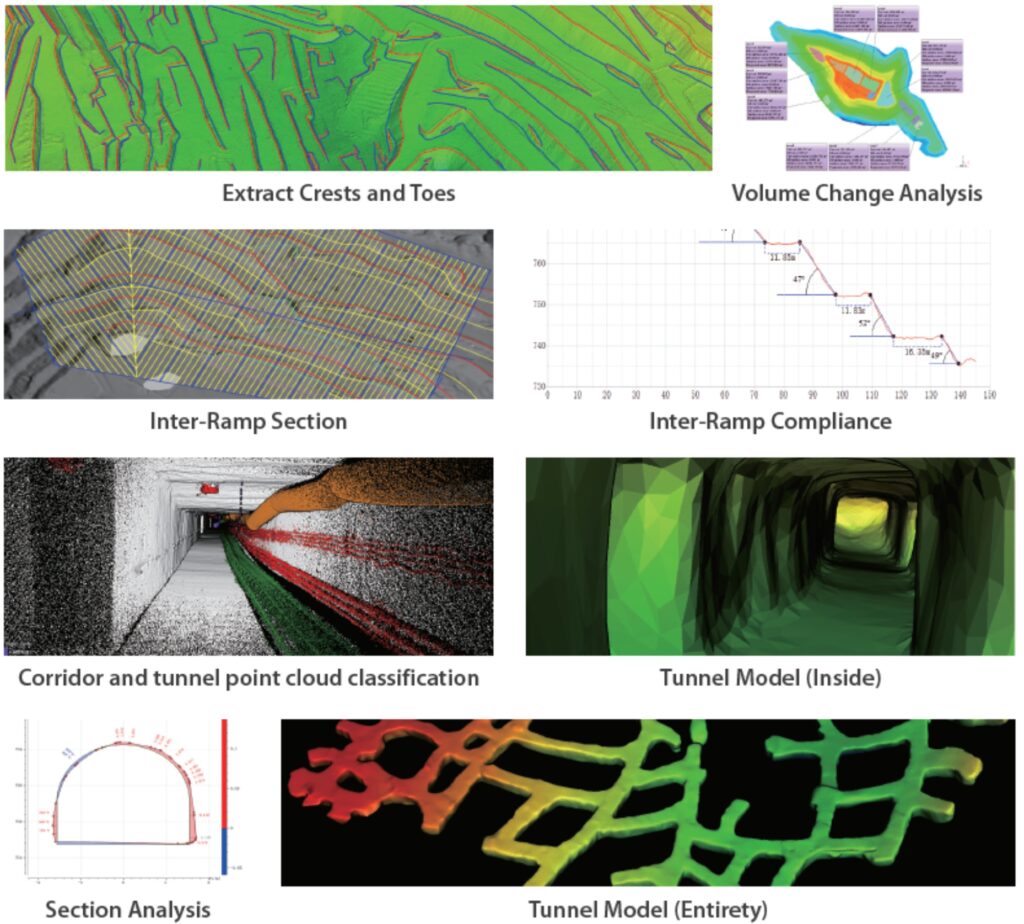
Based on the 3D point cloud data obtained from multiple platforms such as airborne and backpack systems, LiDAR360 mining module enables slope line extraction, stockpile volume measurement, and multi-period change analysis of open pit mines, as well as roadway modeling, section analysis, and point cloud classification to meet the needs of applications such as transport step laying, stockpile change monitoring, and construction acceptance, efficiently supporting mining production.
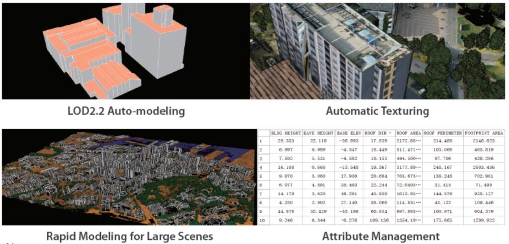
LiDAR360 identifies ground, vegetation, buildings, and other feature targets from massive point cloud data, and employs intelligent algorithms for terrain and feature scene separation, vegetation, and building target monolithic segmentation and modeling to achieve city-level geographic scene and physical replica restoration, helping real-world 3D construction.
| Equipment | ground, mobile, airborne laser scanners |
| Format | LiData LAS LAS E57 |
| Modules | Forest, Relief, Power lines |
Inquire price for Lidar360