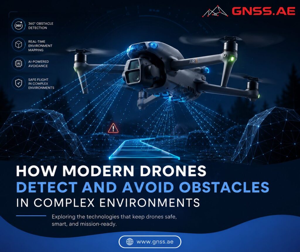
As drone operations become increasingly autonomous, obstacle avoidance has evolved from a helpful flight feature into a core safety requirement. It directly affects mission reliability, operational efficiency, and the ability to fly in complex environments with minimal human intervention.
A few years ago, obstacle sensing was largely associated with consumer drones, helping pilots avoid trees, buildings, and other obvious hazards during manual flights. Today, enterprise drones are routinely used for infrastructure inspections, surveying, public safety operations, and cargo transport. Many of these missions take place close to structures and in environments where maintaining safe distances manually can be difficult.
As a result, the challenge extends beyond simply detecting obstacles. Modern drones must continuously interpret their surroundings, identify potential hazards, and make real-time flight adjustments without interrupting the mission itself.
The growing importance of obstacle avoidance reflects how drone operations have evolved over the past decade.
Infrastructure inspection is one of the clearest examples. During inspections of transmission towers, substations, bridges, wind turbines, and industrial facilities, drones often operate only a few meters from structures. Collecting high-quality data while maintaining safe clearance can be challenging, especially when flying around complex assets with multiple obstacles. Modern obstacle avoidance systems help aircraft maintain safe flight paths without compromising inspection coverage.
The same trend is driving the expansion of BVLOS operations. Long-range inspections of power lines, pipelines, rail corridors, and other linear infrastructure are becoming increasingly common. As drones move beyond the operator’s direct field of view, onboard sensing systems effectively become part of the aircraft’s safety architecture. Detecting and avoiding obstacles autonomously is essential for reducing operational risk and enabling scalable BVLOS workflows.

Cargo delivery and automated logistics present similar challenges. Drones carrying payloads frequently fly at relatively low altitudes, where they may encounter buildings, utility infrastructure, trees, or temporary obstacles that were not accounted for during mission planning. In these environments, the ability to identify and respond to hazards in real time is critical for maintaining safe and reliable operations.
For this reason, obstacle avoidance has evolved from a pilot-assistance feature into a fundamental requirement for autonomous drone operations.

Most modern drones rely on visual sensing systems as their primary method of obstacle detection.
These systems typically rely on multiple cameras positioned around the aircraft to monitor its surroundings. By analyzing images captured from different viewpoints, the drone can estimate distances and generate a three-dimensional representation of nearby objects.
The main advantage of vision systems is that they provide broad environmental coverage while adding relatively little weight or power demand. In many operating conditions, this level of awareness is sufficient to support safe navigation and obstacle avoidance.
Like any sensor technology, however, camera-based detection has limitations. Performance can degrade in low-light conditions or when visibility is affected by glare, shadows, fog, dust, or smoke. Distance estimation can also become less reliable when observing uniform surfaces that lack distinct visual features. Therefore, vision systems are often combined with additional sensing technologies to improve reliability across a wider range of environments.
Unlike cameras, LiDAR measures distance directly. It emits laser pulses and calculates the time it takes for the reflected signal to return, allowing the drone to determine the position of nearby objects with a high degree of accuracy.
The difference becomes particularly important in environments where camera systems struggle. Thin structures, power lines, lattice towers, and poorly textured surfaces can be difficult to evaluate using vision alone. LiDAR can often detect these features with greater consistency.
LiDAR also depends less on ambient lighting conditions. Whether operating in daylight, at dusk, or at night, the sensor continues to collect distance data without relying on visible light.


LiDAR is less dependent on lighting conditions than cameras, but it is not immune to environmental challenges. Heavy rain, fog, snow, and airborne particles can reduce sensor performance and affect detection accuracy.
Millimeter-wave radar systems detect objects using radio waves rather than optical measurements. As a result, they are less affected by lighting conditions and can continue operating in environments where cameras experience reduced visibility.
Radar is particularly useful for detecting larger objects at greater distances and for maintaining situational awareness during adverse weather conditions.
Rather than replacing cameras or LiDAR, radar typically works alongside them. Each sensor contributes different information, creating a more complete understanding of the surrounding environment.
This trend toward sensor fusion is becoming increasingly common in enterprise drone platforms designed for demanding operational scenarios.
Once a potential hazard has been identified, the aircraft must determine how to respond while maintaining safe and stable flight.
This process runs continuously throughout a mission. Data from cameras, LiDAR, radar, GNSS receivers, and inertial measurement units (IMUs) is processed by the flight controller in real time, allowing the drone to evaluate nearby obstacles.
Depending on the platform, operating mode, and proximity of the obstacle, the aircraft may:

The effectiveness of an obstacle avoidance system depends not only on its sensors but also on the software that interprets incoming data and controls the aircraft’s response.
A practical example is DJI’s Advanced Pilot Assistance System (APAS). Instead of simply stopping when an obstacle is detected, APAS can use sensor data to identify a viable path around the object and continue the flight. This approach helps reduce unnecessary interruptions while maintaining obstacle clearance in complex environments.
Drone Model | Vision System | LiDAR | Radar | Intelligent Path Planning |
Omnidirectional binocular vision | Horizontal rotating and upper-mounted LiDAR | Six-direction millimeter-wave radar | Yes | |
Omnidirectional binocular vision | Rotating LiDAR | Millimeter-wave radar | Yes | |
Five-direction binocular vision | High-precision LiDAR | Front and rear millimeter-wave radar | Yes | |
DJI Mavic 3 Series | Omnidirectional binocular vision | No | No | Yes |
Obstacle avoidance systems have evolved from simple pilot-assistance features into a core component of modern drone operations.
As missions become increasingly autonomous, aircraft must be capable of sensing, interpreting, and responding to their environment with minimal operator intervention. No single sensing technology can provide reliable performance under every condition. Cameras, LiDAR, and radar each offer distinct strengths and limitations.
For this reason, the most capable drone platforms increasingly rely on a combination of sensing technologies rather than a single solution. The goal is not merely to avoid collisions, but to support safe, predictable operations in the complex environments where enterprise drones are expected to work.