For oil and gas operators, the main hurdle isn’t gathering more data anymore. It’s about getting to the right spots safely, collecting accurate details quickly, and acting before a minor issue can turn into a costly shutdown, environmental disaster, or expensive repair.
Pipelines extend for hundreds of kilometers through remote terrain. Flare stacks rise more than 30 meters above active facilities. Tanks, wells, and substations often sit in areas that are difficult, dangerous, or expensive to access.
Traditional inspection methods still depend on rope access teams, scaffolding, manual walkdowns, or helicopter surveys. These methods work, but they are slow, costly, and put personnel at unnecessary risk.
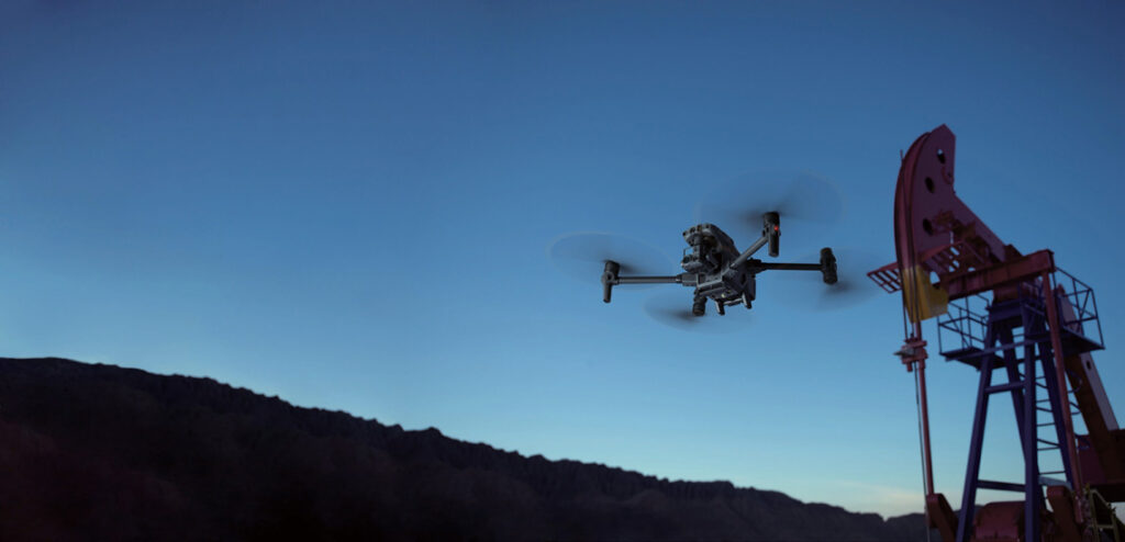
In 2026, drone programs have become one of the fastest-growing technologies in the oil & gas sector. They address safety, speed, and data quality all at once.
Modern DJI drones inspect pipelines, detect methane leaks, scan flare stacks, create LiDAR models, and can repeat missions automatically from a remote dock. Instead of sending people into risky areas, operators gather high-res visual, thermal, and gas detection data safely from a distance.
This leads to a new kind of workflow that’s quicker, more consistent, easier to document, and more useful for managing assets over time.
Drones don’t just speed up inspections. They change the way decisions happen.
When inspections can be completed more frequently and with better data, operators no longer need to wait for a scheduled shutdown or visible failure. Maintenance becomes proactive rather than reactive.
Drones equipped with thermal cameras, LiDAR, or methane sensors can identify:
Inspection Task | Traditional Method | Drone-Based Method | Practical Difference |
Pipeline inspection | Ground crews, ATV, helicopter | Drone with visual, thermal, or LiDAR payload | Larger areas inspected in less time |
Flare stack inspection | Shutdown, scaffolding, rope access | Drone inspection while facility remains operational | Eliminates unnecessary shutdowns |
Methane leak detection | Handheld sensors and manual walkdown | Drone with TDLAS or OGI payload | Faster leak localization and quantification |
Terrain and corridor survey | Ground survey crew | LiDAR drone mission | Higher coverage and better terrain visibility |
Several operators are already using this approach at scale.
A California oil & gas company now uses methane-detection payloads instead of sending inspectors to climb equipment manually. Another international energy operator uses DJI Dock 3 to launch automated inspections of tanks, wells, powerlines, flare stacks, and pipeline corridors without requiring a pilot on site.
The shift is no longer experimental. By 2026, drones are becoming a standard inspection tool across the industry.

The first wave of oil and gas drone programs centered on the DJI Matrice 350 RTK. It remains widely used in 2026 because it supports a wide range of payloads, from thermal zoom cameras to gas sensors and LiDAR. However, inspection workflows are changing quickly. Newer platforms place more emphasis on portability, autonomous operation, and higher-resolution 3D data.
One of the most important changes is the transition from the Zenmuse L2 to the newer Zenmuse L3. While the L2 remains common in existing fleets, most new LiDAR deployments in 2026 are beginning to shift toward the L3 because of its improved point density, better vegetation penetration, longer effective range, and more reliable performance around complex industrial structures.
The most relevant current models are shown below.
DJI Platform | Best Use Case in Oil & Gas | Why It Matters in 2026 |
Heavy-duty inspections, LiDAR, methane detection, third-party payloads | Still the best choice when multiple payload options are required | |
Portable thermal inspections of tanks, flare stacks, and pipelines | Smaller and faster to deploy than the M350 RTK | |
Corridor mapping, visual surveys, orthomosaics | More practical for routine inspection flights and mapping | |
Autonomous and all-weather inspections with thermal imaging | Adds IP55 protection, thermal camera, night operation, and Dock 3 support | |
DJI Dock 3 with Matrice 4D or 4TD | Fully remote inspections of large facilities and pipeline corridors | Enables 24/7 drone-in-a-box operation without a pilot on site |
Long-range inspections of large oil & gas facilities, offshore sites, and multi-payload missions | Extends flight time and payload capacity, making it practical to combine thermal, zoom, LiDAR, and gas-detection workflows in a single flight |
The DJI Matrice 4TD has become one of the most practical inspection platforms for oil & gas operators. It offers the portability of the Matrice 4 series but adds features typically found only on larger drones.
The aircraft offers:
This makes it especially useful for flare stack inspections, tank farms, pipeline routes, and night operations.
For bigger operations, DJI Dock 3 is gaining importance. Unlike earlier docks, Dock 3 can be fixed in place or mounted on vehicles. Operators can install it permanently at a refinery or move it between locations.
The dock automatically launches, lands, charges, and uploads data from either the Matrice 4D or Matrice 4TD. Combined with FlightHub 2, this creates a repeatable inspection workflow that can run daily without requiring a pilot at the site.
Payload or Sensor | Recommended Platform | Typical Oil & Gas Task |
Matrice 350 RTK | Flare stacks, thermal inspections, visual zoom inspections | |
Matrice 350 RTK | Existing LiDAR workflows and corridor mapping | |
Matrice 350 RTK / Matrice 400 | Next-generation LiDAR mapping, dense vegetation, large industrial sites, digital twins | |
Matrice 350 RTK | Methane detection and LDAR compliance | |
Matrice 350 RTK | Detection of methane, VOCs, H2S, CO and multi-gas incidents | |
Integrated thermal camera | Matrice 4T / 4TD | Fast thermal inspections without an external payload |
FlightHub 2 is becoming a go-to tool, not only for remote mission control but also for scheduling regular inspections, analyzing past flights, managing geofenced assets, and overseeing multiple locations all from one easy-to-use interface. A more detailed overview of these workflow improvements is described in the GNSS.AE article “DJI Terra 5.2, Modify 1.6 and FlightHub 2: Key Updates for Mapping and Inspection Workflows.”

Pipeline inspections are one of the clearest examples of how drones change the workflow.
Traditionally, inspectors travelled along the route on foot, by vehicle, or by helicopter. The process was slow and often limited by terrain, weather, or access restrictions.
With a drone, the same corridor can be inspected in a fraction of the time.
Typically, the process starts with a pre-planned flight path in DJI Pilot 2. Operators upload a KML file or alignment map, then send the drone along the route.
For standard visual inspections, the Matrice 350 RTK paired with the H30T payload provides:
When a more detailed corridor assessment is needed, the same drone can be equipped with the Zenmuse L3 LiDAR sensor. Compared with the older L2, it captures denser point clouds, performs better in areas with pipes, steel structures, and partial GNSS obstruction, and produces more complete terrain models beneath vegetation.
This data is especially useful when operators need to compare inspections over time and detect small changes before they become a risk.

Method | Coverage Speed | Access to Remote Terrain | Detail Level |
Manual ground inspection | Low | Limited | Moderate |
Helicopter survey | High | Good | Moderate |
Drone with H30T | High | Excellent | High |
Drone with Zenmuse L3 | High | Excellent | Very high, including 3D terrain and measurement |
Some operators are also beginning to use multispectral imaging to identify hidden saltwater leaks. Stressed vegetation often appears before a leak is visible at ground level
Flare stack inspections are traditionally among the most expensive and disruptive inspection tasks in the industry.
In many facilities, a manual inspection requires partial plant shutdowns, scaffolding, or rope access, not to mention specialized personnel and hours or days of preparation. Drones simplify this dramatically.
Using a Matrice 350 RTK with the H30T payload, the operator can inspect the flare stack while the facility continues operating.
The thermal camera identifies:
At the same time, the zoom camera captures detailed visual evidence of corrosion, cracks, or damaged components.
The side-by-side thermal and visual view in DJI Pilot 2 makes it easier to confirm whether a temperature anomaly corresponds to a visible defect.
Operators can also save a manual mission and replay it for consistent inspections, ensuring reliable comparisons over time. For refineries where downtime means significant costs, avoiding unnecessary shutdowns is a major financial win.

Methane leak detection is another area where drones are becoming much more practical.
Traditional leak detection still depends largely on technicians walking through a facility with handheld instruments. While this approach is accurate, it becomes slow and difficult around flare stacks, elevated equipment, large tank farms, and remote sites.
Drone-based gas sensing makes it possible to inspect the same area much faster.
A common setup in 2026 is the Matrice 350 RTK carrying either the Sniffer4D Nano2+ Methane or the Sniffer4D Nano2+ Multi-Gas sensor. The choice depends on whether the operator only needs methane measurements or needs to detect several gases at once.
The Sniffer4D Nano2+ Methane is typically used for:
The Sniffer4D Nano2+ Multi-Gas is more suitable when operators also need to monitor VOCs, hydrogen sulfide, carbon monoxide, or other gases around refineries and industrial facilities.
We compared these two models in detail in one of our previous articles: “Sniffer4D Nano2+ Multi-Gas vs Sniffer4D Nano2+ Methane: Which UAV Gas Sensor Fits the Job?”

LiDAR is becoming increasingly important because it produces more than an inspection image. It creates a long-term record of the site.
The Zenmuse L2 enables operators to generate highly accurate 3D models not just of pipelines but of tank farms, roads, wetlands, and environmentally sensitive zones.
These models can be processed in DJI Terra and shared with engineering, GIS, and maintenance teams. Recent DJI Terra updates have improved terrain classification, corridor processing, and the handling of larger LiDAR datasets, making it easier to build and compare digital twins over time. More details are described in the GNSS.AE article “DJI Terra 5.2, Modify 1.6 and FlightHub 2: Key Updates for Mapping and Inspection Workflows.”
The result is a digital twin that supports:
LiDAR is particularly useful in areas with vegetation because the laser can penetrate through the canopy and reveal the actual terrain underneath.
In wetland environments, this makes it possible to identify boundaries, drainage patterns, and unsuitable construction areas more accurately than with standard imagery alone.
The financial case for drones is usually strongest when companies compare the full cost of a traditional inspection.
A flare stack inspection may require shutdown time, access equipment, contractors, and additional safety personnel. A pipeline survey may require several days of travel and field work.
Drone inspections reduce those costs in several ways:
Operators also gain value from the data itself. High-resolution imagery, thermal reports, and LiDAR models are no longer used by only one department. The same dataset can support:
This cross-department use significantly increases the return on each flight.
By 2026, drones are no longer a futuristic concept in oil & gas. It is becoming part of normal operations.
The leaders here aren’t necessarily those with the largest fleets, but rather those who have crafted repeatable workflows addressing specific inspection challenges.
Whether the goal is methane detection, pipeline monitoring, flare stack checking, or LiDAR mapping, DJI platforms now offer a practical path to safer, faster, and higher-quality data collection. The question operators face today isn’t whether drones add value—it’s where they can deliver that value most quickly.