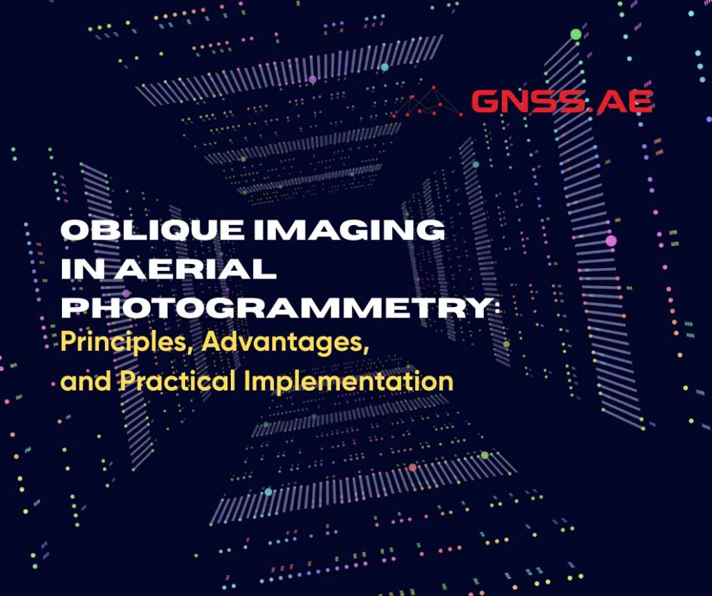
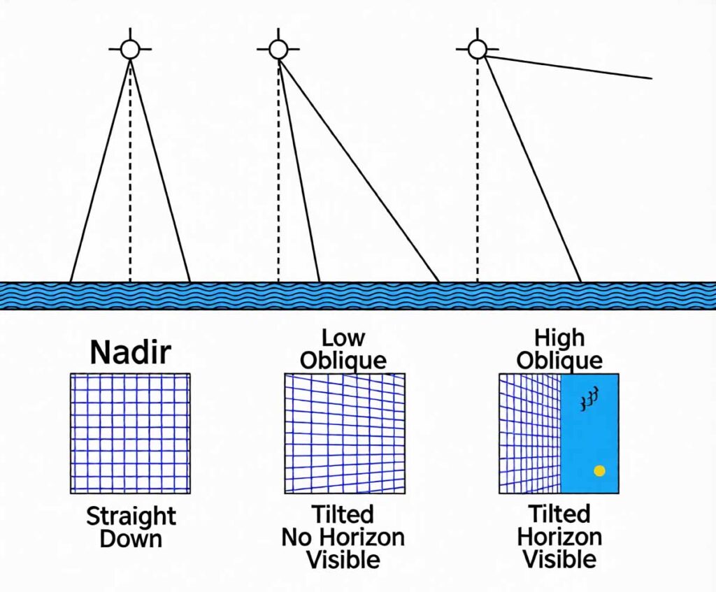
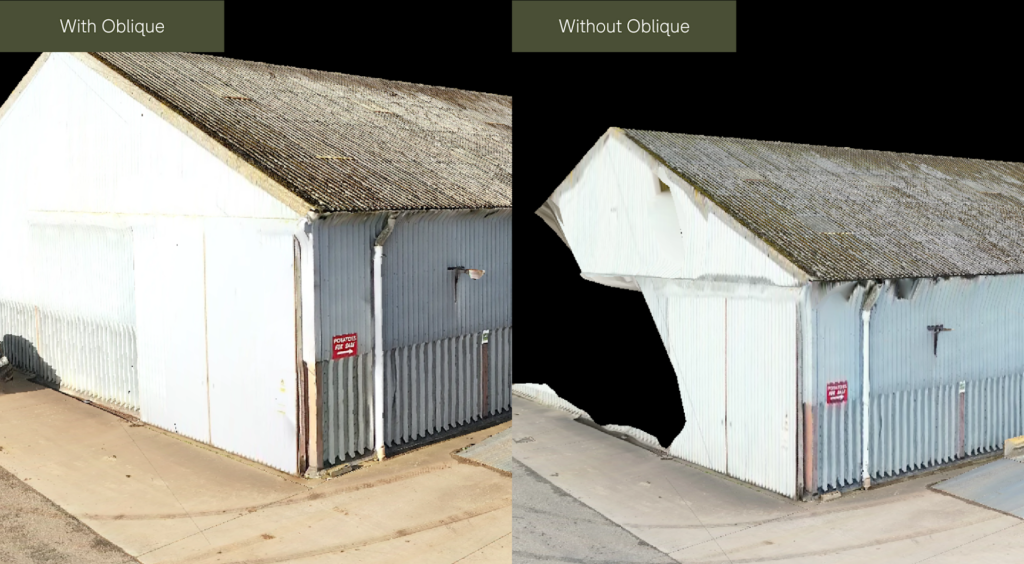
Oblique imaging refers to acquiring aerial images at an angle relative to the ground surface, typically around 30° to 45° from vertical. While nadir imagery is highly effective for orthomosaics and mapping horizontal surfaces, oblique imagery captures vertical and near‑vertical features such as façades, retaining walls, bridge sides, towers, and other structures that are poorly represented in nadir‑only datasets.
In classical oblique photogrammetry, the goal is to obtain multiple viewing directions for each object. Traditionally, this is achieved by collecting imagery from forward, backward, left, and right perspectives in addition to nadir views. The additional viewpoints enrich the image network and provide stronger geometry for 3D reconstruction.
Integrating oblique imagery into photogrammetric workflows delivers several practical advantages:
Modern oblique photogrammetry can be implemented in several ways. The main approaches differ in hardware complexity, acquisition speed, and the volume of data produced.
The most common implementation paths are:
A widely adopted and methodologically “classic” solution for oblique photogrammetry is the five‑lens oblique camera system. These systems typically combine one nadir‑facing lens with four fixed oblique lenses oriented in different directions. Camera platforms of this class (including Share‑type oblique cameras and similar solutions) capture five perspectives simultaneously during a single flight line.
Key strengths of five‑lens systems include:
These systems helped establish oblique photogrammetry as a standard practice for large‑scale city modeling, cadastral applications, and infrastructure mapping. Their typical trade‑offs are increased payload complexity and weight, higher cost, and a larger volume of imagery that must be stored and processed.
Beyond fixed multi‑lens rigs, modern systems implement oblique capture through software‑driven control of a single camera mounted on a stabilized gimbal. This approach can deliver the geometric benefits of oblique imagery while simplifying hardware requirements.
With Smart Oblique Capture, the camera orientation is adjusted automatically during the mission to acquire the required oblique views. Instead of collecting every possible oblique angle uniformly across the entire site, the system targets oblique capture where it is most valuable for reconstruction. This selective strategy can reduce data redundancy and often leads to:
Another advantage is the tight synchronization of camera orientation with the aircraft’s navigation data. Position and orientation information can be leveraged during processing to support more stable alignment and reconstruction, particularly in complex scenes.
DJI Zenmuse P1 is a practical example of implementing oblique capture through controlled camera rotations on a three‑axis gimbal. In this configuration, oblique imagery is produced not by multiple fixed lenses, but by dynamically rotating a single high‑resolution camera during the mission.
This approach can achieve oblique coverage comparable to multi‑camera systems while maintaining a simpler hardware architecture. Because the camera’s orientation and capture timing are coordinated with the flight plan, the dataset can be optimized to include the views needed for robust 3D reconstruction without excessive redundancy. In many workflows, this translates into faster field operations and more efficient processing.
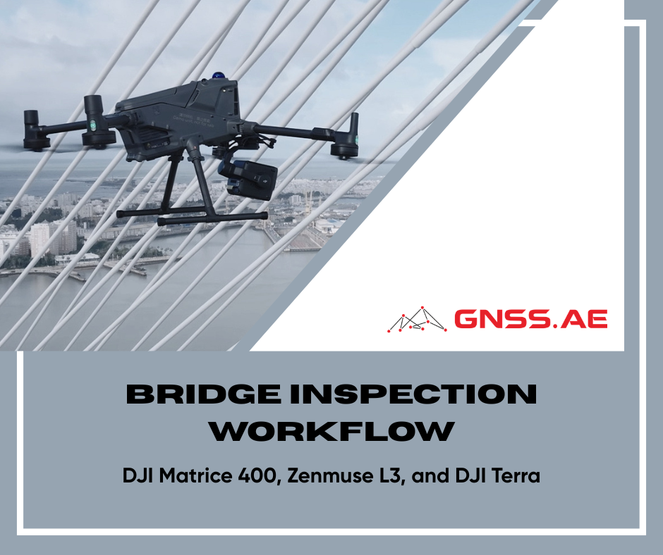
Oblique concepts are increasingly integrated into modern LiDAR-RGB payloads, not as a by-product, but as a dedicated acquisition strategy. DJI Zenmuse L3 implements this approach through a combination of dual RGB cameras oriented at different angles and a dedicated Oblique Collection mode.
The two RGB cameras capture visual data from different viewing directions, improving coverage of façades, walls, and other vertical structures that are typically underrepresented in nadir-only acquisition. In Oblique Collection mode, data is acquired along inclined trajectories, allowing both LiDAR and RGB sensors to observe vertical and complex geometries from multiple perspectives.
LiDAR provides stable and reliable geometric reconstruction, particularly in areas where image-based matching is limited, while the multi-angle RGB imagery enhances scene interpretation and colorization. Together, these capabilities produce more complete and structurally consistent 3D datasets, suitable for digital twins, corridor mapping, urban environments, and complex infrastructure documentation.
A typical end‑to‑end workflow for oblique photogrammetry includes:

Oblique imaging is a core element of modern aerial photogrammetry. By adding multi‑directional views to nadir datasets, it improves 3D reconstruction robustness, enables accurate modeling of vertical surfaces, reduces occlusions, and enhances texture realism. The evolution from five‑lens camera systems to software‑guided Smart Oblique Capture and hybrid LiDAR‑RGB payloads has made oblique workflows more efficient, scalable, and accessible. Today, combining nadir and oblique data is widely regarded as standard practice for producing accurate and realistic 3D spatial models.