The capabilities of modern electronic total stations can be described as virtually limitless — from high-precision measurements to wireless data transfer to remote computers and the processing of large volumes of information. In this article, we break down this this complex, high-precision instrument.
What picture comes to mind when we hear the word surveyor? Most often, it’s a person standing behind a camera-like device mounted on a tripod. We see such people on construction sites, along roads, and in cities, and usually their work considered to be taking measurements.
Some even assume they are filming a movie or recording speeding violations. Professionals in surveying will quickly clarify: modern total stations indeed have many functions, including photo and video recording — almost like filmmaking. But the name of this precise, multifunctional device is the total station.
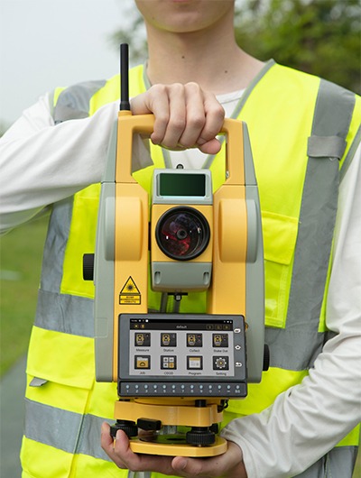
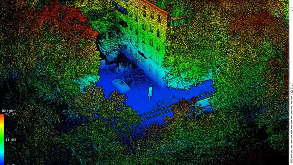
A total station is a surveying instrument that provides a complete picture of the surrounding environment and terrain. It measures distances and angles in both horizontal and vertical planes, based on line-of-sight to the target.
In addition to surveying and topography, total stations are widely used in:
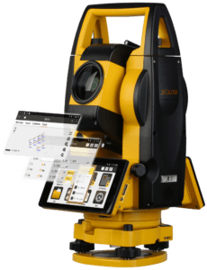
Despite its compact size, the total station combines the functions of several instruments: a theodolite, an electronic distance meter, and a computer.
Modern total stations are capable of much more than just measurements — they allow wireless data transfer to remote computers and the processing of large datasets in real time.
From a historical perspective, total stations are relatively new — first appearing in the 1970s, just about fifty years ago. Their foundation, however, lies in the theodolite — an optical-mechanical device for measuring horizontal and vertical angles, first described by Leonard Digges in his Geometrical Practise (1571).
The earliest total stations resembled a theodolite with an electronic distance meter attached. It wasn’t until compact distance meters were developed that both instruments could be integrated into a single housing. Even today, surveyors still use optical instruments in particularly challenging conditions.
The first electronic total station was the AGA-136, produced in Sweden in the 1980s. This was a technological breakthrough: the optical system for angle measurement was replaced with an electronic one. Data were sent to a processor, calculations were performed, and results were displayed instantly.

As noted, the primary field of use for total stations is surveying. Before the rise of GNSS and laser scanning technologies, the total station was the most effective tool for large-scale mapping. Yet, because surveying underpins so many human activities, total stations are used across multiple industries.
One of the most closely linked fields is construction. Whether it’s a stadium, a road, a bridge, a dam, or a residential building — the first professional to arrive at the site is the surveyor. They prepare topographic plans, establish the construction grid, and oversee every stage of the build: from setting out the axes of future structures to conducting as-built surveys and verifying the completed work.
On any construction site, the most effective instrument of the surveyor is the total station. With millimeter accuracy, it enables:
In summary, the total station remains an indispensable tool that bridges precision science and practical fieldwork.