Real-Time Kinematic Global Navigation Satellite System (RTK GNSS) is a high-precision satellite positioning technology that has revolutionized how industries capture spatial data. With accuracy down to the centimeter level, RTK GNSS plays a vital role in sectors such as construction, surveying, agriculture, and transportation—where precision isn’t just desirable, it’s essential.
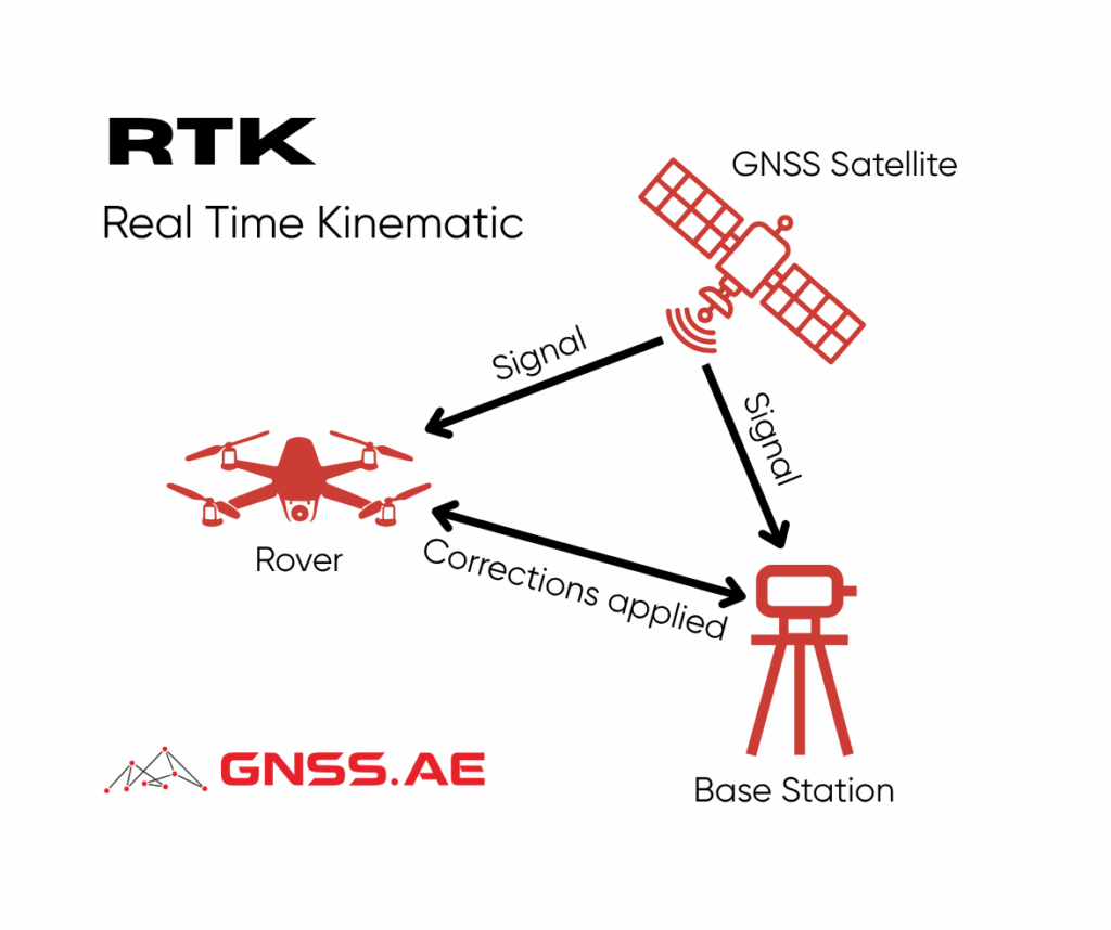
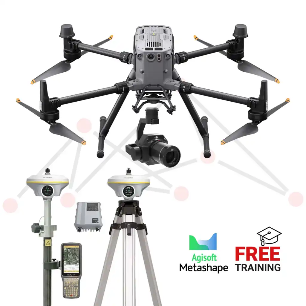
At the heart of RTK GNSS lies the concept of differential positioning. It uses two GNSS receivers:
A fixed base station installed at a precisely known location
A mobile rover that requires accurate position information in the field
Both the base and the rover receive signals from multiple GNSS satellites. The base station, knowing its exact coordinates, calculates any discrepancies between the expected and actual satellite signals. It then generates correction data, which is transmitted in real time to the rover receiver. By applying this correction, the rover can eliminate most of the errors caused by atmospheric interference, satellite clock drift, and signal path distortion.
What sets RTK GNSS apart is its use of carrier-phase measurements—offering accuracy down to 1–2 centimeters, far surpassing standard GNSS systems that are accurate only to several meters.
The key advantage of RTK GNSS is its real-time correction capability. Users in the field see highly accurate positioning results instantly, with no need for time-consuming post-processing. This enables real-time decision-making, faster field operations, and immediate validation of collected data.
For instance, in surveying tasks, RTK allows operators to stake out property lines or collect geospatial data without needing to return to the office to verify measurements. This speeds up project timelines and reduces costly rework.
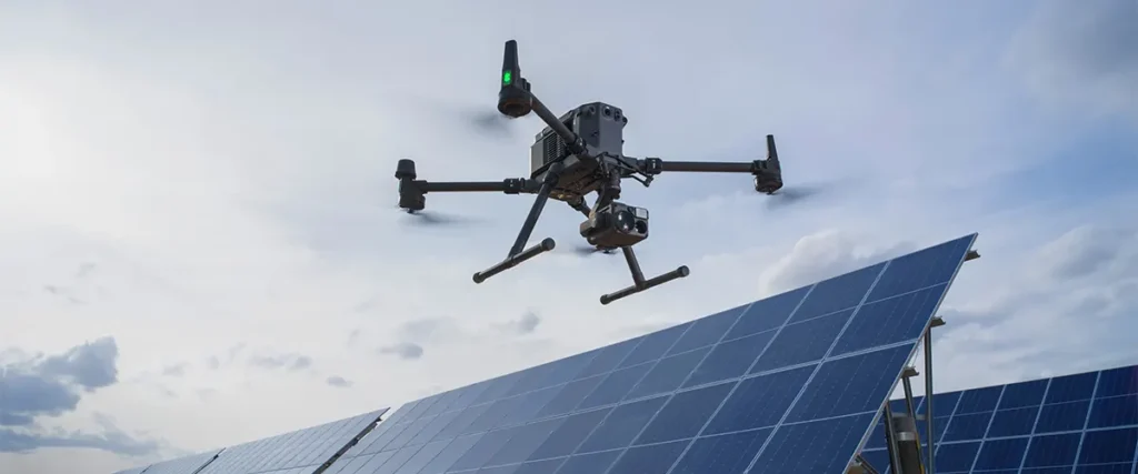
In aerial surveying, RTK has transformed how data is collected. Traditionally, ground control targets (GCPs) were used extensively to align and scale aerial photogrammetry. With RTK-equipped drones, however, the reliance on ground targets is significantly reduced.
Although GCPs are still used to calibrate the photogrammetric model and align it to the project datum, far fewer are needed. The accuracy of the data now primarily depends on the precise position of the drone, not the density of control points. This gives end users greater confidence in the accuracy of spatial data across the entire site, regardless of where targets are placed.
RTK is especially effective on open sites where the drone and operator can stay near the base station to maintain signal. On larger or obstructed sites, Post-Processed Kinematic (PPK) methods are preferred. PPK allows the drone to collect data without needing a constant link to the base, offering more flexibility in pilot movement and flight planning.
RTK GNSS technology has found widespread use across various industries where spatial precision is critical:
In all these sectors, positional accuracy directly impacts operational efficiency, resource utilization, and safety. RTK GNSS allows professionals to:
Moreover, the reliability of RTK GNSS data reduces the need for repeated measurements, contributing to long-term cost savings and increased trust in spatial decision-making.
As satellite constellations grow and communication infrastructure improves, RTK GNSS is becoming more accessible, even in remote or challenging environments. It is also increasingly integrated into drone platforms, autonomous vehicles, and smart agriculture systems.
If you’re ready to enhance your operations with real-time centimeter-level positioning, GNSS.AE is here to help. With deep industry expertise and a curated range of professional GNSS solutions, we will guide you in selecting the most suitable RTK GNSS equipment for your specific needs.