Inquire Now
In this time of rapid global change, it’s of great necessity to map, detect, address and predict the changes across the globe. Indeed, geostationary satellite imagery helps plenty of industries identify, monitor and understand the impact of changes on environments and human dynamics (eg. economy, health and sociopolitical stability) at an unprecedented speed and scale. This space technology and intelligence enjoy a number of applications and enable various organizations to make decisions with confidence.
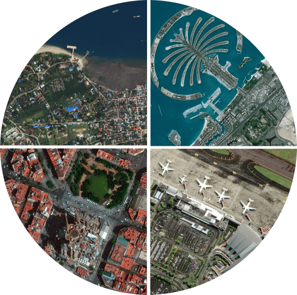
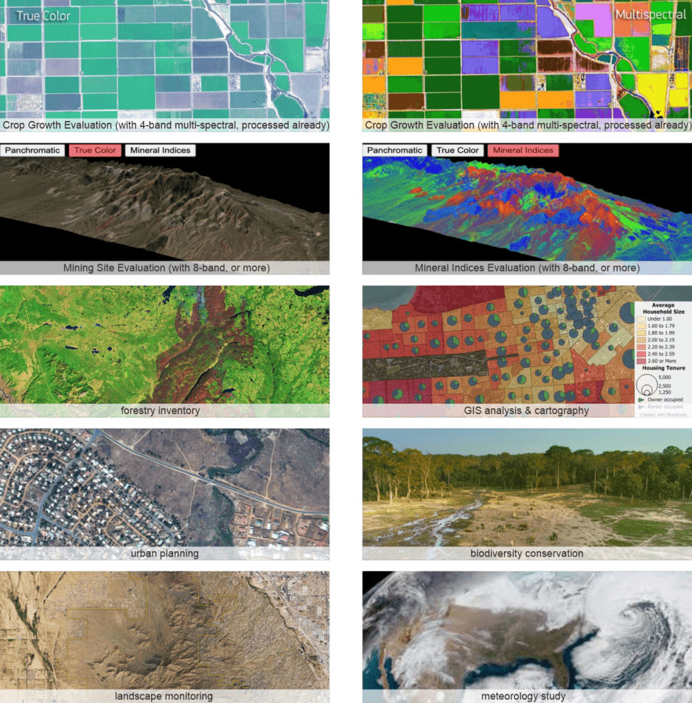
By combining multi-source data, applied artificial intelligence, machine learning and rich domain knowledge, we provide 2 parts of products and services and they are Cloud-based Satellite Imagery Basemaps and Conventional Satellite Imageries. Fueled by Maxar (formerly known as Digital Globe) and other major high-resolution commercial imaging satellites, our products and services are qualified for a variety of scientific analysis and further applications.

0.3/0.4/0.5/0.8/1 m resolution options, panchromatic or multi-spectral, ortho-ready or stereo pair from major commercial satellites such as Gaofen 1/2, Jilin-1, Superview-1, Beijing 2/3, Worldview1/2/3/4, GeoEye-1, QuickBird, Ikonos, Pleiades, Kompsat 1/2/3, etc.

Satellite imagery processing is simply not an easy task. However, our cloud database is ready to deliver your targeted products at an incredible speed, yet such database worldwide is almost updated daily.

For ortho study and analysis, just consider the finished products, cloud-based satellite imagery basemaps. Then, for vectorized mapping consisted of elevation information, please go with conventional satellite images in form of raw data.

Besides satellite images processing using specialized remote sensing software, map4tasking (for cloud basemaps) and on-demand tasking collection (for raw data) at different intervals are available for diverse needs.
Inquire price for South Multi-Source High-Resolution Satellite Imagery Products & Services